
Glendon is an unincorporated community in Moore County, North Carolina, United States. [1]
Glendon is an unincorporated community in Moore County, North Carolina, United States. [1]
Glendon sits at an altitude of 301 feet above sea level. [2] It was originally known as Fair Haven. Residents of the community changed its name to Glendon [3] in honor of E. F. Glenn, the original owner of the land on which the community was established. [2] In 1897 a railroad was laid through the village and a depot was built. [4] For a time the depot hosted a telegraph station, but the cable was removed at an unknown date before 1924. [5] In 1900 the North Carolina Geological Survey identified large deposits of pyrophyllite (locally mislabeled talc) nearby. Shortly thereafter several companies established mining operations to extract the mineral. [6] The railroad was used to ship the pyrophyllite. [5] The town also hosted a post office, though by 2009 it was in disuse. [7]
In 1963 the population of Glendon was estimated to number at no greater than 25 people. [8] The railway depot was demolished in 1972. [9] In 2014 a firefighting and emergency medical service station was built in the village. [10] Since the 2015, the community has hosted a biannual music festival, Glendonfest. [11] [12]
Richmond County is a county located on the central southern border of the U.S. state of North Carolina. As of the 2010 Census, the population was 46,639. Its county seat is Rockingham. Richmond County comprises the Rockingham, NC Micropolitan Statistical Area. The Hamlet-Rockingham metropolitan area has a population of 22,579.

Spruce Pine is a town in Mitchell County, North Carolina, United States. The population was 2,175 at the 2010 census.

Star is a town in Montgomery County, North Carolina, United States. The population was 876 at the 2010 census.

Robbins is a city in Moore County, North Carolina, United States. The population was 1,097 at the 2010 census.

Randleman is a city in Randolph County, North Carolina, United States. The population was 4,113 at the 2010 census. It is the home of NASCAR's Petty family, the Victory Junction Gang Camp and was the location of the Richard Petty Museum from 2003–2014.

Seagrove is a town in Randolph County, North Carolina, United States. The population was 228 at the 2010 census. It was named after a railroad official when the area was connected by rail. The center of population of North Carolina is located a few miles east of Seagrove.

Hamlet is a city in Richmond County, North Carolina, United States. The population was 6,495 at the 2010 census.

Roseboro is a town in Sampson County, North Carolina, United States. The population was 1,191 at the 2010 census.

Indian Trail is a suburban town in Union County, North Carolina, United States. Founded on March 12, 1861, the town holds a history of traders traveling along the "Indian Trail," which ran from Petersburg, Virginia, to the Waxhaw Indians and gold mining areas. Indian Trail was first a farming community; however, German and Scot-Irish and Irish settlers began to move into the area due to its geographical location. In 1874, the Seaboard Coast Line Railroad was built between the cities Charlotte, North Carolina and Monroe, North Carolina. The railroad, which runs through the town, brought prosperity to the area. Indian Trail was incorporated as a town in 1907, with established city limits based upon a one-half mile radius from the intersection of Indian Trail Road and the Seaboard Railroad. Indian Trail has grown rapidly in the 21st Century: Indian Trail's census count jumped from 1,942 in 1990 to 33,518 in 2010. Every Fourth of July the town holds an annual parade which is one of the biggest parades in the Charlotte metropolitan area.
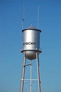
Hemingway is a town in Williamsburg and Georgetown Counties, South Carolina. The population was 459 at the 2010 census.

Gibsonville is a town in both Alamance and Guilford counties in the U.S. state of North Carolina. Most of Gibsonville is situated in the Greensboro-Winston-Salem-High Point Combined Statistical Area and the eastern portion is in the Burlington, North Carolina Metropolitan Statistical Area, encompassing all of Alamance County. According to the 2010 Census, the population of Gibsonville was 6,410.

Thomasville is a city in Davidson County, North Carolina, United States. The population was 26,757 at the 2010 census. The city was once notable for its furniture industry, as were its neighbors High Point and Lexington. This Piedmont Triad community was established in 1852 and hosts the state's oldest festival, "Everybody's Day". Built around the local railway system, Thomasville is home to the oldest railroad depot in the state, just a few hundred feet from the city's most notable landmark, "The Big Chair".

Davidson is a town located in northern Mecklenburg County, North Carolina, on the banks of Lake Norman. The population was 10,944 at the 2010 census, and in 2019 the estimated population was 13,054. The town was founded in 1837 with the establishment of the Presbyterian Davidson College, named for Brigadier General William Lee Davidson, a local Revolutionary War hero. The land for Davidson College came from Davidson's estate, a large portion of which was donated by his son.
Haywood is an unincorporated community in southeastern Chatham County, North Carolina, United States. It is part of the Moncure census-designated place. Along with several other unincorporated communities, it lies along the panhandle of Chatham County between Lee County and Wake County. Haywood lies at an elevation of 246 feet (75 m).

Cherokee is a census-designated place (CDP) in Swain and Jackson counties in Western North Carolina, United States, within the Qualla Boundary land trust. Cherokee is located in the Oconaluftee River Valley around the intersection of U.S. Routes 19 and 441. As of the 2010 census, the CDP had a population of 2,138. It is the capital of the federally recognized Eastern Band of Cherokee Indians, one of three recognized Cherokee tribes and the only one in North Carolina.

Minneapolis is a community located along US 19-E in Avery County, North Carolina. It shares its name with two other cities nationwide: another small town in Kansas, and the much larger and more famous city of Minneapolis, Minnesota, that state's largest city.
Nebo is an unincorporated community in the Nebo Township of eastern McDowell County, North Carolina. The zip code is 28761.
Overhills is an unincorporated community located in the Johnsonville Township of Harnett County near the Cumberland County town of Spring Lake. It is a part of the Dunn Micropolitan Area, which is also a part of the greater Raleigh–Durham–Cary Combined Statistical Area (CSA) as defined by the United States Census Bureau.
Cumnock formerly known as Egypt is an unincorporated community in northwestern Lee County, North Carolina, United States. It lies on Cumnock Road, about a mile north of U.S. Route 421.
Harpers Crossroads is an unincorporated community in Chatham County, North Carolina, United States. It is located at the intersection of State Highway 902, and Siler City Glendon Rd.
Municipalities and communities of Moore County, North Carolina, United States | ||
|---|---|---|
| City |  | |
| Towns | ||
| Villages | ||
| CDP | ||
| Unincorporated communities | ||