Gragg | |
|---|---|
 Gragg, NC | |
 Gragg Location within the state of North Carolina | |
| Coordinates: 36°04′23″N81°46′14″W / 36.07306°N 81.77056°W | |
| Country | United States |
| State | North Carolina |
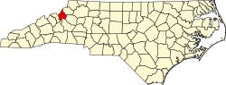
| County | Avery County |
| Named after | William Gragg [1] |
| Elevation | 2,664 ft (812 m) |
| Time zone | UTC-5 (Eastern (EST)) |
| • Summer (DST) | UTC-4 (EDT) |
| ZIP code | 28645 |
| Area code | 828 |
| GNIS feature ID | 1020484 [2] |
Gragg is an unincorporated community in Avery County, North Carolina, United States, spanning approximately one-half mile in radius from the intersection of Edgemont Road and Globe Road. [3] Gragg can be accessed from US 221 via mile marker #305 on the Blue Ridge Parkway. The area was originally known as "'Carey's Flat'".