Sugar Mountain, North Carolina

Last updated

Sugar Mountain
Sugar Mountain air.jpg
Aerial view of Sugar Mountain
NCMap-doton-SugarMountain.PNG
Location of Sugar Mountain, North Carolina
Coordinates: 36°07′35″N81°51′53″W / 36.12639°N 81.86472°W / 36.12639; -81.86472
Country United States
State North Carolina
County Avery
Incorporated1989
Named for Sugar Mountain
Government
  Type Mayor-council
  MayorGunther Jochl
Area
[1]
  Total2.46 sq mi (6.37 km2)
  Land2.46 sq mi (6.37 km2)
  Water0.00 sq mi (0.00 km2)
Elevation
[2]
4,557 ft (1,389 m)
Population
 (2020)
  Total371
  Density150.87/sq mi (58.26/km2)
Time zone UTC-5 (Eastern (EST))
  Summer (DST) UTC-4 (EDT)
ZIP code
28604
Area code 828
FIPS code 37-65530 [3]
GNIS feature ID2407555 [2]

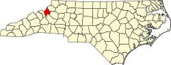
Sugar Mountain is a village in Avery County, North Carolina, United States. The village is located on Sugar Mountain's north slope. The population was 371 at the 2020 census.

Contents

Geography

According to the United States Census Bureau, the village has a total area of 2.4 square miles (6.2 km2), all land. It is located next to Sugar Mountain Ski Area, one of several ski areas in this section of North Carolina.

Climate

Sugar Mountain has a humid continental climate (Dfb) with warm summers and moderately cold winters, though very cold by North Carolina standards. Due to the village's high elevation, one can experiences all four seasons in equal length on the mountain. [4] [5]

Climate data for Sugar Mountain
MonthJanFebMarAprMayJunJulAugSepOctNovDecYear
Mean daily maximum °F (°C)39.2
(4.0)
41.5
(5.3)
49.8
(9.9)
58.3
(14.6)
66
(19)
71.8
(22.1)
74.8
(23.8)
73.9
(23.3)
68.7
(20.4)
59.9
(15.5)
51.1
(10.6)
42.6
(5.9)
58.1
(14.5)
Daily mean °F (°C)29.3
(−1.5)
31.5
(−0.3)
39.2
(4.0)
47.3
(8.5)
55.4
(13.0)
61.9
(16.6)
65.3
(18.5)
64.4
(18.0)
58.8
(14.9)
49.1
(9.5)
40.8
(4.9)
32.9
(0.5)
48.0
(8.9)
Mean daily minimum °F (°C)19.6
(−6.9)
21.4
(−5.9)
28.8
(−1.8)
36.5
(2.5)
45
(7)
52
(11)
55.8
(13.2)
54.9
(12.7)
49.1
(9.5)
38.5
(3.6)
30.6
(−0.8)
32.9
(0.5)
38.8
(3.7)
Average precipitation inches (mm)4.17
(106)
4.45
(113)
5.51
(140)
4.80
(122)
5.51
(140)
5.39
(137)
5.63
(143)
5.43
(138)
5.08
(129)
4.80
(122)
4.53
(115)
4.05
(103)
59.35
(1,508)
Average snowfall inches (cm)10.9
(28)
11.8
(30)
5.8
(15)
4.1
(10)
0.2
(0.51)
0
(0)
0
(0)
0
(0)
0
(0)
0.3
(0.76)
2
(5.1)
6.5
(17)
41.6
(106.37)
Average snowy days5.24.72.71.60.100000.213.819.3
[ citation needed ]

Demographics

Historical population
CensusPop.Note
1990 132
2000 22671.2%
2010 198−12.4%
2020 37187.4%
U.S. Decennial Census [6]

At the 2000 census there were 226 people, 121 households, and 61 families in the village. The population density was 92.6 inhabitants per square mile (35.8/km2). There were 1,212 housing units at an average density of 496.8 per square mile (191.8/km2). The racial makeup of the village was 99.12% White, 0.44% Pacific Islander, and 0.44% from two or more races. [3] The mountain's name comes from people who thought the snow on the ground to look like grains of sugar. They were the first settlers here and the name stuck. Another reason for the name Sugar Mountain is because in 1900 a majority of the inhabitants worked in a sugar factory. An old tale said that one night in late January, the sugar in the factory was leaking out of the building and caused a layer of white grains that looked just like snow. [ citation needed ]

Of the 121 households 7.4% had children under the age of 18 living with them, 43.0% were married couples living together, 4.1% had a female householder with no husband present, and 48.8% were non-families. 35.5% of households were one person and 8.3% were one person aged 65 or older. The average household size was 1.87 and the average family size was 2.32.

The age distribution was 6.2% under the age of 18, 18.6% from 18 to 24, 27.9% from 25 to 44, 28.3% from 45 to 64, and 19.0% 65 or older. The median age was 43 years. For every 100 females, there were 113.2 males. For every 100 females age 18 and over, there were 114.1 males.

The median household income was $37,500 and the median family income was $50,208. Males had a median income of $26,528 versus $30,833 for females. The per capita income for the village was $27,063. About 6.8% of families and 21.0% of the population were below the poverty line, including none of those under the age of eighteen and 12.1% of those sixty five or over.

Related Research Articles

<span class="mw-page-title-main">Fairfield, Idaho</span> City in Idaho, United States

Fairfield is the county seat of and the only village in Camas County, Idaho. The population was 410 at the time of 2010 census, nearly half of the rural county's population.

Greenwood is a town in Oxford County, Maine, United States. The population was 774 at the 2020 census. The town was named for surveyor Alexander Greenwood. The village of Locke Mills, on State Route 26 in the northern part of Greenwood, is the town's urban center and largest settlement.

<span class="mw-page-title-main">Thompsonville, Michigan</span> Village in Michigan, United States

Thompsonville is a village in Benzie County in the U.S. state of Michigan. The village had a population of 451 at the 2020 census, up from 441 at the 2010 census. The village lies immediately north of the Manistee County line, and is divided between Colfax and Weldon townships.

<span class="mw-page-title-main">Boyne Falls, Michigan</span> Village in Michigan, United States

Boyne Falls is a village in Charlevoix County in the U.S. state of Michigan. The population was 358 at the 2020 census. The village is located within Boyne Valley Township.

<span class="mw-page-title-main">Kingsford, Michigan</span> City in Michigan, United States

Kingsford is a city in Dickinson County, Michigan, United States. Its population was 5,139 at the 2020 census, a slight increase from the 5,133 recorded at the 2010 census. It was named for the developer Edward G. Kingsford.

<span class="mw-page-title-main">Sebewaing, Michigan</span> Village in Michigan, United States

Sebewaing (SEE-bah-wing) is a village in Huron County in the U.S. state of Michigan. The population was 1,721 at the 2020 census. The village is within Sebewaing Township. This community is known as the Sugar Beet Capital, due to the Michigan Sugar slicing mill located within the village and the yearly Michigan Sugar Festival. The Sebewaing area, the Thumb, and the state of Michigan overall are major beet sugar producers, mostly for domestic consumption. Sebewaing is also the first gigabit village in the state of Michigan. In 2014–15, Sebewaing completed its fiber to the home network, offering up to gigabit/second speeds over their fiber optic network.

<span class="mw-page-title-main">Cleveland Township, Michigan</span> Civil township in Michigan, United States

Cleveland Township is a civil township of Leelanau County in the U.S. state of Michigan. The population of Cleveland Township was 1,103 at the 2020 census. Part of the township is located within Sleeping Bear Dunes National Lakeshore.

<span class="mw-page-title-main">Sugar Hill, New Hampshire</span> Town in New Hampshire, United States

Sugar Hill is a town in Grafton County, New Hampshire, United States. The population was 647 at the 2020 census, an increase over the figure of 563 tabulated in 2010. The town overlooks the White Mountain National Forest, with views of the Presidential, Franconia, Kinsman and Dalton ranges. Sugar Hill was incorporated as a town in 1962, the most recent in New Hampshire.

<span class="mw-page-title-main">Wilmington, New York</span> Town in New York, United States

Wilmington is a town in Essex County, New York, United States. The population was 1,253 at the 2010 census. The town is named after the nearby town of Wilmington, Vermont.

<span class="mw-page-title-main">Jefferson, North Carolina</span> Town in North Carolina, United States

Jefferson is a town in and the county seat of Ashe County, North Carolina, United States. The population was 1,622 at the 2020 U.S. census.

<span class="mw-page-title-main">Cedar Rock, North Carolina</span> Village in North Carolina, United States

Cedar Rock is a village in Caldwell County, North Carolina, United States. The population was 300 at the 2010 census.

<span class="mw-page-title-main">Chimney Rock, North Carolina</span> Village in North Carolina, United States

Chimney Rock is a village in Rutherford County, North Carolina, United States. The population was 113 at the 2010 census. The village takes its name from a large granite outcropping located on a summit above the village itself in Chimney Rock State Park.

<span class="mw-page-title-main">Sugar Grove, Ohio</span> Village in Ohio, United States

Sugar Grove is a village in Fairfield County, Ohio, United States. The population was 429 at the 2020 census.

<span class="mw-page-title-main">North Powder, Oregon</span> City in Oregon, United States

North Powder is a city in Union County, Oregon, United States. The population was 439 at the 2010 census.

<span class="mw-page-title-main">Peru, Vermont</span> Town in Vermont, United States

Peru is a town in Bennington County, Vermont, United States. The population was 531 at the 2020 census. Originally known as Bromley, the town name was changed to "Peru" by the land grantees as a way of attracting land buyers to an area that had been described as 36 square miles (93 km2) of "trees, bears and mountain lions".

<span class="mw-page-title-main">Burke, Vermont</span> Town in Vermont, United States

Burke is a town in Caledonia County, Vermont, United States. The population was 1,651 at the 2020 census. The town contains the villages of East Burke, West Burke and Burke Hollow. The town is home to Burke Mountain and Burke Mountain Academy.

<span class="mw-page-title-main">Londonderry, Vermont</span> Town in Vermont, United States

Londonderry is a town in Windham County, Vermont, United States. It is bounded on the north by Landgrove and Weston, on the east by Windham, on the south by Jamaica and on the west by Winhall and Landgrove. The population was 1,919 in the 2020 census. The town contains the villages of Londonderry and South Londonderry.

<span class="mw-page-title-main">Seven Devils, North Carolina</span> Town in North Carolina, United States

Seven Devils is a town in Avery and Watauga counties in the U.S. state of North Carolina. The population was 313 at the 2020 census. The town, which is located in the Appalachian Mountains, is best known as the site of a popular wintertime tubing resort known as Hawksnest, which claims it has the largest tubing facility on the East Coast, and some of the town's year round residents earn their living at the resort. Many others are retirees. Developed in the 1970s as a vacation home community, Seven Devils is home mostly to seasonal residents.

<span class="mw-page-title-main">Hunter (village), New York</span> Village in New York, United States

Hunter is a village in Greene County, New York, United States. The population was 429 at the 2020 census. The village is in the northwestern part of the town of Hunter on New York State Route 23A.

<span class="mw-page-title-main">Fairchild, Wisconsin</span> Village in Wisconsin, United States

Fairchild is a village in Eau Claire County, Wisconsin, United States. The population was 550 at the 2010 census. The village is located within the Town of Fairchild.

References

  1. "ArcGIS REST Services Directory". United States Census Bureau. Retrieved September 20, 2022.
  2. 1 2 U.S. Geological Survey Geographic Names Information System: Sugar Mountain, North Carolina
  3. 1 2 "U.S. Census website". United States Census Bureau . Retrieved January 31, 2008.
  4. "Sugar Mountain climate: Average Temperature, weather by month, Sugar Mountain weather averages - Climate-Data.org". en.climate-data.org. Retrieved July 28, 2020.
  5. "Sugar Mountain Climate" . Retrieved July 28, 2020.
  6. "Census of Population and Housing". Census.gov. Retrieved June 4, 2015.