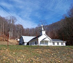
Frank, North Carolina

Last updated
Frank
Unincorporated community
Frank, NC 28657, USA - panoramio.jpg
A church in Frank
USA North Carolina location map.svg
Red pog.svg
Frank
Location within the state of North Carolina
Coordinates: 36°04′14″N82°00′09″W / 36.07056°N 82.00250°W / 36.07056; -82.00250 Coordinates: 36°04′14″N82°00′09″W / 36.07056°N 82.00250°W / 36.07056; -82.00250
Country United States
State North Carolina
County Avery County
Elevation 2,982 ft (909 m)
Time zone Eastern (EST) (UTC-5)
  Summer (DST) EDT (UTC-4)
ZIP code 28657
Area code(s) 828
GNIS feature ID 1020351 [1]

Frank is an unincorporated community in Avery County, North Carolina, United States. The community is located along US 19-E, between the communities of Minneapolis and Roaring Creek.

Avery County, North Carolina County in the United States

Avery County is a county located in the U.S. state of North Carolina. As of the 2010 census, the population was 17,797. The county seat is Newland. The county seat was initially established in Elk Park when the county was first formed, but was moved to Newland upon completion of the courthouse in 1912. Founded in 1911, it is the youngest of North Carolina's 100 counties.

North Carolina State of the United States of America

North Carolina is a state in the southeastern region of the United States. It borders South Carolina and Georgia to the south, Tennessee to the west, Virginia to the north, and the Atlantic Ocean to the east. North Carolina is the 28th-most extensive and the 9th-most populous of the U.S. states. The state is divided into 100 counties. The capital is Raleigh, which along with Durham and Chapel Hill is home to the largest research park in the United States. The most populous municipality is Charlotte, which is the second-largest banking center in the United States after New York City.

U.S. Route 19 highway in the United States

U.S. Route 19 (US 19) is a north–south U.S. Highway. Despite encroaching Interstate Highways, the route has remained a long-haul route, connecting the Gulf of Mexico with Lake Erie.

See also

Big Yellow Mountain mountain in United States of America

Big Yellow Mountain is a mountain in the North Carolina High Country and wholly in the Pisgah National Forest. Its elevation reaches 5,440 feet. The mountain generates feeder streams for the North Toe River.

Grassy Ridge Bald mountain in United States of America

Grassy Ridge Bald is a mountain in North Carolina and is part of the Roan Highlands, within the Pisgah National Forest. Its elevation reaches 6,165 feet and it is on the border between Avery and Mitchell counties. The mountain generates feeder streams for the North Toe River.

Little Yellow Mountain (North Carolina) mountain in United States of America

Little Yellow Mountain is a mountain in the North Carolina High Country and wholly in the Pisgah National Forest. Its elevation reaches 5,504 ft (1,678 m), it is on the border between Avery and Mitchell counties. The mountain generates feeder streams for the North Toe River.

Related Research Articles

Asheville, North Carolina City in North Carolina, United States

Asheville is a city and the county seat of Buncombe County, North Carolina, United States. It is the largest city in Western North Carolina, and the 12th-most populous city in the U.S. state of North Carolina. The city's population was 89,121 according to 2016 estimates. It is the principal city in the four-county Asheville metropolitan area, with a population of 424,858 in 2010.

Western Carolina University coeducational public university in Cullowhee, North Carolina, United States

Western Carolina University (WCU) is a public university in Cullowhee, North Carolina, United States. It is part of the University of North Carolina system.

Great Smoky Mountains American mountain range along North Carolina/Tennessee border

The Great Smoky Mountains are a mountain range rising along the Tennessee–North Carolina border in the southeastern United States. They are a subrange of the Appalachian Mountains, and form part of the Blue Ridge Physiographic Province. The range is sometimes called the Smoky Mountains and the name is commonly shortened to the Smokies. The Great Smokies are best known as the home of the Great Smoky Mountains National Park, which protects most of the range. The park was established in 1934, and, with over 11 million visits per year, it is the most visited national park in the United States.

Grandfather Mountain mountain

Grandfather Mountain is a mountain, a non-profit attraction, and a North Carolina state park near Linville, North Carolina. At 5,946 feet, it is the highest peak on the eastern escarpment of the Blue Ridge Mountains, one of the major chains of the Appalachian Mountains. The Blue Ridge Parkway passes by the south side of the mountain and also passes over the nearby Grandmother Gap. It is located at the meeting point of Avery, Caldwell, and Watauga counties.

Penland School of Crafts

The Penland School of Crafts ("Penland") is an Arts and Crafts educational center located in the Blue Ridge Mountains in Spruce Pine, North Carolina, about 50 miles from Asheville.

Wildlife of North Carolina

This article seeks to serve as a field-guide, central repository, and listing for the flora and fauna of North Carolina and surrounding territories.

The Baum Bugle: A Journal of Oz is the official journal of The International Wizard of Oz Club. The journal was founded in 1957, with its first issue released in June of that year. It publishes three times per year, with issues dated Spring, Autumn, and Winter; Issue No. 1 of Volume 50 appeared in the Spring of 2006. The journal publishes both scholarly and popular articles on L. Frank Baum, the Oz books written by Baum and other writers, and related subjects, plus reviews of Oz-related films and theater productions, rare photographs and illustrations, and similar materials.

Gregory Bald mountain in United States of America

Gregory Bald is a mountain in the Great Smoky Mountains. It has an elevation of 4,949 feet above sea level. The mountain's majestic summit makes it a popular hiking destination. Another feature that attracts many visitors are the flame azaleas that bloom over the bald every summer. The azaleas reach peak bloom around mid-to-late June.

Minneapolis, North Carolina Unincorporated community in North Carolina, United States

Minneapolis is a community located along US 19-E in Avery County, North Carolina. It shares its name with two other cities nationwide: another small town in Kansas, and the much larger and more famous city of Minneapolis, Minnesota, that state's largest city and twin city of its capital, Saint Paul.

Elk Knob State Park state park in North Carolina

Elk Knob State Park is an 3,680-acre (14.9 km2) North Carolina state park in Watauga County, North Carolina, in the United States. Opened in 2003, it is one of North Carolina's newest state parks. Elk Knob State Park was established to preserve the natural state of Elk Knob, the second highest peak in Watauga County. The park is open for year-round recreation and is currently undergoing an expansion of facilities to provide greater recreational opportunities to visitors. Elk Knob State Park is on Meat Camp Road, 5.5 miles (8.9 km) from North Carolina Highway 194, 9.5 miles (15.3 km) north of Boone, in the Blue Ridge Mountains.

Cove (Appalachian Mountains) A small valley in the Appalachian Mountains between two ridge lines

In the central and southern Appalachian Mountains of Eastern North America, a cove is a small valley between two ridge lines that is closed at one or both ends.

Plott Balsams

The Plott Balsams are a mountain range in western North Carolina, in the southeastern United States. They are part of the Blue Ridge Mountain Province of the Southern Appalachian Mountains. The Plott Balsams stretch from the city of Sylva in the Tuckasegee River valley to the southwest to Maggie Valley in the northeast. The Great Smoky Mountains border the Plott Balsams to the north and the Great Balsam Mountains border the range to the south. The range comprises parts of Jackson County and Haywood County.

Mayfield Mountain, Granville County, North Carolina is situated in Wilton, North Carolina. This hill is accompanied by one other "mountain" called Jenkins Mountain. These hills rise two to three hundred feet above the surrounding hills. At the base of these mountains is a river called Ford's Fork creek. These hills are abundant with wildlife including Whitetail deer, Bobcats, Coyotes, Carolina river dogs, Groundhogs, Turkeys, Red and yellow tailed hawks, Owls, Grey squirrels, Black bears, and Rabbits. These mountains are privately owned.

Bears Paw mountain in United States of America

Hanging Rock, also known as Bear's Paw, is a mountain in the North Carolina High Country, next to the town of Seven Devils. It is along the Avery and Watauga border. Its elevation reaches 5,203 feet (1,586 m). The mountain generates feeder streams for the Elk and Watauga rivers.

Roaring Creek, North Carolina Unincorporated community in North Carolina, United States

Roaring Creek is an unincorporated community in Avery County, North Carolina, United States. The community was named after Roaring Creek, which flows in the area. The community is located along US 19-E, between the communities of Frank and Plumtree.

Plumtree, North Carolina Unincorporated community in North Carolina, United States

Plumtree is an unincorporated community in Avery County, North Carolina, United States. The community is located along US 19-E, between the communities of Roaring Creek and Ingalls.

References