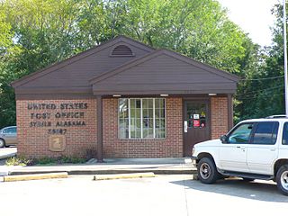
Ellenboro, North Carolina | |
---|---|
Nickname: The Boro | |
Motto: Small Town Friendly | |
Coordinates: 35°19′51″N81°45′41″W / 35.33083°N 81.76139°W | |
Country | United States |
State | North Carolina |
County | Rutherford |
Area | |
• Total | 1.26 sq mi (3.28 km2) |
• Land | 1.26 sq mi (3.28 km2) |
• Water | 0.00 sq mi (0.00 km2) |
Elevation | 1,040 ft (320 m) |
Population (2020) | |
• Total | 723 |
• Density | 571.54/sq mi (220.64/km2) |
Time zone | UTC-5 (Eastern (EST)) |
• Summer (DST) | UTC-4 (EDT) |
ZIP code | 28040 |
Area code | 828 |
FIPS code | 37-20780 [3] |
GNIS feature ID | 2406439 [2] |
Ellenboro is a town in Rutherford County, North Carolina, United States. The population was 723 at the 2020 census. [4]
According to the United States Census Bureau, the town has a total area of 0.9 square miles (2.3 km2), all land.
Census | Pop. | Note | %± |
---|---|---|---|
1900 | 172 | — | |
1910 | 293 | 70.3% | |
1920 | 333 | 13.7% | |
1930 | 431 | 29.4% | |
1940 | 471 | 9.3% | |
1950 | 537 | 14.0% | |
1960 | 492 | −8.4% | |
1970 | 465 | −5.5% | |
1980 | 560 | 20.4% | |
1990 | 514 | −8.2% | |
2000 | 479 | −6.8% | |
2010 | 873 | 82.3% | |
2020 | 723 | −17.2% | |
U.S. Decennial Census [5] |
As of the census [3] of 2000, there were 479 people, 2 households, and 12 families residing in the town. The population density was 513.6 inhabitants per square mile (198.3/km2). There were 251 housing units at an average density of 269.1 per square mile (103.9/km2). The racial makeup of the town was 82.46% White, 16.91% African American, 0.21% Native American, and 0.42% from two or more races. Hispanic or Latino of any race were 0.84% of the population.
There were 222 households, out of which 25.7% had children under the age of 18 living with them, 39.2% were married couples living together, 13.5% had a female householder with no husband present, and 43.2% were non-families. 37.8% of all households were made up of individuals, and 13.1% had someone living alone who was 65 years of age or older. The average household size was 2.16 and the average family size was 2.85.
In the town, the population was spread out, with 21.5% under the age of 18, 10.6% from 18 to 24, 27.6% from 25 to 44, 27.6% from 45 to 64, and 12.7% who were 65 years of age or older. The median age was 38 years. For every 100 females, there were 92.4 males. For every 100 females age 18 and over, there were 92.8 males.
The median income for a household in the town was $31,429, and the median income for a family was $37,083. Males had a median income of $27,500 versus $21,042 for females. The per capita income for the town was $16,472. About 10.3% of families and 12.1% of the population were below the poverty line, including 10.3% of those under age 18 and 34.1% of those age 65 or over.
Ellenboro is a town in Rutherford County.
In 1880, the Seaboard Air Line Railroad built a line from Wilmington to Rutherfordton. At the highest point on that line, the town of Ellenboro sprang up. In 1884, as the community of 179 people was trying to decide on a name for the town, Seaboard engineer John Robinson proposed that it be named for his daughter, Ellen, who was dying of a fever. In return, Robinson donated a large brass bell to the town. The bell hung for many years in the school, but disappeared some time after a new school building was built.
In those early days, the most important social event of the year was held in early July and was known as "Big Days." Big Days celebrations drew crowds from miles around (as pictured above in a turn of the century photo, showing a prize-winning wagon load of revelers). The festivities included a steam-powered merry-go-round, sack races, foot races, minstrel shows, side shows, produce sales, and lemonade dipped from zinc tubs.
In 1928, a young agriculture teacher at Ellenboro School, A.B. Bushong, organized the first Colfax Free Fair held in early fall on the school grounds, providing an opportunity for farmers and homemakers to display their best efforts of the year: canned and baked goods, crops, and handicrafts. Students also proudly exhibited their work competing for ribbons. Beauty and baby contests were held. A major part of the fair (especially for the children) was the rides provided every year by Lee Rides. Over the years, the fair, still held every September, has become a time for former students and Ellenboro residents who may have moved away to come home and visit with friends and to catch up on the year's news.
Steele is a town in northeastern St. Clair County, Alabama, United States. It was incorporated in 1952. At the 2010 census the population was 1,043, down from 1,093. The town is a part of the Birmingham–Hoover–Cullman Combined Statistical Area. It was initially known as Steel's Station or Steele's Depot in the late 19th century.
Oakland is a city in Coles County, Illinois, United States. The population was 739 at the 2020 census.
Pleasant Hill is a village in Pike County, Illinois, United States. The population was 966 at the 2010 census.
Kirklin is a town in Kirklin Township, Clinton County, Indiana, United States. The population was 788 at the 2010 census. The town was named for Nathan Kirk, a local pioneer settler.
Mooreland is a town in Blue River Township, Henry County, Indiana, United States. The population was 375 at the 2010 census.
Kincaid is a city in Anderson County, Kansas, United States. As of the 2020 census, the population of the city was 103.
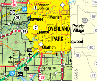
Merriam is a city in Johnson County, Kansas, United States, and part of the Kansas City Metropolitan Area. As of the 2020 census, the population of the city was 11,098. Merriam is included in the Shawnee Mission postal designation. It is also the headquarters of Seaboard Corporation.
Sherman is a town in Aroostook County, Maine, United States. The population was 815 at the 2020 census.
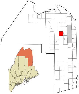
Wade is a town in Aroostook County, Maine, United States. The population was 229 at the 2020 census.
Springfield is a town in Penobscot County, Maine, United States. The population was 293 at the 2020 census.
Middlefield is a town in Hampshire County, Massachusetts, United States. The population was 385 at the 2020 census. It is part of the Springfield, Massachusetts Metropolitan Statistical Area.
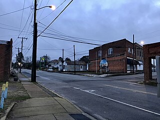
Seaboard is a township in Northampton County, North Carolina, United States, created as a company town by the Seaboard and Roanoke Railroad, approximately 10 miles northeast of Weldon in the mid-1840s as a place for railroad employees to live.
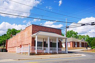
Bostic is a town in Rutherford County, North Carolina, United States. The population was 355 at the 2020 census.
Donnybrook is a city in Ward County, North Dakota, United States. The population was 75 at the 2020 census. It is part of the Minot Micropolitan Statistical Area.
Cheviot is a city in west-central Hamilton County, Ohio, United States. It is a suburb of Cincinnati. The population was 8,658 at the 2020 census.
Rutherford is a census-designated place (CDP) in Swatara Township, Dauphin County, Pennsylvania, United States. The area is also known as Rutherford Heights. The population was 4,303 at the 2010 census, an increase over the figure of 3,859 tabulated in 2000. It is part of the Harrisburg–Carlisle Metropolitan Statistical Area.
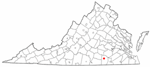
Alberta is a town in Brunswick County, Virginia, United States. The population was 302 at the 2020 census. It is home to the Christanna Campus of Southside Virginia Community College.
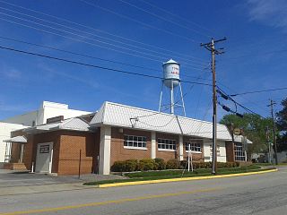
McKenney is an incorporated town in Dinwiddie County, Virginia, United States. The population was 483 at the 2010 census.
Ellenboro is a town in Ritchie County, West Virginia, United States. The population was 222 at the 2020 census. The town is located at the junction of U.S. Route 50 and West Virginia Route 16; the North Bend Rail Trail also passes through the town. The town was named for Ellen Mariah Williamson, the eldest daughter of the family that granted a right of way for the Baltimore and Ohio Railroad to build their line through the town; an earlier name for the community was Shumley. Ellenboro was incorporated in 1903.
The Town of Jamestown is located in Grant County, Wisconsin, United States. The population was 2,077 at the 2020 census. The census-designated places of Kieler and Sandy Hook and the unincorporated communities of Fair Play, Louisburg, and Rutledge are located within the town; The unincorporated community of Sinsinawa is located partially in the town. The ghost town of Sinnipee was located in the town.