List of counties in North Dakota

Last updated

Counties of North Dakota
Location State of North Dakota
Number53
Populations674 (Slope) – 196,362 (Cass)
Areas632 square miles (1,640 km2) (Eddy) – 2,742 square miles (7,100 km2) (McKenzie)
Government
Subdivisions

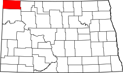
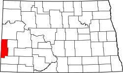
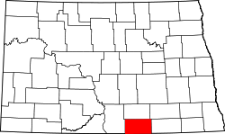
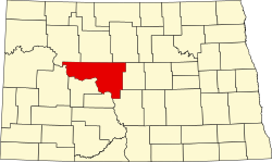
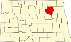
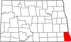
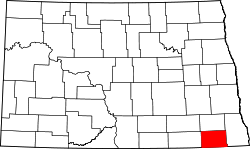
This is a list of counties in North Dakota. There are 53 counties in the U.S. state of North Dakota.

Contents

The Federal Information Processing Standard (FIPS) code, which is used by the United States government to uniquely identify states and counties, is provided with each entry. [1] North Dakota's code is 38, which when combined with any county code would be written as 38XXX. The FIPS code for each county links to census data for that county. [2]

ND counties, shaded by population ND counties by population.svg
ND counties, shaded by population

List

County
FIPS code [2] County seat [3] Est. [3] Etymology [4] Population [5] Area [3] [5] Map
AdamsCounty 001 Hettinger 1885John Quincy Adams, a railroad agent and cousin of the former president who was instrumental in having the Chicago, Milwaukee and St. Paul Railway built through North Dakota 2,163988 sq mi
(2,559 km2)
Map of North Dakota highlighting Adams County.svg
BarnesCounty 003 Valley City 1875 Dakota Territory judge Alanson H. Barnes10,7261,492 sq mi
(3,864 km2)
Map of North Dakota highlighting Barnes County.svg
BensonCounty 005 Minnewaukan 1883Dakota territorial legislator Bertil W. Benson 5,7451,389 sq mi
(3,597 km2)
Map of North Dakota highlighting Benson County.svg
BillingsCounty 007 Medora 1879 Frederick H. Billings (1823–1890), who was president of the Northern Pacific Railroad 1,0341,152 sq mi
(2,984 km2)
Map of North Dakota highlighting Billings County.svg
BottineauCounty 009 Bottineau 1873Named for frontiersman Pierre Bottineau 6,3491,669 sq mi
(4,323 km2)
Map of North Dakota highlighting Bottineau County.svg
BowmanCounty 011 Bowman 1883Dakota territorial legislator Edward M. Bowman 2,8671,162 sq mi
(3,010 km2)
Map of North Dakota highlighting Bowman County.svg
BurkeCounty 013 Bowbells 1910 John Burke, tenth Governor of North Dakota 2,1341,104 sq mi
(2,859 km2)
Map of North Dakota highlighting Burke County.svg
BurleighCounty 015 Bismarck 1873 Walter A. Burleigh (1820–1896), territorial delegate to Congress100,0121,633 sq mi
(4,229 km2)
Map of North Dakota highlighting Burleigh County.svg
CassCounty 017 Fargo 1873 George Washington Cass (1810–1888), who was the president of the Northern Pacific Railroad 196,3621,766 sq mi
(4,574 km2)
Map of North Dakota highlighting Cass County.svg
CavalierCounty 019 Langdon 1873Charles Cavalier, French fur trapper and one of the area's original settlers3,5961,489 sq mi
(3,856 km2)
Map of North Dakota highlighting Cavalier County.svg
DickeyCounty 021 Ellendale 1881Dakota territorial legislator George H. Dickey 4,9001,131 sq mi
(2,929 km2)
Map of North Dakota highlighting Dickey County.svg
DivideCounty 023 Crosby 1910Named because it was created upon the division of Williams County2,1351,259 sq mi
(3,261 km2)
Map of North Dakota highlighting Divide County.svg
DunnCounty 025 Manning 1883John P. Dunn, an early civic leader of Bismarck, who opened the first drugstore in North Dakota4,0192,010 sq mi
(5,206 km2)
Map of North Dakota highlighting Dunn County.svg
EddyCounty 027 New Rockford 1885Ezra B. Eddy, a Fargo banker and one of the territory's wealthiest citizens2,263632 sq mi
(1,637 km2)
Map of North Dakota highlighting Eddy County.svg
EmmonsCounty 029 Linton 1879James Emmons, an early entrepreneur and businessman who operated the first steamboat across the Missouri River in Bismarck 3,2241,510 sq mi
(3,911 km2)
Map of North Dakota highlighting Emmons County.svg
FosterCounty 031 Carrington 1873Either James S. Foster and George I. Foster, brother, and prominent farmers during the territorial days3,309635 sq mi
(1,645 km2)
Map of North Dakota highlighting Foster County.svg
Golden ValleyCounty 033 Beach 1912Named for either promotional reasons or for the Golden Valley Land and Cattle Company1,7431,002 sq mi
(2,595 km2)
Map of North Dakota highlighting Golden Valley County.svg
Grand ForksCounty 035 Grand Forks 1873Named for Grand Forks, North Dakota, which in turn was named for its location at the intersection of the Red Lake River and the Red River of the North 72,7081,438 sq mi
(3,724 km2)
Map of North Dakota highlighting Grand Forks County.svg
GrantCounty 037 Carson 1916 Ulysses S. Grant (1822–1885), eighteenth U.S. President2,2151,660 sq mi
(4,299 km2)
Map of North Dakota highlighting Grant County.svg
GriggsCounty 039 Cooperstown 1881 Alexander Griggs, a steamboat captain and founder of Grand Forks, North Dakota 2,248708 sq mi
(1,834 km2)
Map of North Dakota highlighting Griggs County.svg
HettingerCounty 041 Mott 1883Mathias K. Hettinger, the father-in-law of Erastus A. Williams, the North Dakota Speaker of the House during that session2,4151,132 sq mi
(2,932 km2)
Map of North Dakota highlighting Hettinger County.svg
KidderCounty 043 Steele 1873 Jefferson Parrish Kidder, territorial delegate to the 44th Congress and 45th Congresses 2,3421,352 sq mi
(3,502 km2)
Map of North Dakota highlighting Kidder County.svg
LaMoureCounty 045 LaMoure 1873Dakota territorial legislator and North Dakota state legislator Judson LaMoure 4,0961,147 sq mi
(2,971 km2)
Map of North Dakota highlighting LaMoure County.svg
LoganCounty 047 Napoleon 1873 Illinois U.S. Senator John A. Logan (1826–1886)1,869993 sq mi
(2,572 km2)
Map of North Dakota highlighting Logan County.svg
McHenryCounty 049 Towner 1873James McHenry, one of the area's original settlers5,1311,874 sq mi
(4,854 km2)
Map of North Dakota highlighting McHenry County.svg
McIntoshCounty 051 Ashley 1883Edward H. McIntosh, a member of the Territorial Legislature2,488975 sq mi
(2,525 km2)
Map of North Dakota highlighting McIntosh County.svg
McKenzieCounty 053 Watford City 1905 Alexander McKenzie, party boss known in the state as "the senator-maker"14,2522,742 sq mi
(7,102 km2)
Map of North Dakota highlighting McKenzie County.svg
McLeanCounty 055 Washburn 1883John A. McLean, first mayor of Bismarck, North Dakota 9,8322,110 sq mi
(5,465 km2)
Map of North Dakota highlighting McLean County.svg
MercerCounty 057 Stanton 1875William Henry Harrison Mercer, an early settler8,3091,045 sq mi
(2,707 km2)
Map of North Dakota highlighting Mercer County.svg
MortonCounty 059 Mandan 1873 Governor of Indiana Oliver Hazard Perry Throck Morton 33,8951,926 sq mi
(4,988 km2)
Map of North Dakota highlighting Morton County.svg
MountrailCounty 061 Stanley 1873Joseph Mountraille, Metis voyageur and early explorer9,3831,824 sq mi
(4,724 km2)
Map of North Dakota highlighting Mountrail County.svg
NelsonCounty 063 Lakota 1883Dakota territorial legislator Nelson E. Nelson2,991982 sq mi
(2,543 km2)
Map of North Dakota highlighting Nelson County.svg
OliverCounty 065 Center 1885Dakota territorial legislator Harry S. Oliver1,879724 sq mi
(1,875 km2)
Map of North Dakota highlighting Oliver County.svg
PembinaCounty 067 Cavalier 1867Named for the high-bush cranberries which grew wild in the area. Pembina may be from an Ojibwa phrase, anepeminan sipi, referring to the berries, as they grew in abundance around the Redberry River; it may also be from an Ojibwa word meaning meeting place. The name originally applied to the old Pembina Territory 6,6611,119 sq mi
(2,898 km2)
Map of North Dakota highlighting Pembina County.svg
PierceCounty 069 Rugby 1887 Gilbert Ashville Pierce, a Governor of Dakota Territory and later a U.S. Senator from North Dakota 3,9021,018 sq mi
(2,637 km2)
Map of North Dakota highlighting Pierce County.svg
RamseyCounty 071 Devils Lake 1873 Minnesota U.S. Senator Alexander Ramsey 11,4631,186 sq mi
(3,072 km2)
Map of North Dakota highlighting Ramsey County.svg
RansomCounty 073 Lisbon 1873Named for locally situated Fort Ransom 5,603863 sq mi
(2,235 km2)
Map of North Dakota highlighting Ransom County.svg
RenvilleCounty 075 Mohall 1873 Joseph Renville, missionary and interpreter for Dakota Native Americans2,279875 sq mi
(2,266 km2)
Map of North Dakota highlighting Renville County.svg
RichlandCounty 077 Wahpeton 1873Morgan T. Rich, early settler16,5581,437 sq mi
(3,722 km2)
Map of North Dakota highlighting Richland County.svg
RoletteCounty 079 Rolla 1873Joseph Rolette, Jr. (1820–1871), a prominent fur trapper and local political organizer11,728902 sq mi
(2,336 km2)
Map of North Dakota highlighting Rolette County.svg
SargentCounty 081 Forman 1883Homer E. Sargent, a general manager of the Northern Pacific Railroad 3,776859 sq mi
(2,225 km2)
Map of North Dakota highlighting Sargent County.svg
SheridanCounty 083 McClusky 1873 American Civil War officer Philip Henry Sheridan (1831–1888)1,266972 sq mi
(2,517 km2)
Map of North Dakota highlighting Sheridan County.svg
SiouxCounty 085 Fort Yates 1915The Native American Sioux people3,6431,094 sq mi
(2,833 km2)
Map of North Dakota highlighting Sioux County.svg
SlopeCounty 087 Amidon 1915Topographical feature within the county known as the Missouri Slope6741,218 sq mi
(3,155 km2)
Map of North Dakota highlighting Slope County.svg
StarkCounty 089 Dickinson 1879George Stark, a vice president of the Northern Pacific Railroad 33,0011,338 sq mi
(3,465 km2)
Map of North Dakota highlighting Stark County.svg
SteeleCounty 091 Finley 1883Edward H. Steele, secretary-treasurer of the Red River Land Company1,782712 sq mi
(1,844 km2)
Map of North Dakota highlighting Steele County.svg
StutsmanCounty 093 Jamestown 1873Dakota Territorial Legislator Enos Stutsman 21,3922,222 sq mi
(5,755 km2)
Map of North Dakota highlighting Stutsman County.svg
TownerCounty 095 Cando 1883Dakota territorial legislator Oscar M. Towner2,0301,025 sq mi
(2,655 km2)
Map of North Dakota highlighting Towner County.svg
TraillCounty 097 Hillsboro 1875Walter John Strickland Traill, early settler7,908862 sq mi
(2,233 km2)
Map of North Dakota highlighting Traill County.svg
WalshCounty 099 Grafton 1881 George H. Walsh, early settler and one of the founders of the University of North Dakota 10,3051,282 sq mi
(3,320 km2)
Map of North Dakota highlighting Walsh County.svg
WardCounty 101 Minot 1888Dakota territorial legislator Mark Ward (1844–1902)68,3322,013 sq mi
(5,214 km2)
Map of North Dakota highlighting Ward County.svg
WellsCounty 103 Fessenden 1873Dakota territorial legislator Edward Payson Wells3,8761,271 sq mi
(3,292 km2)
Map of North Dakota highlighting Wells County.svg
WilliamsCounty 105 Williston 1890Dakota territorial legislator Erastus Appelman Williams39,1132,071 sq mi
(5,364 km2)
Map of North Dakota highlighting Williams County.svg

See also

Related Research Articles

The Federal Information Processing Standards (FIPS) of the United States are a set of publicly announced standards that the National Institute of Standards and Technology (NIST) has developed for use in computer systems of non-military United States government agencies and contractors. FIPS standards establish requirements for ensuring computer security and interoperability, and are intended for cases in which suitable industry standards do not already exist. Many FIPS specifications are modified versions of standards the technical communities use, such as the American National Standards Institute (ANSI), the Institute of Electrical and Electronics Engineers (IEEE), and the International Organization for Standardization (ISO).

FIPS state codes were numeric and two-letter alphabetic codes defined in U.S. Federal Information Processing Standard Publication 5-2 to identify U.S. states and certain other associated areas. The standard superseded FIPS PUB 5-1 on May 28, 1987, and was superseded on September 2, 2008, by ANSI standard INCITS 38:2009.

The Federal Information Processing Standard Publication 6-4 is a five-digit Federal Information Processing Standards code which uniquely identified counties and county equivalents in the United States, certain U.S. possessions, and certain freely associated states.

References

  1. "FIPS Publish 6-4". National Institute of Standards and Technology. Archived from the original on 2013-09-29. Retrieved 2008-02-03.
  2. 1 2 "EPA County FIPS Code Listing". US Environmental Protection Agency . Retrieved 2008-02-03.
  3. 1 2 3 "NACo – Find a county". National Association of Counties. Archived from the original on 25 October 2007. Retrieved 24 February 2012.
  4. "County History". Official Portal for North Dakota State Government. Archived from the original on 2 February 2015. Retrieved 24 February 2012.
  5. 1 2 "North Dakota QuickFacts". 2023 Census estimate. U.S. Census Bureau . Retrieved 20 April 2024.