County
| FIPS code [12] | County seat [13] | Largest City [14] | Est. [13] | Formed from [6] [7] | Named for [15] | Density (per mi2) | Pop. [16] | Area [13] | Map
|
|---|
| AtlanticCounty | 001 | Mays Landing | Egg Harbor Township 47,842 | 1837 | Gloucester County | The Atlantic Ocean, which forms the county's eastern border | 497.53 | 279,114 | 561 sq mi
(1,453 km2) | 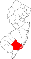 |
|---|
| BergenCounty | 003 | Hackensack | Hackensack 46,030 | 1683 | One of four original counties created in East Jersey | Bergen, New Netherland settlement | 4,182.23 | 978,641 | 234 sq mi
(606 km2) |  |
|---|
| BurlingtonCounty | 005 | Mount Holly | Evesham Township 46,826 | 1694 | One of two original counties created in West Jersey | The old ancient name for an inland market near Bridlington, England | 590.70 | 475,515 | 805 sq mi
(2,085 km2) |  |
|---|
| CamdenCounty | 007 | Camden | Cherry Hill 74,553 | 1844 | Gloucester County | Charles Pratt, 1st Earl Camden (1714–1794), an English supporter of the colonists during the American Revolution [17] | 2,405.35 | 533,988 | 222 sq mi
(575 km2) | 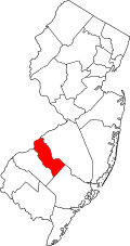 |
|---|
| Cape MayCounty | 009 | Cape May Court House | Lower Township 22,057 | 1692 | Burlington County | Cape May, named in turn for the 17th-century Dutch explorer Cornelius Jacobsen Mey, who explored and surveyed the Delaware Bay to the south of the county | 368.14 | 93,875 | 255 sq mi
(660 km2) |  |
|---|
| CumberlandCounty | 011 | Bridgeton | Vineland 60,780 | 1748 | Salem County | Prince William, Duke of Cumberland (1721–1765), second son of George II of Great Britain and military victor at the Battle of Culloden in 1746 | 318.36 | 155,678 | 489 sq mi
(1,267 km2) |  |
|---|
| EssexCounty | 013 | Newark | Newark 311,549 | 1683 | One of four original counties created in East Jersey | The county of Essex in England | 6,996.25 | 881,527 | 126 sq mi
(326 km2) |  |
|---|
| GloucesterCounty | 015 | Woodbury | Washington Township 48,677 | 1686 | Burlington County | The city of Gloucester, England | 959.33 | 311,783 | 325 sq mi
(842 km2) |  |
|---|
| HudsonCounty | 017 | Jersey City | Jersey City 292,449 | 1840 | Bergen County | The English explorer Henry Hudson (d. 1611), who explored portions of New Jersey's coastline | 15,663.51 | 736,185 | 47 sq mi
(122 km2) |  |
|---|
| HunterdonCounty | 019 | Flemington | Raritan Township 23,447 | 1714 | Burlington County | Robert Hunter (1664–1734), the Colonial Governor of New Jersey from 1710 to 1720 | 306.30 | 131,708 | 430 sq mi
(1,114 km2) | 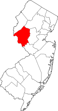 |
|---|
| MercerCounty | 021 | Trenton | Hamilton Township 92,297 | 1838 | Burlington, Hunterdon, Middlesex, and Somerset counties | The Continental Army General Hugh Mercer (1726–1777), who died at the Battle of Princeton [18] | 1,735.12 | 392,138 | 226 sq mi
(585 km2) |  |
|---|
| MiddlesexCounty | 023 | New Brunswick | Edison 107,588 | 1683 | One of four original counties created in East Jersey | The historic county of Middlesex in England | 2,862.12 | 890,119 | 311 sq mi
(805 km2) |  |
|---|
| MonmouthCounty | 025 | Freehold Borough | Middletown Township 67,106 | 1683 | One of four original counties created in East Jersey | The historic County of Monmouth in Great Britain | 1,371.86 | 647,520 | 472 sq mi
(1,222 km2) |  |
|---|
| MorrisCounty | 027 | Morristown | Parsippany-Troy Hills 56,162 | 1739 | Hunterdon County | Colonel Lewis Morris (1671–1746), colonial governor of New Jersey at the time of the county's formation [19] [20] | 1,115.25 | 523,053 | 469 sq mi
(1,215 km2) |  |
|---|
| OceanCounty | 029 | Toms River | Lakewood Township 135,158 | 1850 | Monmouth and Burlington counties | The Atlantic Ocean, which forms the eastern border of New Jersey | 1,047.85 | 666,434 | 915 sq mi
(2,370 km2) |  |
|---|
| PassaicCounty | 031 | Paterson | Paterson 159,732 | 1837 | Bergen and Essex counties | Pasaeck, a Lenape word meaning "valley" | 2,846.47 | 526,597 | 185 sq mi
(479 km2) |  |
|---|
| SalemCounty | 033 | Salem | Pennsville Township 12,684 | 1694 | One of two original counties created in West Jersey | Salem, Biblical town, which takes its name from the Hebrew word for "peace." | 194.89 | 65,874 | 338 sq mi
(875 km2) | 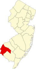 |
|---|
| SomersetCounty | 035 | Somerville | Franklin Township 68,364 | 1688 | Middlesex County | The county of Somerset in England | 1,172.02 | 357,467 | 305 sq mi
(790 km2) |  |
|---|
| SussexCounty | 037 | Newton | Vernon Township 22,358 | 1753 | Morris County | The county of Sussex in England | 283.00 | 147,444 | 521 sq mi
(1,349 km2) | 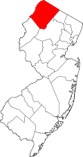 |
|---|
| UnionCounty | 039 | Elizabeth | Elizabeth 137,298 | 1857 | Essex County | The union of the United States, which was being threatened by the dispute over slavery | 5,768.54 | 594,160 | 103 sq mi
(267 km2) | 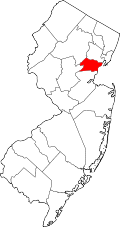 |
|---|
| WarrenCounty | 041 | Belvidere | Phillipsburg 15,249 | 1824 | Sussex County | The American Revolutionary War General Joseph Warren (1741–1775), killed at the Battle of Bunker Hill | 312.94 | 112,031 | 358 sq mi
(927 km2) | 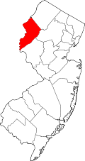 |
|---|


