Belvidere, New Jersey | |
---|---|
Location in Warren County Location in New Jersey | |
Coordinates: 40°49′47″N75°04′24″W / 40.829802°N 75.073337°W [1] [2] | |
Country | United States |
State | New Jersey |
County | Warren |
Incorporated | April 7, 1845 |
Named for | Italian language "beautiful to see" |
Government | |
• Type | Town |
• Body | Town Council |
• Mayor | Kathleen B. Miers. (R, term ends December 31, 2023) [4] [5] |
• Administrator / Municipal clerk | Teresa A. Yeisley [6] |
Area | |
• Total | 1.48 sq mi (3.84 km2) |
• Land | 1.45 sq mi (3.75 km2) |
• Water | 0.04 sq mi (0.09 km2) 2.36% |
• Rank | 452nd of 565 in state 22nd of 22 in county [1] |
Elevation | 266 ft (81 m) |
Population | |
• Total | 2,520 |
• Estimate (2023) [10] | 2,536 |
• Rank | 467th of 565 in state 16th of 22 in county [11] |
• Density | 1,738.6/sq mi (671.3/km2) |
• Rank | 316th of 565 in state 4th of 22 in county [11] |
Time zone | UTC−05:00 (Eastern (EST)) |
• Summer (DST) | UTC−04:00 (Eastern (EDT)) |
ZIP Code | |
Area codes | 908 [14] |
FIPS code | 3404104990 [1] [15] [16] |
GNIS feature ID | 885156 [1] [17] |
Website | www |
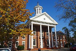
Belvidere is a town and the county seat of Warren County, in the U.S. state of New Jersey. [18] As of the 2020 United States census, the town's population was 2,520, [9] a decrease of 161 (−6.0%) from the 2010 census count of 2,681, [19] [20] which in turn reflected a decline of 90 (−3.2%) from the 2,771 counted in the 2000 census. [21]
Belvidere was incorporated as a town by an act of the New Jersey Legislature on April 7, 1845, from portions of Oxford Township, based on the results of a referendum held that day. [22] The town's name means "beautiful to see" in Italian. [23]
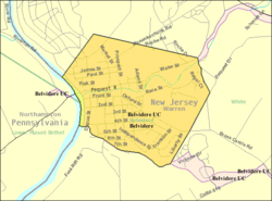
According to the U.S. Census Bureau, the town had a total area of 1.48 square miles (3.84 km2), including 1.45 square miles (3.75 km2) of land and 0.04 square miles (0.09 km2) of water (2.36%). [1] [2] Dildine Island is located in the Delaware River, approximately 4 miles (6.4 km) north of Belvidere.
Belvidere borders White Township in Warren County and Northampton County in Pennsylvania across the Delaware River. [24] [25] [26]
Climate data for Belvidere, New Jersey (1991–2020 normals, extremes 1893–present) | |||||||||||||
---|---|---|---|---|---|---|---|---|---|---|---|---|---|
Month | Jan | Feb | Mar | Apr | May | Jun | Jul | Aug | Sep | Oct | Nov | Dec | Year |
Record high °F (°C) | 69 (21) | 77 (25) | 87 (31) | 96 (36) | 100 (38) | 103 (39) | 106 (41) | 103 (39) | 104 (40) | 94 (34) | 81 (27) | 73 (23) | 106 (41) |
Mean maximum °F (°C) | 58.2 (14.6) | 59.8 (15.4) | 68.5 (20.3) | 81.2 (27.3) | 87.8 (31.0) | 91.3 (32.9) | 93.9 (34.4) | 92.3 (33.5) | 88.8 (31.6) | 80.2 (26.8) | 71.2 (21.8) | 60.0 (15.6) | 95.2 (35.1) |
Mean daily maximum °F (°C) | 36.5 (2.5) | 39.8 (4.3) | 48.1 (8.9) | 60.6 (15.9) | 70.9 (21.6) | 79.3 (26.3) | 84.1 (28.9) | 82.6 (28.1) | 76.3 (24.6) | 64.2 (17.9) | 52.4 (11.3) | 41.4 (5.2) | 61.3 (16.3) |
Daily mean °F (°C) | 27.3 (−2.6) | 29.2 (−1.6) | 37.0 (2.8) | 48.3 (9.1) | 58.5 (14.7) | 67.4 (19.7) | 72.3 (22.4) | 71.0 (21.7) | 64.1 (17.8) | 52.3 (11.3) | 41.3 (5.2) | 32.5 (0.3) | 50.1 (10.1) |
Mean daily minimum °F (°C) | 18.0 (−7.8) | 18.6 (−7.4) | 25.9 (−3.4) | 36.1 (2.3) | 46.0 (7.8) | 55.5 (13.1) | 60.5 (15.8) | 59.4 (15.2) | 51.9 (11.1) | 40.3 (4.6) | 30.2 (−1.0) | 23.6 (−4.7) | 38.8 (3.8) |
Mean minimum °F (°C) | 3.4 (−15.9) | 5.6 (−14.7) | 14.5 (−9.7) | 25.3 (−3.7) | 33.2 (0.7) | 43.9 (6.6) | 52.4 (11.3) | 50.3 (10.2) | 40.1 (4.5) | 28.8 (−1.8) | 18.3 (−7.6) | 11.2 (−11.6) | 1.6 (−16.9) |
Record low °F (°C) | −20 (−29) | −15 (−26) | −5 (−21) | 9 (−13) | 27 (−3) | 31 (−1) | 42 (6) | 40 (4) | 28 (−2) | 18 (−8) | 1 (−17) | −14 (−26) | −20 (−29) |
Average precipitation inches (mm) | 3.22 (82) | 2.72 (69) | 3.63 (92) | 3.95 (100) | 4.08 (104) | 4.48 (114) | 4.81 (122) | 4.55 (116) | 4.63 (118) | 4.75 (121) | 3.31 (84) | 4.08 (104) | 48.21 (1,225) |
Average snowfall inches (cm) | 9.9 (25) | 5.2 (13) | 3.5 (8.9) | 0.3 (0.76) | 0.0 (0.0) | 0.0 (0.0) | 0.0 (0.0) | 0.0 (0.0) | 0.0 (0.0) | 0.0 (0.0) | 0.4 (1.0) | 4.0 (10) | 23.3 (59) |
Average precipitation days (≥ 0.01 in) | 10.6 | 8.8 | 10.7 | 11.1 | 13.7 | 12.0 | 11.3 | 11.1 | 9.0 | 10.4 | 9.8 | 12.0 | 130.5 |
Average snowy days (≥ 0.1 in) | 3.8 | 2.6 | 1.6 | 0.1 | 0.0 | 0.0 | 0.0 | 0.0 | 0.0 | 0.0 | 0.2 | 2.1 | 10.4 |
Source: NOAA [27] [28] |
Census | Pop. | Note | %± |
---|---|---|---|
1850 | 1,001 | — | |
1860 | 1,530 | 52.8% | |
1870 | 1,882 | 23.0% | |
1880 | 1,773 | −5.8% | |
1890 | 1,768 | −0.3% | |
1900 | 1,784 | 0.9% | |
1910 | 1,764 | −1.1% | |
1920 | 1,793 | 1.6% | |
1930 | 2,073 | 15.6% | |
1940 | 2,060 | −0.6% | |
1950 | 2,406 | 16.8% | |
1960 | 2,636 | 9.6% | |
1970 | 2,722 | 3.3% | |
1980 | 2,475 | −9.1% | |
1990 | 2,669 | 7.8% | |
2000 | 2,771 | 3.8% | |
2010 | 2,681 | −3.2% | |
2020 | 2,520 | −6.0% | |
2023 (est.) | 2,536 | [10] | 0.6% |
Population sources: 1850–1920 [29] 1850–1870 [30] 1850 [31] 1870 [32] 1880–1890 [33] 1890–1910 [34] 1910–1930 [35] 1940–2000 [36] [37] 2010 [19] [20] 2020 [9] |
The 2010 United States census counted 2,681 people, 1,054 households, and 682 families in the town. The population density was 1,847.0 inhabitants per square mile (713.1/km2). There were 1,140 housing units at an average density of 785.4 per square mile (303.2/km2). The racial makeup was 96.01% (2,574) White, 1.57% (42) Black or African American, 0.11% (3) Native American, 0.78% (21) Asian, 0.00% (0) Pacific Islander, 0.22% (6) from other races, and 1.31% (35) from two or more races. Hispanic or Latino of any race were 3.62% (97) of the population. [19]
Of the 1,054 households, 30.8% had children under the age of 18; 48.8% were married couples living together; 12.3% had a female householder with no husband present and 35.3% were non-families. Of all households, 28.7% were made up of individuals and 10.6% had someone living alone who was 65 years of age or older. The average household size was 2.52 and the average family size was 3.17. [19]
25.3% of the population were under the age of 18, 8.2% from 18 to 24, 23.4% from 25 to 44, 30.6% from 45 to 64, and 12.4% who were 65 years of age or older. The median age was 41.0 years. For every 100 females, the population had 93.0 males. For every 100 females ages 18 and older there were 88.5 males. [19]
The Census Bureau's 2006–2010 American Community Survey showed that (in 2010 inflation-adjusted dollars) median household income was $60,707 (with a margin of error of +/− $10,476) and the median family income was $74,028 (+/− $13,366). Males had a median income of $53,796 (+/− $11,432) versus $32,000 (+/− $7,359) for females. The per capita income for the town was $28,220 (+/− $2,359). About 0.8% of families and 2.3% of the population were below the poverty line, including none of those under age 18 and 2.9% of those age 65 or over. [38]
As of the 2000 U.S. Census, [15] there were 2,771 people, 1,088 households, and 716 families residing in the town. The population density was 2,091.7 inhabitants per square mile (807.6/km2). There were 1,165 housing units at an average density of 879.4 per square mile (339.5/km2). The racial makeup of the town was 98.02% White, 0.51% African American, 0.04% Native American, 0.51% Asian, 0.25% from other races, and 0.69% from two or more races. Hispanic or Latino of any race were 2.31% of the population. [39] [37]
There were 1,088 households, out of which 36.4% had children under the age of 18 living with them, 52.0% were married couples living together, 9.7% had a female householder with no husband present, and 34.1% were non-families. 28.5% of all households were made up of individuals, and 11.1% had someone living alone who was 65 years of age or older. The average household size was 2.54 and the average family size was 3.17. [39] [37]
In the town, the population was spread out, with 28.1% under the age of 18, 6.1% from 18 to 24, 32.2% from 25 to 44, 20.7% from 45 to 64, and 12.8% who were 65 years of age or older. The median age was 36 years. For every 100 females, there were 92.0 males. For every 100 females age 18 and over, there were 88.5 males. [39] [37]
The median income for a household in the town was $52,792, and the median income for a family was $62,212. Males had a median income of $41,800 versus $31,444 for females. The per capita income for the town was $23,231. About 1.3% of families and 3.4% of the population were below the poverty line, including 0.4% of those under age 18 and 10.4% of those age 65 or over. [39] [37]
A large site of DSM-Firmenich Nutritional Products that includes 250,000 square feet (23,000 m2) of facilities in the town, manufacturing products including arachidonic acid and beta-carotene by fermentation processes, is located on the town's border with White Township. [40]
Belvidere is governed under the Town form of municipal government. The town is one of nine municipalities (of the 564) statewide that use this traditional form of government. [41] The governing body is comprised of the mayor and the six-member Town Council, with all positions elected at-large on a partisan basis as part of the November general election. A mayor is elected directly by the voters to a four-year term of office. The town council consists of six members elected to serve three-year terms on a staggered basis, with two seats coming up for election each year in a three-year cycle. [3] [42]
As of 2022 [update] , the Mayor of Belvidere is Republican Kathy B Miers, whose term of office ends December 31, 2023. Members of the Town Council are Council President Laurel Napolitani (R, 2023), Glen E. Matlock (R, 2022; elected to serve an unexpired term), Kathleen Miers (R, 2023), Donald Mitchell (R, 2022), Joseph Roth (R, 2024) and Adam Zmigrodski (R, 2024). [4] [43] [44] [45] [46]
Glen Matlock was elected in November 2020 to serve the term of office expiring in December 2022 that had been held by Charles A. Makatura Jr. until he resigned from office in January 2020. [45] [47]
In March 2015, the town council selected Timothy Petre from three candidates nominated by the Republican municipal committee to fill the seat expiring in December 2017 that had been held by William J. Murphy until he resigned from office. [48] Petre served on an interim basis until the November 2015 general election, when Laurel Napolitani was elected to serve the balance of the term of office. [49]
In December 2014, the town council selected Laurel Napolitani from among three names nominated by the Republican municipal committee to fill the term expiring in December 2016 that had been held by Michael Viglianco, who resigned from council in December 2014 after moving out of Belvidere. [50] [51] Napolitani served on an interim basis until the November 2015 general election, when Walter Tutka was elected to serve the balance of the term of office. [49]
Belvidere is located in the 7th Congressional District [52] and is part of New Jersey's 23rd state legislative district. [53]
For the 118th United States Congress , New Jersey's 7th congressional district is represented by Thomas Kean Jr. ( R , Westfield ). [54] New Jersey is represented in the United States Senate by Democrats Cory Booker ( Newark , term ends 2027) [55] and George Helmy ( Mountain Lakes , term ends 2024), who was appointed to the seat following the resignation of Bob Menendez ( Englewood Cliffs ). [56] [57]
For the 2024-2025 session , the 23rd legislative district of the New Jersey Legislature is represented in the State Senate by Doug Steinhardt ( R , Lopatcong Township ) and in the General Assembly by John DiMaio (R, Hackettstown ) and Erik Peterson (R, Franklin Township ). [58]
Warren County is governed by a three-member Board of County Commissioners, who are chosen at-large on a staggered basis in partisan elections with one seat coming up for election each year as part of the November general election. At an annual reorganization meeting held in the beginning of January, the board selects one of its members to serve as Commissioner Director and other as Deputy Director. [59] As of 2024 [update] , Warren County's Commissioners are:
Deputy Director Jason J. Sarnoski (R, Lopatcong Township; 2025), [60] Lori Ciesla (R, Lopatcong Township; 2026), [61] and Director James R. Kern III (R, Pohatcong Township; 2025). [62] [63]
Constitutional officers of Warren County are: Clerk Holly Mackey (R, Alpha; 2027), [64] [65] Sheriff James McDonald Sr. (R, Phillipsburg; 2025) [66] [67] and Surrogate Michael J. Doherty (R, Washington; 2025). [68] [69] [70]
As of March 2011, there were a total of 1,687 registered voters in Belvidere, of which 380 (22.5% vs. 21.5% countywide) were registered as Democrats, 611 (36.2% vs. 35.3%) were registered as Republicans and 694 (41.1% vs. 43.1%) were registered as Unaffiliated. There were 2 voters registered as either Libertarians or Greens. [71] Among the town's 2010 Census population, 62.9% (vs. 62.3% in Warren County) were registered to vote, including 84.3% of those ages 18 and over (vs. 81.5% countywide). [71] [72]
In the 2012 presidential election, Republican Mitt Romney received 656 votes (53.8% vs. 56.0% countywide), ahead of Democrat Barack Obama with 521 votes (42.7% vs. 40.8%) and other candidates with 24 votes (2.0% vs. 1.7%), among the 1,220 ballots cast by the town's 1,724 registered voters, for a turnout of 70.8% (vs. 66.7% in Warren County). [73] [74] In the 2008 presidential election, Republican John McCain received 693 votes (55.0% vs. 55.2% countywide), ahead of Democrat Barack Obama with 514 votes (40.8% vs. 41.4%) and other candidates with 27 votes (2.1% vs. 1.6%), among the 1,260 ballots cast by the town's 1,684 registered voters, for a turnout of 74.8% (vs. 73.4% in Warren County). [75] In the 2004 presidential election, Republican George W. Bush received 779 votes (61.9% vs. 61.0% countywide), ahead of Democrat John Kerry with 452 votes (35.9% vs. 37.2%) and other candidates with 21 votes (1.7% vs. 1.3%), among the 1,259 ballots cast by the town's 1,640 registered voters, for a turnout of 76.8% (vs. 76.3% in the whole county). [76]
In the 2013 gubernatorial election, Republican Chris Christie received 68.3% of the vote (494 cast), ahead of Democrat Barbara Buono with 27.0% (195 votes), and other candidates with 4.7% (34 votes), among the 740 ballots cast by the town's 1,758 registered voters (17 ballots were spoiled), for a turnout of 42.1%. [77] [78] In the 2009 gubernatorial election, Republican Chris Christie received 480 votes (56.7% vs. 61.3% countywide), ahead of Democrat Jon Corzine with 221 votes (26.1% vs. 25.7%), Independent Chris Daggett with 116 votes (13.7% vs. 9.8%) and other candidates with 18 votes (2.1% vs. 1.5%), among the 847 ballots cast by the town's 1,642 registered voters, yielding a 51.6% turnout (vs. 49.6% in the county). [79]
The Belvidere School District serves students in pre-kindergarten through twelfth grade. [80] As of the 2020–21 school year, the district, comprised of two schools, had an enrollment of 631 students and 61.5 classroom teachers (on an FTE basis), for a student–teacher ratio of 10.3:1. [81] Schools in the district (with 2020–21 enrollment data from the National Center for Education Statistics [82] ) are Oxford Street Elementary School [83] with 262 students in grades PreK-8, and Belvidere High School [84] with 367 students in grades 9-12. [85] [86] [87] As part of a cost-saving measure, Third Street School was closed after the 2018–2019 school year and merged into Oxford Street Elementary School. [88] [89] Students from Harmony Township, Hope Township and White Township attend the district's high school as part of sending/receiving relationships with the respective districts. [85] [90]
Students from the town and from all of Warren County are eligible to attend Ridge and Valley Charter School in Blairstown (for grades K–8) [91] or Warren County Technical School in Washington borough (for 9–12), [92] with special education services provided by local districts supplemented throughout the county by the Warren County Special Services School District in Oxford Township (for Pre-K–12). [85] [93]
Belvidere was rated one of the Top 5 Schools in each county with the highest rate of drug/violence/bullying incidents, based on the number of incidents per every 100 enrolled students. [94]
As of May 2010 [update] , the town had a total of 16.39 miles (26.38 km) of roadways, of which 14.38 miles (23.14 km) were maintained by the municipality and 2.01 miles (3.23 km) by Warren County. [95]
The most prominent highway is County Route 620. [96]
The Riverton–Belvidere Bridge crosses the Delaware River, connecting Belvidere with Riverton, Pennsylvania, operated by the Delaware River Joint Toll Bridge Commission. There is no toll for crossing on either side, after tolls were abolished by the Joint Commission for the Elimination of Toll Bridges in 1929. The bridge is 653 feet (199 m) long, connecting County Route 620 Spur (Water Street) in Belvidere to former Pennsylvania Route 709 on the Riverton side. [97]
People who were born in, residents of, or otherwise closely associated with Belvidere include:
Warren County is a county located in the U.S. state of New Jersey. According to the 2020 census, the county was the state's 19th-most populous county, with a population of 109,632, its highest decennial count ever and an increase of 940 (+0.9%) from the 2010 census count of 108,692, which in turn reflected an increase of 6,255 (+6.1%) from 102,437 counted at the 2000 census. The county is part of the North Jersey region of the state.
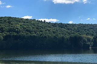
Allamuchy Township is a township in Warren County, in the U.S. state of New Jersey. As of the 2020 United States census, the township's population was 5,335, an increase of 1,012 (+23.4%) from the 2010 census count of 4,323, which in turn reflected an increase of 446 (+11.5%) from the 3,877 counted in the 2000 census.
Alpha is a borough in Warren County, in the U.S. state of New Jersey. As of the 2020 United States census, the borough's population was 2,328, a decrease of 41 (−1.7%) from the 2010 census count of 2,369, which in turn reflected a decline of 113 (−4.6%) from the 2,482 counted in the 2000 census.
Franklin Township is a township in Warren County, in the U.S. state of New Jersey. As of the 2020 United States census, the township's population was 2,968, a decrease of 208 (−6.5%) from the 2010 census count of 3,176, which in turn reflected an increase of 408 (+14.7%) from the 2,768 counted in the 2000 census.
Frelinghuysen Township is a township in Warren County, in the U.S. state of New Jersey. As of the 2020 United States census, the township's population was 2,199, a decrease of 31 (−1.4%) from the 2010 census count of 2,230, which in turn reflected an increase of 147 (+7.1%) from the 2,083 counted in the 2000 census.
Greenwich Township is a township in Warren County, in the U.S. state of New Jersey. As of the 2020 United States census, the township's population was 5,473, a decrease of 239 (−4.2%) from the 2010 census count of 5,712, which in turn reflected an increase of 1,347 (+30.9%) from the 4,365 counted in the 2000 census.
Hardwick Township is a township in Warren County, in the U.S. state of New Jersey. As of the 2020 United States census, the township's population was 1,598, a decrease of 98 (−5.8%) from the 2010 census count of 1,696, which in turn reflected an increase of 232 (+15.8%) from the 1,464 counted in the 2000 census.
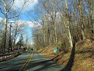
Harmony Township is a township located in Warren County in the U.S. state of New Jersey. As of the 2020 United States census, the township's population was 2,503, a decrease of 164 (−6.1%) from the 2010 census count of 2,667, which in turn reflected a decline of 62 (−2.3%) from the 2,729 counted in the 2000 census.
Hope Township is a township in Warren County in the U.S. state of New Jersey. As of the 2020 United States census, the township's population was 1,835, a decrease of 117 (−6.0%) from the 2010 census count of 1,952, which in turn reflected an increase of 61 (+3.2%) from the 1,891 counted in the 2000 census. The 2010 population of 1,952 reflected an all-time high since the 1,903 recorded in the 1840 census, the first recorded population after the township was formed.
Independence Township is a township in Warren County, in the U.S. state of New Jersey. As of the 2020 United States census, the township's population was 5,469, a decrease of 193 (−3.4%) from the 2010 census count of 5,662, which in turn reflected an increase of 59 (+1.1%) from the 5,603 counted in the 2000 census.
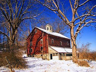
Knowlton Township is a township in Warren County, in the U.S. state of New Jersey. As of the 2020 United States census, the township's population was 2,894, a decrease of 161 (−5.3%) from the 2010 census count of 3,055, which in turn reflected an increase of 78 (+2.6%) from the 2,977 counted in the 2000 census.
Liberty Township is a township in Warren County in the U.S. state of New Jersey. As of the 2020 United States census, the township's population was 2,670, a decrease of 272 (−9.2%) from the 2010 census count of 2,942, which in turn reflected an increase of 177 (+6.4%) from the 2,765 counted in the 2000 census.
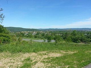
Lopatcong Township is a township in Warren County, within the U.S. state of New Jersey. As of the 2020 United States census, the township's population was 8,776, an increase of 762 (+9.5%) from the 2010 census count of 8,014, which in turn reflected an increase of 2,249 (+39.0%) from the 5,765 counted in the 2000 census.
Mansfield Township is a township in Warren County, in the U.S. state of New Jersey. As of the 2020 United States census, the township's population was 7,781, its highest decennial census count ever, and an increase of 56 (+0.7%) from the 2010 census count of 7,725, which in turn reflected an increase of 1,072 (+16.1%) from the 6,653 counted in the 2000 census.
Oxford Township is a township in Warren County, in the U.S. state of New Jersey. As of the 2020 United States census, the township's population was 2,444, a decrease of 70 (−2.8%) from the 2010 census count of 2,514, which in turn reflected an increase of 207 (+9.0%) from the 2,307 counted in the 2000 census.
Phillipsburg is a town located along the Delaware River that is the most populous municipality in Warren County, in the U.S. state of New Jersey. It is part of the Allentown-Bethlehem-Easton, PA-NJ metropolitan statistical area. As of the 2020 United States census, the town's population was 15,249, an increase of 299 (+2.0%) from the 2010 census count of 14,950, which in turn reflected a decline of 216 (−1.4%) from the 15,166 counted in the 2000 census.
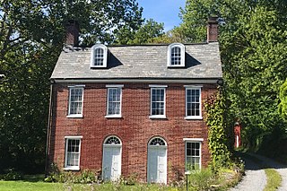
Pohatcong Township is a township in Warren County, in the U.S. state of New Jersey. As of the 2020 United States census, the township's population was 3,241, a decrease of 98 (−2.9%) from the 2010 census count of 3,339, which in turn reflected a decline of 77 (−2.3%) from the 3,416 counted in the 2000 census.
Washington is a borough in Warren County, in the U.S. state of New Jersey. As of the 2020 United States census, the borough's population was 7,299, an increase of 838 (+13.0%) from the 2010 census count of 6,461, which in turn reflected a decline of 251 (−3.7%) from the 6,712 counted in the 2000 census.
Washington Township is a township in Warren County, in the U.S. state of New Jersey. As of the 2020 United States census, the township's population was 6,492, a decrease of 159 (−2.4%) from the 2010 census count of 6,651, which in turn reflected an increase of 403 (+6.5%) from the 6,248 counted in the 2000 census.
White Township is a township in Warren County, in the U.S. state of New Jersey. As of the 2020 United States census, the township's population was 4,606, a decrease of 276 (−5.7%) from the 2010 census count of 4,882, which in turn reflected an increase of 637 (+15.0%) from the 4,245 counted in the 2000 census.