Port Warren, New Jersey | |
|---|---|
 Jim and Mary Lee Morris Canal Museum | |
 Port Warren  Port Warren  Port Warren | |
| Coordinates: 40°41′41″N75°08′26″W / 40.6947°N 75.1406°W | |
| Country | |
| State | |
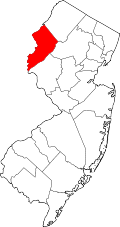
| County | Warren |
| Township | Greenwich |
| Elevation | 259 ft (79 m) |
| Time zone | UTC−05:00 (Eastern (EST)) |
| • Summer (DST) | UTC−04:00 (EDT) |
| GNIS feature ID | 879449 [1] |
Port Warren is an unincorporated community located within Greenwich Township in Warren County, New Jersey. [1]
Contents
Inclined Plane 9 West of the Morris Canal was located here. It was the largest plane of the canal and also one of only three double-track planes. [2] The plane tender's house is now the Jim and Mary Lee Morris Canal Museum. [3] The interaction of the Lopatcong Creek with the canal resulted in building an overflow and waste weir downstream of the inclined plane. [4]