Delaware Park, New Jersey

Last updated

Delaware Park, New Jersey
Location map of Warren County, New Jersey.svg
Red pog.svg
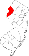
Delaware Park, New Jersey
Delaware Park's location in Warren County (Inset: Warren County in New Jersey)
USA New Jersey location map.svg
Red pog.svg
Delaware Park, New Jersey
Delaware Park, New Jersey (New Jersey)
Usa edcp location map.svg
Red pog.svg
Delaware Park, New Jersey
Delaware Park, New Jersey (the United States)
USA New Jersey location map.svg
Red pog.svg
Delaware Park, New Jersey
Delaware Park, New Jersey (New Jersey)
Usa edcp location map.svg
Red pog.svg
Delaware Park, New Jersey
Delaware Park, New Jersey (the United States)
Coordinates: 40°42′18″N75°11′18″W / 40.705109°N 75.188281°W / 40.705109; -75.188281
Country Flag of the United States.svg  United States
State Flag of New Jersey.svg  New Jersey
County Warren
Township Lopatcong
Area
[1]
  Total0.24 sq mi (0.64 km2)
  Land0.24 sq mi (0.64 km2)
  Water0.00 sq mi (0.00 km2)  0.00%
Elevation
[2]
364 ft (111 m)
Population
 (2020) [3]
  Total739
  Density3,016.33/sq mi (1,163.09/km2)
Time zone UTC−05:00 (Eastern (EST))
  Summer (DST) UTC−04:00 (Eastern (EDT))
ZIP Code
08865 [4]
Area code 908
FIPS code 3417260 [5] [6] [7]
GNIS feature ID02583983 [5] [8]

Delaware Park is an unincorporated community and census-designated place (CDP) located within Lopatcong Township, in Warren County, in the U.S. state of New Jersey, that was created as part of the 2010 United States Census. [9] [10] [11] As of the 2010 Census, the CDP's population was 700. [12]

Contents

Geography

According to the United States Census Bureau, the CDP had a total area of 0.246 square miles (0.637 km2), all of which was land. [5] [13]

Demographics

Historical population
CensusPop.Note
2010 1,555
2020 739−52.5%
Population sources: 2010 [12] [3]

2010 census

The 2010 United States census counted 700 people, 265 households, and 195 families in the CDP. The population density was 2,848.2 per square mile (1,099.7/km2). There were 278 housing units at an average density of 1,131.1 per square mile (436.7/km2). The racial makeup was 96.43% (675) White, 0.57% (4) Black or African American, 0.00% (0) Native American, 1.14% (8) Asian, 0.00% (0) Pacific Islander, 0.29% (2) from other races, and 1.57% (11) from two or more races. Hispanic or Latino of any race were 5.71% (40) of the population. [12]

Of the 265 households, 34.0% had children under the age of 18; 57.7% were married couples living together; 12.5% had a female householder with no husband present and 26.4% were non-families. Of all households, 22.3% were made up of individuals and 8.3% had someone living alone who was 65 years of age or older. The average household size was 2.64 and the average family size was 3.11. [12]

25.6% of the population were under the age of 18, 5.9% from 18 to 24, 23.3% from 25 to 44, 31.3% from 45 to 64, and 14.0% who were 65 years of age or older. The median age was 41.4 years. For every 100 females, the population had 96.6 males. For every 100 females ages 18 and older there were 92.3 males. [12]

Related Research Articles

Columbia is an unincorporated community and census-designated place (CDP) located within Knowlton Township in Warren County, in the U.S. state of New Jersey. While the community has existed for over a century, the CDP was created as part of the 2010 United States Census. As of the 2010 Census, the CDP's population was 229. The area is served as United States Postal Service ZIP Code 07832.

<span class="mw-page-title-main">Stewartsville, New Jersey</span> Populated place in Warren County, New Jersey, US

Stewartsville is an unincorporated community and census-designated place (CDP) located within Greenwich Township in Warren County, in the U.S. state of New Jersey, that was created as part of the 2010 United States Census. As of the 2010 Census, the CDP's population was 349.

<span class="mw-page-title-main">Port Colden, New Jersey</span> Census-designated place in New Jersey, United States

Port Colden is an unincorporated community and census-designated place (CDP) located within Washington Township, in Warren County, in the U.S. state of New Jersey, that was created as part of the 2010 United States Census. As of the 2010 Census, the CDP's population was 122.

<span class="mw-page-title-main">Marksboro, New Jersey</span> Census-designated place in Warren County, New Jersey, United States

Marksboro is an unincorporated community and census-designated place (CDP) located within Frelinghuysen Township in Warren County, in the U.S. state of New Jersey, that was created as part of the 2010 United States Census, though settlement and naming of the community date back to before 1760. As of the 2010 Census, the CDP's population was 82.

Lopatcong Overlook is an unincorporated community and census-designated place (CDP) located within Lopatcong Township, in Warren County, in the U.S. state of New Jersey, that was created as part of the 2010 United States Census. As of the 2010 Census, Lopatcong Overlook's population was 734.

<span class="mw-page-title-main">Anderson, New Jersey</span> Populated place in Warren County, New Jersey, US

Anderson is an unincorporated community and census-designated place (CDP) located within Mansfield Township, in Warren County, in the U.S. state of New Jersey, that was created as part of the 2010 United States census. As of the 2020 United States census, the CDP's population was 306, a decrease of 36 (-10.5%) from the 342 enumerated at the 2010 census.

Blairstown is an unincorporated community and census-designated place (CDP) located within Blairstown Township, in Warren County, in the U.S. state of New Jersey. The CDP was created as part of the 2010 United States census. As of the 2010 United States census, the CDP's population was 515.

<span class="mw-page-title-main">Brainards, New Jersey</span> Census-designated place in New Jersey, United States

Brainards is an unincorporated community and census-designated place (CDP) located within Harmony Township, in Warren County, in the U.S. state of New Jersey, that was created as part of the 2010 United States Census. As of the 2010 United States Census, the CDP's population was 202. It was formerly known as Martin's Creek.

Bridgeville is an unincorporated community and census-designated place (CDP) located within White Township, in Warren County, in the U.S. state of New Jersey, that was created as part of the 2010 United States Census. As of the 2010 Census, the CDP's population was 106.

Broadway is an unincorporated community and census-designated place (CDP) located within Franklin Township, in Warren County, in the U.S. state of New Jersey, that was created as part of the 2010 United States Census. As of the 2010 Census, the CDP's population was 244.

New Village is an unincorporated community and census-designated place (CDP) located within Franklin Township in Warren County, New Jersey, United States, that was created as part of the 2010 United States Census. As of the 2010 Census, the CDP's population was 421.

Greenwich is an unincorporated community and census-designated place (CDP) located within Greenwich Township in Warren County, in the U.S. state of New Jersey, that was defined as part of the 2010 United States Census. As of the 2010 Census, the CDP's population was 2,755.

Upper Stewartsville is an unincorporated community and census-designated place (CDP) located within Greenwich Township in Warren County, in the U.S. state of New Jersey, that was defined as part of the 2010 United States Census. As of the 2010 Census, the CDP's population was 212.

Harmony is an unincorporated community and census-designated place (CDP) located within Harmony Township in Warren County, in the U.S. state of New Jersey, that was defined as part of the 2010 United States Census. As of the 2010 Census, the CDP's population was 441.

Hutchinson is an unincorporated community and census-designated place (CDP) located within Harmony Township in Warren County, in the U.S. state of New Jersey, that was defined as part of the 2010 United States Census. As of the 2010 Census, the CDP's population was 135.

<span class="mw-page-title-main">Hope (CDP), New Jersey</span> Populated place in Warren County, New Jersey, US

Hope is an unincorporated community and census-designated place (CDP) located within Hope Township in Warren County, in the U.S. state of New Jersey, that was defined as part of the 2010 United States Census. As of the 2010 Census, the CDP's population was 195.

Mount Hermon is an unincorporated community and census-designated place (CDP) located within Hope Township in Warren County, in the U.S. state of New Jersey, that was defined as part of the 2010 United States Census. As of the 2010 Census, the CDP's population was 141.

Silver Lake is an unincorporated community and census-designated place (CDP) located within Hope Township in Warren County, in the U.S. state of New Jersey, that was defined as part of the 2010 United States Census. As of the 2010 Census, the CDP's population was 368.

Mountain Lake is an unincorporated community and census-designated place (CDP) located within Liberty Township in Warren County, in the U.S. state of New Jersey, that was created as part of the 2010 United States Census. As of the 2020 United States census, the CDP's population was 494 a decrease of 81 (−14.1%) from the 575 recorded at the 2010 census.

Upper Pohatcong is an unincorporated community and census-designated place (CDP) located within Pohatcong Township in Warren County, in the U.S. state of New Jersey, that was defined as part of the 2010 United States Census. As of the 2010 Census, the CDP's population was 1,781.

References

  1. "ArcGIS REST Services Directory". United States Census Bureau. Retrieved October 11, 2022.
  2. U.S. Geological Survey Geographic Names Information System: Delaware Park Census Designated Place, Geographic Names Information System. Accessed September 21, 2012.
  3. 1 2 "Census Population API". United States Census Bureau. Retrieved October 11, 2022.
  4. Look Up a ZIP Code for Delaware Park, NJ, United States Postal Service. Accessed June 4, 2013.
  5. 1 2 3 Gazetteer of New Jersey Places, United States Census Bureau. Accessed July 21, 2016.
  6. U.S. Census website, United States Census Bureau. Accessed September 4, 2014.
  7. Geographic codes for New Jersey, Missouri Census Data Center. Accessed June 9, 2023.
  8. US Board on Geographic Names, United States Geological Survey. Accessed September 4, 2014.
  9. GCT-PH1 - Population, Housing Units, Area, and Density: 2010 - County -- County Subdivision and Place from the 2010 Census Summary File 1 for Warren County, New Jersey Archived 2020-02-12 at archive.today , United States Census Bureau. Accessed June 4, 2013.
  10. 2006-2010 American Community Survey Geography for New Jersey, United States Census Bureau. Accessed June 4, 2013.
  11. New Jersey: 2010 - Population and Housing Unit Counts - 2010 Census of Population and Housing (CPH-2-32), United States Census Bureau, p. III-5, August 2012. Accessed June 4, 2013. "Warren County—Name Changes: Beattystown CDP name corrected from Beatyestown; New CDPs: Allamuchy (formed from part of deleted Allamuchy-Panther Valley CDP), Anderson, Asbury, Blairstown, Brainards, Bridgeville, Broadway, Brookfield, Buttzville, Columbia, Delaware, Delaware Park, Finesville, Great Meadows (formed from part of deleted Great Meadows-Vienna CDP and additional area), Greenwich, Hainesburg, Harmony, Hope, Hutchinson, Johnsonburg, Lopatcong Overlook, Marksboro, Mountain Lake, Mount Hermon, New Village, Panther Valley (formed from part of deleted Allamuchy-Panther Valley CDP), Port Colden, Port Murray, Silver Lake, Stewartsville, Upper Pohatcong, Upper Stewartsville, and Vienna (formed from part of deleted Great Meadows-Vienna and additional area)"
  12. 1 2 3 4 5 DP-1 - Profile of General Population and Housing Characteristics: 2010 Demographic Profile Data for Delaware Park CDP, New Jersey Archived 2020-02-12 at archive.today , United States Census Bureau. Accessed September 20, 2012.
  13. US Gazetteer files: 2010, 2000, and 1990, United States Census Bureau. Accessed September 4, 2014.