Delaware, Warren County, New Jersey

Last updated

Delaware, New Jersey
DELAWARE HISTORIC DISTRICT, WARREN COUNTY, NJ.jpg
Delaware Post Office, house built in 1860 by John I. Blair
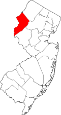
Location map of Warren County, New Jersey.svg
Red pog.svg
Delaware
Location in Warren County
USA New Jersey relief location map.svg
Red pog.svg
Delaware
Location in New Jersey
Usa edcp relief location map.png
Red pog.svg
Delaware
Location in the United States
Coordinates: 40°53′26″N075°04′00″W / 40.89056°N 75.06667°W / 40.89056; -75.06667 [1]
Country Flag of the United States.svg  United States
State Flag of New Jersey.svg  New Jersey
County Warren
Township Knowlton
Area
[2]
  Total0.410 sq mi (1.063 km2)
  Land0.380 sq mi (0.985 km2)
  Water0.030 sq mi (0.078 km2)  7.38%
Elevation
[1]
292 ft (89 m)
Population
  Total150
  Density394.6/sq mi (152.4/km2)
Time zone UTC−05:00 (Eastern (EST))
  Summer (DST) UTC−04:00 (EDT)
ZIP Code
07833 [4]
Area code 908
FIPS code 34-17200 [2] [5] [6]
GNIS feature ID2583982 [1]

Delaware (also known as Delaware Station) is an unincorporated community and census-designated place (CDP) located along the Delaware River within Knowlton Township in Warren County, New Jersey. [7] [8] It was created as part of the 2010 United States Census. [9] [10] [11] As of the 2010 Census, the CDP's population was 150. [3] The area is served as United States Postal Service ZIP Code 07833. [4]

Contents

History

Railroad magnate John I. Blair purchased land in the area and had it surveyed into lots in 1856. The Delaware, Lackawanna and Western Railroad began passenger service in July 1856. A storehouse built by Blair in 1860 was also used as the post office. [12]

Geography

According to the United States Census Bureau, the CDP had a total area of 0.410 square miles (1.063 km2), including 0.380 square miles (0.985 km2) of land and 0.030 square miles (0.078 km2) of water (7.38%). [2] [13]

Demographics

2000 census

As of the 2000 United States Census, the population for ZIP Code Tabulation Area 07833 was 159. [14]

2010 census

The 2010 United States census counted 150 people, 60 households, and 46 families in the CDP. The population density was 394.6 per square mile (152.4/km2). There were 70 housing units at an average density of 184.1 per square mile (71.1/km2). The racial makeup was 88.67% (133) White, 0.00% (0) Black or African American, 0.00% (0) Native American, 4.67% (7) Asian, 0.00% (0) Pacific Islander, 5.33% (8) from other races, and 1.33% (2) from two or more races. Hispanic or Latino of any race were 10.67% (16) of the population. [3]

Of the 60 households, 30.0% had children under the age of 18; 66.7% were married couples living together; 8.3% had a female householder with no husband present and 23.3% were non-families. Of all households, 18.3% were made up of individuals and 8.3% had someone living alone who was 65 years of age or older. The average household size was 2.50 and the average family size was 2.83. [3]

18.7% of the population were under the age of 18, 6.0% from 18 to 24, 22.7% from 25 to 44, 38.7% from 45 to 64, and 14.0% who were 65 years of age or older. The median age was 45.8 years. For every 100 females, the population had 117.4 males. For every 100 females ages 18 and older there were 110.3 males. [3]

Historic district

Delaware Historic District
DELAWARE HISTORIC DIST. WARREN COUNTY.jpg
Dr. Jabez Gwinnup House
LocationAnn, Clinton, Charles, and Valley Streets, Delaware Road, NJ 46 and Ferry Lane
Area90 acres (36 ha)
Architectural styleItalianate, Queen Anne
NRHP reference No. 03000128 [15]
NJRHP No.2766 [16]
Significant dates
Added to NRHPMarch 20, 2003
Designated NJRHPDecember 19, 2002

The Delaware Historic District is a 90-acre (36 ha) historic district encompassing the community. It was added to the National Register of Historic Places on March 20, 2003 for its significance in architecture, community development, commerce, transportation, recreation and industry. The district includes 60 contributing buildings, 3 contributing structures, and 3 contributing sites. The Federal-style Dr. Jabez Gwinnup House is one of the oldest houses in the district, built c.1815. [17]

Notable people

People who were born in, residents of, or otherwise closely associated with Delaware include:

See also

Related Research Articles

Columbia is an unincorporated community and census-designated place (CDP) located within Knowlton Township in Warren County, in the U.S. state of New Jersey. While the community has existed for over a century, the CDP was created as part of the 2010 United States Census. As of the 2010 Census, the CDP's population was 229. The area is served as United States Postal Service ZIP Code 07832.

<span class="mw-page-title-main">Johnsonburg, New Jersey</span> Populated place in Warren County, New Jersey, US

Johnsonburg is an unincorporated community and census-designated place (CDP) located within Frelinghuysen Township in Warren County, in the U.S. state of New Jersey, that was created as part of the 2010 United States Census. As of the 2020 Census, the CDP's population was 381, up from 101 in the 2010 Census.

<span class="mw-page-title-main">Asbury, New Jersey</span> Populated place in Warren County, New Jersey, US

Asbury is an unincorporated community and census-designated place (CDP) located within Franklin Township in Warren County, in the U.S. state of New Jersey, that was created as part of the 2010 United States Census. As of the 2010 Census, the CDP's population was 273.

<span class="mw-page-title-main">Stewartsville, New Jersey</span> Populated place in Warren County, New Jersey, US

Stewartsville is an unincorporated community and census-designated place (CDP) located within Greenwich Township in Warren County, in the U.S. state of New Jersey, that was created as part of the 2010 United States Census. As of the 2010 Census, the CDP's population was 349.

<span class="mw-page-title-main">Port Murray, New Jersey</span> Census-designated place in Warren County, New Jersey, United States

Port Murray is an unincorporated community and census-designated place (CDP) located within Mansfield Township in Warren County, in the U.S. state of New Jersey, that was created as part of the 2010 United States Census. As of the 2010 Census, the CDP's population was 129.

<span class="mw-page-title-main">Port Colden, New Jersey</span> Census-designated place in New Jersey, United States

Port Colden is an unincorporated community and census-designated place (CDP) located within Washington Township, in Warren County, in the U.S. state of New Jersey, that was created as part of the 2010 United States Census. As of the 2010 Census, the CDP's population was 122.

Hainesburg is an unincorporated community and census-designated place (CDP) located within Knowlton Township in Warren County, in the U.S. state of New Jersey. While the community has existed for over a century, the CDP was designated as part of the 2010 United States Census. As of the 2010 Census, the CDP's population was 91.

Delaware Park is an unincorporated community and census-designated place (CDP) located within Lopatcong Township, in Warren County, in the U.S. state of New Jersey, that was created as part of the 2010 United States Census. As of the 2010 Census, the CDP's population was 700.

<span class="mw-page-title-main">Anderson, New Jersey</span> Populated place in Warren County, New Jersey, US

Anderson is an unincorporated community and census-designated place (CDP) located within Mansfield Township, in Warren County, in the U.S. state of New Jersey, that was created as part of the 2010 United States census. As of the 2020 United States census, the CDP's population was 306, a decrease of 36 (-10.5%) from the 342 enumerated at the 2010 census.

<span class="mw-page-title-main">Brainards, New Jersey</span> Census-designated place in New Jersey, United States

Brainards is an unincorporated community and census-designated place (CDP) located within Harmony Township, in Warren County, in the U.S. state of New Jersey, that was created as part of the 2010 United States Census. As of the 2010 United States Census, the CDP's population was 202. It was formerly known as Martin's Creek.

Bridgeville is an unincorporated community and census-designated place (CDP) located within White Township, in Warren County, in the U.S. state of New Jersey, that was created as part of the 2010 United States Census. As of the 2010 Census, the CDP's population was 106.

Broadway is an unincorporated community and census-designated place (CDP) located within Franklin Township, in Warren County, in the U.S. state of New Jersey, that was created as part of the 2010 United States Census. As of the 2010 Census, the CDP's population was 244.

Upper Stewartsville is an unincorporated community and census-designated place (CDP) located within Greenwich Township in Warren County, in the U.S. state of New Jersey, that was defined as part of the 2010 United States Census. As of the 2010 Census, the CDP's population was 212.

Harmony is an unincorporated community and census-designated place (CDP) located within Harmony Township in Warren County, in the U.S. state of New Jersey, that was defined as part of the 2010 United States Census. As of the 2010 Census, the CDP's population was 441.

Hutchinson is an unincorporated community and census-designated place (CDP) located within Harmony Township in Warren County, in the U.S. state of New Jersey, that was defined as part of the 2010 United States Census. As of the 2010 Census, the CDP's population was 135.

<span class="mw-page-title-main">Hope (CDP), New Jersey</span> Populated place in Warren County, New Jersey, US

Hope is an unincorporated community and census-designated place (CDP) located within Hope Township in Warren County, in the U.S. state of New Jersey, that was defined as part of the 2010 United States Census. As of the 2010 Census, the CDP's population was 195.

Silver Lake is an unincorporated community and census-designated place (CDP) located within Hope Township in Warren County, in the U.S. state of New Jersey, that was defined as part of the 2010 United States Census. As of the 2010 Census, the CDP's population was 368.

Mountain Lake is an unincorporated community and census-designated place (CDP) located within Liberty Township in Warren County, in the U.S. state of New Jersey, that was created as part of the 2010 United States Census. As of the 2020 United States census, the CDP's population was 494 a decrease of 81 (−14.1%) from the 575 recorded at the 2010 census.

<span class="mw-page-title-main">Finesville, New Jersey</span> Populated place in Warren County, New Jersey, US

Finesville is an unincorporated community and census-designated place (CDP) located within Pohatcong Township in Warren County, New Jersey, United States, that was defined as part of the 2010 United States Census. As of the 2010 Census, the CDP's population was 175.

Upper Pohatcong is an unincorporated community and census-designated place (CDP) located within Pohatcong Township in Warren County, in the U.S. state of New Jersey, that was defined as part of the 2010 United States Census. As of the 2010 Census, the CDP's population was 1,781.

References

  1. 1 2 3 "Delaware Census Designated Place". Geographic Names Information System . United States Geological Survey, United States Department of the Interior.
  2. 1 2 3 Gazetteer of New Jersey Places, United States Census Bureau. Accessed July 21, 2016.
  3. 1 2 3 4 5 DP-1 - Profile of General Population and Housing Characteristics: 2010 Demographic Profile Data for Delaware CDP, New Jersey Archived February 12, 2020, at archive.today , United States Census Bureau. Accessed June 3, 2013.
  4. 1 2 Look Up a ZIP Code for Delaware, NJ, United States Postal Service. Accessed June 3, 2013.
  5. U.S. Census website, United States Census Bureau. Accessed September 4, 2014.
  6. Geographic codes for New Jersey, Missouri Census Data Center. Accessed June 9, 2023.
  7. "Delaware". Geographic Names Information System . United States Geological Survey, United States Department of the Interior. Variant name: Delaware Station
  8. "Locality Search". State of New Jersey.
  9. GCT-PH1 - Population, Housing Units, Area, and Density: 2010 - County -- County Subdivision and Place from the 2010 Census Summary File 1 for Warren County, New Jersey Archived 2020-02-12 at archive.today , United States Census Bureau. Accessed June 4, 2013.
  10. 2006-2010 American Community Survey Geography for New Jersey, United States Census Bureau. Accessed June 4, 2013.
  11. New Jersey: 2010 - Population and Housing Unit Counts - 2010 Census of Population and Housing (CPH-2-32), United States Census Bureau, p. III-5, August 2012. Accessed June 4, 2013. "Warren County—Name Changes: Beattystown CDP name corrected from Beatyestown; New CDPs: Allamuchy (formed from part of deleted Allamuchy-Panther Valley CDP), Anderson, Asbury, Blairstown, Brainards, Bridgeville, Broadway, Brookfield, Buttzville, Columbia, Delaware, Delaware Park, Finesville, Great Meadows (formed from part of deleted Great Meadows-Vienna CDP and additional area), Greenwich, Hainesburg, Harmony, Hope, Hutchinson, Johnsonburg, Lopatcong Overlook, Marksboro, Mountain Lake, Mount Hermon, New Village, Panther Valley (formed from part of deleted Allamuchy-Panther Valley CDP), Port Colden, Port Murray, Silver Lake, Stewartsville, Upper Pohatcong, Upper Stewartsville, and Vienna (formed from part of deleted Great Meadows-Vienna and additional area)"
  12. Snell, James P.; Clayton, W.W. (1881). "Delaware Station". History of Sussex and Warren Counties, New Jersey, with Illustrations and Biographical Sketches of its Prominent Men and Pioneers. Philadelphia: Everts & Peck. pp. 627–8. OCLC   14075041.
  13. US Gazetteer files: 2010, 2000, and 1990, United States Census Bureau. Accessed September 4, 2014.
  14. DP-1 - Profile of General Demographic Characteristics: 2000; Census 2000 Summary File 1 (SF 1) 100-Percent Data for ZCTA5 07833 Archived 2020-02-10 at archive.today , United States Census Bureau. Accessed June 3, 2013.
  15. "National Register Information System  (#03000128)". National Register of Historic Places . National Park Service. November 2, 2013.
  16. "New Jersey and National Registers of Historic Places – Warren County" (PDF). New Jersey Department of Environmental Protection - Historic Preservation Office. September 28, 2021. p. 5.
  17. Bertland, Dennis (June 2002). "National Register of Historic Places Inventory/Nomination: Delaware Historic District". National Park Service. With accompanying 29 photos
  18. Lyman, William Denison. History of the Yakima Valley, Washington; comprising Yakima, Kittitas, and Benton Counties, Volume II, The S.J. Clarke Publishing Co., 1919. Accessed December 10, 2017. "Charles H. Flummerfelt, a prominent figure in insurance and real estate circles in Ellensburg, having now an extensive clientage, was born in Delaware, Warren county, New Jersey, on the 31st of July, 1863, a son of Daniel A. and Macrina H. (Hoagland) Flummerfelt, both of whom were representatives of old colonial families."