Stewartsville, New Jersey | |
---|---|
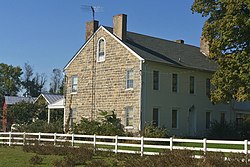
![]() Hulshizer/Brill farm on North main street built in 1833 | |
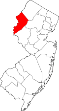
Location in Warren County Location in New Jersey | |
Coordinates: 40°41′38″N75°6′41″W / 40.69389°N 75.11139°W [1] [2] | |
Country | ![]() |
State | ![]() |
County | Warren |
Township | Greenwich |
Named for | Thomas Stewart |
Area | |
• Total | 1.08 sq mi (2.80 km2) |
• Land | 1.08 sq mi (2.80 km2) |
• Water | 0.00 sq mi (0.00 km2) 0.00% |
Elevation | 315 ft (96 m) |
Population | |
• Total | 636 |
• Density | 587.80/sq mi (226.98/km2) |
Time zone | UTC−05:00 (Eastern (EST)) |
• Summer (DST) | UTC−04:00 (EDT) |
ZIP Code | 08886 [5] |
Area code | 908 |
FIPS code | 34-70800 [6] [7] [8] |
GNIS feature ID | 2584031 [1] |
Stewartsville is an unincorporated community and census-designated place (CDP) located within Greenwich Township in Warren County, in the U.S. state of New Jersey, [9] that was created as part of the 2010 United States Census. [10] [11] [12] As of the 2010 Census, the CDP's population was 349. [13]
The area is served as United States Postal Service ZIP Code 08886. [5]
The community of Stewartsville was named after Thomas Stewart, a secretary to George Washington, who purchased property in the area in 1793. [14]
According to the United States Census Bureau, the CDP had a total area of 0.129 square miles (0.333 km2), all of which was land. [6] [2]
Census | Pop. | Note | %± |
---|---|---|---|
2020 | 636 | — | |
U.S. Decennial Census [15] [4] |
The 2010 United States census counted 349 people, 134 households, and 96 families in the CDP. The population density was 2,714.4 per square mile (1,048.0/km2). There were 144 housing units at an average density of 1,120.0 per square mile (432.4/km2). The racial makeup was 93.98% (328) White, 4.58% (16) Black or African American, 0.00% (0) Native American, 0.57% (2) Asian, 0.00% (0) Pacific Islander, 0.00% (0) from other races, and 0.86% (3) from two or more races. Hispanic or Latino of any race were 6.30% (22) of the population. [13]
Of the 134 households, 36.6% had children under the age of 18; 52.2% were married couples living together; 14.2% had a female householder with no husband present and 28.4% were non-families. Of all households, 21.6% were made up of individuals and 8.2% had someone living alone who was 65 years of age or older. The average household size was 2.60 and the average family size was 3.05. [13]
26.4% of the population were under the age of 18, 7.4% from 18 to 24, 26.4% from 25 to 44, 27.8% from 45 to 64, and 12.0% who were 65 years of age or older. The median age was 40.3 years. For every 100 females, the population had 97.2 males. For every 100 females ages 18 and older there were 90.4 males. [13]
As of the 2000 United States Census, the population for ZIP Code Tabulation Area 08886 was 4,854. [16]
The area is accessible via exit 4 and exit 3 on Interstate 78.
Stewartsville had a station on the Morris and Essex Railroad, located 80 miles (130 km) from New York City. [17]
The nearby Kennedy House and Mill, located on Route 173 in Kennedy Mills, was listed on the National Register of Historic Places in 1996. [18]
The town features two churches, the First Lutheran Church and the Stewartsville Presbyterian Church. [19]
People who were born in, residents of, or otherwise closely associated with Stewartsville include:
Columbia is an unincorporated community and census-designated place (CDP) located within Knowlton Township in Warren County, in the U.S. state of New Jersey. While the community has existed for over a century, the CDP was created as part of the 2010 United States Census. As of the 2010 Census, the CDP's population was 229. The area is served as United States Postal Service ZIP Code 07832.
Delaware is an unincorporated community and census-designated place (CDP) located along the Delaware River within Knowlton Township in Warren County, New Jersey. It was created as part of the 2010 United States Census. As of the 2010 Census, the CDP's population was 150. The area is served as United States Postal Service ZIP Code 07833.
Johnsonburg is an unincorporated community and census-designated place (CDP) located within Frelinghuysen Township in Warren County, in the U.S. state of New Jersey, that was created as part of the 2010 United States Census. As of the 2020 Census, the CDP's population was 381, up from 101 in the 2010 Census.
Asbury is an unincorporated community and census-designated place (CDP) located within Franklin Township in Warren County, in the U.S. state of New Jersey, that was created as part of the 2010 United States Census. As of the 2010 Census, the CDP's population was 273.
Port Murray is an unincorporated community and census-designated place (CDP) located within Mansfield Township in Warren County, in the U.S. state of New Jersey, that was created as part of the 2010 United States Census. As of the 2010 Census, the CDP's population was 129.
Port Colden is an unincorporated community and census-designated place (CDP) located within Washington Township, in Warren County, in the U.S. state of New Jersey, that was created as part of the 2010 United States Census. As of the 2010 Census, the CDP's population was 122.
Hainesburg is an unincorporated community and census-designated place (CDP) located within Knowlton Township in Warren County, in the U.S. state of New Jersey. While the community has existed for over a century, the CDP was designated as part of the 2010 United States Census. As of the 2010 Census, the CDP's population was 91.
Delaware Park is an unincorporated community and census-designated place (CDP) located within Lopatcong Township, in Warren County, in the U.S. state of New Jersey, that was created as part of the 2010 United States Census. As of the 2010 Census, the CDP's population was 700.
Lopatcong Overlook is an unincorporated community and census-designated place (CDP) located within Lopatcong Township, in Warren County, in the U.S. state of New Jersey, that was created as part of the 2010 United States Census. As of the 2010 Census, Lopatcong Overlook's population was 734.
Anderson is an unincorporated community and census-designated place (CDP) located within Mansfield Township, in Warren County, in the U.S. state of New Jersey, that was created as part of the 2010 United States census. As of the 2020 United States census, the CDP's population was 306, a decrease of 36 (-10.5%) from the 342 enumerated at the 2010 census.
Brainards is an unincorporated community and census-designated place (CDP) located within Harmony Township, in Warren County, in the U.S. state of New Jersey, that was created as part of the 2010 United States Census. As of the 2010 United States Census, the CDP's population was 202. It was formerly known as Martin's Creek.
Bridgeville is an unincorporated community and census-designated place (CDP) located within White Township, in Warren County, in the U.S. state of New Jersey, that was created as part of the 2010 United States Census. As of the 2010 Census, the CDP's population was 106.
Broadway is an unincorporated community and census-designated place (CDP) located within Franklin Township, in Warren County, in the U.S. state of New Jersey, that was created as part of the 2010 United States Census. As of the 2010 Census, the CDP's population was 244.
Greenwich is an unincorporated community and census-designated place (CDP) located within Greenwich Township in Warren County, in the U.S. state of New Jersey, that was defined as part of the 2010 United States Census. As of the 2010 Census, the CDP's population was 2,755.
Upper Stewartsville is an unincorporated community and census-designated place (CDP) located within Greenwich Township in Warren County, in the U.S. state of New Jersey, that was defined as part of the 2010 United States Census. As of the 2010 Census, the CDP's population was 212.
Harmony is an unincorporated community and census-designated place (CDP) located within Harmony Township in Warren County, in the U.S. state of New Jersey, that was defined as part of the 2010 United States Census. As of the 2010 Census, the CDP's population was 441.
Hutchinson is an unincorporated community and census-designated place (CDP) located within Harmony Township in Warren County, in the U.S. state of New Jersey, that was defined as part of the 2010 United States Census. As of the 2010 Census, the CDP's population was 135.
Hope is an unincorporated community and census-designated place (CDP) located within Hope Township in Warren County, in the U.S. state of New Jersey, that was defined as part of the 2010 United States Census. As of the 2010 Census, the CDP's population was 195.
Silver Lake is an unincorporated community and census-designated place (CDP) located within Hope Township in Warren County, in the U.S. state of New Jersey, that was defined as part of the 2010 United States Census. As of the 2010 Census, the CDP's population was 368.
Mountain Lake is an unincorporated community and census-designated place (CDP) located within Liberty Township in Warren County, in the U.S. state of New Jersey, that was created as part of the 2010 United States Census. As of the 2020 United States census, the CDP's population was 494 a decrease of 81 (−14.1%) from the 575 recorded at the 2010 census.