Marksboro, New Jersey | |
|---|---|
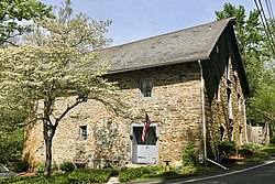 Marksboro Grist Mill on Spring Valley Road | |
 Marksboro Location in Warren County  Marksboro Location in New Jersey  Marksboro Location in the United States | |
| Coordinates: 40°59′11″N74°54′16″W / 40.986418°N 74.904367°W [1] [2] | |
| Country | |
| State | |
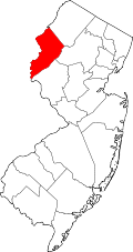
| County | Warren |
| Township | Frelinghuysen |
| Named after | Mark Thompson |
| Area | |
• Total | 2.17 sq mi (5.63 km2) |
| • Land | 2.15 sq mi (5.57 km2) |
| • Water | 0.023 sq mi (0.06 km2) 1.08% |
| Elevation | 515 ft (157 m) |
| Population | |
• Total | 186 |
| • Density | 86.4/sq mi (33.37/km2) |
| Time zone | UTC−05:00 (Eastern (EST)) |
| • Summer (DST) | UTC−04:00 (EDT) |
| Area code | 908 |
| FIPS code | 34-43980 [1] [6] [7] |
| GNIS feature ID | 02584009 [1] [8] |
Marksboro is an unincorporated community and census-designated place (CDP) [9] located within Frelinghuysen Township in Warren County, in the U.S. state of New Jersey, [10] that was created as part of the 2010 United States census, [11] [12] [13] though settlement and naming of the community date back to before 1760. [14] As of the 2010 Census, the CDP's population was 82. [15]