Paulina, New Jersey

Last updated

Paulina, New Jersey
Lackawanna-Limited-Paulina-NJ.JPG
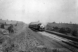
The westbound Lackawanna Limited nears Paulina, circa 1912
Location map of Warren County, New Jersey.svg
Red pog.svg
Paulina
Location of Paulina in Warren County. Inset: Location of Warren County within the state of New Jersey
USA New Jersey location map.svg
Red pog.svg
Paulina
Location within New Jersey
Usa edcp location map.svg
Red pog.svg
Paulina
Location with the United States
Coordinates: 40°58′35″N74°56′38″W / 40.97639°N 74.94389°W / 40.97639; -74.94389
Country Flag of the United States.svg  United States
State Flag of New Jersey.svg  New Jersey
County Warren
Township Blairstown
Elevation
[1]
112 m (367 ft)
Time zone UTC−05:00 (Eastern (EST))
  Summer (DST) UTC−04:00 (EDT)
GNIS feature ID879172 [1]

Paulina is an unincorporated community located in Blairstown in Warren County, in the U.S. state of New Jersey. [1] [2]

Contents

Paulina is located on the Paulins Kill, approximately 1 mi (1.6 km) east of downtown Blairstown.

History

Around 1768, William Armstrong constructed a grist mill there, which remained for more than a century. A second grist mill was constructed in Paulina in 1783 by Peter B. Shafer. That mill was later used as an axe-helve factory and saw mill. [3]

By 1851, Paulina had a post office, and by 1882 the population was 110. In 1890, a grist mill was still located there. [3] [4] [5]

In 1895, the Paulina Dam, also known as the Paulina Lake Dam, [6] was built on the Paulins Kill. Rated a "significant hazard" by the New Jersey Department of Environmental Protection, the process of removing it started in December 2023. [7]

Paulina Dam in December 2022 Paulina Dam on the Paulins Kill, Paulina, NJ.jpg
Paulina Dam in December 2022

Today

The Paulinskill Valley Trail, a 30-mile (48 km) long recreational rail trail following the former route of the New York, Susquehanna and Western Railway, passes through Paulina. [8]

Paulinskill Valley Trail along the Paulins Kill near Paulina Mile post 81, Paulinskill Valley Trail, Paulina, NJ.jpg
Paulinskill Valley Trail along the Paulins Kill near Paulina

Related Research Articles

<span class="mw-page-title-main">Blairstown, New Jersey</span> Township in Warren County, New Jersey, United States

Blairstown is a township in Warren County, in the U.S. state of New Jersey. As of the 2020 United States census, the township's population was 5,704, a decrease of 263 (−4.4%) from the 2010 census count of 5,967, which in turn reflected an increase of 220 (+3.8%) from the 5,747 counted in the 2000 census.

<span class="mw-page-title-main">Paulins Kill</span> River in New Jersey, United States

The Paulins Kill is a 41.6-mile (66.9 km) tributary of the Delaware River in northwestern New Jersey in the United States. With a long-term median flow rate of 76 cubic feet of water per second (2.15 m³/s), it is New Jersey's third-largest contributor to the Delaware River, behind the Musconetcong River and Maurice River. The river drains an area of 176.85 square miles (458.0 km2) across portions of Sussex and Warren counties and 11 municipalities. It flows north from its source near Newton, and then turns southwest. The river sits in the Ridge and Valley geophysical province.

<span class="mw-page-title-main">Swartswood State Park</span> State park in Sussex County, New Jersey

Swartswood State Park is a 3,460-acre (14.0 km2) protected area located in the Swartswood section of Stillwater and Hampton townships in Sussex County, New Jersey, in the United States. Established in 1915 by the state's Forest Park Reservation Commission, it was the first state park established by the state of New Jersey for the purposes of recreation at the state's third-largest freshwater lake. Today, Swartswood State Park is operated and maintained by the New Jersey Division of Parks and Forestry.

<span class="mw-page-title-main">Popolopen</span> Mountain in the United States

Popolopen is the name of several related landmarks mainly within the Hudson Highlands of Orange County, New York. These include a mountain, Popolopen Torne—or simply "The Torne", and a short and steep-sided nearby valley officially called Hell Hole, but often Popolopen Gorge. Popolopen Creek runs through this valley. The Popolopen Bridge spans its mouth at the Hudson River and is crossed by Route 9W. Popolopen Lake feeds the headwaters of its namesake creek. Despite local usage, the United States Board on Geographical Names recognizes only the lake, creek and bridge as bearing the name "Popolopen."

<span class="mw-page-title-main">Susquehanna State Park (Maryland)</span> State park in Maryland, United States

Susquehanna State Park is a public recreation area located on the banks of the lower Susquehanna River north of the city of Havre de Grace, Maryland. The state park's main area is on the west bank of the river; the park also manages land on the river islands and east bank. The park offers fishing, boating, camping, and trails for hiking and equestrian use. It is managed as a complex with Rocks State Park and Palmer State Park by the Maryland Department of Natural Resources.

<span class="mw-page-title-main">Crabtree Creek (Neuse River tributary)</span> Stream in North Carolina, USA

Crabtree Creek is a tributary of the Neuse River in central Wake County, North Carolina, United States. The creek begins in the town of Cary and flows through Morrisville, William B. Umstead State Park, and the northern sections of Raleigh before emptying into the Neuse at Anderson Point Park, a large city park located in East Raleigh.

<span class="mw-page-title-main">Paulinskill Valley Trail</span>

The Paulinskill Valley Trail is a rail trail along the Paulins Kill river in New Jersey. It is the sixth longest trail in the state at 27 miles (43 km). It was originally a right-of-way of the New York, Susquehanna and Western Railroad and the Blairstown Railway.

<span class="mw-page-title-main">Asbury, New Jersey</span> Populated place in Warren County, New Jersey, US

Asbury is an unincorporated community and census-designated place (CDP) located within Franklin Township in Warren County, in the U.S. state of New Jersey, that was created as part of the 2010 United States Census. As of the 2010 Census, the CDP's population was 273.

<span class="mw-page-title-main">Blairstown Railway</span>

The Blairstown Railway (BRWY) opened in 1877 and ran between Blairstown and Delaware, New Jersey, a distance of approximately 12 miles (19 km). The single-track railroad was built under the direction of railroad magnate John I. Blair, one of the wealthiest persons in the United States at that time, who had previously built the Warren Railroad, and for whom Blairstown is named.

<span class="mw-page-title-main">Marksboro, New Jersey</span> Census-designated place in Warren County, New Jersey, United States

Marksboro is an unincorporated community and census-designated place (CDP) located within Frelinghuysen Township in Warren County, in the U.S. state of New Jersey, that was created as part of the 2010 United States Census, though settlement and naming of the community date back to before 1760. As of the 2010 Census, the CDP's population was 82.

<span class="mw-page-title-main">Hainesburg, New Jersey</span> Populated place in Warren County, New Jersey, US

Hainesburg is an unincorporated community and census-designated place (CDP) located within Knowlton Township in Warren County, in the U.S. state of New Jersey. While the community has existed for over a century, the CDP was designated as part of the 2010 United States Census. As of the 2010 Census, the CDP's population was 91.

<span class="mw-page-title-main">Wallpack Valley</span>

Wallpack Valley is a valley located in Sussex County in northwestern New Jersey formed by Wallpack Ridge on the west, and Kittatinny Mountain on the east. Wallpack Ridge separates the Wallpack Valley from the valley of the Delaware River, and contains the watershed of the Flat Brook and its main tributaries Big Flat Brook and Little Flat Brook. It is a narrow valley, roughly 25 miles (40 km) in length running from Montague Township south of Port Jervis, New York to the Walpack Bend in the Delaware River near Flatbrookville in Walpack Township where the Flat Brook enters the Delaware at 300 feet above sea level.

<span class="mw-page-title-main">Finesville, New Jersey</span> Populated place in Warren County, New Jersey, US

Finesville is an unincorporated community and census-designated place (CDP) located within Pohatcong Township in Warren County, in the U.S. state of New Jersey. The CDP was defined as part of the 2010 United States Census. As of the 2010 Census, the CDP's population was 175.

Jacksonburg Creek is a tributary of the Paulins Kill located along the eastern face of Kittatinny Mountain in Warren County in northwestern New Jersey in the United States. It rises near the Warren County-Sussex County border in Hardwick Township and enters the Paulins Kill approximately one mile south of Blairstown. The Appalachian Trail passes within its watershed and crosses the creek as it traverses the ridgeline of Kittatinny Mountain.

Carpentersville is an unincorporated community located in Pohatcong Township in Warren County, in the U.S. state of New Jersey.

<span class="mw-page-title-main">Warrington, New Jersey</span> Populated place in Warren County, New Jersey, US

Warrington is an unincorporated community located within Knowlton Township in Warren County, in the U.S. state of New Jersey. It is located on the Paulins Kill, approximately 1 mi (1.6 km) northeast of where it flows into the Delaware River.

Townsbury is an unincorporated community located within Liberty Township in Warren County, in the U.S. state of New Jersey.

<span class="mw-page-title-main">Wortendyke, New Jersey</span> Populated place in Bergen County, New Jersey, US

Wortendyke is a residential and commercial unincorporated community located within Midland Park, in Bergen County, in the U.S. state of New Jersey.

<span class="mw-page-title-main">Oaks Creek</span> River in New York State

Oaks Creek is a river that drains Canadarago Lake, which is situated in the north central region of Otsego County, New York. The creek begins by the Hamlet of Schuyler Lake and flows southeast approximately 9.32 miles (15.00 km), dropping only 105 feet (32 m) in elevation, before converging with the Susquehanna River south of the Village of Cooperstown, by the Hamlet of Index. From the source to Oaksville the creek flows along Panther Mountain. Fly Creek is a main tributary, that converges with Oaks Creek south of the Hamlet of Fly Creek.

<span class="mw-page-title-main">Springtown, Warren County, New Jersey</span> Populated place in Warren County, New Jersey, US

Springtown is an unincorporated community located at the intersection of Springtown Road and the Pohatcong Creek in Pohatcong Township, Warren County, New Jersey. It was named after the many small springs in the valley.

References

  1. 1 2 3 U.S. Geological Survey Geographic Names Information System: Paulina
  2. Locality Search, State of New Jersey. Accessed December 21, 2014.
  3. 1 2 Cummins, George Wyckoff (1911). History of Warren County, New Jersey. Lewis Historical Publishing Company. pp. 78, 134, 156. OL   24171900M.
  4. Industries of New Jersey. Historical Publishing Company. 1882. p. 114. OL   24332547M.
  5. Annual Report of the State Geologist for the Year 1890. New Jersey Geological Survey. 1891. p. 227.
  6. "Paulina Lake Dam". GeoNames.
  7. Rodas, Steven (December 11, 2023). "Demolition starts on hazardous 128-year-old dam. Why so many more remain". NJ.com .
  8. "Paulins Kill Valley Trail". Metrotrails. Retrieved November 28, 2017.