Anderson, New Jersey | |
|---|---|
 Anderson United Methodist Church | |
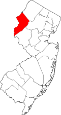
 Anderson Location in Warren County  Anderson Location in New Jersey  Anderson Location in the United States | |
| Coordinates: 40°45′43″N74°55′46″W / 40.761867°N 74.929543°W | |
| Country | |
| State | |
| County | Warren |
| Township | Mansfield |
| Area | |
• Total | 0.89 sq mi (2.31 km2) |
| • Land | 0.89 sq mi (2.30 km2) |
| • Water | 0.0039 sq mi (0.01 km2) 0.34% |
| Elevation | 502 ft (153 m) |
| Population | |
• Total | 306 |
| • Density | 343.8/sq mi (132.7/km2) |
| Time zone | UTC−05:00 (Eastern (EST)) |
| • Summer (DST) | UTC−04:00 (EDT) |
| Area code | 908 |
| FIPS code | 34-01300 [4] [5] [6] |
| GNIS feature ID | 02583965 [4] [7] |
Anderson is an unincorporated community and census-designated place (CDP) [8] located within Mansfield Township, in Warren County, in the U.S. state of New Jersey, that was created as part of the 2010 United States census. [9] [10] As of the 2020 United States census, the CDP's population was 306, [3] a decrease of 36 (-10.5%) from the 342 enumerated at the 2010 census. [11]