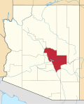
List of counties in Arizona

Last updated

Counties of Arizona
Category Federal Unit
Location State of Arizona
Number15
Populations9,369 (Greenlee) – 4,585,871 (Maricopa)
Areas1,238 square miles (3,210 km2) (Santa Cruz) – 18,661 square miles (48,330 km2) (Coconino)
Government
Subdivisions

There are 15 counties in the U.S. state of Arizona. [1] Four counties (Mohave, Pima, Yavapai and Yuma) were created in 1864 following the organization of the Arizona Territory in 1862. The now defunct Pah-Ute County was split from Mohave County in 1865, but merged back in 1871. All but La Paz County were created by the time Arizona was granted statehood in 1912. La Paz County was established in 1983 after many years of pushing for independence from Yuma County. [2]

Contents

Eight of Arizona's fifteen counties are named after various Native American groups that are resident in parts of what is now Arizona, with another (Cochise County) being named after a native leader. Four other counties, Gila County, Santa Cruz County, Pinal County, and Graham County, are named for physical features of Arizona's landscape: the Gila River, the Santa Cruz River, Pinal Peak, and Mount Graham, respectively. Another county, La Paz County, is named after a former settlement, while the final county, Greenlee County, is named after one of the state's early pioneers. [3]

Under Arizona laws, a county shall not be formed or divided by county initiative unless each proposed county would have all of the following characteristics: (1) at least three-fourths of one percent of the total state assessed valuation and at least the statewide per capita assessed valuation; (2) a population of at least three-fourths of one percent of the total state population according to the most recent United States decennial census; (3) at least one hundred square miles of privately owned land; (4) common boundaries with either (a) at least three other existing or proposed counties; or (b) at least two other existing or proposed counties and the state boundary. [4] A county formation commission is required to be formed to evaluate the feasibility of the proposed county. [5] A proposal to divide a county must be approved by a majority of the votes cast in each proposed new county. [6]

Under the Arizona Constitution, counties are politically and legally creatures of the state, and do not have charters of their own. Counties are governed by boards of supervisors which act in the capacity of executive authority for the county within the statutes and powers prescribed by Arizona state law. With few exceptions, these powers are narrowly construed. The state legislature devotes considerable time to local matters, with limited discretion granted to the Board of Supervisors on minor ordinance, zoning, and revenue collection issues.

Arizona's postal abbreviation is AZ and its FIPS code is 04.

Alphabetical listing

County
FIPS code [7] County seat [8] Est. [8] Formed from [2] Etymology [3] Population [9] Area [8] [9] Map
ApacheCounty 001 St. Johns 1879Yavapai CountyThe Apache (Ndee) people. Apache is an exonym from Zuni ʔapaču "Navajos" or Yavapai ʔpačə "enemy".65,03611,218 sq mi
(29,054 km2)
Map of Arizona highlighting Apache County.svg
CochiseCounty 003 Bisbee 1881Pima County Cochise (1805-1874), a Chiricahua Apache chief and leader of an 1861 uprising. Cochise is an anglicisation of K'uu-ch'ish "oak".124,6406,219 sq mi
(16,107 km2)
Map of Arizona highlighting Cochise County.svg
CoconinoCounty 005 Flagstaff 1891Yavapai CountyCoconino is a former designation for the Havasupai, Hualapai, and/or Yavapai, derived from the Hopi exonym Kohonino.144,47218,661 sq mi
(48,332 km2)
Map of Arizona highlighting Coconino County.svg
GilaCounty 007 Globe 1881Maricopa and Pinal CountiesThe Gila River, a tributary of the Colorado. Possibly from Apache dzil "mountain," via Spanish Xila.54,0034,796 sq mi
(12,422 km2)
Map of Arizona highlighting Gila County.svg
GrahamCounty 009 Safford 1881Apache and Pima Counties Mount Graham, in the Pinaleños. Mt. Graham itself is named for topographical engineer James Duncan Graham (1799-1865). [10] 39,5254,641 sq mi
(12,020 km2)
Map of Arizona highlighting Graham County.svg
GreenleeCounty 011 Clifton 1909Graham CountyMason Greenlee (1835-1903), early prospector. Named by an amendment initially intended to delay the bill creating "Lincoln County". [11] 9,3691,848 sq mi
(4,786 km2)
Map of Arizona highlighting Greenlee County.svg
La PazCounty 012 Parker 1983Yuma County La Paz, Arizona, a historic boomtown on the Colorado River. A common placename, La Paz means "The Peace" in Spanish.16,7104,513 sq mi
(11,689 km2)
Map of Arizona highlighting La Paz County.svg
MaricopaCounty 013 Phoenix 1871Pima and Yavapai CountiesThe Maricopa (Piipaash) people. First attested in Spanish as Cocomaricopa, no origin or meaning is definitively known.4,585,8719,224 sq mi
(23,890 km2)
Map of Arizona highlighting Maricopa County.svg
MohaveCounty 015 Kingman 1864The Mohave (Aha Makhav) people. The Mohave endonym means "along the water," referring to the Colorado. [12] 223,68213,470 sq mi
(34,887 km2)
Map of Arizona highlighting Mohave County.svg
NavajoCounty 017 Holbrook 1895Apache CountyThe Navajo (Diné) people. Navajo is an exonym from Tewa Navahu "big field," referring to the San Juan River Valley 109,1759,959 sq mi
(25,794 km2)
Map of Arizona highlighting Navajo County.svg
PimaCounty 019 Tucson 1864The Pima (Akimel O'odham) people. Pima is a Spanish exonym from the O'odham phrase pi mac "(I) don't know," presumably heard during initial encounters.1,063,1629,189 sq mi
(23,799 km2)
Map of Arizona highlighting Pima County.svg
PinalCounty 021 Florence 1875Maricopa and Pima counties Pinal Peak, possibly from Spanish pinal "place of pines". Pinal Peak is now within the borders of Gila County.484,2395,374 sq mi
(13,919 km2)
Map of Arizona highlighting Pinal County.svg
Santa CruzCounty 023 Nogales 1899Cochise and Pima counties Santa Cruz River, a tributary of the Gila. A common placename, Santa Cruz means "Holy Cross" in Spanish.49,1581,238 sq mi
(3,206 km2)
Map of Arizona highlighting Santa Cruz County.svg
YavapaiCounty 025 Prescott 1864The Yavapai people. The Yavapé are one of four major Yavapai bands.249,0818,128 sq mi
(21,051 km2)
Map of Arizona highlighting Yavapai County.svg
YumaCounty 027 Yuma 1864Yuma is a former name of the Quechan people, derived from the O'odham exonym Yumĭ.213,2215,519 sq mi
(14,294 km2)
Map of Arizona highlighting Yuma County.svg

Excluded counties

Counties of the Territory of New Mexico, 1852. Santa Ana County, New Mexico Territory.png
Counties of the Territory of New Mexico, 1852.

Extinct counties

Proposed counties

See also

Related Research Articles

<span class="mw-page-title-main">La Paz County, Arizona</span> County in the United States

La Paz County is the 15th county in the U.S. state of Arizona, located in the western part of the state. As of the 2020 census, its population was 16,557, making it the second-least populous county in Arizona. The county seat is Parker. The name of the county is the Spanish word for "the peace", and is taken from the early settlement of La Paz along the Colorado River.

<span class="mw-page-title-main">Pah-Ute County, Arizona Territory</span> Former county in the Arizona Territory (1865–1871)

Pah-Ute County is a former county in the northwest corner of Arizona Territory that existed from 1865 until 1871, at which point most of the area was transferred to Nevada. The remainder was merged into Mohave County. The majority of the territory is now in Clark County, Nevada, which includes the city of Las Vegas. Due to the transfer of most of the county's land to Nevada, Pah-Ute is sometimes referred to as Arizona's "Lost County". Pah-Ute is a historic spelling of the tribal name Paiute.

<span class="mw-page-title-main">Arizona State Legislature</span> Legislative branch of the state government of Arizona

The Arizona State Legislature is the state legislature of the U.S. state of Arizona. It is a bicameral legislature that consists of a lower house, the House of Representatives, and an upper house, the Senate. Composed of 90 legislators, the state legislature meets in the Capitol Complex in the state capital of Phoenix. Created by the Arizona Constitution upon statehood in 1912, the Arizona State Legislature met biennially until 1950. Today, they meet annually.

<span class="mw-page-title-main">Arizona Association of Counties</span> Member association for elected officials

The Arizona Association of Counties (AACo) was established in 1968 as a member association for all elected officials of Arizona's 15 counties. AACo represents each Arizona county and its elected officials by serving as a liaison to the Arizona State Legislature, United States Congress, other governmental agencies, the media and the public. AACo also sponsors various educational programs and renders professional services for the benefit of its membership and county government.

The Arizona Court of Appeals is the intermediate appellate court for the state of Arizona. It is divided into two divisions, with a total of twenty-eight judges on the court: nineteen in Division 1, based in Phoenix, and nine in Division 2, based in Tucson.

The 13th Arizona Territorial Legislative Assembly was a session of the Arizona Territorial Legislature which began on January 12, 1885, in Prescott, Arizona. The session's accomplishments included allocation of a variety of territorial institutions including a university, normal school, prison, and insane asylum. Nicknames bestowed to the session include the "bloody thirteenth" due to fights in the halls of government and nearby saloons, and the "thieving thirteenth" due to the very large appropriations approved by this legislature.

The 1st Arizona Territorial Legislative Assembly was a session of the Arizona Territorial Legislature which began on September 26, 1864, in Prescott, Arizona, and ran for forty-three days. The session was responsible for enacting Arizona's first legal code, creation of the territory's first four counties, and authorizing a volunteer militia to fight hostile Indians.

The 6th Arizona Territorial Legislative Assembly was a session of the Arizona Territorial Legislature which met in Tucson beginning on January 11, 1871, and ran until February 14, 1871.

<span class="mw-page-title-main">2002 United States House of Representatives elections in Arizona</span>

The 2002 congressional elections in Arizona were elections for Arizona's delegation to the United States House of Representatives, which occurred along with congressional elections nationwide on November 5, 2002. Arizona has eight seats, as apportioned during the 2000 United States census and thus gaining two since the previous election. Democrats and Republicans each gained a seat as result, with Republicans having six seats and Democrats having two seats.

<span class="mw-page-title-main">Arizona Department of Homeland Security</span> State agency

The Arizona Department of Homeland Security (AZDOHS) is a state agency within the executive branch of the Arizona state government designed to develop, coordinate, and implement of a state policy to secure the state of Arizona from terrorist threat or attack. AZDOHS manages federal homeland security grants related to terrorism prevention and hazard management.

<span class="mw-page-title-main">Sacate, Arizona</span> Pima village, railroad siding, Catholic mission

Sacate is a populated place in the Middle Gila River Valley area, within Pinal County, Arizona, United States. Located 8 mi (13 km) north of Maricopa on the south side of the Gila River near Pima Butte, Sacate was an Pima village, a railroad station of the Southern Pacific Railroad, and a Catholic mission. It had originally been called Sacaton Station but the name was shortened to its current version in 1904.

<span class="mw-page-title-main">Agriculture in Arizona</span>

Agriculture in Arizona is a notable sector in the state's economy, contributing more than $23.3 billion in 2018. Arizona's diverse climate allows it to export all sorts of commodities such as nuts, wheat, cotton, eggs, meat, and dairy to the United States and 70 other countries. In 2018, the state produced 455.7 million pounds (206.7 kt) of red meat and ranked 3rd in producing vegetables in the United States, occupying 26 million acres of land for farms and ranches combined.

Rio Virgen County is a former county in the U.S. state of Utah. It was established by the Territory of Utah in February 1869.

<span class="mw-page-title-main">1966 Arizona Senate election</span>

The 1966 Arizona Senate election was held on November 8, 1966. Voters elected all 30 members of the Arizona Senate to serve two-year terms. Following the landmark Reynolds v. Sims (1964) US Supreme Court decision, every state had to redraw state electoral districts to be approximately equal in population. Before Reynolds, the Arizona Senate consisted of 28 members with two elected Senators from each of the state's 14 counties. After the ruling, the Arizona Senate shifted to electoral districts.

<span class="mw-page-title-main">1966 Arizona House of Representatives election</span>

The 1966 Arizona House of Representatives elections were held on November 8, 1966. Voters elected all 60 members of the Arizona House of Representatives in new multi-member districts to serve a two-year term. The elections coincided with the elections for other offices, including Governor, U.S. House, and State Senate.

<span class="mw-page-title-main">1968 Arizona House of Representatives election</span>

The 1968 Arizona House of Representatives elections were held on November 5, 1968. Voters elected all 60 members of the Arizona House of Representatives in multi-member districts to serve a two-year term. The elections coincided with the elections for other offices, including Governor, U.S. Senate, U.S. House, and State Senate.

References

  1. "Find A County". uscounties.org. Archived from the original on September 5, 2012. Retrieved April 7, 2012.
  2. 1 2 Adams, Ward R. (1997). History of Arizona. Higginson Book Company. ISBN   0-8328-7044-7.
  3. 1 2 Kane, Joseph & Aiken, Charles (2004). The American Counties: Origins of County Names, Dates of Creation, and Population Data, 1950–2000 . Scarecrow Press. p.  333. ISBN   0-8108-5036-2. arizona county origins.
  4. Ariz. Rev. Stat. § 11-132(B)
  5. Ariz. Rev. Stat. § 11-136
  6. Ariz. Rev. Stat. § 11-137(H)
  7. "EPA County FIPS Code Listing". EPA. Archived from the original on September 28, 2004. Retrieved April 9, 2007.
  8. 1 2 3 National Association of Counties. "NACo – Find a county". Archived from the original on April 10, 2005. Retrieved April 30, 2008.
  9. 1 2 "Arizona QuickFacts". U.S. Census Bureau. Retrieved March 20, 2024. (2023 Census estimate)
  10. "A Little Bit of Mount Graham History". University of Arizona. Archived from the original on February 27, 2014. Retrieved March 1, 2015.
  11. "History of Greenlee County: Mason Greenlee". Greenlee County Government. Archived from the original on February 19, 2014. Retrieved July 20, 2007.
  12. "The Name Mojave". Mojave Desert Heritage and Cultural Association. Archived from the original on February 13, 2015. Retrieved March 1, 2015.
  13. Rowe, Jeremy (2011). Early Maricopa County: 1871–1920. Arcadia Publishing. p. 39. ISBN   978-0-7385-7416-5 . Retrieved November 15, 2017.
  14. 1 2 Mark, Jay (January 12, 2017). "Tempe history: Tempe – Seat of Butte County". The Arizona Republic . Retrieved November 15, 2017.
  15. McClintock, James H. (1916). Arizona, Prehistoric, Aboriginal, Pioneer, Modern: The Nation's Youngest Commonwealth Within a Land of Ancient Culture, Volume 2. Arizona: S. J. Clarke publishing Company. p. 334. Retrieved February 17, 2017.