Kaibab Plateau

Last updated

Kaibab
Buckskin Mountain, Buckskin Plateau, Kaibab Mountain
Kaibab Plateau 2006-04-30 MODIS 250m.jpg
Kaibab Plateau viewed from space, April 2006
Highest point
Elevation 8,701 ft (2,652 m) [1]
Prominence 3,580 ft (1,090 m) [2]
Isolation 70.44 mi (113.36 km) [3]
Listing List of mountain peaks of Arizona
Coordinates 36°7′36″N112°0′32″W / 36.12667°N 112.00889°W / 36.12667; -112.00889 [1]
Naming
Etymology Southern Paiute word meaning "mountain lying down"
Geography
USA Arizona relief location map.svg
Red triangle with thick white border.svg
Kaibab_Plateau
Location in of the Kaibab Plateau
Usa edcp relief location map.png
Red triangle with thick white border.svg
Kaibab_Plateau
Kaibab_Plateau (the United States)
Location Coconino County, Arizona and Kane County, Utah in the United States

The Kaibab Plateau is a plateau almost entirely in Coconino County, Arizona (but extending slightly north into Kane County, Utah) in the Southwestern United States. [4] The high plain is also known as the Buckskin Mountain, Buckskin Plateau, and Kaibab Mountain. [1]

Contents

Description

View of the Vermillion Cliffs (to the northeast) from the Kaibab Plateau, June 2008 Kaibab Plateau 100 2838 0225 edited-1.jpg
View of the Vermillion Cliffs (to the northeast) from the Kaibab Plateau, June 2008

The plateau, part of the larger Colorado Plateau, is bordered on the south by the Grand Canyon and reaches an elevation of 9,200 feet (2,800 m). The plateau is divided between Kaibab National Forest and the "North Rim" portion of Grand Canyon National Park. Tributary canyons of the Colorado River form the plateau's eastern and western boundaries, and tiers of uplifted cliffs define the northern edges of the landform. Winter snowfall is often heavy (sometimes exceeding 17 feet [5.2 m]), and this creates opportunities for backcountry Nordic skiing and snow camping. [5]

This broad feature is heavily forested with aspen, spruce-fir, ponderosa pine, and pinyon-juniper woodland, and stands in sharp contrast to the arid lowlands encircling it. The cool forests of the plateau are home to the Kaibab squirrel, which is endemic to the region. Other fauna includes deer, turkey, cougar, and bobcat. The Kaibab deer are particularly important because of the changes in their population during the early 1900s. This particular fluctuation is a great example of population engineering and the effects humans can have on nature.

Physiography

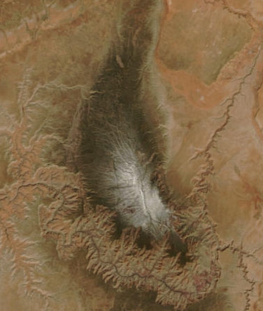
The Kaibab Plateau consists of approximately 1,152 square miles (2,980 km2) which are above 6,000 feet (1,800 m). The highest point has an elevation of 9,200 feet (2,800 m), [2] [6] a topographic prominence of 3,580 feet (1,090 m), [2] and a topographic isolation of 70.44 miles (113.36 km). [3] The plateau is bounded on the south by the Grand Canyon of the Colorado River, the elevation in this southern area of the plateau varies from 8,800 feet (2,700 m) to slightly less than 6,000 feet (1,800 m).

The most extensive platform of the plateau is the Esplanade, which is called "Sand Rocks" by local cowboys. This area was formed as a result from weathering of the Hermit shale, which left a hard layer of Permian sandstone exposed. This red sandstone is one of the outstanding features of the plateau.

The plateau's western boundary is the Kanab Creek Canyon which high perpendicular walls form a natural barrier to the movement of most animals. The northwestern boundary of the plateau is marked by a fault line north of the Snake Gulch which is approximately sixteen miles to the east of the Kanab Creek. The eastern boundary is marked by the so-called Houserock Valley, which is a marble platform caused by a monoclinical fold, which strata dips down 2,000 to 3,000 feet. [7]

Climate

The climate of the Kaibab Plateau consists of rain and thunderstorms in late summer during the summer monsoon season, snow, heavy at times, in winter, and drier weather in early summer. There was an average annual precipitation of 26.57 inches (67.5 cm) for the period 1925 to 1936. During winter, snow is heavy and often accumulates at a depth of 8–10 feet (2.4–3.0 m). June is the driest month of the year, followed by May and early July.

Storms occur several times each week until early September. The highest portions of the plateau are usually touched by snow, and snowstorms usually occur between May and September. [7]

The Kaibab Plateau High Point, 9,213 ft (2,808 m), [8] has a dry-summer humid continental climate (Köppen Dsb), bordering on a dry-summer subalpine climate (Köppen Dsc). Most of the plateau is within the 6b USDA Hardiness Zone (-5°F to 0°F), with the highest elevations in the 6a zone (-10°F to -5°F). [9] There is no weather station at the summit, but this climate table contains interpolated data for an area around the summit.

Climate data for Kaibab Plateau HP 36.3923 N, 112.1498 W, Elevation: 9,150 ft (2,789 m) (1991–2020 normals)
MonthJanFebMarAprMayJunJulAugSepOctNovDecYear
Mean daily maximum °F (°C)38.8
(3.8)
39.9
(4.4)
45.6
(7.6)
51.1
(10.6)
60.5
(15.8)
72.8
(22.7)
76.6
(24.8)
74.1
(23.4)
68.2
(20.1)
57.4
(14.1)
46.0
(7.8)
38.2
(3.4)
55.8
(13.2)
Daily mean °F (°C)27.0
(−2.8)
27.9
(−2.3)
33.0
(0.6)
38.0
(3.3)
46.9
(8.3)
57.5
(14.2)
62.8
(17.1)
60.8
(16.0)
54.4
(12.4)
44.1
(6.7)
34.3
(1.3)
26.8
(−2.9)
42.8
(6.0)
Mean daily minimum °F (°C)15.3
(−9.3)
15.8
(−9.0)
20.3
(−6.5)
25.0
(−3.9)
33.3
(0.7)
42.2
(5.7)
49.0
(9.4)
47.5
(8.6)
40.7
(4.8)
30.8
(−0.7)
22.6
(−5.2)
15.4
(−9.2)
29.8
(−1.2)
Average precipitation inches (mm)5.33
(135)
5.01
(127)
4.39
(112)
1.66
(42)
1.17
(30)
0.60
(15)
1.99
(51)
2.91
(74)
1.89
(48)
2.24
(57)
1.88
(48)
2.85
(72)
31.92
(811)
Source: PRISM Climate Group [10]

Dry Park is a Remote Automated Weather Station located 6 miles northwest of the Kaibab Plateau High Point, at an elevation of 8706 ft (2654 m). [11]

Climate data for Dry Park (RAWS), Arizona, 1999–2020 normals: 8706ft (2654m)
MonthJanFebMarAprMayJunJulAugSepOctNovDecYear
Record high °F (°C)67
(19)
64
(18)
75
(24)
76
(24)
86
(30)
89
(32)
96
(36)
92
(33)
89
(32)
79
(26)
72
(22)
70
(21)
96
(36)
Mean maximum °F (°C)59.0
(15.0)
58.7
(14.8)
62.7
(17.1)
69.0
(20.6)
77.9
(25.5)
86.1
(30.1)
88.3
(31.3)
84.5
(29.2)
81.0
(27.2)
72.1
(22.3)
65.5
(18.6)
58.7
(14.8)
88.8
(31.6)
Mean daily maximum °F (°C)43.0
(6.1)
43.6
(6.4)
49.0
(9.4)
54.3
(12.4)
64.8
(18.2)
76.9
(24.9)
79.0
(26.1)
76.3
(24.6)
70.7
(21.5)
59.6
(15.3)
49.4
(9.7)
41.4
(5.2)
59.0
(15.0)
Daily mean °F (°C)30.7
(−0.7)
31.3
(−0.4)
36.1
(2.3)
41.4
(5.2)
50.1
(10.1)
60.1
(15.6)
64.3
(17.9)
62.1
(16.7)
56.1
(13.4)
46.3
(7.9)
37.4
(3.0)
29.9
(−1.2)
45.5
(7.5)
Mean daily minimum °F (°C)18.4
(−7.6)
18.9
(−7.3)
23.3
(−4.8)
28.5
(−1.9)
35.4
(1.9)
43.3
(6.3)
49.6
(9.8)
47.8
(8.8)
41.5
(5.3)
33.0
(0.6)
25.3
(−3.7)
18.4
(−7.6)
32.0
(0.0)
Mean minimum °F (°C)0.6
(−17.4)
1.1
(−17.2)
7.9
(−13.4)
15.5
(−9.2)
24.1
(−4.4)
32.0
(0.0)
41.4
(5.2)
40.4
(4.7)
29.7
(−1.3)
20.0
(−6.7)
7.2
(−13.8)
1.2
(−17.1)
−4.1
(−20.1)
Record low °F (°C)−15
(−26)
−8
(−22)
1
(−17)
8
(−13)
17
(−8)
25
(−4)
35
(2)
32
(0)
20
(−7)
2
(−17)
−4
(−20)
−13
(−25)
−15
(−26)
Source: XMACIS2 [12]

Kaibab deer

Kaibab deer from the DOCUMERICA series, a program sponsored by the Environmental Protection Agency to photograph subjects of American environmental concern during the 1970s, May 1972 image DEER IN KAIBAB NATIONAL FOREST, NEAR THE NORTH RIM OF GRAND CANYON - NARA - 544114.tif
Kaibab deer from the DOCUMERICA series, a program sponsored by the Environmental Protection Agency to photograph subjects of American environmental concern during the 1970s, May 1972 image

At the beginning of the 20th century, the Kaibab Plateau was witness to an interesting experiment in what some might call population engineering. The plateau's pre-1905 population of mule deer was estimated to be around 4,000. This number was never confirmed by any kind of count or survey, and has become an accepted number mainly because no other estimate is available. The average carrying capacity of the land was unknown, in part because this concept was not widely used by naturalists at the time. Years later, Aldo Leopold estimated that the capacity had been about 30,000 deer.[ citation needed ]

The idea in 1906 was simply to protect and expand the herd, so on November 28, President Theodore Roosevelt created the Grand Canyon National Game Preserve. Overgrazing by herds of sheep, cattle, and horses had taken place on the plateau since the 1880s. During that time, many predators were also killed by ranchers and bounty hunters. By the time Roosevelt established the game preserve, ranchers had moved most domestic livestock elsewhere. The primary change brought by the creation of the game preserve was to ban deer hunting. Government efforts, led by the United States Forest Service, began to protect the deer's numbers by killing off their natural predators once again; to this end, between 1907 and 1939, 816 mountain lions, 20 wolves, 7388 coyotes and over 500 bobcats were reportedly killed. [13]

The deer population experienced a great increase in numbers during the early decades of the 20th century. One estimate put the population as high as 100,000 deer inhabiting the range in 1924. Again, there was no systematic survey to support this estimate, which may have been exaggerated to twice the actual number. Shortly after that time, however, the deer population did begin to decline from over-browsing. By the mid-1920s, many deer were starving to death.

After a heated legal dispute between the federal government and the state of Arizona, hunting was once more permitted, to reduce the deer's numbers. Hunters were able to kill only a small fraction of the starving deer. The range itself was damaged, and its carrying capacity was greatly reduced.

Prey and predator population dynamics

X Fire Tree Planting Restoration Project, Kaibab National Forest,
April 2012 Hoedad2-Kaibab-Nat-Forest.jpg
X Fire Tree Planting Restoration Project, Kaibab National Forest,
April 2012

Once ecologists began to study the area and reflect on the changes that had occurred there, they began to use the Kaibab deer as a simple lesson about how the removal of the deer's natural predators, which had been done in the interest of preserving the deer population, had allowed the deer to over-reproduce, and quickly overwhelm the plateau's resources. Some ecologists suggested that the situation highlighted the importance of keeping a population in balance with its environment's carrying capacity.

The more meaningful lesson of the Kaibab suggests that human efforts to protect wildlife and preserve wild areas must be balanced with ecological complexity and social priorities that are difficult to predict. Changes take place, sometimes rapidly, but their effects linger for decades. Today, the Arizona Game Commission manages the area, controlling the numbers of deer as well as predators, and issues hunting permits to keep the deer in balance with the range. [14]

Kaibab Lake in the Williams Ranger District, Kaibab National Forest, August 2020 Kaibab Lake Campground.jpg
Kaibab Lake in the Williams Ranger District, Kaibab National Forest, August 2020

Although the story of the Kaibab deer rose to fame in the 1920s due to their sudden increase and decrease in population, the story can also be used to demonstrate the way in which scientific studies and ideas about history can help educate current students. The first interpretation of the deer story as demonstrated in textbooks was that predator control had destroyed the deer's population growth. It was thought that initially the high number of deer predators were obtruding the growth of the deer's population, therefore rules were put in place in order to minimize the predator population and allow the deer to increase their population size. However, as scientific studies continued, ecologist Graeme Caughley suggested that predator control alone could not have caused the Kaibab irruption, but rather factors like climate, grazing by other animals, and preservation policies actually had more significant impacts on the deer [15]

Caughley's opinion led to confusion by teachers and scientists over what to include and teach in ecology and biology classes, therefore this story stopped being used as an example of prey and predator population dynamics. This is important to the development of scientific studies because it shows that events—like the Kaibab deer controversy—do not have a definitive start and beginning but include other opinions and approaches which teachers use to showcase the richness of controversy.

In the summers of 2002 and 2003, forest ecologist Dan Binkley and associates undertook a careful analysis of the age structure of aspen stands on the Kaibab. Their work shows that few aspen sprouted successfully on the plateau in the 1920s. They ruled out browsing by domestic livestock or exceptionally dry conditions as causes of that change and concluded that the age structure of aspen in the area was probably due to a period of severe overbrowsing by a large population of deer. This, they write, is consistent with the original assessment of the rapid rise in deer population as a result of persistent predator control. Their contribution of original research is a refreshing addition to the ongoing discussion of predator-prey interactions on the Kaibab. [Binkley, Dan, et al., 2006. "Was Aldo Leopold right about the Kaibab deer herd?" Ecosystems 9: 227–241]

The Kaibab deer controversy has revolutionized the way science is taught in textbooks, and the way students question ecology and biology. In addition, students now learn that human intervention can lead to big repercussions regarding specific animal's population and development in certain regions.[ citation needed ]

See also

Related Research Articles

<span class="mw-page-title-main">White Mountains (California)</span> Mountain range in California, United States

The White Mountains of California and Nevada are a triangular fault-block mountain range facing the Sierra Nevada across the upper Owens Valley. They extend for approximately 60 mi (97 km) as a greatly elevated plateau about 20 mi (32 km) wide on the south, narrowing to a point at the north, with elevations generally increasing south to north. The range's broad southern end is near the community of Big Pine, where Westgard Pass and Deep Springs Valley separate it from the Inyo Mountains. The narrow northern end is at Montgomery Pass, where U.S. Route 6 crosses. The Fish Lake Valley lies east of the range; the southeast part of the mountains are separated from the Silver Peak Range by block faulting across the Furnace Creek Fault Zone, forming a feeder valley to Fish Lake Valley. The range lies within the eastern section of the Inyo National Forest.

<span class="mw-page-title-main">San Gorgonio Mountain</span> Highest peak of the Transverse Ranges of California, United States

San Gorgonio Mountain, also known locally as Mount San Gorgonio, or Old Greyback, is the highest peak in Southern California and the Transverse Ranges at 11,503 feet (3,506 m).

<span class="mw-page-title-main">Kaibab National Forest</span> Protected area in northern Arizona

Kaibab National Forest borders both the north and south rims of the Grand Canyon, in north-central Arizona. Its 1.6 million acres is divided into three sections: the North Kaibab Ranger District, the Tusayan Ranger District, and the Williams Ranger District. It is managed by the United States Forest Service. Grand Canyon National Park separates the North Kaibab and the South Kaibab. The South Kaibab covers 1,422 square miles (3,680 km2) and the North Kaibab stretches over 1,010 square miles (2,600 km2). Elevations vary on the forest from 5,500 feet in the southwest corner to 10,418 feet at the summit of Kendrick Peak on the Williams Ranger District. The forest as a whole is headquartered in Williams.

<span class="mw-page-title-main">Mount Timpanogos</span> Mountain in Utah, United States

Mount Timpanogos, often referred to as Timp, is the second-highest mountain in Utah's Wasatch Range. Timpanogos rises to an elevation of 11,752 ft (3,582 m) above sea level in the Uinta-Wasatch-Cache National Forest. With 5,270 ft (1,610 m) of topographic prominence, Timpanogos is the 47th-most prominent mountain in the contiguous United States.

<span class="mw-page-title-main">Humphreys Peak</span> Highest mountain in Arizona

Humphreys Peak is the highest natural point and the second most prominent peak after Mount Graham in the U.S. state of Arizona, with an elevation of 12,633 feet (3,851 m) and is located within the Kachina Peaks Wilderness in the Coconino National Forest, about 11 miles (17.7 km) north of Flagstaff, Arizona. Humphreys Peak is the highest of a group of dormant volcanic peaks known as the San Francisco Peaks.

<span class="mw-page-title-main">Mount Nebo (Utah)</span> Mountain in Utah, United States

Mount Nebo is the southernmost and highest mountain in the Wasatch Range of Utah, in the United States, and the centerpiece of the Mount Nebo Wilderness, inside the Uinta National Forest. It is named after the biblical Mount Nebo in Jordan, overlooking Israel from the east of the Jordan River, which is said to be the place of Moses' death.

Boulder Mountain in Utah, United States makes up half of the Aquarius Plateau of South Central Utah in Wayne and Garfield counties. The mountain rises to the west of Capitol Reef National Park and consists of steep slopes and cliffs with over 50,000 acres (200 km²) of rolling forest and meadowlands on the top. The mountain has a nearly flat summit of roughly 70 square miles. The mountain is the highest timbered plateau in North America and is part of the Dixie National Forest.

<span class="mw-page-title-main">Coconino National Forest</span> United States protected area in Arizona

The Coconino National Forest is a 1.856-million acre United States National Forest located in northern Arizona in the vicinity of Flagstaff, with elevations ranging from 2,600 feet to the highest point in Arizona at 12,633 feet. Originally established in 1898 as the "San Francisco Mountains National Forest Reserve", the area was designated a U.S. National Forest by Pres. Theodore Roosevelt on July 2, 1908, when the San Francisco Mountains National Forest Reserve was merged with lands from other surrounding forest reserves to create the Coconino National Forest. Today, the Coconino National Forest contains diverse landscapes, including deserts, ponderosa pine forests, flatlands, mesas, alpine tundra, and ancient volcanic peaks. The forest surrounds the towns of Sedona and Flagstaff and borders four other national forests; the Kaibab National Forest to the west and northwest, the Prescott National Forest to the southwest, the Tonto National Forest to the south, and the Apache-Sitgreaves National Forest to the southeast. The forest contains all or parts of nine designated wilderness areas, including the Kachina Peaks Wilderness, which includes the summit of the San Francisco Peaks. The headquarters are in Flagstaff. The Coconino National Forest consists of three districts: Flagstaff Ranger District, Mogollon Rim Ranger District, and Red Rock Ranger District, which have local ranger district offices in Flagstaff, Happy Jack, and Sedona.

<span class="mw-page-title-main">Mount Lyell (California)</span> Mountain in the American state of California

Mount Lyell is the highest point in Yosemite National Park, at 13,114 feet (3,997 m). It is located at the southeast end of the Cathedral Range, 1+14 miles northwest of Rodgers Peak. The peak as well as nearby Lyell Canyon is named after Charles Lyell, a well-known 19th century geologist. The peak had one of the last remaining glaciers in Yosemite, Lyell Glacier. The Lyell Glacier is currently considered to be a permanent ice field, not a living glacier. Mount Lyell divides the Tuolumne River watershed to the north, the Merced to the west, and the Rush Creek drainage in the Mono Lake Basin to the southeast.

<span class="mw-page-title-main">Arizona Strip</span> Part of Arizona north of the Colorado River

The Arizona Strip is the part of Arizona lying north of the Colorado River. Despite being larger in area than several U.S. states, the entire region has a population of fewer than 10,000 people. Consisting of northeastern Mohave County and northwestern Coconino County, the largest settlements in the Strip are Colorado City, Fredonia, and Beaver Dam, with smaller communities of Scenic, Littlefield and Desert Springs. The Kaibab Indian Reservation lies within the region. Lying along the North Rim of the Grand Canyon creates physical barriers to the rest of Arizona. Only three major roads traverse the region: I-15 crosses the northwestern corner, while Arizona State Route 389 and U.S. Route 89A cross the northeastern part of the strip, and US 89A crosses the Colorado River via the Navajo Bridge, providing the only direct road connection between the strip and the rest of the state. The nearest metropolitan area is the St. George, Utah, metro area, to which the region is more connected than to the rest of Arizona.

<span class="mw-page-title-main">Mount Williamson</span> Mountain in California, United States

Mount Williamson, at an elevation of 14,379 feet (4,383 m), is the second-highest mountain in both the Sierra Nevada range and the state of California, and the sixth-highest peak in the contiguous United States.

<span class="mw-page-title-main">Jacob Lake, Arizona</span> Unincorporated community in the state of Arizona, United States

Jacob Lake is a small unincorporated community on the Kaibab Plateau in Coconino County, Arizona, United States, at the junction of U.S. Route 89A and State Route 67. Named after the Mormon explorer Jacob Hamblin, the town is known as the "Gateway to the Grand Canyon" because it is the starting point of Route 67, the only paved road leading to the North Rim of the Grand Canyon some 44 miles (71 km) to the south. The town itself consists of the Jacob Lake Inn which maintains motel rooms and cabins, a restaurant, lunch counter, gift shop, bakery, and general store; a gas station/garage; campground; and a visitors center run by the U.S. Forest Service. In the summer months, there is also a nearby center for horse rides.

<span class="mw-page-title-main">Gila Wilderness</span> Wilderness area in New Mexico, United States

Gila Wilderness was designated the world's first wilderness area on June 3, 1924. Along with Aldo Leopold Wilderness and Blue Range Wilderness, the 558,014 acre wilderness is part of New Mexico's Gila National Forest. The wilderness is approximately 27 miles (43 km) from north to south and 39 miles (63 km) east to west.

<span class="mw-page-title-main">Kanab Creek Wilderness</span> Protected area in the Kaibab National Forest

Kanab Creek Wilderness is a 75,300-acre (305 km2) wilderness area located along the Coconino/Mohave County line in the U.S. state of Arizona, approximately 30 miles (48 km) south of Fredonia. 68,600 acres (278 km2) of the Wilderness are located in the North Kaibab Ranger District of the Kaibab National Forest, the remaining 6,700 acres (27 km2) are administered by the Bureau of Land Management.

<span class="mw-page-title-main">Geography of Arizona</span>

Arizona is a landlocked state situated in the southwestern region of the United States of America. It has a vast and diverse geography famous for its deep canyons, high- and low-elevation deserts, numerous natural rock formations, and volcanic mountain ranges. Arizona shares land borders with Utah to the north, the Mexican state of Sonora to the south, New Mexico to the east, and Nevada to the northwest, as well as water borders with California and the Mexican state of Baja California to the southwest along the Colorado River. Arizona is also one of the Four Corners states and is diagonally adjacent to Colorado.

The Great Western Trail is a north-south long distance multiple use route that runs from Canada to Mexico through five western states in the United States. The trail has access for both motorized and non-motorized users and traverses 4,455 miles (7,170 km) through Arizona, Utah, Idaho, Wyoming, and Montana. It was designated a National Millennium Trail in 1999.

Buckskin Mountain is a 16-mile (26 km) mountain ridge that spans from Coconino County, Arizona to Kane County, Utah in the United States, that is divided almost equally between the two counties.

<span class="mw-page-title-main">Kanab Plateau</span> Plateau in Arizona, United States

The Kanab Plateau is a 45-mile long plateau located at the north of the Grand Canyon in Arizona, United States. The plateau is adjacent west of the Kaibab Plateau of the North Rim, with a basin containing the Kanab Creek watershed in between. The basin is the site of the Kanab Creek Wilderness, with Snake Gulch at its north perimeter, and at the base of the Kanab Plateau, forming its southeast border.

<span class="mw-page-title-main">San Antonio Mountain (New Mexico)</span> Volcanic mountain in New Mexico, US

San Antonio Mountain is a free-standing volcanic peak in Rio Arriba County, New Mexico. With an elevation of 10,908 feet, San Antonio Mountain is the highest peak within the Taos Plateau volcanic field, the largest volcanic field within the Rio Grande Rift valley.

Saddle Mountain Wilderness is a protected wilderness area managed by the Kaibab National Forest north of Grand Canyon National Park in the U.S. state of Arizona. Established in 1984 under the Arizona Wilderness Act, the area on the Kaibab Plateau includes its namesake summit, a prominent ridge shaped like a saddle that reaches an elevation of 8,424 feet. Elevations in the northern part of the wilderness on the edge of Marble Canyon start at about 6,000 feet and rise to 8,000 on the southern ridge which forms the Nankoweap Rim of the Grand Canyon.

References

  1. 1 2 3 U.S. Geological Survey Geographic Names Information System: Kaibab Plateau
  2. 1 2 3 Kaibab Plateau High Point, Arizona at Peakbagger.com
  3. 1 2 "Kaibab Plateau AZ". ListsOfJohn.com.
  4. Kaibab Plateau at Peakbagger.com
  5. "Land Use History of North America: Colorado Plateau: Kaibab Plateau, Arizona". Archived from the original on December 19, 2005 via Wayback Machine.
  6. "Kaibab Plateau & North Rim Lookout". SummitPost.org.
  7. 1 2 Rasmussen, D. Irwin (July 1941). "Biotic Communities of Kaibab Plateau, Arizona". Ecological Monographs. 11 (3). Hoboken, New Jersey: Wiley: 229–275. doi:10.2307/1943204. JSTOR   1943204.
  8. "Kaibab Plateau High Point, Arizona". Peakbagger. Retrieved January 1, 2024.
  9. "Arizona Hardiness Zones Map – 2023". Plantmaps.com. Retrieved January 1, 2024.
  10. "PRISM Climate Group, Oregon State University". PRISM Climate Group, Oregon State University. Retrieved January 1, 2024. To find the table data on the PRISM website, start by clicking Coordinates (under Location); copy Latitude and Longitude figures from top of table; click Zoom to location; click Precipitation, Minimum temp, Mean temp, Maximum temp; click 30-year normals, 1991–2020; click 800m; click Retrieve Time Series button.
  11. "Data of Meteorological Station Maverick Fork, Arizona". geographic.org. Retrieved January 1, 2024.
  12. "xmACIS2". National Oceanic and Atmospheric Administration. Retrieved January 1, 2024.
  13. Young, Chris. "A history of the Kaibab deer".
  14. "Grand Canyon officials to make another run at corralling and reducing bison herd". Los Angeles Times . Associated Press. September 2, 2019. Retrieved May 17, 2020.
  15. Young, Chris, A Textbook History: Use of the Kaibab Lesson in Teaching Biology[ ISBN missing ][ page needed ]