Rawhide Mountains

Last updated
Rawhide Mountains
USA Arizona relief location map.svg
Red triangle with thick white border.svg
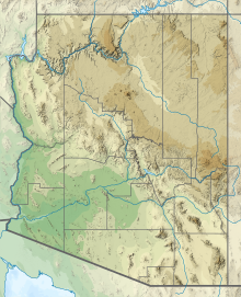
Rawhide Mountains in Arizona
Highest point
PeakAubrey Peak (Rawhide Mountains)
Elevation 2,953 [1]  ft (900 m)
Dimensions
Length15 mi (24 km)NW-SE
Width9 mi (14 km)
Geography
CountryUnited States
StateArizona
Region Maria fold and thrust belt
((southeast)-Mojave Desert)
((northwest)-Sonoran Desert)
County Mohave County, Arizona
Settlement Swansea, AZ-(ghost town) &
Parker Dam, California
Range coordinates 34°18′09″N113°42′04″W / 34.3025°N 113.7010°W / 34.3025; -113.7010
Borders on Bill Williams River

The Rawhide Mountains are a mountain range of western Arizona, in the southwest of Mohave County. It is part of a block of mountain ranges on the north of an insular region called the Maria fold and thrust belt, containing mountain ranges, valleys, and plains. The Rawhide Mountains border the much smaller Artillery Mountains southeast, bordering on Alamo Lake State Park and the south-flowing Big Sandy River.

Contents

The border to the southwest are the Bill Williams Mountains, and the Poachie Range with the large Arrastra Mountain Wilderness is northeast and east.

The high point of the range is Aubrey Peak at 2,953 feet (900 m). [2] Two other peaks lie at the southeast, Miller Peak at 2,793 feet (851 m) and Fools Peak at 2,939 feet (896 m).

The southern perimeter of the Rawhide Mountains is the west-flowing Bill Williams River. The river is part of the northern border of the Maria fold and thrust belt with the block of mountains north forming the border, and is also part of the southeast Mojave Desert, another de facto border.

South of the river is the northwestern Sonoran Desert. The major mountain block at the intersection of this region west in California is the Whipple Mountains of southeast California, in the northeast Colorado Desert (the northwestern Sonoran Desert). The Whipple Mountains cause the south-flowing Colorado River to traverse southeast, then back southwest around the Whipple Mountains massif. The Colorado then turns back to the south. (It makes another excursion south of the Trigo Mountains massif.)
Rawhide Mountains and Aubrey Peak Wildernesses

Approximately half of the Rawhide Mountains contain wilderness areas.

Aubrey Peak Wilderness

The northwest of the range consists of the Aubrey Peak Wilderness, of 15,400-acre (6,232 ha). It is accessed by unimproved dirt roads, which are on the southwest and southeast perimeter. Two geologic hikes are profiled in the region. The route starts at Wikieup and Hike 29 [3] is in the southern Hualapai Mountains at a mountain saddle. The route is the access to Centennial Wash, Hike 30, [4] where the wash is part of the southeast border of the Aubrey Peak Wilderness.

Rawhide Mountains Wilderness

The Rawhide Mountains Wilderness is a large wilderness that is on both banks of the Bill Williams River, and the confluence of the Big Sandy River. It is in the northeast of the Buckskin Mountains, the southeast of the Rawhide's and forms the western border of Alamo Lake, at Alamo Lake State Park.

Related Research Articles

<span class="mw-page-title-main">Chemehuevi Mountains</span> Landform in southern California near the Colorado River

The Chemehuevi Mountains are found at the southeast border of San Bernardino County in southeastern California adjacent the Colorado River. Located south of Needles, California and northwest of the Whipple Mountains, the mountains lie in a north–south direction in general, and are approximately 15 miles (24 km) in length.

<span class="mw-page-title-main">Turtle Mountains (California)</span> Mountain range in California, United States

The Turtle Mountains, are located in northeastern San Bernardino County, in the southeastern part of California. The colorful Turtle Mountains vary from deep reds, browns, tans and grays, to black. The area has numerous springs and seeps. The Turtle Mountains are also a National Natural Landmark, with two mountain sections of entirely different composition.

<span class="mw-page-title-main">Whipple Mountains</span> Landform in San Bernardino County, Arizona

The Whipple Mountains are located in eastern San Bernardino County, California. They are directly west of the Colorado River, Parker Dam, and Lake Havasu; south of Needles, California; north of Parker, Arizona and Vidal, California; and northeast of Vidal Junction, California.

<span class="mw-page-title-main">Muggins Mountains</span> Landform in Yuma County, Arizona

The Muggins Mountains is a mountain range in southwest Arizona east of Yuma, Arizona, northeast of the Gila Mountains, and east of the Laguna Mountains. The Castle Dome Mountains lie to the northeast across the broad Castle Dome Plain. The Muggins Mountains Wilderness occupies the southwest portion of the range.

The Mopah Range is a desert mountain range, in the Lower Colorado River Valley region, in southeastern San Bernardino County, California.

The Harcuvar Mountains are a narrow mountain range in western-central Arizona, United States. The range lies just east of the north–south Colorado River, and south of the east–west, west-flowing Bill Williams River, from Alamo Lake.

<span class="mw-page-title-main">Buckskin Mountains (Arizona)</span> Landform in La Paz County

The Buckskin Mountains is a mountain range in La Paz County, Arizona, United States. The range lies just east of the north–south Colorado River, and borders south of the east–west, west-flowing Bill Williams River.

Butler Valley is a valley of the Maria fold and thrust belt in western Arizona, USA. It lies east of the Colorado River, and is south of the west-flowing Bill Williams River.

The Whipple Mountains Wilderness is a 76,122-acre (30,805 ha) wilderness administered by the Bureau of Land Management (BLM). Most of the Whipple Mountains are within the wilderness area. It is located in the northeastern Colorado Desert near the Colorado River. Lake Havasu and Lake Havasu City are 25 miles (40 km) to the North. Earp, California and Parker, Arizona are 20 miles (32 km) to the South. The Parker Dam is 8 miles (13 km) due east.

The Centennial Wash (Mohave County) is a northern minor wash tributary to the west-flowing Bill Williams River. The wash drains from the western third of the Rawhide Mountains, and partially forms the southeast border of the wilderness at the northwest of the Rawhide's, the Aubrey Peak Wilderness.

The Aubrey Peak Wilderness is a 15,400-acre (6,230 ha) wilderness administered by the Bureau of Land Management (BLM). The wilderness is located in northwest Arizona in the southwest of Mohave County, a region of the southeastern Mojave Desert's extension into northwest Arizona.

<span class="mw-page-title-main">Hummingbird Springs Wilderness</span> Protected area in Maricopa County, Arizona, US

The Hummingbird Springs Wilderness is a 31,200-acre (12,626 ha) wilderness administered by the Bureau of Land Management (BLM). The wilderness is located in the northwest of Maricopa County in northern regions of the central Sonoran Desert of Arizona.

Dutch Flat of Arizona is a valley south of the Sacramento Valley and Interstate 40 in southern Mohave County.

The Black Hills of Greenlee County are a 20 mi (32 km) long mountain range of the extreme northeast Sonoran Desert bordering the south of the White Mountains of eastern Arizona's transition zone.

<span class="mw-page-title-main">Poachie Range</span> Landform in La Paz, Mohave, and Yavapai Counties, Arizona

The Poachie Range is a moderate length mountain range and massif in southeast Mohave County, Arizona, and the extreme southwest corner of Yavapai County; the range also abuts the northeast corner of La Paz County. The Poachie Range massif is bordered by the south-flowing Big Sandy River on its west, and the west-flowing Santa Maria River on its south; both rivers converge at the Poachie Range's southwest at Alamo Lake in Alamo Lake State Park.

The Date Creek Mountains are a short, arid range in southwest Yavapai County, Arizona. Congress is on its southeast foothills, and Wickenburg lies 15 mi (24 km) southeast.

The Aquarius Mountains are a 45-mi (72 km) long mountain range in southeast Mohave County, Arizona. The range lies in the northwest of the Arizona transition zone, and at the southwest of the Coconino Plateau, a subsection of the Colorado Plateau.

<span class="mw-page-title-main">Toroweap Fault</span> Geologic feature in the Grand Canyon, Arizona

The Toroweap Fault of northwest Arizona and southwest Utah is part of a fault system of the west Grand Canyon region, Arizona, US; also the west perimeter regions of the Coconino and Colorado Plateaus. The Hurricane Fault originates at the Toroweap Fault, in the region of the Colorado River, and strikes as the westerly depression of the Toroweap Fault. The Toroweap strikes northerly from the Colorado at the east of Toroweap Valley, and enters south Utah; from the Colorado River, the Hurricane Fault strikes north-northwest along the west flank of the small, regional Uinkaret Mountains, the west border of Toroweap Valley. The Hurricane Fault, and the Hurricane Cliffs strike into southwest Utah as part of the west, and southwest perimeter of the Colorado Plateau. The Hurricane Cliffs are made of Kaibab Limestone, an erosion resistant, cliff-forming rock unit.

The Peacock Mountains are a small, 26 mi (42 km) long mountain range in northwest Arizona, US. The range is a narrow sub-range, and an extension north, at the northeast of the Hualapai Mountains massif, which lies to the southwest. The range is defined by the Hualapai Valley to the northwest, and north and south-flowing washes on its east border, associated with faults and cliffs; the Cottonwood Cliffs are due east, and are connected to the Aquarius Cliffs southward at the west perimeter of the Aquarius Mountains; the cliffs are a result of the Aquarius Fault, which is an extension southward from the Grand Wash Cliffs and Grand Wash Fault which crosses the Colorado River at Lake Mead, and the west perimeter of the Grand Canyon/Colorado Plateau.

References

  1. U.S. Geological Survey Geographic Names Information System: Rawhide Mountains
  2. McCracken Peak, AZ section.
  3. Luchhitta, 2001. Hiking Arizona's Geology, Hike 29.
  4. Luchhitta, 2001. Centennial Wash, Hike 30.

Aubrey Peak