Mohave County occupies the northwestern corner of the U.S. state of Arizona. As of the 2020 census, its population was 213,267. The county seat is Kingman, and the largest city is Lake Havasu City. It is the fifth largest county in the United States.

The Chocolate Mountains of California are located in Imperial and Riverside counties in the Colorado Desert of Southern California. The mountains stretch more than 60 miles (100 km) in a northwest to southeast direction, and are located east of the Salton Sea and south and west of the Chuckwalla Mountains and the Colorado River. To the northwest lie the Orocopia Mountains.

The Hualapai Mountains are a mountain range located in Mohave County, east of Kingman, Arizona. Rising up to 8,417 feet at its highest peak, the higher elevations of the Hualapai Mountains support Madrean Sky Island habitats, and are host to a plethora of unique flora and fauna in a wide range of microclimates, high above the surrounding Mojave Desert.

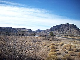
The 112,400-acre (45,500 ha) Warm Springs Wilderness makes up the entirety of the Black Mesa and parts of the surrounding foothills, washes, alluvial fans, and valleys. The Black Mesa is the southernmost section of the Black Mountains of western Mohave County, in northwest Arizona. The region is in the east and southeast of the Mojave Desert of Arizona, southern Nevada, and California.
The Black Mesa of northwestern Arizona is the extreme southern section of the Black Mountains.
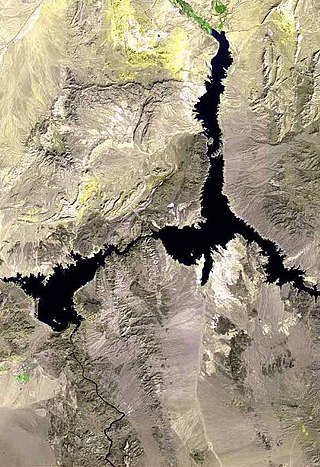
The Black Mountains of northwest Arizona are an extensive, mostly linear, north-south trending 75 miles (121 km) long mountain range. It forms the north-south border of southwest Mohave County as it borders the eastern shore of the south-flowing Colorado River from Hoover Dam.
Mount Tipton is a mountain in northwestern Arizona in the United States. With a summit elevation of 7,153 feet (2,180 m), it is the tallest mountain in the Cerbat Mountains which border Kingman on the north, and is the high point of the Mount Tipton Wilderness which comprises the entirety of the northern portion of the Cerbat Mountains. The community of Dolan Springs lies west at the base of Mount Tipton at the northwest side of the Cerbat Range.
The Mount Tipton Wilderness is a 30,760-acre (124.5 km2) wilderness area in the U.S. state of Arizona. It is located in northwestern Arizona and comprises the north portion of the Cerbat Mountains; the Cerbat Mountains extend 23 miles (37 km) northwesterly from the northern edge of Kingman.

The Kofa Mountains of Yuma and La Paz counties in Arizona is the central mountain range of the Kofa National Wildlife Refuge. The range lies about 60 miles northeast of Yuma in the southwestern part of the state. Kofa Wilderness takes up 547,719 acres of the refuge, making it the second largest wilderness area in Arizona. The equally extensive Castle Dome Mountains comprise the southern refuge border; the western end of the Tank Mountains are in the southeast of the wildlife refuge, and the New Water Wilderness in the New Water Mountains ends the extension of the Kofa National Wildlife Refuge to the north. Scenic "King Valley" is south of the Kofa Mountains between the Castle Dome Mountains.
The Copper Mountains is a minor north–south trending mountain range, only 8 miles long in southwestern Arizona in the southwestern Sonoran Desert.

The Muggins Mountains is a mountain range in southwest Arizona east of Yuma, Arizona, northeast of the Gila Mountains, and east of the Laguna Mountains. The Castle Dome Mountains lie to the northeast across the broad Castle Dome Plain. The Muggins Mountains Wilderness occupies the southwest portion of the range.

The Gila Mountains of Yuma County are a 26-mile (42 km) long mountain range in southwestern Arizona in the northwest Sonoran Desert.
The Dome Rock Mountains are a mountain range in southern La Paz County, Arizona. The range borders the Colorado River on the west and the Colorado River Indian Reservation on the northwest located in the Lower Colorado River Valley. Quartzsite, Arizona lies on the eastern foothills of the range.

The Little Ajo Mountains is a mountain range in southern Arizona, in extreme western Pima County, Arizona. The city of Ajo sits on the northeast of this small mountain range. Both the mountain range and city take their name from the Spanish word for garlic.
The Harcuvar Mountains are a narrow mountain range in western-central Arizona, United States. The range lies just east of the north–south Colorado River, and south of the east–west, west-flowing Bill Williams River, from Alamo Lake.

The Buckskin Mountains is a mountain range in La Paz County, Arizona, United States. The range lies just east of the north–south Colorado River, and borders south of the east–west, west-flowing Bill Williams River.

The Big Burro Mountains are a moderate length 35-mile (56 km) long, mountain range located in central Grant County, New Mexico. The range's northwest-southeast 'ridgeline' is located 15 mi southwest of Silver City.
The Peacock Mountains are a small, 26 mi (42 km) long mountain range in northwest Arizona, US. The range is a narrow sub-range, and an extension north, at the northeast of the Hualapai Mountains massif, which lies to the southwest. The range is defined by the Hualapai Valley to the northwest, and north and south-flowing washes on its east border, associated with faults and cliffs; the Cottonwood Cliffs are due east, and are connected to the Aquarius Cliffs southward at the west perimeter of the Aquarius Mountains; the cliffs are a result of the Aquarius Fault, which is an extension southward from the Grand Wash Cliffs and Grand Wash Fault which crosses the Colorado River at Lake Mead, and the west perimeter of the Grand Canyon/Colorado Plateau.

The Mineral Park mine is a large open-pit copper mine located in the Cerbat Mountains, 14 mi (23 km) northwest of Kingman, Arizona. A 2013 report said that Mineral Park has an estimated reserves of 389 million t of ore grading 0.14% copper and 31 million oz of silver.
The White Hills are a range of hills in northern Mohave County, Arizona. These hills lie north of the Cerbat Mountains and extend south from the Colorado River at Lake Mead between the Detrital Valley to the west and the Gold Basin and the upper Hualapai Valley to the east. The north region of the White Hills is located in Lake Mead National Recreation Area.