Hualapai Mountains

Last updated

Hualapai Mountains
Hualapai Mountain range.jpg
The Hualapai Mountains are home to the highest peaks in Mohave County, Arizona.
Highest point
Peak Hualapai Peak
Elevation 8,417 ft (2,566 m)
Naming
Native name'Amat 'Avii Kahuwaaly (Mohave)
Geography
USA Arizona relief location map.svg
Red triangle with thick white border.svg
Location of Hualapai Mountains in Arizona.
CountryUnited States
StateArizona
County Mohave County
Range coordinates 34°54′00″N113°53′03″W / 34.900008°N 113.8841121°W / 34.900008; -113.8841121
Topo map USGS Hualapai Peak, Dean Peak

The Hualapai Mountains are a mountain range located in Mohave County, east of Kingman, Arizona. Rising up to 8,417 feet at its highest peak, [1] the higher elevations of the Hualapai Mountains support Madrean Sky Island habitats, and are host to a plethora of unique flora and fauna in a wide range of microclimates, high above the surrounding Mojave Desert.

Contents

Etymology

Pronounced: "wah-lah-pie" [2]

Meaning of "Hualapai" in Hualapai language: "People of the tall Pines". [3]

English spelling: Walapai

Spanish spelling: Hualapai

Most used spelling: Hualapai, though both are acceptable [2]

Other names for Hualapai Mountain:

Mojave language: Amat 'Avii Kahuwaaly [4]

Panorama of the Hualapai Mountains taken from Kingman in December 2009 Hualapai Mountains Arizona Panorama.jpg
Panorama of the Hualapai Mountains taken from Kingman in December 2009

Geography

The Hualapai Mountain range is located in the central portion of the Basin and Range Province of the southwestern United States, and along the western-most extension of the Arizona Transition Zone (or "Central Highlands" of Arizona). [5]

Summits

The most notable peaks in the Hualapai Mountain Range include:

Hualapai Peak

(8,417 feet / 2,566 meters) [6] is the highest peak in the range, as well as the highest point in Mohave County. [7]

Hayden Peak

(8,390 feet / 2,560 meters) is the second highest peak in the range, and is the site of a communications tower, which is gated and is not accessible to the public.

Aspen Peak

Aspen Peak, as seen from Pine Lake Aspen Peak as seen from Pine Lake.jpg
Aspen Peak, as seen from Pine Lake

(8,167 feet / 2,489 meters) is among the most visited of the 8,000-foot peaks in the range, and is located within the Hualapai Mountain County Park. Small stands of quaking aspen grow near its summit, giving the upper portion of the mountain an autumn display amidst a sea of tall evergreens.

Dean Peak

(8,013 feet / 2,442 meters) is the northern-most of the notable peaks in this range, and is named after the Dean Mine and its discoverer William Dean. [8] who discovered rich gold and silver-sulfide ore there. [9]

Wabayuma Peak

(7,601 feet / 2,317 meters) is located in the southern portion of the range, and is in the boundary of the Wabayuma Peak Wilderness Area, consisting of 40,000 acres managed by the Bureau of Land Management Kingman Field Office. [10]

Other notable peaks

Getz Peak is located directly to the north of the Hualapai County Park Ranger Station, and is the site of multiple communications towers, which are also gated, and not accessible to the public.

Watershed tributaries

The Hualapai Mountain range extends into both the Upper and Lower Colorado River Basin watersheds. [11]

Ecology

Flora

Diverse plant communities in Hualapai Mountains Hualapai Mountain Plant Communities.jpg
Diverse plant communities in Hualapai Mountains

The Hualapai Mountains contain a dramatic range of plant communities depending on the elevation, slope direction, and microclimate conditions of a given area.

Desert/xeric shrublands

Xeric plant communities in Hualapai Mountains Xeric plant communities in Hualapai Mountain foothills.jpg
Xeric plant communities in Hualapai Mountains
Desert plant communities in the Hualapai Mountain foothills Desert plant communities in the Hualapai Mountain foothills.jpg
Desert plant communities in the Hualapai Mountain foothills

−282 feet (−86 m)3,500 feet (1,100 m)

Dominating the landscape surrounding the Hualapai Mountain Sky Island, and at the lowest portion of its foothills, is the Mojave Desert which ranges from altitudes as high as 3,500 feet (1,100 m), and as low as 282 feet (86 m) below sea level, at Badwater Basin in Death Valley National Park, California. [15] (approximately 175 miles (282 km) away as the crow flies). This list includes plant species which are native and predominant throughout the environment in and around the Hualapai Mountain foothills:

Grasslands

4,000–5,000 feet (1,200–1,500 m)

The most prominent grassland communities in the area are found on the east side of the range, across Big Sandy River Valley up to the foot of the Hualapai Mountains. Dominant species of perennial grass may include:

Interior chapparel scrubland

Mixed scrub, yucca, and cacti in Hualapai Mountain Foothills Mixed scrub, yucca, and cacti in Hualapai Mountain Foothills.jpg
Mixed scrub, yucca, and cacti in Hualapai Mountain Foothills
Delicate ecosystems emerge from dying scrub Delicate ecosystems emerge from dying scrub.jpg
Delicate ecosystems emerge from dying scrub

3,000–5,000 feet (910–1,520 m)

A landscape that is dominated by short, woody shrubs, especially on south-facing mountain slopes, and areas which are recovering from wildfires. This plant community makes up the buffer between the harsh desert below and the fragile forest-environments above.

May include the following plant varieties/species:

Piñon-Juniper woodlands

(left) Pinyon Pine, (right) Juniper, (bottom left) Yucca, (bottom middle) Manzanita Pinyon-juniper plant community in Hualapai Mountains.jpg
(left) Pinyon Pine, (right) Juniper, (bottom left) Yucca, (bottom middle) Manzanita

4,500–7,500 feet (1,400–2,300 m)

Pinyon-juniper woodlands are nurse plants of ecological facilitation between chapparel scrubland and forested environments at higher elevations. [16] Juniper tends to be more predominant at lower elevations, while Piñon Pine grow more vigorously at slightly higher elevations.

Other flora varieties of this plant community may include:

Mountain conifer forest

Lush micro-climates exist in the upper reaches of the Hualapai Mountains Gambel Oak and Ponderosa Pine in the Hualapai Mountain sunrise.jpg
Lush micro-climates exist in the upper reaches of the Hualapai Mountains
A unique world about the Mohave Desert A unique world above the Mojave Desert.jpg
A unique world about the Mohave Desert

5000+ feet

Tall pines and thick stands of broad-leaved trees constitute the montane conifer forests in the upper elevations of the Hualapai Mountains.

Trees include:

Grasses may include:

Wildlife

Black bear, elk, mule deer, mountain lion, javelina, and other animals can be found here. Mountain lion and bear have been drawn to civilized areas like Pinion Pines and Atherton Acres due to the large deer population, though bear sightings are very uncommon. There are some animals only native to the Hualapai Mountain range, including a breed of ground squirrel, and tarantula. [17]

Geology

History

Points of interest and activities

Hualapai Mountain County Park

View of Kingman, Arizona, from the top of the Hualapai Mountains Received 10207963485189141.jpg
View of Kingman, Arizona, from the top of the Hualapai Mountains

The area that is now Hualapai Mountain Park was first developed in the 1930s by the Civilian Conservation Corps (CCC), and is, today, managed by the Mohave County Parks department. The park encompasses over 2,300 acres (9.3 km2) with elevations ranging from 4,984 feet (1,519 m) to the highest peak within its boundary; Hayden Peak8,390 feet (2,560 m)., [1] and is the gateway to the high point of Mohave County; Hualapai Peak at 8,417 feet (2,566 m). Hualapai Peak is located south of the Mohave County Park boundary on Bureau of Land Management land.

The park has cabins, recreation areas, dry camping campsites, and hook-up spots for recreational vehicles, and is generally open year-round for camping and recreation. There are signs telling the history, varieties of vegetation, local and migratory birds, and other wildlife which can be spotted around the park. There are over 10 miles (16 km) of hiking trails ranging in difficulty, and an OHV trailhead near the ranger station which leads to a vast network of trails on both the county park and BLM lands.

Pine Lake Valley

Overlook of Pine Lake Community Overlook of Pine Lake Community.jpg
Overlook of Pine Lake Community

Near the end of Hualapai Mountain Road, just past the Hualapai Mountain Park ranger station, is a community known as Pine Lake. The lake itself, for which the valley gets its name, is privately owned, and is not available to the public, however, it is viewable from a number of high points surrounding the valley, namely along Flag Mine Road, as well as Ponderosa Drive, the public access route to the county "Fuels Management" area (community burn-pile).

The community has approximately 140 homes and is a little over 6,000 ft (1,800 m) in elevation. Some basic amenities, including the Hualapai Mountain Resort (general store, hotel, restaurant, bar, and event center), a volunteer fire department, and some privately owned cabins for rent may be found here.

Wildcow Campground

Accessed from Flag Mine Road, Wild Cow Springs Campground is located on Antelope Wash Road (fire evacuation route). The campground is managed by the Bureau of Land Management, and is a paid site with outhouses and a few bear-proof trashcans, but it is recommended to pack out your garbage if possible. [18]

This site is technically accessible with a 5th wheel or class A motorhome, but comes with its own risks. Contact the Bureau of Land Management Kingman Field Office for road conditions if in doubt.

Off-road trails

A snippet of the Arizona Peace Trail in the Hualapai Mountains Arizona Peace Trail traverses the Hualapai Mountain range.jpg
A snippet of the Arizona Peace Trail in the Hualapai Mountains
A view of the Aquarius Mountains from the top of the AZ Peace Trail View from AZ Peace Trail (Flag Mine Road).jpg
A view of the Aquarius Mountains from the top of the AZ Peace Trail
The jagged skyline seen from the top of the Hualapai Mountains is illuminated with intense pastel colors from a sunset Sunset as seen from the Hualapai Mountains.jpg
The jagged skyline seen from the top of the Hualapai Mountains is illuminated with intense pastel colors from a sunset

From the Pine Lake Community there are a number of dirt roads that lead out into the mountains. There are two main routes in and out of the community, via the Hualapai Mountain Road, and Flag Mine Road (Arizona Peace Trail). Other ATV routes exist, but are not recommended for general through-way travel, or low clearance vehicles.

From Flag Mine Road one can access many different routes along the "Ridge Road" (a piece of the Arizona Peace Trail) of the Hualapai Mountains, which traverses north–south through the various valleys, canyons and washes. There are a number of other routes and trails, including the Moss Wash Basin which is adopted by a local OHV group. At the end of Flag Mine Road is the Boreana Mine, and the route to Yucca.

The main fire evacuation route is generally maintained to allow low clearance vehicles, but most other roads and atv trails will require high clearance and/ or four-wheel drive. There is a designated fire escape route to get out of out the mountains to the east (toward highway 95) in the event of a wildfire that prevents fleeing using the main road (Antelope Wash Road accessed from Flag Mine Road at the BLM Wildcow Campground) Travel at your own risk. A high-quality OHV/Trail map of the Hualapai Mountains and surrounding areas is generally available at the Mohave County Sheriff's Office (search and rescue map).

Related Research Articles

<span class="mw-page-title-main">Mojave River</span> River in California, United States

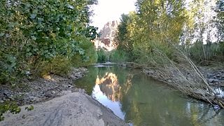
The Mojave River is an intermittent river in the eastern San Bernardino Mountains and the Mojave Desert in San Bernardino County, California, United States. Most of its flow is underground, while its surface channels remain dry most of the time, except for the headwaters and several bedrock gorges in the lower reaches.

<span class="mw-page-title-main">Great Basin Desert</span> Desert in the western United States

The Great Basin Desert is part of the Great Basin between the Sierra Nevada and the Wasatch Range. The desert is a geographical region that largely overlaps the Great Basin shrub steppe defined by the World Wildlife Fund, and the Central Basin and Range ecoregion defined by the U.S. Environmental Protection Agency and United States Geological Survey. It is a temperate desert with hot, dry summers and snowy winters. The desert spans large portions of Nevada and Utah, and extends into eastern California. The desert is one of the four biologically defined deserts in North America, in addition to the Mojave, Sonoran, and Chihuahuan Deserts.

<span class="mw-page-title-main">San Francisco Peaks</span> Mountain range in Arizona, United States

The San Francisco Peaks are a volcanic mountain range in the San Francisco volcanic field in north central Arizona, just north of Flagstaff and a remnant of the former San Francisco Mountain. The highest summit in the range, Humphreys Peak, is the highest point in the state of Arizona at 12,637 feet (3,852 m) in elevation. The San Francisco Peaks are the remains of an eroded stratovolcano. An aquifer within the caldera supplies much of Flagstaff's water while the mountain itself is in the Coconino National Forest, a popular recreation site. The Arizona Snowbowl ski area is on the western slopes of Humphreys Peak, and has been the subject of major controversy involving several tribes and environmental groups.

<span class="mw-page-title-main">Big Sandy River (Arizona)</span> River in Arizona

The Big Sandy River is both an intermittent and perennial stream in Mohave and La Paz counties in northwestern Arizona in the United States. It begins where Cottonwood Wash and Trout Creek converge in the Hualapai Indian Reservation east of U.S. Route 93 then flows past Wikieup south of Kingman. The Big Sandy River then passes the Signal Ghost Town Site, meanders through the Arrastra Mountain Wilderness, and joins the Santa Maria River in Southern Mohave County to form the Bill Williams River. The Bill Williams River then empties into Alamo Lake State Park. The Big Sandy River is 55.7 miles (89.6 km) long.

<span class="mw-page-title-main">Hualapai</span> Native American tribe

The Hualapai is a federally recognized Native American tribe in Arizona with about 2300 enrolled members. Approximately 1353 enrolled members reside on the Hualapai Reservation, which spans over three counties in Northern Arizona.

<span class="mw-page-title-main">Virgin Mountains</span> Mountain range

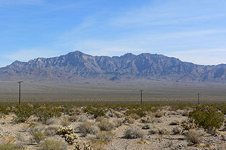
The Virgin Mountains are a mountain range of the northeastern Mojave Desert, located in Clark County, southeastern Nevada and Mohave County, northwestern Arizona.

<span class="mw-page-title-main">Providence Mountains</span> Peaks in Mojave Desert, California

The Providence Mountains are found in the eastern Mojave Desert of San Bernardino County, California, U.S. The range reaches an elevation of 7,162 feet (2,183 m) at Edgar Peak and is home to the Mitchell Caverns Natural Preserve in the Providence Mountains State Recreation Area, and the Mojave National Preserve.

<span class="mw-page-title-main">Sacramento Mountains (California)</span>

The Sacramento Mountains are a mountain range in the Eastern Mojave Desert and within Mojave Trails National Monument, in San Bernardino County, California.

<span class="mw-page-title-main">Cerbat Mountains</span> Landform in Mohave County, Arizona

The Cerbat Mountains is a mountain range in Mohave County in northwest Arizona immediately north of Kingman. The Cerbat Mountains and the White Hills (Arizona) adjacent north, are the dividing ranges between the Detrital Valley west, and the Hualapai Valley east.

The Piper Mountain Wilderness is a federally designated wilderness area located in the White Mountains 20 miles (32 km) northeast of Big Pine, California in Inyo County, California.

<span class="mw-page-title-main">Deserts of California</span> Region of California

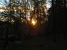
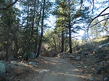
The deserts of California are the distinct deserts that each have unique ecosystems and habitats. The deserts are home to a sociocultural and historical "Old West" collection of legends, districts, and communities, and they also form a popular tourism region of dramatic natural features and recreational development.

<span class="mw-page-title-main">Mohave Mountains</span> Landform in Mohave County, Arizona

The Mohave Mountains are a small 18-mi (29 km) long mountain range of northwest Arizona. The range is a northwest trending range in southwest Mohave County that parallels a southeast-flowing stretch of the Colorado River, the Arizona-California border. The range also forms the southwest border of a flatland region to its east and north, namely, Dutch Flat which lies east, at the south end of Sacramento Valley. Lake Havasu City, AZ on the Colorado, lays opposite the southwest flank of the range, where the London Bridge was reconstructed at Lake Havasu.

The Rawhide Mountains are a mountain range of western Arizona, in the southwest of Mohave County. It is part of a block of mountain ranges on the north of an insular region called the Maria fold and thrust belt, containing mountain ranges, valleys, and plains. The Rawhide Mountains border the much smaller Artillery Mountains southeast, bordering on Alamo Lake State Park and the south-flowing Big Sandy River.

Dutch Flat of Arizona is a valley south of the Sacramento Valley and Interstate 40 in southern Mohave County.

<span class="mw-page-title-main">Great Basin montane forests</span> Temperate coniferous forests ecoregion of the United States

The Great Basin montane forests is an ecoregion of the Temperate coniferous forests biome, as designated by the World Wildlife Fund (WWF).

The Date Creek Mountains are a short, arid range in southwest Yavapai County, Arizona. Congress is on its southeast foothills, and Wickenburg lies 15 mi (24 km) southeast.

The Aquarius Mountains are a 45-mi (72 km) long mountain range in southeast Mohave County, Arizona. The range lies in the northwest of the Arizona transition zone, and at the southwest of the Coconino Plateau, a subsection of the Colorado Plateau.

The Peacock Mountains are a small, 26 mi (42 km) long mountain range in northwest Arizona, US. The range is a narrow sub-range, and an extension north, at the northeast of the Hualapai Mountains massif, which lies to the southwest. The range is defined by the Hualapai Valley to the northwest, and north and south-flowing washes on its east border, associated with faults and cliffs; the Cottonwood Cliffs are due east, and are connected to the Aquarius Cliffs southward at the west perimeter of the Aquarius Mountains; the cliffs are a result of the Aquarius Fault, which is an extension southward from the Grand Wash Cliffs and Grand Wash Fault which crosses the Colorado River at Lake Mead, and the west perimeter of the Grand Canyon/Colorado Plateau.

Hualapai Valley is a valley in Mohave County, Arizona.

<span class="mw-page-title-main">Antares, Arizona</span> Census-designated place in Arizona, United States

Antares is an unincorporated community and census designated place (CDP) in Mohave County, Arizona, United States. As of the 2020 census, it had a population of 132. It exists along part of historic U.S. Route 66.

References

  1. 1 2 "Mohave County Parks".
  2. 1 2 "Hualapai Indian Fact Sheet". Native Languages of the Americas website. 2020. Retrieved December 15, 2021.
  3. The Hualapai Tribe Website. Accessed 2011-07-25.
  4. Munro, P et al. A Mojave Dictionary Los Angeles: UCLA, 1992
  5. Schuch, Ursula (July 2015). "Arizona Climate Zones and their Application to Growing Plants" (PDF). The University of Arizona.
  6. "Hualapai Mountains". Peak Bagger. Retrieved December 15, 2021.
  7. n.d, Dean (April 19, 2005). "The Highest Point of Mohave". Summit Post. Retrieved December 15, 2021.
  8. "Dean Peak, Hualapai Mountains, Mohave County, Arizona". Mindat.org. Retrieved December 15, 2021.
  9. "Dean Mine (Atlantic Mine), Hualapai Spring, Maynard Mining District, Hualapai Mountains, Mohave County, Arizona". MINDAT. Retrieved December 15, 2021.
  10. "Wabayuma Peak Wilderness". Department of the Interior's Bureau of Land Management website. Retrieved December 15, 2021.
  11. McIntosh, Dennis. "Arizona Watershed Information". University of Arizona. Retrieved December 16, 2021.
  12. Anning, David W.; Flynn, Marilyn E.; Truini, Margot. "Hydrogeologic Investigation of the Detrital, Hualapai, and Sacramento Valleys of Northwestern Arizona: A Project of the Rural Watershed Initiative". United States Geological Survey website. Retrieved December 16, 2021.
  13. "Big Sandy River Near Wikieup, AZ". United States Geological Survey website. Retrieved December 16, 2021.
  14. "Yavapai County Native Naturalized Plants – Plant Communities". University of Arizona website. Retrieved December 16, 2021.
  15. "Death Valley – Frequently Asked Questions". U.S. Department of the Interior's National Park Service website. Retrieved December 16, 2021.
  16. "Pinyon-Juniper Woodlands Distribution". National Park Service website. February 3, 2015.
  17. Pesek, Margo Bartlett (August 8, 2010). "Hualapai Mountains provide recreation opportunities". Las Vegas Review-Journal. Retrieved September 1, 2016.
  18. "Wild Cow Springs Campground". Department of the Interior's Bureau of Land Management website. Retrieved December 16, 2021.