Mohave County, Arizona

Last updated

Mohave County
Kingman courthouse.jpg
Mohave County Courthouse in Kingman
Mohave County, Arizona seal.png
Map of Arizona highlighting Mohave County.svg
Location within the U.S. state of Arizona
Arizona in United States.svg
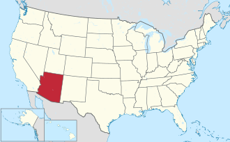
Arizona's location within the U.S.
Coordinates: 35°40′55″N113°51′47″W / 35.6819°N 113.8631°W / 35.6819; -113.8631
CountryFlag of the United States.svg United States
StateFlag of Arizona.svg  Arizona
FoundedNovember 9, 1864
Named for Fort Mohave
Seat Kingman
Largest city Lake Havasu City
Area
  Total13,461 sq mi (34,860 km2)
  Land13,311 sq mi (34,480 km2)
  Water150 sq mi (400 km2)  1.1%
Population
 (2020)
  Total213,267
  Estimate 
(2023)
223,682 Increase2.svg
  Density16/sq mi (6.1/km2)
Time zone UTC−7 (Mountain)
Congressional districts 2nd, 9th
Website www.mohave.gov

Mohave County is in the northwestern corner of the U.S. state of Arizona. As of the 2020 census, its population was 213,267. [1] The county seat is Kingman, [2] and the largest city is Lake Havasu City. It is the fifth largest county in the United States (by area).

Contents

Mohave County includes the Lake Havasu City–Kingman, Arizona Metropolitan Statistical Area, which is also included in the Las Vegas-Henderson, Nevada-Arizona Combined Statistical Area.

Mohave County contains parts of Grand Canyon National Park and Lake Mead National Recreation Area and all of the Grand Canyon–Parashant National Monument. The Kaibab, Fort Mojave and Hualapai Indian Reservations also lie within the county.

History

Mohave County was the one of four original Arizona Counties created by the 1st Arizona Territorial Legislature. The county territory was originally defined as being west of longitude 113° 20' and north of the Bill Williams River. [3] Pah-Ute County was created from it in 1865 and was merged back into Mohave County in 1871 when much of its territory was ceded to Nevada in 1866. The county's present boundaries were established in 1881. The county is also notable for being home to a large polygamous Fundamentalist Church of Jesus Christ of Latter-Day Saints sect located in Colorado City.

Mohave County has had five county seats: Mohave City (1864–1867), Hardyville (1867–1873), Cerbat (1873–1877), Mineral Park (1877–1887), and Kingman (1887–present). [4]

Geography

According to the United States Census Bureau, the county has a total area of 13,461 square miles (34,860 km2), of which 13,311 square miles (34,480 km2) is land and 150 square miles (390 km2) (1.1%) is water. [5] It is the second-largest county by area in Arizona and the fifth-largest in the contiguous United States.

The county consists of two sections divided by the Grand Canyon, with no direct land communication between them. The northern section, smaller and less populated, forms the western part of the Arizona Strip, bordering Utah and Nevada. The larger southern section borders Nevada and California across the Colorado River, which forms most of the county's western boundary. The southern section includes Kingman, the county seat, and other cities, as well as part of the Mojave Desert.

Adjacent counties

Mohave County and its adjacent counties form the largest such block of counties outside of Alaska. Their combined land area is 89,567.34 square miles (231,978.3 km2), or larger than that of the state of Idaho. They include the #1 (San Bernardino), #2 (Coconino), #5 (Mohave), and #7 (Lincoln) largest counties outside of Alaska. If Nye County, Nevada- which is #3 for total county area that does not border Mohave but borders neighboring Lincoln and Clark counties is included, then the combined land area would be 107,726.34 squard miles or larger than the state of Colorado.

National protected areas

There are 18 official wilderness areas in Mohave County that are part of the National Wilderness Preservation System. Most of these are managed by the Bureau of Land Management, but some are integral parts of the preceding protected areas, or have shared jurisdiction with the BLM. Some extend into neighboring counties (as indicated below) All wilderness areas within Grand Canyon–Parashant National Monument are managed by BLM, although the National Monument shares management with the National Park Service:

Demographics

Historical population
CensusPop.Note
1870 179
1880 1,190564.8%
1890 1,44421.3%
1900 3,426137.3%
1910 3,77310.1%
1920 5,25939.4%
1930 5,5726.0%
1940 8,59154.2%
1950 8,510−0.9%
1960 7,736−9.1%
1970 25,857234.2%
1980 55,865116.1%
1990 93,49767.4%
2000 155,03265.8%
2010 200,18629.1%
2020 213,2676.5%
2023 (est.)223,682 [6] 4.9%
U.S. Decennial Census [7]
1790–1960 [8] 1900–1990 [9]
1990–2000 [10] 2010–2020 [1]

2000 census

As of the census of 2000, there were 155,032 people, 62,809 households, and 43,401 families living in the county. The population density was 12 people per square mile (4.6 people/km2). There were 80,062 housing units at an average density of 6 units per square mile (2.3 units/km2). The racial makeup of the county was 90.1% White, 0.5% Black or African American, 2.4% Native American, 0.8% Asian, 0.1% Pacific Islander, 4.0% from other races, and 2.1% from two or more races. 11.1% of the population were Hispanic or Latino of any race.

There were 62,809 households, out of which 25.1% had children under the age of 18 living with them, 55.1% were married couples living together, 9.3% had a female householder with no husband present, and 30.9% were non-families. 24.1% of all households were made up of individuals, and 11.3% had someone living alone who was 65 years of age or older. The average household size was 2.45 and the average family size was 2.87.

In the county, the population was spread out, with 23.1% under the age of 18, 6.5% from 18 to 24, 23.2% from 25 to 44, 26.7% from 45 to 64, and 20.5% who were 65 years of age or older. The median age was 43 years. For every 100 females there were 98.90 males. For every 100 females age 18 and over, there were 96.80 males.

The median income for a household in the county was $31,521, and the median income for a family was $36,311. Males had a median income of $28,505 versus $20,632 for females. The per capita income for the county was $16,788. About 9.8% of families and 13.9% of the population were below the poverty line, including 20.4% of those under age 18 and 7.7% of those age 65 or over.

2010 census

As of the census of 2010, there were 200,186 people, 82,539 households, and 54,036 families living in the county. [11] The population density was 15.0 inhabitants per square mile (5.8/km2). There were 110,911 housing units at an average density of 8.3 units per square mile (3.2 units/km2). [12] The racial makeup of the county was 86.9% white, 2.2% American Indian, 1.1% Asian, 0.9% black or African American, 0.2% Pacific islander, 6.0% from other races, and 2.7% from two or more races. Those of Hispanic or Latino origin made up 14.8% of the population. [11] In terms of ancestry, 23.1% were German, 16.2% were Irish, 15.6% were English, 5.7% were Italian, and 4.5% were American. [13]

Of the 82,539 households, 24.5% had children under the age of 18 living with them, 49.5% were married couples living together, 10.4% had a female householder with no husband present, 34.5% were non-families, and 26.7% of all households were made up of individuals. The average household size was 2.39 and the average family size was 2.86. The median age was 47.6 years. [11]

The median income for a household in the county was $39,785 and the median income for a family was $47,530. Males had a median income of $36,222 versus $28,060 for females. The per capita income for the county was $21,523. About 11.6% of families and 16.1% of the population were below the poverty line, including 24.7% of those under age 18 and 7.0% of those age 65 or over. [14]

Politics, government, and infrastructure

Since 2008, Mohave has taken over from Graham and Yavapai as the “reddest” county in the state, and in 2016 it stood as such by twenty percentage points. No Democratic presidential nominee has carried Mohave County since Lyndon Johnson, who, despite the home state advantage of Arizona native Barry Goldwater, did so in 1964, by a margin of only 152 votes. (In the 1990s, Bill Clinton came very close to winning this county, if not because of a combination of significant nationwide rural appeal and third-party candidate Ross Perot's Western appeal himself.)

In recent elections it has become common for Democratic nominees to receive less than thirty percent of the county's vote, and Hillary Clinton in 2016 received less than 22 percent. In 2020 Donald Trump received nearly 75% of the vote in Mohave County.

United States presidential election results for Mohave County, Arizona [15] [16]
Year Republican Democratic Third party
No.%No.%No.%
2020 78,53574.88%24,83123.67%1,5171.45%
2016 58,28272.90%17,45521.83%4,2065.26%
2012 49,16869.91%19,53327.77%1,6272.31%
2008 44,33365.20%22,09232.49%1,5702.31%
2004 36,79463.53%20,50335.40%6181.07%
2000 24,38655.25%17,47039.58%2,2855.18%
1996 17,99743.33%16,62940.04%6,90716.63%
1992 13,68433.69%13,25532.63%13,67733.67%
1988 17,65162.40%10,19736.05%4381.55%
1984 17,36469.26%7,43629.66%2721.08%
1980 13,80968.86%4,90024.43%1,3456.71%
1976 7,60151.92%6,50444.43%5353.65%
1972 6,75568.92%2,58826.41%4584.67%
1968 3,20851.64%2,10933.95%89514.41%
1964 2,09148.19%2,24351.69%50.12%
1960 1,64155.59%1,30344.14%80.27%
1956 1,52360.99%96838.77%60.24%
1952 1,74662.09%1,06637.91%00.00%
1948 1,16743.03%1,49955.27%461.70%
1944 97442.64%1,30357.05%70.31%
1940 1,19837.16%2,02462.78%20.06%
1936 60924.08%1,81471.73%1064.19%
1932 53723.52%1,66072.71%863.77%
1928 1,12760.33%72838.97%130.70%
1924 73838.00%47524.46%72937.54%
1920 99657.97%72242.03%00.00%
1916 64328.89%1,33559.97%24811.14%
1912 698.56%32039.70%41751.74%

The Mohave County Administration Building is located in downtown Kingman at 700 West Beale Street. The old County Complex, which the Administration Building replaced, was located adjacent to the courthouse on Spring Street and 4th Street. The Mohave County Superior Courthouse, built in 1915, is an Art Deco/Streamline Moderne building on the National Register of Historic Places. The county jail is adjacent to the County Administration Building at 501 S. Highway 66.

Arizona State Prison – Kingman, a privately run prison of the Arizona Department of Corrections, is located in unincorporated Mohave County near Golden Valley and Kingman. [17] [18]

Education

K-12 school districts

The following school districts serve Mohave County: [19]

Unified school districts
High school districts
Elementary school districts

Additionally there is a charter school:

Colleges

Public libraries

The Mohave County Library has ten branches. The branches in Bullhead City, Kingman and Lake Havasu City are open 56 hours a week. The branch in Mohave Valley is open 40 hours a week. Branches in Chloride, Dolan Springs, Golden Shores, Golden Valley, Meadview and Valle Vista are open 15 hours a week.

Transportation

Major highways

Airports

The following public use airports are located in Mohave County:

Communities

Cities

Town

Census-designated places

Ghost towns

Indian communities

County population ranking

The population ranking of the following table is based on the 2010 census of Mohave County. [22] [23]

county seat

RankCity/Town/etc.Population (2010 Census)Municipal typeIncorporated
1 Lake Havasu City 52,527City1978
2 Bullhead City 39,540City1984
3Kingman 28,068City1952
4 Fort Mohave 14,364 CDP
5 New Kingman-Butler 12,134CDP
6 Golden Valley 8,370CDP
7 Colorado City 4,821City1913 (founded)
8 Mohave Valley 2,616CDP
9 Desert Hills 2,245CDP
10Golden Shores2,047CDP
11 Dolan Springs 2,033CDP
12 Beaver Dam 1,962CDP
13Valle Vista1,659CDP
14 Scenic 1,643CDP
15Centennial Park1,264CDP
16 Meadview 1,224CDP
17 Peach Springs 1,090CDP
18 Willow Valley 1,062CDP
19 Arizona Village 946CDP
20Walnut Creek562CDP
21So-Hi477CDP
22Cane Beds448CDP
23Lazy Y U428CDP
24 Mesquite Creek 416CDP
25 White Hills 323CDP
26 Littlefield 308CDP
27Crystal Beach279CDP
28 Chloride 271CDP
29Pinion Pines186CDP
30Clacks Canyon173CDP
31Pine Lake138CDP
32 Oatman 135CDP
33Truxton134CDP
34 Wikieup 133CDP
t-35Antares126CDP
t-35 Yucca 126CDP
36 Kaibab (partially in Coconino County )124CDP
37Katherine103CDP
38 Moccasin 89CDP
39McConnico70CDP
40 Hackberry 68CDP
41 Mojave Ranch Estates 52CDP
42 Valentine 38CDP
43Crozier14CDP
44 Topock 10CDP
45Grand Canyon West2CDP

Economy

Mining

See also

Related Research Articles

<span class="mw-page-title-main">Clark County, Nevada</span> County in Nevada, United States

Clark County is a county located in the U.S. state of Nevada. As of the 2020 census, the population was 2,265,461. Most of the county population resides in the Las Vegas Census County Divisions, which has 2,196,623 people as of the 2020 Census, across 435 square miles (1,130 km2). It is by far the most populous county in Nevada, and the 11th-most populous county in the United States. It covers 7% of the state's land area but holds 73% of the state's population, making Nevada the most centralized state in the United States.

<span class="mw-page-title-main">San Bernardino County, California</span> County in southern California, United States

San Bernardino County, officially the County of San Bernardino, is a county located in the southern portion of the U.S. state of California, and is located within the Inland Empire area. As of the 2020 U.S. Census, the population was 2,181,654, making it the fifth-most populous county in California and the 14th-most populous in the United States. The county seat is San Bernardino.

<span class="mw-page-title-main">Coconino County, Arizona</span> County in Arizona, United States

Coconino County is a county in the north-central part of the U.S. state of Arizona. Its population was 145,101 at the 2020 census. The county seat is Flagstaff. The county takes its name from Cohonino, a name applied to the Havasupai people. It is the second-largest county by area in the contiguous United States, behind San Bernardino County, California. It has 18,661 sq mi (48,300 km2), or 16.4% of Arizona's total area, and is larger than the nine smallest states in the U.S.

<span class="mw-page-title-main">Yavapai County, Arizona</span> County in Arizona, United States

Yavapai County is near the center of the U.S. state of Arizona. As of the 2020 census, its population was 236,209, making it the fourth-most populous county in Arizona. The county seat is Prescott.

<span class="mw-page-title-main">Bullhead City, Arizona</span> City in Mohave County, Arizona

Bullhead City is a city located on the Colorado River in Mohave County, Arizona, United States, 97 miles (156 km) south of Las Vegas, Nevada, and directly across the Colorado River from Laughlin, Nevada, whose casinos and ancillary services supply much of the employment for Bullhead City. Bullhead City is located at the southern end of Lake Mohave.

<span class="mw-page-title-main">Desert Hills, Arizona</span> CDP in Mohave County, Arizona

Desert Hills is an unincorporated community and census-designated place (CDP) in Mohave County, Arizona, United States. The population was 2,764 at the 2020 census, up from 2,245 at the 2010 census.

<span class="mw-page-title-main">Dolan Springs, Arizona</span> CDP in Mohave County, Arizona

Dolan Springs is an unincorporated community and census-designated place (CDP) in Mohave County, Arizona, United States. The population was 1,989 at the 2020 census, down from 2,033 at the 2010 census.

<span class="mw-page-title-main">Golden Valley, Arizona</span> CDP in Mohave County, Arizona

Golden Valley is an unincorporated area and census-designated place (CDP) in Mohave County, Arizona, United States. The population was 8,801 at the 2020 census.

<span class="mw-page-title-main">Kingman, Arizona</span> City in Arizona, United States

Kingman is a city in, and the county seat of, Mohave County, Arizona, United States. It is named after Lewis Kingman, an engineer for the Atlantic and Pacific Railroad. It is located 105 miles (169 km) southeast of Las Vegas, Nevada, and 180 miles (290 km) northwest of Arizona's state capital, Phoenix. The population was 32,689 at the 2020 census.

<span class="mw-page-title-main">Lake Havasu City, Arizona</span> City in Mohave County, Arizona

Lake Havasu City is a city in Mohave County, Arizona, United States. As of the 2020 census, the population of the city was 57,144, up from 52,527 in 2010. It is served by Lake Havasu City Airport.

<span class="mw-page-title-main">Mohave Valley, Arizona</span> CDP in Mohave County, Arizona

Mohave Valley is an unincorporated community and census-designated place (CDP) in Mohave County, Arizona, United States. The population was 2,693 at the 2020 census. It is geographically connected to Needles, California, Fort Mohave and Bullhead City.

<span class="mw-page-title-main">Laughlin, Nevada</span> Unincorporated community in the state of Nevada, United States

Laughlin is an unincorporated community in Clark County, Nevada, United States. Laughlin lies 90 miles (140 km) south of Las Vegas, in the far southern tip of Nevada. As a resort town, it is known for its gaming and water recreation. As of the 2020 census, the population was 8,658. For statistical purposes, the United States Census Bureau has defined Laughlin as a census-designated place (CDP). It is located on the Colorado River, downstream from the Davis Dam and Lake Mohave, and directly across from the much larger Bullhead City, Arizona. The nearby communities of Bullhead City, Arizona; Needles, California; Fort Mohave, Arizona; and Mohave Valley, Arizona, bring the area's total population to about 100,000. Laughlin is also 286 miles (460 km) northeast of Los Angeles.

<span class="mw-page-title-main">Lake Mead National Recreation Area</span> U.S. protected area in Nevada and Arizona

Lake Mead National Recreation Area is a U.S. national recreation area in southeastern Nevada and northwestern Arizona. Operated by the National Park Service, Lake Mead NRA follows the Colorado River corridor from the westernmost boundary of Grand Canyon National Park to just north of the cities of Laughlin, Nevada and Bullhead City, Arizona. It includes all of the eponymous Lake Mead as well as the smaller Lake Mohave – reservoirs on the river created by Hoover Dam and Davis Dam, respectively – and the surrounding desert terrain and wilderness.

<span class="mw-page-title-main">Mohave Valley</span> Landform along the Colorado River in Arizona

The Mohave Valley is a valley located mostly on the east shore of the south-flowing Colorado River in northwest Arizona. The valley extends into California's San Bernardino County; the northern side of the valley extends into extreme southeast Clark County, Nevada. The main part of the valley lies in southwest Mohave County, Arizona and is at the intersection of the southeast Mojave and northwest Sonoran deserts.

<span class="mw-page-title-main">Arizona Strip</span> Part of Arizona north of the Colorado River

The Arizona Strip is the part of Arizona lying north of the Colorado River. Despite being larger in area than several U.S. states, the entire region has a population of fewer than 10,000 people. Consisting of northeastern Mohave County and northwestern Coconino County, the largest settlements in the Strip are Colorado City, Fredonia, and Beaver Dam, with smaller communities of Scenic, Littlefield and Desert Springs. The Kaibab Indian Reservation lies within the region. Lying along the North Rim of the Grand Canyon creates physical barriers to the rest of Arizona. Only three major roads traverse the region, I-15 crosses the northwestern corner while Arizona State Route 389 and U.S. Route 89A crosses the northeastern part of the strip, US 89A crosses the Colorado River via the Navajo Bridge, providing the only direct road connection between the strip and the rest of the state. The nearest metropolitan area is the St. George, Utah metro area, to which the region is more connected than to the rest of Arizona.

<span class="mw-page-title-main">Mount Trumbull Wilderness</span> Protected area in Mohave County, Arizona

The Mount Trumbull Wilderness is a 7,880 acre (31 km2) wilderness area located on the Uinkaret Plateau in the Arizona Strip. It is managed by the Bureau of Land Management.

<span class="mw-page-title-main">Grand Canyon West, Arizona</span> Census-designated place in Arizona, United States

Grand Canyon West is a census-designated place (CDP) in Mohave County, Arizona, United States, located on the Hualapai Reservation. The population was reported as 0 at the 2020 census. Grand Canyon West is home to the tribe's Grand Canyon business operations, including the Grand Canyon West Airport and the Grand Canyon Skywalk. Typically, they are open from 8:00 a.m. – 6:00 p.m., including all holidays.

<span class="mw-page-title-main">Fort Mohave, Arizona</span> Census-designated place in Arizona, United States

Fort Mohave is an unincorporated community and census-designated place in Mohave County, Arizona, United States. It is named for a nearby fort that was used during the Mohave War. As of the 2020 census, the population of Fort Mohave was 16,190, up from 14,364 in 2010 and 8,919 in 2000. It is a suburb of Bullhead City. Its recent growth has made it the most populous unincorporated community in Mohave County.

<span class="mw-page-title-main">Scenic, Arizona</span> CDP in Mohave County, Arizona

Scenic is an unincorporated community and census-designated place (CDP) in Mohave County in extreme northwestern Arizona, United States. As of the 2020 census, its population was 1,321, down from 1,643 in 2010.

<span class="mw-page-title-main">Cane Beds, Arizona</span> Census-designated place in Arizona, United States

Cane Beds is an unincorporated community and census-designated place (CDP) in Mohave County, Arizona, United States. It lies 4 miles (6 km) south of the border with Utah in the Arizona Strip, and is supported by services in Utah as well as some in Nevada.

References

  1. 1 2 "State & County QuickFacts". United States Census Bureau. Retrieved September 27, 2022.
  2. "Find a County". National Association of Counties. Retrieved June 7, 2011.
  3. Wagoner, Jay J. (1970). Arizona Territory 1863–1912: A Political history . Tucson: University of Arizona Press. p.  58. ISBN   0816501769.
  4. Walker, Henry (1986). "Historical Atlas of Arizona", p. 32. University of Oklahoma Press, Norman. ISBN   978-0806120249
  5. "2010 Census Gazetteer Files". United States Census Bureau. August 23, 2012. Retrieved August 23, 2015.
  6. "Annual Estimates of the Resident Population for Counties: April 1, 2020 to July 1, 2023". United States Census Bureau. Retrieved March 28, 2024.
  7. "U.S. Decennial Census". United States Census Bureau. Retrieved May 18, 2014.
  8. "Historical Census Browser". University of Virginia Library. Retrieved May 18, 2014.
  9. "Population of Counties by Decennial Census: 1900 to 1990". United States Census Bureau. Retrieved May 18, 2014.
  10. "Census 2000 PHC-T-4. Ranking Tables for Counties: 1990 and 2000" (PDF). United States Census Bureau. Archived (PDF) from the original on October 9, 2022. Retrieved May 18, 2014.
  11. 1 2 3 "DP-1 Profile of General Population and Housing Characteristics: 2010 Demographic Profile Data". United States Census Bureau. Archived from the original on February 13, 2020. Retrieved January 20, 2016.
  12. "Population, Housing Units, Area, and Density: 2010 – County". United States Census Bureau. Archived from the original on February 13, 2020. Retrieved January 20, 2016.
  13. "DP02 Selected Social Characteristics in the United States – 2006–2010 American Community Survey 5-Year Estimates". United States Census Bureau. Archived from the original on February 13, 2020. Retrieved January 20, 2016.
  14. "DP03 Selected Economic Characteristics – 2006–2010 American Community Survey 5-Year Estimates". United States Census Bureau. Archived from the original on February 13, 2020. Retrieved January 20, 2016.
  15. Leip, David. "Dave Leip's Atlas of U.S. Presidential Elections". uselectionatlas.org. Retrieved May 9, 2018.
  16. Scammon, Richard M. (compiler); America at the Polls: A Handbook of Presidential Election Statistics 1920–1964; pp. 42–44 ISBN   0405077114
  17. "Arizona State Prison – Kingman (MTC)". March 31, 2014.
  18. "Golden Valley CDP, Arizona Archived June 8, 2011, at the Wayback Machine ." U.S. Census Bureau. Retrieved on August 13, 2010.
  19. "2020 Census – School District Reference Map: Mohave County, AZ" (PDF). U.S. Census Bureau. Archived (PDF) from the original on October 9, 2022. Retrieved July 28, 2022.Text list
  20. "HB2515 – 491R – House Bill Summary" . Retrieved November 10, 2021.
  21. 1 2 3 4 5 6 7 Varney, Philip (1980). "Mohave Ghosts". Arizona's Best Ghost Towns. Flagstaff: Northland Press. pp. 46–55. ISBN   0873582179. LCCN   79-91724.
  22. CNMP, US Census Bureau. "This site has been redesigned and relocated. – U.S. Census Bureau". www.census.gov. Retrieved May 9, 2018.
  23. Geography, US Census Bureau. "2010 Census Block Maps". www.census.gov. Retrieved May 9, 2018.

35°40′55″N113°51′47″W / 35.68194°N 113.86306°W / 35.68194; -113.86306