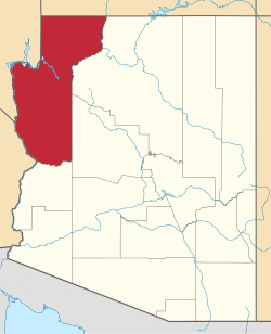
New Kingman-Butler, Arizona | |
---|---|
Coordinates: 35°15′18″N114°1′14″W / 35.25500°N 114.02056°W | |
Country | United States |
State | Arizona |
County | Mohave |
Area | |
• Total | 4.97 sq mi (12.87 km2) |
• Land | 4.97 sq mi (12.87 km2) |
• Water | 0.00 sq mi (0.00 km2) |
Elevation | 3,341 ft (1,018 m) |
Population | |
• Total | 12,907 |
• Density | 2,596.46/sq mi (1,002.60/km2) |
Time zone | UTC-7 (MST) |
ZIP Code | 86409 (Kingman) |
FIPS code | 04-49270 |
New Kingman-Butler is an unincorporated community and census-designated place (CDP) in Mohave County, Arizona, United States, directly north of and bordering the city of Kingman. The population was 12,907 as of the 2020 census. [2]
New Kingman-Butler was named for Leroy Butler, who was the original land developer of the unincorporated community. "New Kingman" was the name of the original real estate development, but it is seldom used by residents except in a historical sense. The area commonly is referred to simply as "Butler". Butler is a distinct locale among the neighborhoods of Kingman.
Butler makes up a substantial amount of the land area of the Kingman area as a whole, but is unincorporated, and is governed directly by Mohave County. There have been numerous plans and attempts to annex all or parts of Butler into the city of Kingman over the years, since it is an integral part of the Kingman community, but each has failed. One major problem with annexation into Kingman is the fact that Butler does not have a developed sanitary sewer system; all residences and buildings in Butler have individual septic tanks. The costs of developing and connecting a sewer system to all customers in Butler, if annexed into Kingman, is considerable. The fiscal assets required for such an investment by the City of Kingman likely could not be raised without assessment of a primary property tax on all landowners in the city; however, no such primary parcel tax has been approved by voters.
New Kingman-Butler is located in central Mohave County at 35°15′18″N114°1′14″W / 35.25500°N 114.02056°W (35.255054, -114.020470). [3] It is bordered to the west by an extension of the city limits of Kingman, the county seat. Downtown Kingman is 7 miles (11 km) to the south.
According to the United States Census Bureau, the CDP has a total area of 5.0 square miles (13 km2), all land. [1]
Census | Pop. | Note | %± |
---|---|---|---|
1990 | 11,627 | — | |
2000 | 14,812 | 27.4% | |
2010 | 12,134 | −18.1% | |
2020 | 12,907 | 6.4% | |
source: [4] |
As of the census [5] of 2000, there were 14,812 people, 5,895 households, and 3,979 families residing in the CDP. The population density was 1,011.6 inhabitants per square mile (390.6/km2). There were 6,630 housing units at an average density of 452.9 per square mile (174.9/km2). The racial makeup of the CDP was 91.3% White, 0.4% Black or African American, 1.7% Native American, 0.4% Asian, 0.1% Pacific Islander, 3.0% from other races, and 3.1% from two or more races. 9.3% of the population were Hispanic or Latino of any race.
There were 5,895 households, out of which 27.9% had children under the age of 18 living with them, 49.9% were married couples living together, 12.1% had a female householder with no husband present, and 32.5% were non-families. 25.2% of all households were made up of individuals, and 12.6% had someone living alone who was 65 years of age or older. The average household size was 2.51 and the average family size was 2.96.
In the CDP, the population was spread out, with 25.7% under the age of 18, 7.7% from 18 to 24, 24.2% from 25 to 44, 23.2% from 45 to 64, and 19.2% who were 65 years of age or older. The median age was 40 years. For every 100 females, there were 95.4 males. For every 100 females age 18 and over, there were 94.0 males.
The median income for a household in the CDP was $25,917, and the median income for a family was $31,173. Males had a median income of $26,891 versus $20,194 for females. The per capita income for the CDP was $13,994. About 13.3% of families and 18.2% of the population were below the poverty line, including 23.4% of those under age 18 and 10.0% of those age 65 or over.
The CDP is in the Kingman Unified School District. [6]
Mohave County is a county in the northwestern corner of the U.S. state of Arizona. As of the 2020 census, its population was 213,267. The county seat is Kingman, and the largest city is Lake Havasu City. It is the fifth largest county in the United States.
Kaibab is an unincorporated community and census-designated place (CDP) in Mohave County, Arizona, United States. It is within the Kaibab Indian Reservation. The population of the CDP was 140 at the 2020 census.
Arizona Village is a census-designated place (CDP) on the Fort Mojave Indian Reservation in Mohave County, Arizona, United States. The population was 1,057 at the 2020 census, up from 946 in 2010 and 351 in 2000.
Desert Hills is an unincorporated community and census-designated place (CDP) in Mohave County, Arizona, United States. The population was 2,764 at the 2020 census, up from 2,245 at the 2010 census.
Dolan Springs is an unincorporated community and census-designated place (CDP) in Mohave County, Arizona, United States. The population was 1,989 at the 2020 census, down from 2,033 at the 2010 census.
Golden Valley is an unincorporated area and census-designated place (CDP) in Mohave County, Arizona, United States, located halfway between Kingman and Bullhead City. The population was 8,801 at the 2020 census.
Mesquite Creek is an unincorporated community and census-designated place (CDP) in Mohave County, Arizona, United States. The population was 403 at the 2020 census.
Mohave Valley is an unincorporated community and census-designated place (CDP) in Mohave County, Arizona, United States. The population was 2,693 at the 2020 census. It is geographically connected to Needles, California, Fort Mohave and Bullhead City.
Mojave Ranch Estates is an unincorporated community and census-designated place (CDP) in Mohave County, Arizona, United States. The population was 53 as of the 2020 census.
Peach Springs is a census-designated place (CDP) in Mohave County, Arizona, United States. The population was 1,098 at the 2020 census. Peach Springs serves as the administrative headquarters of the Hualapai people and is located on the Hualapai Reservation.
Willow Valley is an unincorporated community and census-designated place (CDP) in Mohave County, Arizona, United States. The population was 1,059 as of the 2020 census.
Grand Canyon West is a census-designated place (CDP) in Mohave County, Arizona, United States, located on the Hualapai Reservation. The population was reported as 0 at the 2020 census. Grand Canyon West is home to the tribe's Grand Canyon business operations, including the Grand Canyon West Airport and the Grand Canyon Skywalk. Typically, they are open from 8:00 a.m. – 6:00 p.m., including all holidays.
Crozier is an unincorporated community and census-designated place (CDP) in Mohave County, Arizona, United States. The population was 21 at the 2020 census.
Clacks Canyon is a census-designated place (CDP) in Mohave County, Arizona, United States. The population was 167 at the 2020 census.
Crystal Beach is an unincorporated community in Mohave County, Arizona, United States. The population was 250 at the 2020 census. For statistical purposes, the United States Census Bureau has defined Crystal Beach as a census-designated place (CDP).
Katherine is an unincorporated community and census-designated place (CDP) in Mohave County, Arizona, United States. The population was 76 at the 2020 census, down from 103 at the 2010 census.
Lazy Y U is an unincorporated community and census-designated place (CDP) in Mohave County, Arizona, United States. The population was 474 at the 2020 census, up from 428 at the 2010 census.
McConnico is an unincorporated community and census-designated place (CDP) in Mohave County, Arizona, United States. The population was 63 at the 2020 census.
Pine Lake is an unincorporated community and census-designated place (CDP) in Mohave County, Arizona, United States. The population was 142 at the 2020 census.
Pinion Pines is an unincorporated community and census-designated place (CDP) in Mohave County, Arizona, United States. The population was 158 at the 2020 census.