Kaibab Indian Reservation

Last updated
Kaibab Indian Reservation
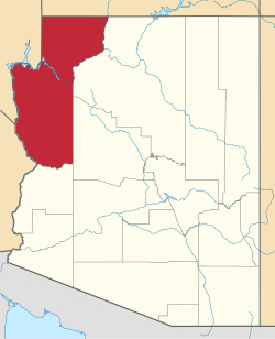
Mohave County Incorporated and Unincorporated areas Kaibab highlighted.svg
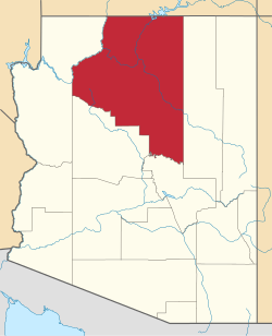
The reservation in Mohave County, with its southeastern corner shown extending into adjacent Coconino County
1720R Kaibab Indian Reservation Locator Map.svg
Coordinates: 36°54′46″N112°40′46″W / 36.91278°N 112.67944°W / 36.91278; -112.67944
Angie Bulletts (Kaibab Paiute) weaves a Paiute cradleboard, Arizona, 2011 Angie Bulletts Paiute.jpg
Angie Bulletts (Kaibab Paiute) weaves a Paiute cradleboard, Arizona, 2011

The Kaibab Indian Reservation is the home of the Kaibab Band of Paiute Indians (Southern Paiute Language: Kai'vi'vits), a federally recognized tribe of Southern Paiutes. The Indian reservation is located in northern part of the U.S. state of Arizona. It covers a land area of 188.75 square miles (488.9 km2) in northeastern Mohave County and northwestern Coconino County adjacent to the southern Utah border. The Pipe Spring National Monument lies in the southwestern section of the reservation. The Thunder Mountain Pootseev Dark-sky preserve is colocated with the reservation.

Contents

As of the 2000 census, its population was 196.

History

Geography

According to the U.S. Census Bureau, the reservation has a total area of 188.75 square miles (488.9 km2), almost all land.

Demographics

As of the census [1] of 2000, there were 196 people, 65 households, and 49 families residing on the reservation. The population density was 1 inhabitant per square mile (0.39/km2). There were 88 housing units at an average density of 0.5/sq mi (0.19/km2). The racial makeup of the reservation was 23.5% White, 66.8% Native American, 4.6% from other races, and 5.1% from two or more races, with no persons identifying as Black or African American, Asian, or Pacific Islander. 10.2% of the population were Hispanic or Latino of any race.

There were 65 households, out of which 61.5% had children under the age of 18 living with them, 36.9% were married couples living together, 32.3% had a female householder with no husband present, and 24.6% were non-families. 23.1% of all households were made up of individuals, and 1.5% had someone living alone who was 65 years of age or older. The average household size was 3.02 and the average family size was 3.49.

On the reservation the population was spread out, with 44.4% under the age of 18, 9.7% from 18 to 24, 24.5% from 25 to 44, 19.9% from 45 to 64, and 1.5% who were 65 years of age or older. The median age was 22 years. For every 100 females there were 73.45 males. For every 100 females age 18 and over, there were 75.81 males.

The median income for a household on the reservation was $20,000, and the median income for a family was $21,250. Males had a median income of $22,000 versus $16,607 for females. The per capita income for the reservation was $7,951. About 29.69% of families and 31.65% of the population were below the poverty line.

Education

The reservation is served by the Fredonia-Moccasin Unified School District.

Related Research Articles

Coconino County, Arizona County in Arizona, United States

Coconino County is a county in the north-central part of the U.S. state of Arizona. Its population was 145,101 at the 2020 census. The county seat is Flagstaff. The county takes its name from Cohonino, a name applied to the Havasupai people. It is the second-largest county by area in the contiguous United States, behind San Bernardino County, California. It has 18,661 sq mi (48,300 km2), or 16.4% of Arizona's total area, and is larger than each of the nine smallest states in the U.S.

Mohave County, Arizona County in Arizona, United States

Mohave County is in the northwestern corner of the U.S. state of Arizona. As of the 2020 census, its population was 213,267. The county seat is Kingman, and the largest city is Lake Havasu City. It is the fifth largest county in the United States.

Fredonia, Arizona Community in Coconino County, Arizona

Fredonia is a town in Coconino County, Arizona, United States. As of the 2010 census it had a population of 1,314. Fredonia is the gateway to the North Rim of the Grand Canyon.

Kaibab is an unincorporated community and census-designated place (CDP) in Mohave County, Arizona, United States. It is within the Kaibab Indian Reservation. The population of the CDP was 140 at the 2020 census.

San Carlos, Arizona CDP in Gila County, Arizona

San Carlos is a census-designated place (CDP) in Gila County, Arizona, United States. The population was 4,038 at the 2010 census, up from 3,716 in 2000.

Fort Hall, Idaho Census-designated place in Idaho, United States

Fort Hall is a census-designated place (CDP) in the southeastern part of the U.S. state of Idaho which is split between Bannock County in the south and Bingham County in the north. It is located on the Fort Hall Indian Reservation along the Snake River north of Pocatello and near the site of the original Fort Hall in the Oregon Country. The population was 3,201 at the 2010 census.

Arbon Valley, Idaho CDP in Idaho, United States

Arbon Valley is a census-designated place (CDP) in Power County, Idaho, in the United States. As of the 2010 census, the CDP population was 599. It lies within the Fort Hall Indian Reservation, just west of the city of Pocatello.

Paxton Township, Redwood County, Minnesota Township in Minnesota, United States

Paxton Township is one of the twenty-six townships of Redwood County, Minnesota, United States. The population was 577 at the 2000 census.

Orr, Minnesota City in Minnesota, United States

Orr is a city in Saint Louis County, Minnesota, United States. The population was 267 at the 2010 census.

Stoney Brook Township is a township in Saint Louis County, Minnesota, United States. The population was 332 at the 2010 census.

Owyhee, Nevada Census-designated place in Nevada, United States

Owyhee is a census-designated place (CDP) in Elko County, Nevada, United States, along the banks of the Owyhee River. The population was 953 at the 2010 census. It is part of the Elko Micropolitan Statistical Area. It is the primary town of the federally recognized Shoshone-Paiute tribe's Duck Valley Indian Reservation, which covers portions of northern Nevada and southern Idaho, and the majority of its population are Native American.

Schurz, Nevada CDP in Nevada, United States

Schurz is a census-designated place (CDP) in Mineral County, Nevada, United States. The population was 658 at the 2010 census. It is located on the Walker River Indian Reservation. It is the burial place of Wovoka, the Paiute messiah who originated the Ghost Dance movement.

Nixon, Nevada CDP in Nevada, United States

Nixon is a census-designated place (CDP) in Washoe County, Nevada, USA. The population was 374 at the 2010 census. It is part of the Reno–Sparks Metropolitan Statistical Area. It is the seat of tribal government of the Paiute Pyramid Lake Indian Reservation and home to the tribe's Museum and Visitor Center.

Wadsworth, Nevada CDP in Nevada, United States

Wadsworth is a census-designated place (CDP) in Washoe County, Nevada, United States. The population was 834 at the 2010 census. It is part of the Reno–Sparks Metropolitan Statistical Area and located entirely within the Pyramid Lake Indian Reservation. The town was named for General James S. Wadsworth, a Civil War general killed at the battle of the Wilderness in 1864. It was given this name by Leland Stanford of the Central Pacific Railroad as a favor to General Irvin McDowell, whom Wadsworth had served under during the Civil War.

Kathryn, North Dakota City in North Dakota, United States

Kathryn is a city in Barnes County, North Dakota, United States. The population was 52 at the 2010 census. Kathryn was founded in 1900. It was named after the daughter of a railroad man.

Panguitch, Utah City and county seat in Utah, United States

Panguitch is a city in and the county seat of Garfield County, Utah, United States. The population was 1,520 at the 2010 census, and was estimated in 2018 to be 1,691. The name Panguitch comes from a Southern Paiute word meaning “Big Fish,” likely named after the plentiful nearby lakes hosting rainbow trout year-round.

Nisqually Reservation CDP in Washington, United States

The Nisqually Reservation, also known as Nisqually Indian Reservation is a federally recognized Indian reservation in Thurston County, Washington, United States. The population was 668 at the 2020 census.

Passamaquoddy Indian Township Reservation Indian reservation in Maine, United States

Passamaquoddy Indian Township Reservation is one of two Indian reservations of the federally recognized Passamaquoddy tribe in Washington County, Maine, United States. The population was 760 at the 2020 census. Most of the 2,500 members of the tribe in the United States live in other parts of Maine. The reservation is located about 13 miles west-northwest of the city of Calais.

Cattaraugus Reservation is an Indian reservation located partly in Cattaraugus County, New York, United States. The population was 314 at the 2010 census. The majority of the residents are of the federally recognized Seneca Nation, one of the original Five Nations of the Iroquois Confederacy.

Brunswick (CDP), Maine Census-designated place in Maine, United States

Brunswick is a census-designated place (CDP) in the town of Brunswick in Cumberland County, Maine, United States. The population was 15,175 at the 2010 census. It is part of the Portland–South Portland–Biddeford, Maine Metropolitan Statistical Area.

References

  1. "U.S. Census website". United States Census Bureau . Retrieved 2008-01-31.

Coordinates: 36°54′46″N112°40′46″W / 36.91278°N 112.67944°W / 36.91278; -112.67944