Winslow West, Arizona

Last updated

Winslow West, Arizona
CDP
Navajo County Incorporated and Unincorporated areas Winslow West highlighted.svg
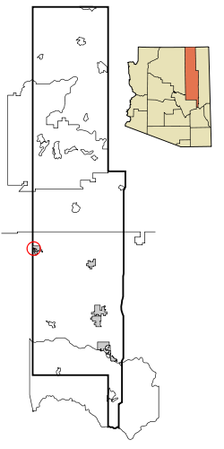
Location in Navajo County and the state of Arizona
Usa edcp location map.svg
Red pog.svg
Winslow West, Arizona
Location in the United States
Coordinates: 35°00′53″N110°42′49″W / 35.01472°N 110.71361°W / 35.01472; -110.71361
CountryUnited States
State Arizona
Counties Coconino, Navajo
Area
[1]
  Total17.20 sq mi (44.55 km2)
  Land17.20 sq mi (44.54 km2)
  Water0.00 sq mi (0.01 km2)
Elevation
[2]
4,967 ft (1,514 m)
Population
 (2020)
  Total457
  Density26.57/sq mi (10.26/km2)
Time zone UTC-7 (MST)
FIPS code 04-83960
GNIS feature ID2409612 [2]

Winslow West is a census-designated place (CDP) in Coconino and Navajo counties in Arizona, United States. The population was 438 at the 2010 census. [3] The entire community is off-reservation trust land belonging to the Hopi Tribe of Arizona. It lies just west of the city of Winslow, and is more than 50 km (31 mi) south of the main Hopi Reservation.

Contents

Geography

Winslow West is located at 35°2′15″N110°44′56″W / 35.03750°N 110.74889°W / 35.03750; -110.74889 (35.037411, -110.748884). [4]

According to the United States Census Bureau, the CDP has a total area of 17.9 square miles (46.3 km2), of which 0.004 square miles (0.01 km2), or 0.02%, is water. [5]

Demographics

Historical population
CensusPop.Note
2000 131
2010 438234.4%
2020 4574.3%
U.S. Decennial Census [6]

As of the census [7] of 2000, there were 131 people, 30 households, and 30 families living in the CDP. The population density was 418.8 inhabitants per square mile (161.7/km2). There were 32 housing units at an average density of 102.3 per square mile (39.5/km2). The racial makeup of the CDP was 98.5% Native American. 1.5% of the population were Hispanic or Latino of any race.

There were 30 households, out of which 86.7% had children under the age of 18 living with them, 26.7% were married couples living together, 63.3% had a female householder with no husband present, and 0.0% were non-families. No households were made up of individuals, and none had someone living alone who was 65 years of age or older. The average household size was 4.37 and the average family size was 3.93.

In the CDP, the age distribution of the population shows 56.5% under the age of 18, 6.9% from 18 to 24, 31.3% from 25 to 44, 4.6% from 45 to 64, and 0.8% who were 65 years of age or older. The median age was 16 years. For every 100 females, there were 95.5 males. For every 100 females age 18 and over, there were 78.1 males.

The median income for a household in the CDP was $8,250, and the median income for a family was $8,250. Males had a median income of $0 versus $26,250 for females. The per capita income for the CDP was $3,951. There were 88.9% of families and 68.4% of the population living below the poverty line, including 56.2% of those under 18 and none of those over 64.

Education

It is in the Winslow Unified School District, [8] which operates Winslow High School.

See also

Related Research Articles

<span class="mw-page-title-main">Coconino County, Arizona</span> County in Arizona, United States

Coconino County is a county in the north-central part of the U.S. state of Arizona. Its population was 145,101 at the 2020 census. The county seat is Flagstaff. The county takes its name from Cohonino, a name applied to the Havasupai people. It is the second-largest county by area in the contiguous United States, behind San Bernardino County, California. It has 18,661 sq mi (48,300 km2), or 16.4% of Arizona's total area, and is larger than the nine smallest states in the U.S.

<span class="mw-page-title-main">Navajo County, Arizona</span> County in Arizona, United States

Navajo County is in the northern part of the U.S. state of Arizona. As of the 2020 census, its population was 106,717. The county seat is Holbrook.

<span class="mw-page-title-main">Round Rock, Arizona</span> CDP in Apache County, Arizona

Round Rock is a Navajo community and census-designated place (CDP) in Apache County, Arizona, United States. The population was 789 at the 2010 census. It is named after a nearby mesa.

<span class="mw-page-title-main">Moenkopi, Arizona</span> Community in Coconino County, Arizona

Moenkopi is a census-designated place (CDP) in Coconino County, Arizona, United States, adjacent to the southeast side of Tuba City off U.S. Route 160. The population was 964 at the 2010 census.

<span class="mw-page-title-main">Tonalea, Arizona</span> CDP in Coconino County, Arizona

Tonalea is a census-designated place (CDP) in Coconino County, Arizona, United States. The population was 549 at the 2010 census. It has also been known as Red Lake.

<span class="mw-page-title-main">Tuba City, Arizona</span> Town in Coconino County, Arizona

Tuba City is an unincorporated town and census-designated place in Coconino County, Arizona, on the Navajo Nation, United States. It is the second-largest community in Coconino County. The population of the census-designated place (CDP) was 8,611 at the 2010 census.

<span class="mw-page-title-main">Canyon Day, Arizona</span> CDP in Gila County, Arizona

Canyon Day is a census-designated place (CDP) in Gila County, Arizona, United States, on the Fort Apache Indian Reservation. The population was 1,209 at the 2010 census.

<span class="mw-page-title-main">Dilkon, Arizona</span> CDP in Navajo County, Arizona

Dilkon is a census-designated place (CDP) in Navajo County, Arizona, United States. The population was 1,184 at the 2010 census. The name of the town is said to be derived from the Navajo phrase "Smooth black rock" or "Bare surface.”

<span class="mw-page-title-main">First Mesa, Arizona</span> CDP in Navajo County, Arizona

First Mesa is a census-designated place (CDP) in Navajo County, Arizona, United States, on the Hopi Reservation. As of the 2010 census, the CDP population was 1,555, spread among three Hopi villages atop the 5,700-foot mesa: Hano, Sitsomovi, and Waalpi.

<span class="mw-page-title-main">Hotevilla-Bacavi, Arizona</span> CDP in Navajo County, Arizona

Hotevilla-Bacavi is a census-designated place (CDP) in Navajo County, Arizona, United States, on the Hopi Reservation. The population was 957 at the 2010 census.

<span class="mw-page-title-main">Jeddito, Arizona</span> CDP in Navajo County, Arizona

Jeddito is a census-designated place (CDP) in Navajo County, Arizona, United States. The population was 293 at the 2010 census.

<span class="mw-page-title-main">Keams Canyon, Arizona</span> CDP in Navajo County, Arizona

Keams Canyon is a census-designated place (CDP) in Navajo County, Arizona, United States, on the Hopi Reservation. The population was 304 at the 2010 census.

<span class="mw-page-title-main">Kykotsmovi Village, Arizona</span> CDP in Navajo County, Arizona

Kykotsmovi Village, also known as K-Town or New Oraibi is a census-designated place (CDP) in Navajo County, Arizona, United States. It is the seat of tribal government of the Hopi Reservation, a sovereign nation located in northeastern Arizona. The Hopi word is spelled Kiqötsmovi and means "mound of ruined houses". The population was 776 at the 2000 census. The Hopi reservation occupies part of Coconino and Navajo counties, encompasses more than 1.5 million acres, and is made up of 12 villages on three mesas. Kykotsmovi is one of the 12 villages located in third mesa. Third Mesa includes Hotvela (Hotevilla), Paaqavi (Bacavi), Munqapi (Moencopi), Kiqotsmovi (Kykotsmovi), and Orayvi (Oraibi).

<span class="mw-page-title-main">Pinon, Arizona</span> Place in Arizona, United States

Pinon is a census-designated place (CDP) in Navajo County, Arizona, United States, and located in the Navajo Nation. The population was 904 at the 2010 census.

<span class="mw-page-title-main">Second Mesa, Arizona</span> CDP in Navajo County, Arizona

Second Mesa is a census-designated place (CDP) in Navajo County, Arizona, on the Hopi Reservation, atop the 5,700-foot mesa. As of the 2020 census, the CDP population was 843, spread among three Hopi Indian villages, Musungnuvi, Supawlavi, and Songoopavi. The Hopi Cultural Center is on Second Mesa.

<span class="mw-page-title-main">Shongopovi, Arizona</span> CDP in Navajo County, Arizona

Shongopovi is a census-designated place (CDP) in Navajo County, Arizona, United States. It is located on the Second Mesa, within the Hopi Reservation.

<span class="mw-page-title-main">Winslow, Arizona</span> City in Arizona, United States

Winslow is a city in Navajo County, Arizona, United States. According to the 2020 census, the population of the city is 9,005. It is approximately 57 miles (92 km) southeast of Flagstaff, 240 miles (390 km) west of Albuquerque, New Mexico, and 329 miles (529 km) southeast of Las Vegas.

<span class="mw-page-title-main">Oljato-Monument Valley, Arizona</span> CDP in Navajo County, Arizona

Oljato-Monument Valley is a census-designated place (CDP) in Navajo County, Arizona, United States. The population was 154 at the 2010 census.

<span class="mw-page-title-main">Sanders, Arizona</span> CDP in Apache County, Arizona

Sanders is a census-designated place (CDP) in Apache County, Arizona, United States. Sanders is located at the junction of U.S. Route 191 and Interstate 40. As of the 2020 census, it had a population of 575.

Seba Dalkai is a census-designated place (CDP) located in Navajo County, Arizona, United States. The population was 136 at the 2010 census.

References

  1. "2020 U.S. Gazetteer Files". United States Census Bureau. Retrieved October 29, 2021.
  2. 1 2 U.S. Geological Survey Geographic Names Information System: Winslow West, Arizona
  3. "Profile of General Population and Housing Characteristics: 2010 Demographic Profile Data (DP-1): Winslow West CDP, Arizona". United States Census Bureau . Retrieved December 8, 2011.
  4. "US Gazetteer files: 2010, 2000, and 1990". United States Census Bureau. February 12, 2011. Retrieved April 23, 2011.
  5. "Geographic Identifiers: 2010 Demographic Profile Data (DP-1): Winslow West CDP, Arizona". United States Census Bureau . Retrieved December 8, 2011.
  6. "Census of Population and Housing". Census.gov. Retrieved June 4, 2016.
  7. "U.S. Census website". United States Census Bureau . Retrieved January 31, 2008.
  8. "2020 CENSUS - SCHOOL DISTRICT REFERENCE MAP: Navajo County, AZ" (PDF). U.S. Census Bureau. pp. 2 (PDF p. 3/4). Retrieved March 18, 2023.

Commons-logo.svg Media related to Winslow West, Arizona at Wikimedia Commons