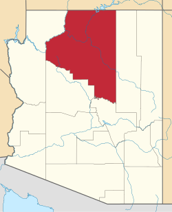
Greenehaven, Arizona

Last updated

Greenehaven, Arizona
USA Arizona location map.svg
Red pog.svg
Greenehaven
Usa edcp location map.svg
Red pog.svg
Greenehaven
Coordinates: 36°59′45″N111°33′24″W / 36.99583°N 111.55667°W / 36.99583; -111.55667
CountryUnited States
State Arizona
County Coconino
Area
[1]
  Total0.77 sq mi (1.98 km2)
  Land0.77 sq mi (1.98 km2)
  Water0.00 sq mi (0.00 km2)
Elevation
[2]
3,980 ft (1,210 m)
Population
 (2020)
  Total381
  Density497.39/sq mi (191.97/km2)
Time zone UTC-7 (MST)
  Summer (DST) UTC-6 (MDT)
ZIP Codes
86036 (Marble Canyon)
86040 (Page)
FIPS code 04-29603
GNIS feature ID2805214 [2]

Greenehaven is an unincorporated community and census-designated place (CDP) in Coconino County, Arizona, United States. It is bordered to the east, west, and south by the city of Page and to the north by the state of Utah. It was first listed as a CDP prior to the 2020 census.

It is within the Fredonia-Moccasin Unified School District. [3]

Demographics

Historical population
CensusPop.Note
2020 381
U.S. Decennial Census [4]

Related Research Articles

<span class="mw-page-title-main">Coconino County, Arizona</span> County in Arizona, United States

Coconino County is a county in the north-central part of the U.S. state of Arizona. Its population was 145,101 at the 2020 census. The county seat is Flagstaff. The county takes its name from Cohonino, a name applied to the Havasupai people. It is the second-largest county by area in the contiguous United States, behind San Bernardino County, California. It has 18,661 sq mi (48,300 km2), or 16.4% of Arizona's total area, and is larger than the nine smallest states in the U.S.

<span class="mw-page-title-main">Yavapai County, Arizona</span> County in Arizona, United States

Yavapai County is near the center of the U.S. state of Arizona. As of the 2020 census, its population was 236,209, making it the fourth-most populous county in Arizona. The county seat is Prescott.

<span class="mw-page-title-main">Bitter Springs, Arizona</span> Census-designated place in Coconino County, Arizona

Bitter Springs is a native village and census-designated place (CDP) on the Navajo Nation in Coconino County, Arizona, United States. As of the 2020 census, the CDP population was 364

<span class="mw-page-title-main">Cameron, Arizona</span> Census-designated place in Coconino County, Arizona, United States

Cameron is a census-designated place (CDP) in Coconino County, Arizona, United States, on the Navajo Nation. The population was 885 at the 2010 census. Most of the town's economy is tourist food and craft stalls, restaurants, and other services for north–south traffic from Flagstaff and Page. There is a ranger station supplying information and hiking permits for the Navajo Nation. There is also a large craft store run by the Nation itself. It is named after Ralph H. Cameron, Arizona's first senator.

<span class="mw-page-title-main">Grand Canyon Village, Arizona</span> Town in Arizona, United States

Grand Canyon Village is a census-designated place (CDP) located on the South Rim of the Grand Canyon, in Coconino County, Arizona, United States. Its population was 2,004 at the 2010 Census. Located in Grand Canyon National Park, it is wholly focused on accommodating tourists visiting the canyon. Its origins trace back to the railroad completed from Williams, to the canyon's South Rim by the Santa Fe Railroad in 1901. Many of the structures in use today date from that period. The village contains numerous landmark buildings, and its historic core is a National Historic Landmark District, designated for its outstanding implementation of town design.

<span class="mw-page-title-main">Kaibito, Arizona</span> CDP in Coconino County, Arizona

Kaibeto is a census-designated place (CDP) in Coconino County, Arizona, United States. The population was 1,522 at the 2010 census.

<span class="mw-page-title-main">LeChee, Arizona</span> CDP in Coconino County, Arizona

LeChee is a census-designated place (CDP) in Coconino County, Arizona, United States. The population was 1,443 at the 2010 census.

<span class="mw-page-title-main">Leupp, Arizona</span> Community in Coconino County, Arizona, US

LeuppLOOP is a census-designated place (CDP) in Coconino County, Arizona, on the Navajo Nation, United States. The population was 951 at the 2010 census.

<span class="mw-page-title-main">Moenkopi, Arizona</span> Community in Coconino County, Arizona

Moenkopi is a census-designated place (CDP) in Coconino County, Arizona, United States, adjacent to the southeast side of Tuba City off U.S. Route 160. The population was 964 at the 2010 census.

<span class="mw-page-title-main">Supai, Arizona</span> CDP in Coconino County, Arizona

Supai is a census-designated place (CDP) in Coconino County, Arizona, United States, within the Grand Canyon.

<span class="mw-page-title-main">Tonalea, Arizona</span> CDP in Coconino County, Arizona

Tonalea is a census-designated place (CDP) in Coconino County, Arizona, United States. The population was 549 at the 2010 census. It has also been known as Red Lake.

<span class="mw-page-title-main">Tuba City, Arizona</span> Town in Coconino County, Arizona

Tuba City is an unincorporated town and census-designated place in Coconino County, Arizona, on the Navajo Nation, United States. It is the second-largest community in Coconino County. The population of the census-designated place (CDP) was 8,611 at the 2010 census.

<span class="mw-page-title-main">Tusayan, Arizona</span> Community in Coconino County, Arizona

Tusayan is a town located in Coconino County, Arizona, United States. It was incorporated in 2010. A resort town near the south entrance to Grand Canyon National Park. The population was 558 at the 2010 census.

<span class="mw-page-title-main">Winslow West, Arizona</span> CDP in Coconino County, Arizona

Winslow West is a census-designated place (CDP) in Coconino and Navajo counties in Arizona, United States. The population was 438 at the 2010 census. The entire community is off-reservation trust land belonging to the Hopi Tribe of Arizona. It lies just west of the city of Winslow, and is more than 50 km (31 mi) south of the main Hopi Reservation.

<span class="mw-page-title-main">Village of Oak Creek, Arizona</span> Community in Yavapai County, Arizona

Village of Oak Creek is an unincorporated community located within Big Park a census-designated place (CDP) in Yavapai County, Arizona, United States. The population was 6,147 at the 2010 census, up from 5,245 in 2000. Big Park is the name of the CDP while the community is more commonly known as the Village of Oak Creek (VOC), and is a bedroom community for Sedona, located seven miles away. Tourism and service to retirees and second-home owners are the basis for the local economy. Big Park, the pioneers' name for the large open area that became the Village of Oak Creek in the early 1960s, is set among scenic red-rock buttes and canyons. The Bell Rock scenic area adjoins the north end of VOC, and the town is surrounded by the Coconino National Forest. A Forest Service Visitor Center is located at the south end of VOC.

Fredonia-Moccasin Unified School District is a school district headquartered in Fredonia, Arizona, United States. It was founded via the merger of Fredonia Elementary School District, Fredonia High School District, Moccasin School District, and Cane Beds School District in May 1974 as the state's first, and to date only ever, school district to cross county lines.

Page High School is a high school in Page, Arizona, United States. It is part of the Page Unified School District. It opened in 1959. Serving over 750 students with a population over 7,000.

The Page Unified School District is the school district for Page, Arizona, United States. It operates Desert View and Lake View elementary schools, Page Middle School, and Page High School. The superintendent is Rob Varner.

<span class="mw-page-title-main">Tolani Lake, Arizona</span> CDP in Coconino County, Arizona

Tolani Lake is a census-designated place in the eastern portion of Coconino County, Arizona, United States, near the Navajo County border. Tolani Lake is located north of Winslow. The population as of the 2010 U.S. Census was 280.

Kaibab Estates West is an unincorporated community and census-designated place (CDP) in Coconino County, Arizona, United States. It is bordered to the south by Yavapai County. It was first listed as a CDP prior to the 2020 census.

References

  1. "2020 U.S. Gazetteer Files". United States Census Bureau. Retrieved October 29, 2021.
  2. 1 2 U.S. Geological Survey Geographic Names Information System: Greenehaven, Arizona
  3. "2020 Census – School District Reference Map: Coconino County, AZ" (PDF). U.S. Census Bureau. p. 2 (PDF p. 3). Retrieved July 15, 2021.
  4. "Census of Population and Housing". Census.gov. Retrieved June 4, 2016.