This article is being considered for deletion in accordance with Wikipedia's deletion policy. Please share your thoughts on the matter at this article's deletion discussion page. |
Rare Metals, Arizona | |
---|---|
Coordinates: 36°08′58″N111°08′11″W / 36.14944°N 111.13639°W Coordinates: 36°08′58″N111°08′11″W / 36.14944°N 111.13639°W | |
Country | United States |
State | Arizona |
County | Coconino |
Elevation | 5,174 ft (1,577 m) |
Time zone | UTC-7 (Mountain (MST)) |
• Summer (DST) | UTC-7 (MST) |
Area code | 928 |
FIPS code | 04-58990 |
GNIS feature ID | 9960 |
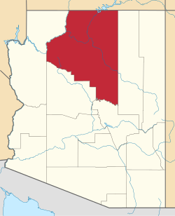
Rare Metals is a populated place in Coconino County, Arizona, United States. [2]
The UK Antarctic Place-Names Committee is a United Kingdom government committee, part of the Foreign and Commonwealth Office, responsible for recommending names of geographical locations within the British Antarctic Territory (BAT) and the South Georgia and the South Sandwich Islands (SGSSI). Such names are formally approved by the Commissioners of the BAT and SGSSI respectively, and published in the BAT Gazetteer and the SGSSI Gazetteer maintained by the Committee. The BAT names are also published in the international Composite Gazetteer of Antarctica maintained by SCAR.
Irvine Glacier is a glacier, 40 miles (64 km) long, draining southeast between the Guettard Range and the Rare Range into the northern part of Gardner Inlet, Antarctica. It was discovered by the Ronne Antarctic Research Expedition (RARE), 1947–48, under Finn Ronne, who named it for George J. Irvine, of the Engineer Depot at Fort Belvoir, Virginia, who outlined the RARE photographic program.
Rio Rico is an unincorporated community and census-designated place (CDP) in Santa Cruz County, Arizona, United States. The population was 18,962 at the 2010 census. The Rio Rico CDP replaced the former CDP's of Rio Rico Northwest, Rio Rico Northeast, Rio Rico Southwest, and Rio Rico Southeast.
Isbrecht Glacier is a small glacier flowing south from Thurston Island in Antarctica between Cox Glacier and Hale Glacier. It was named by the Advisory Committee on Antarctic Names after JoAnn Isbrecht of the United States Geological Survey (USGS), Flagstaff, Arizona, a satellite image processing specialist who was part of the USGS team that compiled the 1:5,000,000-scale Advanced Very High Resolution Radiometer maps of Antarctica and the 1:250,000-scale Landsat image maps of the Siple Coast area in the 1990s.
The Sunset Mountains in Coconino County, Arizona are two a small mesas known as East Sunset Mountain and West Sunset Mountain, located southeast of Winslow. State Route 87 passes between the mountains.
White Mountain Lake is an unincorporated community and census-designated place in Navajo County, Arizona, United States. White Mountain Lake is 7.5 miles (12.1 km) north-northeast of Show Low. White Mountain Lake has a post office with ZIP code 85912.
Anthony Glacier is a glacier which flows in an east-southeast direction to the east coast of Palmer Land where it terminates opposite the south tip of Hearst Island. The upper part of this glacier was seen by a sledge party of the British Graham Land Expedition under John Riddoch Rymill in 1936–37. The glacier was seen from the seaward side in 1940 by a sledging party from the East Base of the United States Antarctic Service, and in 1947 was photographed from the air by the Ronne Antarctic Research Expedition (RARE). It was named by Finn Ronne for Alexander Anthony of the J.P. Stevens Company, New York City, which contributed windproof clothing to the RARE.
Chavez Glacier is a glacier about 10 nmi long flowing south from Canisteo Peninsula into Cranton Bay. It was named by the Advisory Committee on Antarctic Names after Pat Chavez of the United States Geological Survey (USGS), Flagstaff, Arizona, co-leader of the USGS team that compiled the 1:5,000,000-scale Advanced Very High Resolution Radiometer maps of Antarctica in the 1990s.
Lucchitta Glacier is a glacier about 20 nautical miles (37 km) long flowing south from the Hudson Mountains of Antarctica into Pine Island Bay. It was named by the Advisory Committee on Antarctic Names after geologist Baerbel K. Lucchitta of the United States Geological Survey, Flagstaff, Arizona, a specialist in the use of satellite imagery for geological and glaciological studies from the early 1980s to the early 2000s (decade), and one of the pioneers in the use of imagery for glacier velocity measurements in Antarctica.
Buckskin Mountain is a 16-mile (26 km) mountain ridge that spans from Coconino County, Arizona to Kane County, Utah in the United States, that is divided almost equally between the two counties.
Mae West Peaks is a pair of summits in Cochise County, Arizona. The taller of the two was formerly known as Lime Peak and the elevation and coordinates in the infobox refer to this peak. They are in the Little Dragoon Mountains, northwest of Texas Canyon and 3.3 miles (5.3 km) west-southwest of the ghost town of Johnson, Arizona.
White Picacho is a summit with an elevation of 4,285 feet (1,306 m) in the Hieroglyphic Mountains in Yavapai County, Arizona.
Laguna is a populated place situated in Pinal County, Arizona, United States. It is one of two places in Arizona with this name, the other being located in Yuma County. It has an estimated elevation of 1,608 feet (490 m) above sea level.
Balakai Mesa is a summit in the U.S. state of Arizona.
Tapeats Creek is a creek located entirely within the Grand Canyon National Park. It flows southwest from its source near the North Rim of the canyon to the Colorado River at the base of the canyon. It was named by the Second Powell Expedition in the winter of 1871–1872 for a Southern Paiute Indian who claimed ownership of the stream. It contributes the largest amount of water to the Colorado of any tributary on the north side within the Grand Canyon.
House Rock is a ghost town near the northwest end of the House Rock Valley in northern Coconino County, Arizona, United States. The community was named after the House Rock Valley, which was named by the John Wesley Powell Expedition in 1871.