
Coconino County is a county in the North-Central part of the U.S. state of Arizona. Its population was 145,101 at the 2020 census. The county seat is Flagstaff. The county takes its name from Cohonino, a name applied to the Havasupai people. It is the second-largest county by area in the contiguous United States, behind San Bernardino County, California. It has 18,661 sq mi (48,300 km2), or 16.4% of Arizona's total area, and is larger than the nine smallest states in the U.S.

Navajo County is a county in the northern part of the U.S. state of Arizona. As of the 2020 census, its population was 106,717. The county seat is Holbrook.

Cameron is a census-designated place (CDP) in Coconino County, Arizona, United States, on the Navajo Nation. The population was 885 at the 2010 census. Most of the town's economy is tourist food and craft stalls, restaurants, and other services for north–south traffic from Flagstaff and Page. There is a ranger station supplying information and hiking permits for the Navajo Nation. There is also a large craft store run by the Nation itself. It is named after Ralph H. Cameron, one of the two senators first appointed to U.S. Congress for Arizona, upon its federal recognition of statehood.

Kachina Village is a census-designated place (CDP) in Coconino County, Arizona, United States. The population was 2,622 at the 2010 census. Kachina Village is primarily a bedroom community for Flagstaff.
LeuppLOOP is a census-designated place (CDP) in Coconino County, Arizona, on the Navajo Nation, United States. The population was 951 at the 2010 census.

Mountainaire is a census-designated place (CDP) in Coconino County, Arizona, United States. The population was 1,119 at the 2010 census.

Munds Park is an unincorporated census-designated place (CDP) in Coconino County, Arizona, United States. The year round population was 631 at the 2010 census.

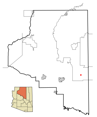
Page is a city in Coconino County, Arizona, United States, near the Glen Canyon Dam and Lake Powell. As of the 2010 census, the population of the city was 7,247.

Tuba City is an unincorporated town and census-designated place in Coconino County, Arizona, on the Navajo Nation, United States. It is the second-largest community in Coconino County. The population of the census-designated place (CDP) was 8,611 at the 2010 census.

Winslow West is a census-designated place (CDP) in Navajo and Coconino counties in Arizona, United States. The population was 438 at the 2010 census. The entire community is off-reservation trust land belonging to the Hopi Tribe of Arizona. It lies just west of the city of Winslow, and is more than 50 km (31 mi) south of the main Hopi Reservation.

Kayenta is a U.S. town which is part of the Navajo Nation and is in Navajo County, Arizona, United States. Established November 13, 1986, the Kayenta Township is unique in being the only "township" existing under the laws of the Navajo Nation.
The Flagstaff Unified School District (FUSD) is a K-12 school district for Flagstaff, Arizona area and neighboring areas. The district has approximately 11,500 students and operates 16 schools; including three high schools (9–12), two middle schools (6–8), four magnet schools, ten elementary schools, and two alternative programs.
Mormon Lake is a populated place situated in Coconino County, Arizona, south of the eponymous lake. It has an estimated elevation of 7,146 feet (2,178 m) above sea level.

Bellemont is an unincorporated community in Coconino County, Arizona, United States, located along Interstate 40, about 11 miles (18 km) west-northwest of Flagstaff. At an elevation of 7,132 feet (2,174 m), it is claimed to be the highest settlement along historic Route 66. It was a known water stop due to its local springs. As of June 2012, it had an estimated population of 893.

Flagstaff High School (FHS) is a secondary school in Flagstaff, Arizona. Flagstaff High School has been opened to the public since 1923. FHS is a four-year public high school of approximately 1,500 students. The students are primarily of five ethnic groups: White, Native American, Hispanic, Asian, and African-American. Approximately 50 percent of the students are minorities; 147 are from various Native American tribes and live at the Bureau of Indian Affairs KinLani Dormitory. The student body represents a broad socio-economic range from low income to upper middle class. Each year approximately 50 percent of the graduates enroll in four-year colleges and universities and 25 percent in two-year institutions.

Fort Valley is a census-designated place in the southern portion of Coconino County in the state of Arizona, United States. Fort Valley is located very close to the city of Flagstaff. The population as of 2010, was 779.
Birdsprings is a settlement in unincorporated Navajo County, Arizona, north of Winslow. The Little Colorado River runs through Birdsprings. It is in the southwestern portion of the Navajo Nation reservation and is part of District 5. The name Birdsprings is in reference to spring that at one time drew birds. The community is small and has a chapter, which was established on December 5, 1955.

Leupp Schools, Inc., is a K-12 grant-funded school affiliated with the Bureau of Indian Education. It is in Leupp, Arizona and has a Winslow postal address. Its GNIS is 7538.
Blue Ridge is an unincorporated community and census-designated place (CDP) in Coconino County, Arizona, United States. It was first listed as a CDP prior to the 2020 census.
Timberline-Fernwood is a census-designated place (CDP) in Coconino County, Arizona, United States. It is bordered to the south by the community of Doney Park and is on U.S. Route 89, 11 miles (18 km) northeast of Flagstaff. It was first listed as a CDP prior to the 2020 census.


