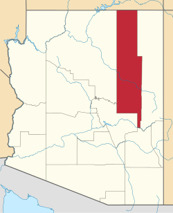
Indian Pine, Arizona | |
|---|---|
| Coordinates: 34°04′48″N109°54′19″W / 34.08000°N 109.90528°W | |
| Country | United States |
| State | Arizona |
| County | Navajo |
| Elevation | 7,176 ft (2,187 m) |
| Time zone | UTC-7 (Mountain (MST)) |
| • Summer (DST) | UTC-7 (MST) |
| ZIP codes | 85935 |
| Area code | 928 |
| FIPS code | 04-35150 |
| GNIS feature ID | 30351 [1] |
Indian Pine is a populated place on the Fort Apache Indian Reservation in Navajo County, Arizona, United States. [1] [2] It is located at the junction of Arizona State Route 260 and the northern end of Arizona State Route 73. [3]


