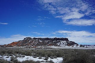
Navajo National Monument is a National Monument located within the northwest portion of the Navajo Nation territory in northern Arizona, which was established to preserve three well-preserved cliff dwellings of the Ancestral Puebloan people: Keet Seel, Betatakin, and Inscription House. The monument is high on the Shonto plateau, overlooking the Tsegi Canyon system, west of Kayenta, Arizona. It features a visitor center with a museum, three short self-guided trails, two small campgrounds, and a picnic area.

Aponi-vi is a populated place situated in Navajo County, Arizona. It has an estimated elevation of 1,122 feet (342 m) above sea level.

Baby Rocks is a populated place situated in Navajo County, Arizona, and appears on the Baby Rocks U.S. Geological Survey Map. It has an estimated elevation of 5,236 feet (1,596 m) above sea level.

Bidahochi is a populated place situated in Navajo County, Arizona. It has an estimated elevation of 5,758 feet (1,755 m) above sea level. The nearby Bidahochi Formation was named for Bidahochi, AZ.

Burton is a populated place situated in Navajo County, Arizona. It has an estimated elevation of 6,109 feet (1,862 m) above sea level.

Castle Butte is a populated place situated in Navajo County, Arizona. It has an estimated elevation of 5,807 feet (1,770 m) above sea level.

Cedar Springs is a populated place situated in Navajo County, Arizona, United States. It has an estimated elevation of 6,279 feet (1,914 m) above sea level.

Chakpahu is a populated place situated in Navajo County, Arizona, United States. It has an estimated elevation of 6,375 feet (1,943 m) above sea level.

Goodwater is a populated place situated in Navajo County, Arizona, United States. It has an estimated elevation of 5,262 feet (1,604 m) above sea level.

Grasshopper is a populated place situated in Navajo County, Arizona, United States. It has an estimated elevation of 5,922 feet (1,805 m) above sea level.

Huk Ovi is a populated place situated in Navajo County, Arizona, United States. It has an estimated elevation of 6,361 feet (1,939 m) above sea level.

Indian Pine is a populated place situated in Navajo County, Arizona, United States. It has an estimated elevation of 7,175 feet (2,187 m) above sea level.

Manila is a populated place situated in Navajo County, Arizona, United States. Its name was bestowed during the Spanish–American War, being named after the Philippines' capital, and has an estimated elevation of 4,954 feet (1,510 m) above sea level.

Mumurva, also known as Monusva Spring Well or Mumurs-va, is a populated place situated in Navajo County, Arizona, United States. Mumurva became the official name as a result of a Board on Geographic Names decision in 1995. It has an estimated elevation of 5,971 feet (1,820 m) above sea level.

Na Ah Tee, historically also known as Na-Ah-Tee Canyon, Na-a-tih Trading Post, and Na-at-tee Canyon, is a populated place situated in Navajo County, Arizona, United States. It has an estimated elevation of 6,263 feet (1,909 m) above sea level.

Navajo is a populated place situated in Apache County, Arizona. It has an estimated elevation of 5,676 feet (1,730 m) above sea level.

Penzance is a populated place situated in Navajo County, Arizona, United States. Named by the Sante Fe Railway in 1888 after the English town of the same name. It has an estimated elevation of 5,062 feet (1,543 m) above sea level.

Pivahn-hon-kya-pi, also known as Pi Va Hon Kia Pi, is a populated place situated in Navajo County, Arizona, United States. It has an estimated elevation of 6,096 feet (1,858 m) above sea level.

Twin Buttes is a populated place situated in Navajo County, Arizona, United States. It is one of two populated locations in Arizona with this name, the other being in Pima County. It has an estimated elevation of 5,794 feet (1,766 m) above sea level.

Wepo Village is a populated place situated in Navajo County, Arizona, United States. It has an estimated elevation of 5,784 feet (1,763 m) above sea level.


