
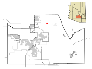
Lukachukai is a census-designated place (CDP) in Apache County, Arizona, United States. The population was 1,701 at the 2010 census. It is within the Navajo Nation.

Bitter Springs is a native village and census-designated place (CDP) on the Navajo Nation in Coconino County, Arizona, United States. As of the 2020 census, the CDP population was 364

Kachina Village is a census-designated place (CDP) in Coconino County, Arizona, United States. The population was 2,622 at the 2010 census. Kachina Village is primarily a bedroom community for Flagstaff.
Kaibab is an unincorporated community and census-designated place (CDP) in Mohave County, Arizona, United States. It is within the Kaibab Indian Reservation. The population of the CDP was 140 at the 2020 census.

Parks is a census-designated place (CDP) in Coconino County, Arizona, United States. The population was 1,188 at the 2010 census.

Pine is an unincorporated community and census-designated place (CDP) in Gila County, Arizona, United States. The population was 1,953 at the 2020 census. Pine was established by four Mormon families in 1879.

East Fork is a census-designated place (CDP) in Navajo County, Arizona, United States, on the Fort Apache Indian Reservation. The population was 699 at the 2010 census.

Drexel-Alvernon was a census-designated place (CDP) in Pima County, Arizona, United States. The population was 4,192 at the 2000 census.
Queen Valley is a census-designated place (CDP) in north central Pinal County, Arizona, United States. The population was 820 at the 2000 census.

Stanfield is a census-designated place (CDP) in Pinal County, Arizona, United States. The population was 651 at the 2000 census. Shamrock Farms operates a farm in Stanfield.

Dustin Acres is a census-designated place (CDP) in Kern County, California, United States. Dustin Acres is located 6.5 miles (10 km) north-northeast of Taft, at an elevation of 384 feet (117 m). The population was 652 at the 2010 census, up from 585 at the 2000 census.

Belden is a census-designated place (CDP) in Plumas County, California, United States. Belden is located on the Feather River Route and the North Fork Feather River, 7 miles (11.3 km) southwest of Caribou. The population was 22 at the 2010 census, down from 26 in 2000.

St. James City is an unincorporated community and census-designated place (CDP) on Pine Island in Lee County, Florida, United States. The population was 3,876 at the 2020 census, up from 3,784 at the 2010 census. It is part of the Cape Coral-Fort Myers, Florida Metropolitan Statistical Area.

North River Shores is an unincorporated area and census-designated place (CDP) in Martin County, Florida, United States. The population was 3,459 at the 2020 census, up from 3,079 in 2010. It is part of the Port St. Lucie Metropolitan Statistical Area.

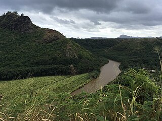
Hanamāʻulu is a census-designated place (CDP) in Kauaʻi County, Hawaiʻi, United States. It is the ancient birthplace of Kawelo, a member of Kauai's ruling family. The population was 4,994 at the 2020 census, up from 3,272 at the 2000 census.
Wailua Homesteads is a census-designated place (CDP) in Kauaʻi County, Hawaiʻi, United States. The population was 5,863 at the 2020 census, up from 4,567 at the 2000 census.

Haviland is a community and census-designated place (CDP) in Dutchess County, New York, United States. The population was 4,174 at the 2020 census. It is part of the Poughkeepsie–Newburgh–Middletown, NY Metropolitan Statistical Area as well as the larger New York–Newark–Bridgeport, NY-NJ-CT-PA Combined Statistical Area.

Aquebogue is a census-designated place (CDP) roughly corresponding to the hamlet by the same name in the Town of Riverhead in Suffolk County, on Long Island, in New York, United States. The CDP's population was 2,438 at the 2010 census.
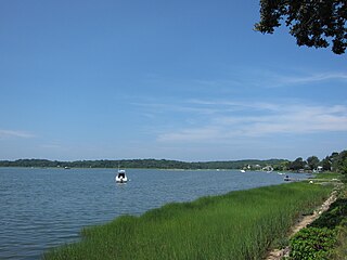
North Sea is a hamlet and census-designated place (CDP) in the Town of Southampton in Suffolk County, on the South Fork of Long Island, in New York, United States. The population was 4,458 at the 2010 census.
Judson is a census-designated place (CDP) in Greenville County, South Carolina, United States. The population was 2,050 at the 2010 census, down from 2,456 at the 2000 census. It is part of the Greenville–Mauldin–Easley Metropolitan Statistical Area.


