McNary, Arizona

Last updated

McNary, Arizona
McNary-General Store-1900.jpg
1900 McNary General Store
Apache County Incorporated and Unincorporated areas McNary highlighted.svg
Location in Apache County and the state of Arizona
Usa edcp location map.svg
Red pog.svg
McNary, Arizona
Location in the United States
Coordinates: 34°05′31″N109°51′17″W / 34.09194°N 109.85472°W / 34.09194; -109.85472
CountryUnited States
State Arizona
Counties Apache, Navajo
Area
[1]
  Total5.75 sq mi (14.88 km2)
  Land5.67 sq mi (14.69 km2)
  Water0.07 sq mi (0.19 km2)
Elevation
[2]
7,363 ft (2,244 m)
Population
 (2020)
  Total484
  Density85.33/sq mi (32.94/km2)
Time zone UTC-7 (MST)
ZIP code
85930
Area code 928
FIPS code 04-43430
GNIS feature ID2408802 [2]

McNary is a census-designated place (CDP) in Apache and Navajo counties in the U.S. state of Arizona, on the Fort Apache Indian Reservation. The population was 528 at the 2010 census. [3]

Contents

History

The community was originally named "Cluff Cienega" by European Americans after Benjamin Cluff, a Mormon bishop who harvested hay here in 1879 and 1880 for use at Fort Apache. In 1919, the name was changed to "Cooley" in honor of Corydon Cooley (d. March 18, 1917), a hotelier of Show Low. In 1924, the Cady Lumber Company moved its entire operations, plus hundreds of employees, from McNary, Louisiana, to Cooley, Arizona. [4] For marketing purposes, the company received permission from the federal government to rename Cooley as McNary. [5] This company was later renamed Southwest Lumber Mills and then Southwest Forest Industries. The mill closed in 1979 after a fire. [6]

Geography

According to the United States Census Bureau, the CDP has a total area of 5.6 square miles (14.4 km2), of which 5.5 square miles (14.2 km2) is land and 0.077 square miles (0.2 km2), or 1.30%, is water. [3]

At an elevation of 7,316 feet (2,230 m), it is the second highest community in Arizona after Alpine.

Climate

The climate in this area has mild differences between highs and lows, and there is adequate rainfall year-round. According to the Köppen Climate Classification system, McNary has a marine west coast climate, abbreviated "Cfb" on climate maps. [7] McNary has recorded one of the lowest temperature in the southwestern state of Arizona, as on January 7, 1971, the temperature froze at around −40 °F / −40 °C. McNary averages 65 inches of snow per year and is one of the coldest places in Arizona, along with Hawley Lake, which recorded the same temperature of −40 °F / −40 °C

Climate data for McNary, Arizona (1991–2020 normals, extremes 1933–present)
MonthJanFebMarAprMayJunJulAugSepOctNovDecYear
Record high °F (°C)68
(20)
72
(22)
74
(23)
80
(27)
89
(32)
98
(37)
98
(37)
91
(33)
89
(32)
88
(31)
79
(26)
73
(23)
98
(37)
Mean maximum °F (°C)56.0
(13.3)
59.5
(15.3)
65.8
(18.8)
72.8
(22.7)
80.5
(26.9)
88.7
(31.5)
89.6
(32.0)
84.5
(29.2)
80.5
(26.9)
75.8
(24.3)
67.1
(19.5)
58.5
(14.7)
91.1
(32.8)
Mean daily maximum °F (°C)44.7
(7.1)
47.3
(8.5)
53.2
(11.8)
59.5
(15.3)
68.9
(20.5)
79.9
(26.6)
80.0
(26.7)
76.9
(24.9)
72.9
(22.7)
64.4
(18.0)
54.1
(12.3)
44.5
(6.9)
62.2
(16.8)
Daily mean °F (°C)32.6
(0.3)
35.0
(1.7)
40.1
(4.5)
44.8
(7.1)
53.3
(11.8)
63.2
(17.3)
66.0
(18.9)
64.3
(17.9)
59.5
(15.3)
50.3
(10.2)
40.9
(4.9)
32.8
(0.4)
48.6
(9.2)
Mean daily minimum °F (°C)20.6
(−6.3)
22.7
(−5.2)
27.0
(−2.8)
30.1
(−1.1)
37.7
(3.2)
46.5
(8.1)
52.0
(11.1)
51.6
(10.9)
46.1
(7.8)
36.2
(2.3)
27.7
(−2.4)
21.0
(−6.1)
34.9
(1.6)
Mean minimum °F (°C)4.5
(−15.3)
8.1
(−13.3)
13.2
(−10.4)
19.4
(−7.0)
26.7
(−2.9)
37.4
(3.0)
46.8
(8.2)
47.1
(8.4)
36.8
(2.7)
23.5
(−4.7)
12.0
(−11.1)
3.9
(−15.6)
1.1
(−17.2)
Record low °F (°C)−23
(−31)
−18
(−28)
−13
(−25)
0
(−18)
8
(−13)
20
(−7)
30
(−1)
32
(0)
21
(−6)
6
(−14)
−5
(−21)
−18
(−28)
−23
(−31)
Average precipitation inches (mm)2.11
(54)
1.96
(50)
1.83
(46)
0.91
(23)
0.70
(18)
0.53
(13)
3.72
(94)
4.60
(117)
2.22
(56)
1.71
(43)
1.56
(40)
2.26
(57)
24.11
(612)
Average snowfall inches (cm)14.8
(38)
13.9
(35)
11.9
(30)
4.7
(12)
0.6
(1.5)
0.0
(0.0)
0.0
(0.0)
0.0
(0.0)
0.0
(0.0)
2.1
(5.3)
5.2
(13)
12.8
(33)
66.0
(168)
Average precipitation days (≥ 0.01 inch)7.97.47.75.04.63.515.216.79.85.95.27.796.6
Average snowy days (≥ 0.1 inch)6.16.05.02.60.60.00.00.00.00.82.46.029.5
Source: National Oceanic and Atmospheric Administration [8] [9]

Demographics

Historical population
CensusPop.Note
2000 349
2010 52851.3%
2020 484−8.3%
U.S. Decennial Census [10]

As of the census [11] of 2000, there were 349 people, 91 households, and 73 families residing in the CDP. The population density was 63.5 inhabitants per square mile (24.5/km2). There were 101 housing units at an average density of 18.4 per square mile (7.1/km2). The racial makeup of the CDP was 82.8% Native American, 8.3% White, 2.6% Black or African American, 2.9% from other races, and 3.4% from two or more races. 11.2% of the population were Hispanic or Latino of any race.

There were 91 households, out of which 63.7% had children under the age of 18 living with them, 44.0% were married couples living together, 31.9% had a female householder with no husband present, and 18.7% were non-families. 16.5% of all households were made up of individuals, and 1.1% had someone living alone who was 65 years of age or older. The average household size was 3.84 and the average family size was 4.18.

In the CDP, the age distribution of the population shows 48.7% under the age of 18, 7.4% from 18 to 24, 30.7% from 25 to 44, 9.5% from 45 to 64, and 3.7% who were 65 years of age or older. The median age was 19 years. For every 100 females, there were 87.6 males. For every 100 females age 18 and over, there were 86.5 males.

The median income for a household in the CDP was $4,375. Males had a median income of $36,875 versus $18,375 for females. The per capita income for the CDP was $2,917. About 78.9% of families and 86.4% of the population were below the poverty line, including 96.6% of those under age 18 and 100% of those age 65 or over.

Education

McNary is served by the McNary Elementary School District, and by the Blue Ridge Junior High School, and Blue Ridge High School in nearby Pinetop-Lakeside. [12] and Alchesay High School which is part of Whiteriver Unified School District.

Infrastructure

Transportation

The White Mountain Apache Tribe operates the Fort Apache Connection Transit, which provides local bus service. [13]

See also

Related Research Articles

<span class="mw-page-title-main">Show Low, Arizona</span> City in Arizona, United States

Show Low is a city in Navajo County, Arizona. It lies on the Mogollon Rim in east central Arizona, at an elevation of 6,345 feet. The city was established in 1870 and incorporated in 1953. According to the 2010 census, the population of the city was 10,660.

<span class="mw-page-title-main">Navajo County, Arizona</span> County in Arizona, United States

Navajo County is in the northern part of the U.S. state of Arizona. As of the 2020 census, its population was 106,717. The county seat is Holbrook.

<span class="mw-page-title-main">Fort Defiance, Arizona</span> CDP in Apache County, Arizona

Fort Defiance is a census-designated place (CDP) in Apache County, Arizona, United States. It is also located within the Navajo Nation. The population was 3,624 at the 2010 census.

<span class="mw-page-title-main">Houck, Arizona</span> CDP in Apache County, Arizona

Houck is a census-designated place (CDP) in Apache County, Arizona, United States. The population was 1,024 at the 2010 census.

<span class="mw-page-title-main">Lukachukai, Arizona</span> CDP in Apache County, Arizona

Lukachukai is a census-designated place (CDP) in Apache County, Arizona, United States. The population was 1,701 at the 2010 census. It is within the Navajo Nation.

<span class="mw-page-title-main">Many Farms, Arizona</span> CDP in Apache County, Arizona

Many Farms is a census-designated place (CDP) in Apache County, Arizona, United States. The population was 1,348 at the 2010 census.

<span class="mw-page-title-main">Nazlini, Arizona</span> CDP in Apache County, Arizona

Nazlini is a census-designated place (CDP) in Apache County, Arizona, United States. The population was 489 at the 2010 census. Nearby are Nazlini Creek and Nazlini Canyon. Nazlini Canyon is the site of many Native American ruins and campsites that were abandoned when erosion made them unusable.

<span class="mw-page-title-main">Sawmill, Arizona</span> CDP in Apache County, Arizona

Sawmill is a census-designated place (CDP) in Apache County, Arizona, United States. Sawmill is a part of Fort Defiance Agency, which is on the Navajo Nation. The population was 748 at the 2010 census. It is named after and developed around a sawmill. A trading post has been present since 1907.

<span class="mw-page-title-main">Teec Nos Pos, Arizona</span> Census-designated place in Arizona, United States

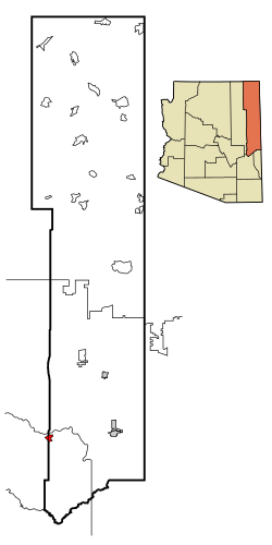
Teec Nos Pos is a census-designated place (CDP) in Apache County, Arizona, United States. The population was 507 at the 2020 census. It is the western terminus of U.S. Route 64.

<span class="mw-page-title-main">Tsaile, Arizona</span> Census-designated place in Arizona, United States

Tsaile is a census-designated place (CDP) in Apache County, Arizona, United States, on the Navajo Nation. The population was 1,205 at the 2010 census.

<span class="mw-page-title-main">Canyon Day, Arizona</span> CDP in Gila County, Arizona

Canyon Day is a census-designated place (CDP) in Gila County, Arizona, United States, on the Fort Apache Indian Reservation. The population was 1,209 at the 2010 census.

<span class="mw-page-title-main">Claypool, Arizona</span> CDP in Gila County, Arizona

Claypool is a census-designated place (CDP) in Gila County, Arizona, United States. The population was 1,538 at the 2010 census, down from 1,794 at the 2000 census. It was named after W. D. Claypool, a member of both the State House of Representatives and State Senate in the 1910s and 1920s.

<span class="mw-page-title-main">Morenci, Arizona</span> CDP in Greenlee County, Arizona

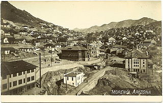
Morenci is a census-designated place (CDP) and company town in Greenlee County, Arizona, United States, and was founded by the Detroit Copper Mining Company of Arizona. The population was 2,000 at the 2000 census and 1,489 at the 2010 census. The biggest employer in Morenci and the owner of the town is Freeport-McMoRan, the owner of the Morenci Mine, the largest copper mining operation in North America, and one of the largest copper mines in the world. The town was a site of the Arizona Copper Mine Strike of 1983. The large open-pit mine is north of the town.

<span class="mw-page-title-main">Cibecue, Arizona</span> Fort Apache Indian Reservation community

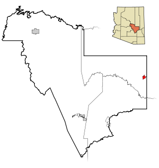
Cibecue is a census-designated place (CDP) in Navajo County, Arizona, United States, on the Fort Apache Indian Reservation. The population was 1,713 in the 2010 United States Census.

<span class="mw-page-title-main">East Fork, Arizona</span> CDP in Navajo County, Arizona

East Fork is a census-designated place (CDP) in Navajo County, Arizona, United States, on the Fort Apache Indian Reservation. The population was 699 at the 2010 census.

<span class="mw-page-title-main">Pinetop-Lakeside, Arizona</span> Town in Navajo County, Arizona

Pinetop–Lakeside is a town in Navajo County, Arizona, United States. According to 2020 census, the population of the town is 4,557. It was founded in 1984 when the neighboring towns of Pinetop and Lakeside merged.

<span class="mw-page-title-main">Whiteriver, Arizona</span> Census designated place in Arizona, United States

Whiteriver is a census-designated place (CDP) located on the Fort Apache Indian Reservation in Navajo County, Arizona, United States. The population was 4,104 at the 2010 census, making it the largest settlement on the Reservation.

<span class="mw-page-title-main">Lake Montezuma, Arizona</span> CDP in Yavapai County, Arizona

Lake Montezuma is a census-designated place (CDP) in Yavapai County in the U.S. state of Arizona. The population was 5,111 at the 2020 census. The CDP includes the communities of Rimrock and McGuireville. Located along Interstate 17, it is 20 miles (32 km) south of Sedona and 8 miles (13 km) north of Camp Verde in central Arizona's Verde Valley.

<span class="mw-page-title-main">McNary, Louisiana</span> Village in Louisiana, United States

McNary is a village in Rapides Parish, Louisiana, United States. It is part of the Alexandria, Louisiana, Metropolitan Statistical Area. The population was 211 at the 2000 census.

Hondah is a census-designated place (CDP) in Navajo County, Arizona, United States, on the Fort Apache Indian Reservation. The population was 812 at the 2010 census.

References

  1. "2020 U.S. Gazetteer Files". United States Census Bureau. Retrieved October 29, 2021.
  2. 1 2 U.S. Geological Survey Geographic Names Information System: McNary, Arizona
  3. 1 2 "Geographic Identifiers: 2010 Demographic Profile Data (G001): McNary CDP, Arizona". U.S. Census Bureau, American Factfinder. Archived from the original on February 12, 2020. Retrieved April 18, 2013.
  4. "McNary, Arizona: A Town on the Move". Forest History Society. May 7, 2012. Retrieved April 3, 2018.
  5. Byrd H. Granger (1960). Arizona Place Names . University of Arizona Press. p.  15 . Retrieved December 5, 2011.
  6. "McNary, Arizona: A town on the move". May 7, 2012.
  7. Climate Summary for McNary, Arizona
  8. "NOWData - NOAA Online Weather Data". National Oceanic and Atmospheric Administration . Retrieved August 15, 2022.
  9. "U.S. Climate Normals Quick Access – Station: MC NARY 2N, AZ". National Oceanic and Atmospheric Administration. Retrieved December 30, 2022.
  10. "Census of Population and Housing". Census.gov. Retrieved June 4, 2016.
  11. "U.S. Census website". United States Census Bureau . Retrieved January 31, 2008.
  12. "Blue Ridge Jr High School – Pinetop-Lakeside, AZ". AreaVibes . Retrieved March 17, 2019.
  13. "Tribal Transportation". WMAT DOT. Retrieved February 3, 2020.