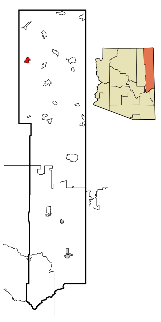
Springerville sits at an elevation of 6,907 feet (2,105m) above sea level. Along with its neighbor Eagar, the communities make up the place known as Round Valley, which is in the central-eastern part of Arizona close to the New Mexico border.
History
Springerville Town Hall in 2009
The town that grew around Henry Springer's trading post was officially given its name on May 10, 1876.[4] Before that time it had gone by names such as Colorado Chiquito, Milligan Settlement, and Valle Redondo (Round Valley).
Springerville is the home of Arizona's Madonna of the Trail statue, unveiled on September 29, 1928.[7]
The town was incorporated in 1948.
In 1951, Twentieth Century Fox filmed an adaptation of Fred Gipson's novel The Home Place titled Return of the Texan at several locations in and around Springerville.[8][9]
In June 2011, most of the town was evacuated due to a nearby wildfire some stayed and met with each other alongside residents of Eagar in the round valley dome.[10]
According to the United States Census Bureau, the town has a total area of 11.7 square miles (30km2), of which 11.6 square miles (30km2) is land and 0.1 square miles (0.26km2), or 1.4%, is water.[3] Springerville has a Mediterranean climate (Köppen Csb).
Climate
Climate data for Springerville, Arizona (1991–2020 normals, extremes 1911–present)
As of the census[15] of 2000, there were 1,972 people, 753 households, and 499 families residing in the town. The population density was 170.8 inhabitants per square mile (65.9/km2). There were 896 housing units at an average density of 77.6 per square mile (30.0/km2). The racial makeup of the town was 79.5% White, 0.2% Black or African American, 6.5% Native American, 0.4% Asian, 0.1% Pacific Islander, 10.2% from other races, and 3.0% from two or more races. 25.2% of the population were Hispanic or Latino of any race.
There were 753 households, out of which 34.3% had children under the age of 18 living with them, 50.6% were married couples living together, 11.2% had a female householder with no husband present, and 33.7% were non-families. 30.1% of all households were made up of individuals, and 14.7% had someone living alone who was 65 years of age or older. The average household size was 2.55 and the average family size was 3.18.
In the town, the age distribution of the population shows 29.2% under the age of 18, 7.6% from 18 to 24, 25.2% from 25 to 44, 23.4% from 45 to 64, and 14.6% who were 65 years of age or older. The median age was 37 years. For every 100 females, there were 94.9 males. For every 100 females age 18 and over, there were 88.4 males.
The median income for a household in the town was $30,769, and the median income for a family was $36,331. Males had a median income of $32,313 versus $19,519 for females. The per capita income for the town was $13,830. About 14.7% of families and 21.0% of the population were below the poverty line, including 25.4% of those under age 18 and 26.1% of those age 65 or over.
Round Valley Primary School is located in the town and serves the town.
Round Valley Intermediate School, Round Valley Middle School, and Round Valley High School serve the town, but are in nearby Eagar. In addition, White Mountain Academy, a K–12 charter school, is located in Eagar.
The high school's football stadium, The Round Valley Ensphere located in Eagar, is the eighth biggest geodesic dome in the world with a diameter of 440 feet / 134 m. The school board voted to give the Dome a pinkish looking color, and it was completed in 1992. It was used as a shelter for evacuees from the Rodeo–Chediski Fire in 2002. Round Valley is the only high school in the world to have a domed stadium.
The first Springerville School House was dedicated September 3, 1884.
In 1969—the Springerville, Eagar, Vernon, Nutrioso, Greer, and Colter Schools consolidated with each other to form the Round Valley Unified School District.
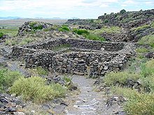
Casa Malpaís is located near Springerville. It is a nationally recognized archeological site.[19]
The name Casa Malpais means "House built from Malapai", which describes the type volcanic vesicular basalt from which the ancient village was constructed. It is thought that the name was given to the village by early Basque sheepherders. The Springerville volcanic field contains over 400 volcanoes within a 50-mile (80km) radius of Springerville, making it the third largest volcanic field in the continental United States.
The first visit to Casa Malpais by a professional anthropologist was in 1883, when Frank Cushing, living at Zuni, visited a site at "El Valle Redondo on the Colorado Chiquito", and was impressed by what he termed "the fissure type pueblo" he found there. In his journal he sketched dry masonry, bridging fissures, upon which the pueblo is constructed.
Unique and unusual features characterize the site. The Great Kiva, painstakingly constructed of volcanic rock, is the centerpiece. A steep basalt staircase set into a crevice of the high red cliff wall leads to the top of the mesa.
Both the Hopi and Zuni people still consider Casa Malpais a sacred ancestral place.
The El Rio opened in 1915, making it the oldest movie theater in Arizona. It was originally called the Apache Theater, until it was changed in 1937 to the El Rio.[21]
"I was the one who had Apache county separated from Yavapai. Everything was very high at that time, and I used to haul my goods from Albuquerque to live on. I was hauling goods one time from Henry Springer's store in Albuquerque, and I told Henry Springer he had better come into Round Valley, as it was called then, and put in a store; that the people were coming in and we would name the postoffice and little village after him, Springerville, and that was old Henry Springer."
Apache County is a county in the northeast corner of the U.S. state of Arizona. Shaped in a long rectangle running north to south, as of the 2020 census, its population was 66,021. The county seat is St. Johns.
Pinal County is a county in the central part of the U.S. state of Arizona. According to the 2020 census, the population of the county was 425,264, making it Arizona's third-most populous county. The county seat is Florence. The county was founded in 1875.
Cibola County is a county in the U.S. state of New Mexico. As of the 2020 census, the population was 27,172. Its county seat is Grants. It is New Mexico's youngest county, and the third youngest county in the United States, created on June 19, 1981, from the westernmost four-fifths of the formerly much larger Valencia County.
Catron County is a county in the U.S. state of New Mexico. As of the 2020 census, the population was 3,579, making it New Mexico's third-least populous county. Its county seat is Reserve. Catron County is New Mexico's largest county by area.
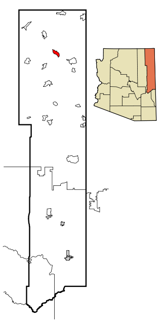
Eagar is a town in Apache County, Arizona, United States. As of the 2010 census, the population of the town was 4,885.
McNary is a census-designated place (CDP) in Apache and Navajo counties in the U.S. state of Arizona, on the Fort Apache Indian Reservation. The population was 528 at the 2010 census.
Rough Rock is a census-designated place (CDP) in Apache County, Arizona, United States. The population was 414 at the 2010 census.
Round Rock is a Navajo community and census-designated place (CDP) in Apache County, Arizona, United States. The population was 789 at the 2010 census. It is named after a nearby mesa.
St. Johns is the county seat of Apache County, Arizona, United States. It is located along U.S. Route 180, mostly west of where that highway intersects with U.S. Route 191. As of the 2010 census, the population of the city was 3,480.
Peridot is an unincorporated community and census-designated place (CDP) in Gila and Graham counties in the U.S. state of Arizona. The population was 1,350 at the 2010 census.
Pima is a town in Graham County, Arizona, United States. As of the 2010 census, the population of the town was 2,387, up from 1,989 in 2000. The estimated population in 2018 was 2,512. Pima is part of the Safford Micropolitan Statistical Area.
Thatcher is a town in Graham County, Arizona, United States. According to the 2010 Census, the population of the town is 4,865. It is part of the Safford Micropolitan Statistical Area.
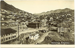
Morenci is a census-designated place (CDP) and company town in Greenlee County, Arizona, United States, and was founded by the Detroit Copper Mining Company of Arizona. The population was 2,000 at the 2000 census and 1,489 at the 2010 census. The biggest employer in Morenci and the owner of the town is Freeport-McMoRan, the owner of the Morenci Mine, the largest copper mining operation in North America, and one of the largest copper mines in the world. The town was a site of the Arizona Copper Mine Strike of 1983. The large open-pit mine is north of the town.
Apache Junction is a city in Pinal and Maricopa County, Arizona, United States. As of the 2020 census, the population was 38,499, most of whom lived in Pinal County. It is named for the junction of the Apache Trail and Old West Highway. The area where Apache Junction is located used to be known as Youngberg. Superstition Mountain, the westernmost peak of the Superstition Mountains, is to the east.
Cibecue is a census-designated place (CDP) in Navajo County, Arizona, United States, on the Fort Apache Indian Reservation. The population was 1,713 in the 2010 United States Census.
Holbrook is a city in Navajo County, Arizona, United States. According to the 2010 census, the population of the city was 5,053. The city is the county seat of Navajo County.
Grants is a city in Cibola County, New Mexico, United States. It is located about 78 miles (126 km) west of Albuquerque. The population was 9,163 at the 2020 Census. It is the county seat of Cibola County.
Greer is an unincorporated community and census-designated place in Apache County, Arizona, United States. Located within the White Mountains of Arizona and surrounded by the Apache-Sitgreaves National Forest, Greer is the highest town in the state at an elevation of approximately 8,400 feet. As of the 2020 census it had a population of 58. Greer was founded circa 1879 by Mormon settlers from Utah. The Greer post office has the ZIP code of 85927.
The Round Valley Unified School District (RVUSD) is an Arizona school district comprising five schools in Apache County, Arizona. The towns that house the schools of RVUSD include Eagar and Springerville, Arizona. As of 2006, RVUSD has 1610 students. The mascot for the entire school system is the Elks.
Casa Malpaís is an archaeological site of the Ancestral Puebloans located near the town of Springerville, Arizona. The site is a nationally recognized archaeological site and was declared a National Historic Landmark in 1964.
This page is based on this Wikipedia article Text is available under the CC BY-SA 4.0 license; additional terms may apply. Images, videos and audio are available under their respective licenses.