Alpine, Arizona

Last updated

Alpine, Arizona
Alpine, AZ, 2012 - panoramio.jpg
USA Arizona location map.svg
Red pog.svg
Alpine
Coordinates: 33°50′46″N109°08′34″W / 33.84611°N 109.14278°W / 33.84611; -109.14278 [1]
CountryUnited States
State Arizona
County Apache
Area
[2]
  Total0.56 sq mi (1.46 km2)
  Land0.56 sq mi (1.46 km2)
  Water0.00 sq mi (0.00 km2)
Elevation
8,006 ft ( [1]  m)
Population
 (2020)
  Total146
  Density258.41/sq mi (99.72/km2)
Time zone UTC-7 (MST)
ZIP Code
85920
Area code 928
FIPS code 04-01920
GNIS Feature ID2582726 [1]

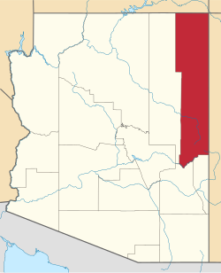
Alpine is a census-designated place in Apache County, Arizona, United States, [1] in Bush Valley in the east central part of the state. As of the 2010 census, it had a population of 145. [3] It is located near the eastern border of the state.

Contents

History

Located approximately 75 miles south of the Navajo Nation, Alpine was settled in 1876 by Anderson Bush, a European-American who built a log house there. He originally used it as a trading post known as "Fort Bush". Bush sold his holdings in 1879 to William Maxwell and Fred Hamblin, Mormon settlers who established the town as a Mormon community. [4] They named the community for its lofty elevation. [5]

The Alpine post office has the ZIP code of 85920. [6]

Geography

Alpine (center of image); Luna Lake, right center. NASA perspective image created by joining Landsat 7 and Digital Elevation Model data. AlpineAZ.jpg
Alpine (center of image); Luna Lake, right center. NASA perspective image created by joining Landsat 7 and Digital Elevation Model data.

Alpine is located at an elevation of 8,050 feet (2,450 m) above sea level in the eastern end of the White Mountains and surrounded by the Apache-Sitgreaves National Forest. Alpine is near the headwaters of the San Francisco River and six miles from the New Mexico border. Alpine is a popular destination for hunting, fishing, and camping. As of 1960, it was the highest place in the United States where farming was successfully conducted. [4]

Demographics

Historical population
CensusPop.Note
1920 147
1930 139−5.4%
1960 300
2010 145
2020 1460.7%
U.S. Decennial Census [7]

Alpine first appeared on the 1900 U.S. Census as the Alpine Precinct of Apache County. 95 residents in 17 households. It also was recorded in 1930. In that census it had a white majority. [8] All county precincts were combined into three districts in 1940. Alpine's population was 165 in 1940. [9] The 1960 census estimated 300 persons. [10] In 2010, it was defined as a census-designated place (CDP).

Climate

Alpine has a warm-summer Mediterranean climate (Köppen Csb) influence by its very high altitude and the North American Monsoon, which brings frequent thunder showers during the summer. Although temperatures are generally comfortable during the daytime, the sun is very intense and at night frosts have occurred even in summer and are an almost daily occurrence from October to May.

Winters are cold, with storms bringing precipitation mostly in the form of snow. Because Alpine is on the eastern end of the Mogollon Rim, it experiences a rain shadow from the White Mountains and receives less snowfall than points west at a similar elevation.

On February 25, 1987, Alpine tied the 24-hour snowfall record for Arizona at 38 inches (96.5 cm); it shares the record with Heber Ranger Station, which first set the record on December 14, 1967. [11]

Climate data for Alpine, Arizona (1991–2020 normals, extremes 1912–present)
MonthJanFebMarAprMayJunJulAugSepOctNovDecYear
Record high °F (°C)72
(22)
72
(22)
74
(23)
79
(26)
92
(33)
94
(34)
94
(34)
89
(32)
87
(31)
86
(30)
77
(25)
72
(22)
94
(34)
Mean maximum °F (°C)57.6
(14.2)
59.4
(15.2)
64.6
(18.1)
70.5
(21.4)
78.2
(25.7)
86.2
(30.1)
86.4
(30.2)
82.4
(28.0)
78.6
(25.9)
73.7
(23.2)
65.6
(18.7)
60.2
(15.7)
87.7
(30.9)
Average high °F (°C)45.6
(7.6)
48.0
(8.9)
53.9
(12.2)
60.6
(15.9)
68.8
(20.4)
78.3
(25.7)
78.5
(25.8)
75.9
(24.4)
71.9
(22.2)
63.8
(17.7)
53.8
(12.1)
46.2
(7.9)
62.1
(16.7)
Daily mean °F (°C)30.5
(−0.8)
33.2
(0.7)
38.2
(3.4)
43.4
(6.3)
50.1
(10.1)
58.4
(14.7)
62.6
(17.0)
61.2
(16.2)
55.5
(13.1)
46.7
(8.2)
37.8
(3.2)
30.9
(−0.6)
45.7
(7.6)
Average low °F (°C)15.3
(−9.3)
18.4
(−7.6)
22.5
(−5.3)
26.2
(−3.2)
31.5
(−0.3)
38.5
(3.6)
46.7
(8.2)
46.4
(8.0)
39.2
(4.0)
29.6
(−1.3)
21.7
(−5.7)
15.7
(−9.1)
29.3
(−1.5)
Mean minimum °F (°C)−3.4
(−19.7)
1.6
(−16.9)
8.4
(−13.1)
14.6
(−9.7)
19.3
(−7.1)
27.2
(−2.7)
38.3
(3.5)
39.6
(4.2)
28.2
(−2.1)
16.3
(−8.7)
6.2
(−14.3)
−2.9
(−19.4)
−8.1
(−22.3)
Record low °F (°C)−32
(−36)
−28
(−33)
−25
(−32)
−6
(−21)
8
(−13)
13
(−11)
27
(−3)
29
(−2)
17
(−8)
−1
(−18)
−18
(−28)
−28
(−33)
−32
(−36)
Average precipitation inches (mm)1.26
(32)
1.13
(29)
0.92
(23)
0.53
(13)
0.71
(18)
0.83
(21)
3.91
(99)
4.31
(109)
2.34
(59)
1.61
(41)
1.16
(29)
1.44
(37)
20.15
(512)
Average snowfall inches (cm)10.7
(27)
9.9
(25)
8.2
(21)
1.7
(4.3)
0.5
(1.3)
0.0
(0.0)
0.0
(0.0)
0.0
(0.0)
0.0
(0.0)
1.3
(3.3)
4.6
(12)
7.9
(20)
44.8
(113.9)
Average precipitation days (≥ 0.01 inch)5.34.74.42.43.84.214.314.97.85.32.84.674.5
Average snowy days (≥ 0.1 inch)3.72.82.31.10.10.00.00.00.00.61.43.115.1
Source 1: NOAA [12]
Source 2: National Weather Service [13]

Government and infrastructure

The U.S. Postal Service operates the Alpine Post Office on U.S. Route 191. [14]

Attractions

Apache-Sitgreaves National Forest, south of Alpine A087, Apache-Sitgreaves National Forest, Alpine, Arizona, USA, 2004.jpg
Apache-Sitgreaves National Forest, south of Alpine

Education

The Alpine Elementary School District, operating Alpine Elementary School, serves Alpine.

The Apache County Library District operates the Alpine Public Library. [16]

See also

Related Research Articles

<span class="mw-page-title-main">Eagar, Arizona</span> Town in Apache County, Arizona

Eagar is a town in Apache County, Arizona, United States. As of the 2010 census, the population of the town was 4,885.

<span class="mw-page-title-main">Lukachukai, Arizona</span> CDP in Apache County, Arizona

Lukachukai is a census-designated place (CDP) in Apache County, Arizona, United States. The population was 1,701 at the 2010 census. It is within the Navajo Nation.

<span class="mw-page-title-main">McNary, Arizona</span> CDP in Apache and Navajo Counties, Arizona

McNary is a census-designated place (CDP) in Apache and Navajo counties in the U.S. state of Arizona, on the Fort Apache Indian Reservation. The population was 528 at the 2010 census. It is a 30-minute drive from Show Low and a 10-minute drive from Pinetop-Lakeside.

<span class="mw-page-title-main">St. Johns, Arizona</span> City in Arizona, United States

St. Johns is the county seat of Apache County, Arizona, United States. It is located along U.S. Route 180, mostly west of where that highway intersects with U.S. Route 191. As of the 2010 census, the population of the city was 3,480.

<span class="mw-page-title-main">Apache Junction, Arizona</span> City in Arizona, United States

Apache Junction is a city in Pinal and Maricopa counties in the state of Arizona. As of the 2020 census, the population was 38,499, most of whom lived in Pinal County. It is named for the junction of the Apache Trail and Old West Highway. The area where Apache Junction is located used to be known as Youngberg. Superstition Mountain, the westernmost peak of the Superstition Mountains, is to the east.

<span class="mw-page-title-main">Cibecue, Arizona</span> Fort Apache Indian Reservation community

Cibecue is a census-designated place (CDP) in Navajo County, Arizona, United States, on the Fort Apache Indian Reservation. The population was 1,713 in the 2010 United States Census.

<span class="mw-page-title-main">Heber-Overgaard, Arizona</span> CDP in Navajo County, Arizona

Heber-Overgaard is a census-designated place (CDP) in Navajo County, Arizona, United States. Situated atop the Mogollon Rim, the community lies at an elevation of 6,627 feet (2,020 m). The population was 2,898 at the 2020 census. Heber and Overgaard are technically two unincorporated communities, but as of the 1990 census, their proximity led to the merged name of "Heber-Overgaard".

<span class="mw-page-title-main">Whiteriver, Arizona</span> Census designated place in Arizona, United States

Whiteriver is a census-designated place (CDP) located on the Fort Apache Indian Reservation in Navajo County, Arizona, United States. The population was 4,104 at the 2010 census, making it the largest settlement on the Reservation.

<span class="mw-page-title-main">Ajo, Arizona</span> Community in Pima County, Arizona

Ajo is an unincorporated community in Pima County, Arizona, United States. It is the closest community to Organ Pipe Cactus National Monument. The population was 3,304 at the 2010 census. Ajo is located on State Route 85 just 43 miles (69 km) from the Mexican border.

<span class="mw-page-title-main">White Mountains (Arizona)</span> Mountain range in eastern Arizona

The White Mountains of Arizona is a mountain range and mountainous region in the eastern part of the state, near the border with New Mexico; it is a continuation from the west of the Arizona transition zone–Mogollon Rim, with the Rim ending in western New Mexico. The White Mountains are a part of the Colorado Plateau high country of Northeast Arizona, the Navajo Nation, with the rest of the Plateau in eastern Utah, northwest New Mexico, and southwestern Colorado. Nearby communities include Show Low, Pinetop-Lakeside, Greer, St. Johns, Springerville, Eagar, and McNary. Much of the range is within the Fort Apache Indian Reservation.

<span class="mw-page-title-main">Apache–Sitgreaves National Forests</span> Protected areas in Arizona and New Mexico

The Apache–Sitgreaves National Forests is a 2.76-million-acre (11,169 km2) United States National Forest which runs along the Mogollon Rim and the White Mountains in east-central Arizona and into the U.S. state of New Mexico. Formerly two forests, it is currently managed as one unit by USDA Forest Service from the Forest Supervisors Office in Springerville, Arizona. Apache–Sitgreaves has over 400 species of wildlife. With its high elevation and cool summer breezes it is a popular weekend destination from the hot desert for Phoenix, Arizona, residents. The forest is divided into 5 Ranger Districts that span almost 300 miles (480 km) from Clifton, Arizona in the east-central portion of Arizona to the eastern boundary of the Coconino National Forest in north-central Arizona. The Apache–Sitgreaves National Forest borders the western and northern borders of the Fort Apache Indian Reservation. It is located in parts of Greenlee, Apache, Navajo, and Coconino counties in eastern and east-central Arizona, and Catron County in western New Mexico. The more northwesterly Sitgreaves National Forest portion lies adjacent to the north side of the Fort Apache Indian Reservation and is located entirely in Arizona, within Navajo, Apache, and Coconino counties. It has a total area of 818,651 acres (3,313 km2). The more southeasterly and much larger Apache National Forest portion lies adjacent to the east side of the Fort Apache and the San Carlos Indian Reservations. It lies on both sides of the border with New Mexico, in Greenlee, Catron, and Apache counties. It has a total area of 1,813,601 acres (7,339 km2).

<span class="mw-page-title-main">Greer, Arizona</span> CDP in Apache County, Arizona

Greer is an unincorporated community and census-designated place in Apache County, Arizona, United States. Located within the White Mountains of Arizona and surrounded by the Apache-Sitgreaves National Forest, Greer is the highest town in the state at an elevation of approximately 8,400 feet. As of the 2020 census it had a population of 58. Greer was founded circa 1879 by Mormon settlers from Utah. The Greer post office has the ZIP code of 85927.

<span class="mw-page-title-main">Summerhaven, Arizona</span> CDP in Pima County, Arizona

Summerhaven is a small unincorporated community and census-designated place (CDP) on Mount Lemmon in the Santa Catalina Mountains north of Tucson in Pima County, Arizona, United States. As of the 2010 census it had a permanent population of 40. Summerhaven sits at an elevation of approximately 7,600 to 8,200 feet above sea level. Summerhaven is accessed via the Catalina Highway from suburban northeast Tucson, and it is about 24.5 miles (39.4 km) from the base of the mountains to Summerhaven.

<span class="mw-page-title-main">Mount Baldy (Arizona)</span> Mountain in Apache County, Arizona, United States

Mount Baldy is an extinct stratovolcano in eastern Arizona in the United States. With a summit elevation of 11,409 feet (3,477 m), the peak of Mount Baldy rises above the tree line and is left largely bare of vegetation, lending the mountain its current name. The Mount Baldy Wilderness occupies the eastern slope of the mountain and is managed by the Apache-Sitgreaves National Forest.

<span class="mw-page-title-main">Cooke City, Montana</span> Census-designated place in Montana, United States

Cooke City is an unincorporated community and census-designated place (CDP) in Park County, Montana, United States. As of the 2020 census, it had a population of 77. Prior to 2010, it was part of the Cooke City-Silver Gate CDP.

<span class="mw-page-title-main">Bylas, Arizona</span> CDP in Graham County, Arizona

Bylas is an unincorporated community and census-designated place in Graham County, Arizona, United States, located within the San Carlos Apache Indian Reservation. As of the 2010 census, its population was 1,962. The community has a medical clinic, a police substation, and a market. Bylas is an Apache settlement divided into two communities, one of the White Mountain Apache, the other of San Carlos and Southern Tonto Apache. It is named for Bylas a chief of the Eastern White Mountain Apache band.

<span class="mw-page-title-main">Concho, Arizona</span> CDP in Apache County, Arizona

Concho is an unincorporated community and census-designated place (CDP) in Apache County, Arizona, United States. Concho is located on Arizona State Route 61, 14 miles (23 km) west of St. Johns. Concho was the original site for the state capital, due to its prosperous farming. As of the 2010 census, the Concho CDP had a population of 38.

Roosevelt is a census-designated place (CDP) in Gila County, Arizona, United States. The population was 28 at the 2010 census.

Klagetoh is a census-designated place (CDP) in Apache County, Arizona, United States. The population was 242 at the 2010 census.

<span class="mw-page-title-main">Haigler Creek, Arizona</span> CDP in Gila County, Arizona

Haigler Creek is an unincorporated community and census-designated place (CDP) in northern Gila County, Arizona, United States. It lies at an elevation of 5,240 feet and is surrounded by the Tonto National Forest. As of the 2020 census, Haigler Creek had a population of 39 people.

References

  1. 1 2 3 4 U.S. Geological Survey Geographic Names Information System: Alpine, Arizona
  2. "2020 U.S. Gazetteer Files". United States Census Bureau. Retrieved October 29, 2021.
  3. "Geographic Identifiers: 2010 Demographic Profile Data (G001): Alpine CDP, Arizona". U.S. Census Bureau, American Factfinder. Archived from the original on February 12, 2020. Retrieved April 17, 2013.
  4. 1 2 Byrd H. Granger (1960). Arizona Place Names . University of Arizona Press. p.  3 . Retrieved November 20, 2011.
  5. The Utah Genealogical and Historical Magazine, Volumes 9-10. 1918. p. 9.
  6. Zip Code Lookup Archived June 15, 2011, at the Wayback Machine
  7. "Census of Population and Housing". Census.gov. Retrieved June 4, 2016.
  8. "Population" (PDF). Fifteenth Census of the United States. Bureau of the Census. 1930.
  9. The Attorneys List. United States Fidelity and Guaranty Company, Attorney List Department. 1940. p. 85.
  10. "Arizona". World Book Encyclopedia. Vol. A. Chicago: Field Enterprises Educational Corporation. 1960. p. 557.
  11. "State Climate Extremes Committee Records".
  12. "U.S. Climate Normals Quick Access". National Oceanic and Atmospheric Administration. Retrieved October 11, 2022.
  13. "NOAA Online Weather Data". National Weather Service. Retrieved October 11, 2022.
  14. "Post Office™ Location – ALPINE Archived August 26, 2012, at the Wayback Machine ." U.S. Postal Service. Retrieved on January 30, 2011.
  15. "Coronado Trail Scenic Byway".
  16. "Alpine Public Library Archived August 13, 2010, at the Wayback Machine ." Apache County Library District. Retrieved on January 30, 2011.