Hotevilla-Bacavi, Arizona

Last updated

Hotevilla-Bacavi, Arizona
CDP
Navajo County Incorporated and Unincorporated areas Hotevilla-Bacavi highlighted.svg
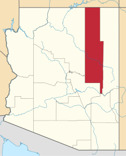
Location in Navajo County and the state of Arizona
USA Arizona location map.svg
Red pog.svg
Hotevilla-Bacavi
Location in Arizona#Location in the United States
Usa edcp location map.svg
Red pog.svg
Hotevilla-Bacavi
Hotevilla-Bacavi (the United States)
Coordinates: 35°54′50″N110°38′26″W / 35.91389°N 110.64056°W / 35.91389; -110.64056
CountryFlag of the United States (23px).png  United States
State Flag of Arizona.svg  Arizona
County Navajo
Area
[1]
  Total11.76 sq mi (30.45 km2)
  Land11.75 sq mi (30.44 km2)
  Water0.00 sq mi (0.01 km2)
Elevation
[2]
6,270 ft (1,910 m)
Population
 (2020)
  Total1,001
  Density85.18/sq mi (32.89/km2)
Time zone UTC-7 (MST)
ZIP code
86030 [3]
Area code 928
FIPS code 04-33945
GNIS feature ID2408402 [2]

Hotevilla-Bacavi (Hopi: Hotvela-Paaqavi; also known as Third Mesa) is a census-designated place (CDP) in Navajo County, Arizona, United States, on the Hopi Reservation. The population was 957 at the 2010 census.

Contents

History

Hotevilla was first settled by the "hostiles", a group of Hopi residents who were forced out of nearby Oraibi in the 1906 Oraibi Split due to ideological differences over European cultural influences by recently arrived settlers, soldiers and missionaries, influences against which the hostiles were opposed. Later attempts to reintegrate displaced residents resulted in another split to the settlement of Bacavi, which later joined with Hotevilla to create a unified settlement. [4] Hotevilla is mentioned by D. H. Lawrence in his Mornings in Mexico travel memoir. The English author visited Hotevilla and Hopi country in 1924. [5]

Geography

According to the United States Census Bureau, the CDP has a total area of 11.9 square miles (31 km2), all land.

Demographics

Historical population
CensusPop.Note
2000 767
2010 95724.8%
2020 1,0014.6%
U.S. Decennial Census [6]
Languages (2000) [7] Percent
Spoke Hopi at home79.4%
Spoke English at home20.6%

At the 2000 census there were 767 people, 246 households, and 181 families in the CDP. The population density was 64.4 inhabitants per square mile (24.9/km2). There were 331 housing units at an average density of 27.8 per square mile (10.7/km2). The racial makeup of the CDP was 96.0% Native American, 3.8% White, and 0.2% from two or more races. 1.0% of the population were Hispanic or Latino of any race. [8] Of the 246 households 34.6% had children under the age of 18 living with them, 41.1% were married couples living together, 28.9% had a female householder with no husband present, and 26.4% were non-families. 24.4% of households were one person and 8.9% were one person aged 65 or older. The average household size was 3.12 and the average family size was 3.72.

The age distribution was 31.0% under the age of 18, 9.0% from 18 to 24, 24.8% from 25 to 44, 22.7% from 45 to 64, and 12.5% 65 or older. The median age was 35 years. For every 100 females, there were 90.8 males. For every 100 females age 18 and over, there were 83.0 males.

The median household income was $13,750 and the median family income was $18,500. Males had a median income of $12,174 versus $19,095 for females. The per capita income for the CDP was $5,975. About 58.9% of families and 69.4% of the population were below the poverty line, including 78.2% of those under age 18 and 41.4% of those age 65 or over.

Education

Hotevilla-Bacavi is a part of the Cedar Unified School District. White Cone High School serves Hotevilla-Bacavi.

Notable people

Related Research Articles

<span class="mw-page-title-main">Moenkopi, Arizona</span> Community in Coconino County, Arizona

Moenkopi is a census-designated place (CDP) in Coconino County, Arizona, United States, adjacent to the southeast side of Tuba City off U.S. Route 160. The population was 964 at the 2010 census.

<span class="mw-page-title-main">Mountainaire, Arizona</span> CDP in Coconino County, Arizona

Mountainaire is a census-designated place (CDP) in Coconino County, Arizona, United States. The population was 1,119 at the 2010 census.

<span class="mw-page-title-main">Winslow West, Arizona</span> CDP in Coconino County, Arizona

Winslow West is a census-designated place (CDP) in Coconino and Navajo counties in Arizona, United States. The population was 438 at the 2010 census. The entire community is off-reservation trust land belonging to the Hopi Tribe of Arizona. It lies just west of the city of Winslow, and is more than 50 km (31 mi) south of the main Hopi Reservation.

<span class="mw-page-title-main">Mesquite Creek, Arizona</span> CDP in Mohave County, Arizona

Mesquite Creek is an unincorporated community and census-designated place (CDP) in Mohave County, Arizona, United States. The population was 403 at the 2020 census.

<span class="mw-page-title-main">First Mesa, Arizona</span> CDP in Navajo County, Arizona

First Mesa is a census-designated place (CDP) in Navajo County, Arizona, United States, on the Hopi Reservation. As of the 2010 census, the CDP population was 1,555, spread among three Hopi villages atop the 5,700-foot mesa: Hano, Sitsomovi, and Waalpi.

<span class="mw-page-title-main">Jeddito, Arizona</span> CDP in Navajo County, Arizona

Jeddito is a census-designated place (CDP) in Navajo County, Arizona, United States. The population was 293 at the 2010 census.

<span class="mw-page-title-main">Keams Canyon, Arizona</span> CDP in Navajo County, Arizona

Keams Canyon is a census-designated place (CDP) in Navajo County, Arizona, United States, on the Hopi Reservation. The population was 304 at the 2010 census.

<span class="mw-page-title-main">Kykotsmovi Village, Arizona</span> CDP in Navajo County, Arizona

Kykotsmovi Village, also known as K-Town or New Oraibi is a census-designated place (CDP) in Navajo County, Arizona, United States. It is the seat of tribal government of the Hopi Reservation, a sovereign nation located in northeastern Arizona. The Hopi word is spelled Kiqötsmovi and means "mound of ruined houses". The population was 776 at the 2000 census. The Hopi reservation occupies part of Coconino and Navajo counties, encompasses more than 1.5 million acres, and is made up of 12 villages on three mesas. Kykotsmovi is one of the 12 villages located in third mesa. Third Mesa includes Hotvela (Hotevilla), Paaqavi (Bacavi), Munqapi (Moencopi), Kiqotsmovi (Kykotsmovi), and Orayvi (Oraibi).

<span class="mw-page-title-main">Pinon, Arizona</span> Place in Arizona, United States

Pinon is a census-designated place (CDP) in Navajo County, Arizona, United States, and located in the Navajo Nation. The population was 904 at the 2010 census.

<span class="mw-page-title-main">Second Mesa, Arizona</span> CDP in Navajo County, Arizona

Second Mesa is a census-designated place (CDP) in Navajo County, Arizona, on the Hopi Reservation, atop the 5,700-foot mesa. As of the 2020 census, the CDP population was 843, spread among three Hopi Indian villages, Musungnuvi, Supawlavi, and Songoopavi. The Hopi Cultural Center is on Second Mesa.

<span class="mw-page-title-main">Shongopovi, Arizona</span> CDP in Navajo County, Arizona

Shongopovi is a census-designated place (CDP) in Navajo County, Arizona, United States. It is located on the Second Mesa, within the Hopi Reservation.

<span class="mw-page-title-main">Thermalito, California</span> Census designated place in California, United States

Thermalito is a census-designated place (CDP) in Butte County, California, United States. The population was 6,646 at the 2010 census, up from 6,045 at the 2000 census. The area is generally considered an integral part of Oroville, and borders the town on two sides, in addition to the near-enclave of the city of Oroville surrounded by Thermalito on all sides, with the exception of the extremely narrow spit of land connecting Afterbay to Oroville proper.

<span class="mw-page-title-main">Meadow Vista, California</span> Census-designated place in California, United States

Meadow Vista is a census-designated place (CDP) in Placer County, California, United States. It is part of the Sacramento–Arden-Arcade–Roseville Metropolitan Statistical Area. The population was 3,217 at the 2010 census, up from 3,096 at the 2000 census.

<span class="mw-page-title-main">Ramblewood, New Jersey</span> Populated place in Burlington County, New Jersey, US

Ramblewood is an unincorporated community and census-designated place (CDP) located within Mount Laurel in Burlington County, in the U.S. state of New Jersey. As of the 2010 United States Census, the CDP's population was 5,907.

Flat Rock is a census-designated place (CDP) in Surry County, North Carolina, United States. The name "Flat Rock" stems from the community's granite quarry. The granite quarry is the largest open-face granite quarry in the world, and has been mined continuously since 1889 by the North Carolina Granite Corporation.

<span class="mw-page-title-main">Northbrook, Ohio</span> Census-designated place in Ohio, United States

Northbrook is a census-designated place (CDP) in Hamilton County, Ohio, United States. The population was 10,912 at the 2020 census.

<span class="mw-page-title-main">Northgate, Ohio</span> Census-designated place in Ohio, United States

Northgate is a census-designated place (CDP) in Colerain Township, Hamilton County, Ohio, United States. The population was 7,277 at the 2020 census.

<span class="mw-page-title-main">Sherwood, Hamilton County, Ohio</span> Census-designated place in Ohio, United States

Sherwood is a census-designated place (CDP) in Hamilton County, Ohio, United States. The population was 3,633 at the 2020 census.

<span class="mw-page-title-main">Mallory, West Virginia</span> Census-designated place in West Virginia, United States

Mallory is a census-designated place (CDP) in Logan County, West Virginia, United States. The population was 1,654 at the 2010 census. The CDP contains the unincorporated communities, from west to east, of Huff Junction, Mallory, Davin, Mineral City, Claypool, Combs Addition, and Gillman Bottom.

<span class="mw-page-title-main">Piney View, West Virginia</span> Census-designated place in West Virginia, United States

Piney View is a census-designated place (CDP) in Raleigh County, West Virginia, United States. The population was 989 at the 2010 census.

References

  1. "2020 U.S. Gazetteer Files". United States Census Bureau. Retrieved October 29, 2021.
  2. 1 2 U.S. Geological Survey Geographic Names Information System: Hotevilla-Bacavi, Arizona
  3. "Hotevilla ZIP Code". zipdatamaps.com. 2022. Retrieved November 11, 2022.
  4. Weir, Bill (2008). The National Geographic traveler. Washington, D.C: National Geographic. p. 87. ISBN   9781426202285.
  5. Lawrence, D. H. (1927). Mornings in Mexico. London: Martin Secker. p. 72. ISBN   0434407186.
  6. "Census of Population and Housing". Census.gov. Retrieved June 4, 2016.
  7. "Data Center Results".
  8. "U.S. Census website". United States Census Bureau . Retrieved January 31, 2008.