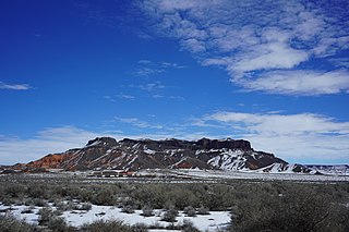
The Hopi are Native Americans who primarily live in the southwestern United States. The majority are enrolled in the Hopi Tribe of Arizona and live on the Hopi Reservation in northeastern Arizona; however, some Hopi people are enrolled in the Colorado River Indian Tribes of the Colorado River Indian Reservation at the border of Arizona and California.

Sun Valley is a populated place in Navajo County, Arizona, United States, east of Holbrook along Interstate 40. It is located at 34°58′50″N110°3′29″W in the Painted Desert and covers an area of 31.6 square miles.

The Awatovi Ruins, spelled Awat'ovi in recent literature, are an archaeological site on the Hopi Reservation in northeastern Arizona, United States. The site contains the ruins of a pueblo estimated to be 500 years old, as well as those of a 17th-century Spanish mission. It was visited in the 16th century by members of Francisco Vázquez de Coronado's exploratory expedition. In the 1930s, Hopi artist Fred Kabotie was commissioned by the Peabody Museum of Archaeology and Ethnology of Harvard University to reproduce the prehistoric murals found during the excavation of the Awatovi Ruins. The site was designated a National Historic Landmark in 1964.

Fred Kabotie was a celebrated Hopi painter, silversmith, illustrator, potter, author, curator and educator. His native name in the Hopi language is Naqavoy'ma which translates to Day After Day.

John Otis Brew, was an American archaeologist of the American Southwest and director at the Peabody Museum at Harvard University. Many of his publications are still used today by archaeologists that conduct their work in the American Southwest. J.O. Brew was a titan in the world of archaeology for his attempts to "preserve our archaeological heritage".
Aripine is a populated place situated in Navajo County, Arizona, United States. It has an estimated elevation of 6,427 feet (1,959 m) above sea level.

Bidahochi is a populated place situated in Navajo County, Arizona, United States. It has an estimated elevation of 5,758 feet (1,755 m) above sea level. The nearby Bidahochi Formation was named for Bidahochi.
Burton is a populated place situated in Navajo County, Arizona, United States. It has an estimated elevation of 6,109 feet (1,862 m) above sea level.
Castle Butte is a populated place situated in Navajo County, Arizona, United States. It has an estimated elevation of 5,807 feet (1,770 m) above sea level.
Hidden Springs is a populated place situated in Coconino County, Arizona, United States, located on U.S. 89 approximately 75 miles north of Flagstaff. It has an estimated elevation of 4,819 feet (1,469 m) above sea level. The San Juan Southern Paiute Tribe of Arizona is located there.
Kinlichee, also known historically as Kin Li Chee, Kin-Li-Chee, or Kin-li-Chee, is a populated place situated in Apache County, Arizona, United States, six miles north-northeast of Ganado. The current name was officially recognized as a result of a decision by the Board on Geographic Names in 1983. It has an estimated elevation of 6,660 feet (2,030 m) above sea level. The name is derived from the Navajo kin dah lichi'i, which means "red house up at an elevation".
Manila is a populated place situated in Navajo County, Arizona, United States. Its name was bestowed during the Spanish–American War, being named after the Philippines' capital, and has an estimated elevation of 4,954 feet (1,510 m) above sea level.
Navajo is a populated place situated in Apache County, Arizona, United States. It has an estimated elevation of 5,676 feet (1,730 m) above sea level.

Shumway, also known as Shumay, is a populated place situated in Navajo County, Arizona. It was named after Charles Shumway, a member of the Church of Jesus Christ of Latter-day Saints, who settled the location. It has an estimated elevation of 5,695 feet (1,736 m) above sea level.
Tes Nez Iah is a populated place situated in the far north of Apache County, Arizona, United States, just south of the Utah border. It is along the banks of the Chinle Creek, approximately four miles west of Mexican Water. It has an estimated elevation of 4,751 feet (1,448 m) above sea level. The name is derived from the Navajo t'iis nééz íí'á, meaning "tall cottonwood trees".
Tolchico, also known as Tolchaco or Tolchiko, is a populated place situated in Coconino County, Arizona, United States. Tolchico is derived from tolchiko, which is the Navajo term for the Colorado River. The name became official as a result of a Board on Geographic Names decision in April 1915. It has an estimated elevation of 4,669 feet (1,423 m) above sea level.
Twin Buttes is a populated place situated in Navajo County, Arizona, United States. It is one of two populated locations in Arizona with this name, the other being in Pima County. It has an estimated elevation of 5,794 feet (1,766 m) above sea level.
Wepo Village is a populated place situated in Navajo County, Arizona, United States. It has an estimated elevation of 5,784 feet (1,763 m) above sea level. Located 5 miles north of Walpi, it is within the boundaries of the Hopi Reservation The name comes from the Hopi word for "onion".
Wheatfields is a populated place situated in Apache County, Arizona, United States, right along the border with New Mexico. It has an estimated elevation of 7,287 feet (2,221 m) above sea level. It is one of two places in Arizona with this name, the other being a CDP in Gila County. In 1909, the US Government set up an irrigation project to assist the Navajo residents. It is a chapter of the Navajo Nation.
Samuel Watson Smith was an American archaeologist and researcher on the indigenous cultures and artifacts of the western Anasazi area.


