Chloride, Arizona | |
|---|---|
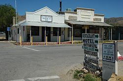 Chloride town center | |
 Location in Mohave County, Arizona | |
 Chloride  Chloride | |
| Coordinates: 35°24′35″N114°11′50″W / 35.40972°N 114.19722°W | |
| Country | United States |
| State | Arizona |
| County | Mohave |
| Founded | 1863 |
| Area | |
• Total | 1.51 sq mi (3.90 km2) |
| • Land | 1.51 sq mi (3.90 km2) |
| • Water | 0 sq mi (0.00 km2) |
| Elevation | 4,009 ft (1,222 m) |
| Population | |
• Total | 229 |
| • Density | 152.0/sq mi (58.67/km2) |
| Time zone | UTC-7 (MST (no DST)) |
| ZIP code | 86431 |
| FIPS code | 04-12910 |
| GNIS feature ID | 2582754 [2] |
Chloride is a one-time silver mining camp in Mohave County, Arizona, United States, and is considered the oldest continuously inhabited mining town in the state. [4] The town is a census-designated place (CDP), with a population at the 2020 census of 229. [3] Chloride has a ZIP Code of 86431.
Contents
The town is located on the southwest flank of the Cerbat Mountains, 23 miles (37 km) northwest of Kingman, the Mohave county seat. Grasshopper Junction is 4 miles (6 km) to the west on U.S. Route 93. [5]


