Walnut Creek, Arizona

Last updated

Walnut Creek, Arizona
Mohave County Arizona Incorporated and Unincorporated areas Walnut Creek Highlighted 0480825.svg
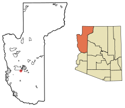
Location in Mohave County, Arizona
USA Arizona location map.svg
Red pog.svg
Walnut Creek
Usa edcp location map.svg
Red pog.svg
Walnut Creek
Coordinates: 35°07′42″N114°07′36″W / 35.12833°N 114.12667°W / 35.12833; -114.12667
Country United States
State Arizona
County Mohave
Area
[1]
  Total
1.53 sq mi (3.97 km2)
  Land1.53 sq mi (3.97 km2)
  Water0.00 sq mi (0.00 km2)
Elevation
[2]
2,782 ft (848 m)
Population
 (2020) [3]
  Total
571
  Density372.23/sq mi (143.70/km2)
Time zone UTC-7 (MST (no DST))
ZIP code
86413 [4]
Area code 928
FIPS code 04-80825
GNIS feature ID2582896 [2]

Walnut Creek is an unincorporated community and census-designated place (CDP) in Mohave County, in the U.S. state of Arizona. [2] The population was 571 at the 2020 census. [3]

Contents

Geography

Walnut Creek is in central Mohave County, 6 miles (10 km) southwest of Kingman, the county seat. Interstate 40 passes to the east of the community, with access from Exit 44. County Route 10 (Oatman Highway) is the main road through the CDP.

Climate

Climate data for Walnut Creek, Arizona (1991–2020)
MonthJanFebMarAprMayJunJulAugSepOctNovDecYear
Mean daily maximum °F (°C)53.9
(12.2)
57.9
(14.4)
65.1
(18.4)
72.0
(22.2)
79.6
(26.4)
89.2
(31.8)
91.6
(33.1)
89.5
(31.9)
84.7
(29.3)
74.6
(23.7)
62.5
(16.9)
52.5
(11.4)
72.8
(22.6)
Daily mean °F (°C)37.9
(3.3)
40.8
(4.9)
46.0
(7.8)
51.4
(10.8)
58.5
(14.7)
66.8
(19.3)
73.1
(22.8)
71.7
(22.1)
65.3
(18.5)
54.6
(12.6)
43.9
(6.6)
36.6
(2.6)
53.9
(12.2)
Mean daily minimum °F (°C)21.9
(−5.6)
23.6
(−4.7)
26.9
(−2.8)
30.9
(−0.6)
37.5
(3.1)
44.4
(6.9)
54.6
(12.6)
53.9
(12.2)
46.0
(7.8)
34.7
(1.5)
25.3
(−3.7)
20.8
(−6.2)
35.0
(1.7)
Average precipitation inches (mm)1.51
(38)
1.86
(47)
1.15
(29)
0.56
(14)
0.40
(10)
0.25
(6.4)
1.84
(47)
2.57
(65)
1.50
(38)
1.00
(25)
0.89
(23)
1.23
(31)
14.76
(373.4)
Average snowfall inches (cm)0.3
(0.76)
1.8
(4.6)
1.0
(2.5)
0.5
(1.3)
0.0
(0.0)
0.0
(0.0)
0.0
(0.0)
0.0
(0.0)
0.0
(0.0)
0.0
(0.0)
0.3
(0.76)
1.6
(4.1)
5.5
(14.02)
Source: NOAA [5]

Demographics

Historical population
CensusPop.Note
2010 562
2020 5711.6%
U.S. Decennial Census [6]

Education

The CDP is in the Kingman Unified School District. [7]

References

  1. "2021 U.S. Gazetteer Files: Arizona". United States Census Bureau. Retrieved May 26, 2022.
  2. 1 2 3 U.S. Geological Survey Geographic Names Information System: Walnut Creek, Arizona
  3. 1 2 "P1. Race – Walnut Creek CDP, Arizona: 2020 DEC Redistricting Data (PL 94-171)". U.S. Census Bureau. Retrieved May 26, 2022.
  4. "Walnut Creek AZ ZIP Code". zipdatamaps.com. 2023. Retrieved May 3, 2023.
  5. "NOAA NCEI U.S. Climate Normals Quick Access". NOAA. Retrieved March 28, 2025.
  6. "Census of Population and Housing". Census.gov. Retrieved June 4, 2016.
  7. "2020 CENSUS - SCHOOL DISTRICT REFERENCE MAP: Mohave County, AZ" (PDF). U.S. Census Bureau. p. 3 (PDF p. 4/4). Retrieved October 4, 2024. - Text list