Related Research Articles

Mohave County is in the northwestern corner of the U.S. state of Arizona. As of the 2010 census, its population was 200,186. The county seat is Kingman, and the largest city is Lake Havasu City. It is the fifth largest county in the United States.

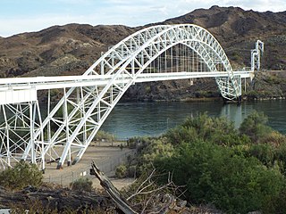
Parker Strip is a census-designated place (CDP) in La Paz County, Arizona, United States. The population was 662 at the 2010 census.

The Mohave Valley is a valley located mostly on the east shore of the south-flowing Colorado River in northwest Arizona. The valley extends into California's San Bernardino County; the northern side of the valley extends into extreme southeast Clark County, Nevada. The main part of the valley lies in southwest Mohave County, Arizona and is at the intersection of the southeast Mojave and northwest Sonoran deserts.
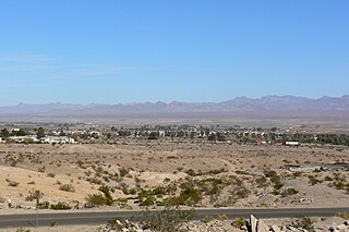
Topock ( ) is a small unincorporated community in Mohave County, Arizona, United States. Topock has a ZIP Code of 86436; in 2010, the population of the 86436 ZCTA was 2,104.
The Black Mountains of northwest Arizona are an extensive, mostly linear, north-south trending 75 miles (121 km) long mountain range. It forms the north-south border of southwest Mohave County as it borders the eastern shore of the south-flowing Colorado River from Hoover Dam.

Castle Dome Landing, Arizona is a ghost town in the Castle Dome Mountains of Yuma County in the U.S. state of Arizona. It was first settled as a transport depot and mining camp around 1863 in what was then the Arizona Territory.

Aubrey Landing, Aubrey City or Aubrey is a ghost town at the mouth of the Bill Williams River in southern Mohave County, Arizona, United States. The town was founded before 1865 and was abandoned sometime after 1886. Aubrey Landing was inundated when Lake Havasu was formed.
Dutch Flat of Arizona is a valley south of the Sacramento Valley and Interstate 40 in southern Mohave County.

Port Isabel was a seaport established on Port Isabel Slough in 1865 during the American Civil War in Sonora, Mexico in the mouth of the Colorado River on the Gulf of California. It was founded to support the increased river traffic caused by the gold rush that began in 1862 on the Colorado River and the Yuma Quartermaster Depot newly established in 1864 to support the Army posts in the Arizona Military District. The slough was discovered in 1865 by the Captain W. H. Pierson of the schooner Isabel, that first used the slough to transfer its cargo to steamboats safe from the tidal bore of the Colorado River. Shortly afterward Port Isabel was established 3 miles up the slough and replaced Robinson's Landing as the place where cargo was unloaded in the river from seagoing craft on to flat bottomed steamboats of the Colorado River and carried up to Fort Yuma and points further north on the river.

Callville is a former settlement of Clark County in the U.S. state of Nevada. Abandoned in 1869, it was submerged under Lake Mead when the Colorado River was dammed, Callville Bay retaining the name. At one time, it was noted to be the southernmost outpost of the Mormon settlement.

Steamboats on the Colorado River operated from the river mouth at the Colorado River Delta on the Gulf of California in Mexico, up to the Virgin River on the Lower Colorado River Valley in the Southwestern United States from 1852 until 1909, when the construction of the Laguna Dam was completed. The shallow draft paddle steamers were found to be the most economical way to ship goods between the Pacific Ocean ports and settlements and mines along the lower river, putting in at landings in Sonora state, Baja California Territory, California state, Arizona Territory, New Mexico Territory, and Nevada state. They remained the primary means of transportation of freight until the advent of the more economical railroads began cutting away at their business from 1878 when the first line entered Arizona Territory.
General Jesup was a side-wheel paddle-steamer, named for General Thomas Jesup then Quartermaster General of the United States Army, and was the second steamboat launched on the Colorado River, in 1854.
Mohave was the first stern-wheel steamboat of that name running on the Colorado River between 1864 and 1875.
Colorado City is now a ghost town, in Clark County, Nevada, located under Lake Mohave at the mouth of El Dorado Canyon.
Drift Desert is a former ranch and steamboat landing on the Colorado River, now a ghost town, in La Paz County, Arizona.
George A. Johnson & Company was a partnership between three men who pioneered navigation on the Colorado River. Benjamin M. Hartshorne, George Alonzo Johnson and Alfred H. Wilcox. The George A. Johnson & Company was formed in the fall of 1852, and was reorganized as the Colorado Steam Navigation Company in 1869.
Iretaba City was a short lived steamboat landing and mining town in Mohave County, Arizona, United States.
Clip, or Clip Landing, was a steamboat landing and mill settlement in Yuma County, Arizona Territory. The site in the present day is a ghost town, on the east bank of the Colorado River in La Paz County, Arizona. The settlement was located 70 miles up river from Yuma. It lies at an elevation of 223 feet, just south of Clip Wash, and the road to the Clip Mine at the top of the wash, 8 miles southeast of the mill.
Norton's Landing or Norton's, was a steamboat landing on the Colorado River, in what was then Yuma County, Arizona Territory. Today it is in La Paz County, Arizona. Nortons Landing is 52 miles upriver from Yuma, Arizona 4 miles above Picacho, California and 18 miles below the Clip, Arizona landing. It lays on a rocky point of land next to the river at 215 feet of elevation just east of Red Cloud Wash and Black Rock Wash, where roads to the district mines in the mountains, met the Colorado River.
Port Isabel Slough was a deep slough in the Colorado River Delta near the mouth of the Colorado River during the 19th century, within the state of Sonora, Mexico.
References
- ↑ Richard E. Lingenfelter, Steamboats on the Colorado River, 1852–1916, University of Arizona Press, Tucson, 1978, pp. 34, 68, 168 Archived 2016-01-18 at the Wayback Machine
- ↑ Arizona Sentinel (Yuma), 30 Aug. 1873, pp. 3, 5; Editorial Correspondence, Aug. 19–20, 1873
- ↑ Parker [Arizona, California] 1:125,000 1909 from lib.utexas.edu accessed August 31, 2016

![Parker [Arizona, California] 1:125,000 1909](http://www.lib.utexas.edu/maps/topo/arizona/pclmaps-topo-az-parker-1909.jpg)
Coordinates: 34°28′41″N114°22′42″W / 34.47806°N 114.37833°W
| | This United States ghost town-related article is a stub. You can help Wikipedia by expanding it. |