Powell, Arizona

Last updated
Powell, Arizona
USA Arizona location map.svg
Red pog.svg
Powell
Usa edcp location map.svg
Red pog.svg
Powell
Coordinates: 34°44′14″N114°22′37″W / 34.73722°N 114.37694°W / 34.73722; -114.37694 Coordinates: 34°44′14″N114°22′37″W / 34.73722°N 114.37694°W / 34.73722; -114.37694 [1]
Country United States
State Arizona
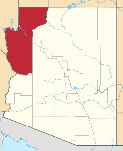
County Mohave
Founded1883
Time zone UTC-7 (MST (no DST))

Powell was a railroad station and settlement in Mohave County, Arizona, United States from 1883 to 1890.

Contents

History

Powell was a station on the Atlantic and Pacific Railroad, at the point where the railroad began crossing the lower Mohave Valley to the Colorado River bridge at the station at Eastbridge, Arizona southeast of Needles, California. [2] It had a post office from October 11, 1883 until it was discontinued July 9, 1886, in favor of Mohave City. [3] From 1903 to 1909 Mellen had its own post office. [4] :120

The bridge across the Colorado River constructed at Eastbridge station in 1883 was washed out or undermined by the spring flooding of the river in 1884, 1886 and 1888. Finally they changed the railroad route southward Beal to Mellen, where from 1889 to May 1890 they built the Red Rock Bridge, a cantilever bridge, on rock foundations, unlike the previous site. The section of track between where the line changed direction to the new bridge, to the station of Powell and the bridge and station at Eastbridge, was abandoned in 1890. [5] :82

The site today

The site of Powell lies under the waters of Goose Lake in Topock Marsh near where the remnant of the old rail bed descends into the waters of the marsh.

Related Research Articles

Mohave County, Arizona County in Arizona, United States

Mohave County is in the northwestern corner of the U.S. state of Arizona. As of the 2020 census, its population was 213,267. The county seat is Kingman, and the largest city is Lake Havasu City. It is the fifth largest county in the United States.

Bullhead City, Arizona City in Mohave County, Arizona

Bullhead City is a city located on the Colorado River in Mohave County, Arizona, United States, 97 miles (156 km) south of Las Vegas, Nevada, and directly across the Colorado River from Laughlin, Nevada, whose casinos and ancillary services supply much of the employment for Bullhead City. Bullhead City is located at the southern end of Lake Mohave.

Kingman, Arizona City in Arizona, United States

Kingman is a city in, and the county seat of, Mohave County, Arizona, United States. It is named after Lewis Kingman, a civil engineer. As of the 2020 census, the population of the city was 32,689, up from 28,068 in 2010. Kingman is located approximately 100 miles (160 km) by road southeast of Las Vegas, Nevada, and 180 miles (290 km) northwest of Arizona's state capital, Phoenix.

Fort Mojave Indian Reservation Indian reservation in United States, Fort Mojave

The Fort Mohave Indian Reservation is an Indian reservation along the Colorado River, currently encompassing 23,669 acres (95.79 km2) in Arizona, 12,633 acres (51.12 km2) in California, and 5,582 acres (22.59 km2) in Nevada. The reservation is home to approximately 1,100 members of the federally recognized Fort Mojave Indian Tribe of Arizona, California, and Nevada, a federally recognized tribe of Mohave people.

Mohave Valley Landform along the Colorado River in Arizona

The Mohave Valley is a valley located mostly on the east shore of the south-flowing Colorado River in northwest Arizona. The valley extends into California's San Bernardino County; the northern side of the valley extends into extreme southeast Clark County, Nevada. The main part of the valley lies in southwest Mohave County, Arizona and is at the intersection of the southeast Mojave and northwest Sonoran deserts.

Davis Dam Dam in Arizona, USA

Davis Dam is a dam on the Colorado River about 70 miles (110 km) downstream from Hoover Dam. It stretches across the border between Arizona and Nevada. Originally called Bullhead Dam, Davis Dam was renamed after Arthur Powell Davis, who was the director of the U.S. Bureau of Reclamation from 1914 to 1923. The United States Bureau of Reclamation owns and operates the dam, which was completed in 1951.

Topock, Arizona Unincorporated community in Arizona, United States

Topock ( ) is a small unincorporated community and census-designated place (CDP) in Mohave County, Arizona, United States. As of the 2020 census, the population within the CDP was 2. Topock and the surrounding region have a ZIP Code of 86436; in 2010, the population of the 86436 ZCTA was 2,104, almost all of whom live in the Golden Shores CDP to the north.

Interstate 40 (I-40) is an east–west Interstate Highway that has a 359.11-mile (577.93 km) section in the US state of Arizona, connecting sections in California and New Mexico. The Interstate is also referred to as the Purple Heart Trail to honor those wounded in combat who have received the Purple Heart. It enters Arizona from the west at a crossing of the Colorado River southwest of Kingman. It travels eastward across the northern portion of the state, connecting the cities of Kingman, Ash Fork, Williams, Flagstaff, Winslow, and Holbrook. I-40 continues into New Mexico, heading to Albuquerque. The highway has major junctions with U.S. Route 93 (US 93)—the main highway connecting Phoenix and Las Vegas, Nevada—in Kingman and again approximately 22 miles (35 km) to the east and I-17—the freeway linking Phoenix to northern Arizona) in Flagstaff.

Aubrey Landing, Aubrey City or Aubrey is a ghost town at the mouth of the Bill Williams River in southern Mohave County, Arizona, United States. The town was founded before 1865 and was abandoned sometime after 1886. Aubrey Landing was inundated when Lake Havasu was formed.

Mohave Mountains Landform in Mohave County, Arizona

The Mohave Mountains are a small 18-mi (29 km) long mountain range of northwest Arizona. The range is a northwest trending range in southwest Mohave County that parallels a southeast-flowing stretch of the Colorado River, the Arizona-California border. The range also forms the southwest border of a flatland region to its east and north, namely, Dutch Flat which lies east, at the south end of Sacramento Valley. Lake Havasu City, AZ on the Colorado, lays opposite the southwest flank of the range, where the London Bridge was reconstructed at Lake Havasu.

Port Isabel, Sonora

Port Isabel was a seaport established on Port Isabel Slough in 1865 during the American Civil War in Sonora, Mexico in the mouth of the Colorado River on the Gulf of California. It was founded to support the increased river traffic caused by the gold rush that began in 1862 on the Colorado River and the Yuma Quartermaster Depot newly established in 1864 to support the Army posts in the Arizona Military District. The slough was discovered in 1865 by the Captain W. H. Pierson of the schooner Isabel, that first used the slough to transfer its cargo to steamboats safe from the tidal bore of the Colorado River. Shortly afterward Port Isabel was established 3 miles up the slough and replaced Robinson's Landing as the place where cargo was unloaded in the river from seagoing craft on to flat bottomed steamboats of the Colorado River and carried up to Fort Yuma and points further north on the river.

El Dorado Canyon (Nevada)

El Dorado Canyon is a canyon in southern Clark County, Nevada famed for its rich silver and gold mines. The canyon was named in 1857 by steamboat entrepreneur Captain George Alonzo Johnson when gold and silver was discovered here. It drains into the Colorado River at the former site of Nelson's Landing.

Steamboats of the Colorado River Overview of steamboats on the Colorado River

Steamboats on the Colorado River operated from the river mouth at the Colorado River Delta on the Gulf of California in Mexico, up to the Virgin River on the Lower Colorado River Valley in the Southwestern United States from 1852 until 1909, when the construction of the Laguna Dam was completed. The shallow draft paddle steamers were found to be the most economical way to ship goods between the Pacific Ocean ports and settlements and mines along the lower river, putting in at landings in Sonora state, Baja California Territory, California state, Arizona Territory, New Mexico Territory, and Nevada state. They remained the primary means of transportation of freight until the advent of the more economical railroads began cutting away at their business from 1878 when the first line entered Arizona Territory.

Beaver Lake was a lake on the west side of the Colorado River in what is now Clark County, Nevada. Beaver Lake lay on a north–south axis, almost entirely within the boundaries of the Camp Mohave Military Reservation. The southern end of the lake was a mile and half west of Fort Mohave and its northern end was located about 2 miles northwest of the camp. The Mojave Road passed by the northern extremity of the lake. Since 1892 the lake has dried up and have returned to desert or been made into farmland. It appears as a depression running north and south, west of the river at an elevation of 490 feet or less.

Beal was a railroad station on the Atlantic and Pacific Railroad line between Needles, California and Topock, Arizona from 1889. It was located 5 miles north on the railroad line to Needles from Mellen.

Polhamus Landing, or Welton & Grounds Landing, was a steamboat landing in Mohave County, Arizona, United States during 1881 and 1882.

Eastbridge was a railroad station on the east bank of the Colorado River in Mohave County, Arizona, United States. It was located at the site of the first bridge the Atlantic and Pacific Railroad built across that river, three miles southeast of Needles, in San Bernardino County, California.

Antares, Arizona Census-designated place in Arizona, United States

Antares is an unincorporated community and census designated place (CDP) in Mohave County, Arizona, United States. As of the 2020 census, it had a population of 132. It exists along part of historic U.S. Route 66.

Lane's Crossing was a ford below the Lower Narrows of the Mojave River in San Bernardino County, California, United States. "Lane's", a ranch and store for travelers at this crossing on the Mormon Road, was established by "Captain" Aaron G. Lane the first pioneer settler on the Mojave River.

Red Rock Bridge Former Colorado River bridge in Arizona

The Red Rock Bridge was a bridge across the Colorado River at Topock, Arizona that carried the Atlantic & Pacific Railroad. It was built in 1890, replacing a wooden bridge dating to 1883 that was repeatedly washed out during spring flooding. It was used by the railroad until 1945 when a new bridge was built. The Red Rock Bridge was then converted to carry the automobile traffic of U.S. Route 66, and did so from 1947 until 1966 when Route 66 traffic was directed onto the Interstate 40 bridge. At that time the Red Rock Bridge was abandoned, and it was eventually dismantled in 1976.

References