Littlefield, Arizona | |
|---|---|
 Littlefield Latter-day Saints Church | |
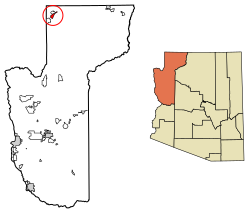 Location in Mohave County, Arizona | |
 Littlefield  Littlefield | |
| Coordinates: 36°53′24″N113°54′47″W / 36.89000°N 113.91306°W | |
| Country | United States |
| State | Arizona |
| County | Mohave |
| Founded | 1865 |
| Area | |
• Total | 11.80 sq mi (30.55 km2) |
| • Land | 11.80 sq mi (30.55 km2) |
| • Water | 0 sq mi (0.00 km2) |
| Elevation | 1,831 ft (558 m) |
| Population | |
• Total | 256 |
| • Density | 21.7/sq mi (8.38/km2) |
| Time zone | UTC-7 (MST) |
| ZIP Code | 86432 |
| FIPS code | 04-41470 |
| GNIS feature ID | 2582816 [2] |
Littlefield is an unincorporated community and census-designated place in Mohave County, Arizona, United States, that is located in the Arizona Strip region. As of the 2020 census, its population was 256, [3] a decline from the figure of 308 tabulated in 2010. [4] It lies just south of Interstate 15, next to the Virgin River, approximately 10 miles (16 km) northeast of Mesquite, Nevada.
