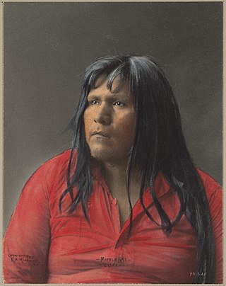
The Cocopah are Native Americans who live in Baja California, Mexico, and Arizona, United States.

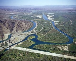
The Quechan, or Yuma, are a Native American tribe who live on the Fort Yuma Indian Reservation on the lower Colorado River in Arizona and California just north of the Mexican border. Despite their name, they are not related to the Quechua people of the Andes. Members are enrolled into the Quechan Tribe of the Fort Yuma Indian Reservation. The federally recognized Quechan tribe's main office is located in Winterhaven, California. Its operations and the majority of its reservation land are located in California, United States.

Imperial County is a county located on the southeast border of the U.S. state of California. As of the 2020 census, the population was 179,702, making it the least populous county in Southern California. The county seat and largest city is El Centro. Imperial is the most recent California county to be established, as it was created in 1907 out of the eastern half of San Diego County.

The Fort Mohave Indian Reservation is an Indian reservation along the Colorado River, currently encompassing 23,669 acres (95.79 km2) in Arizona, 12,633 acres (51.12 km2) in California, and 5,582 acres (22.59 km2) in Nevada. The reservation is home to approximately 1,100 members of the federally recognized Fort Mojave Indian Tribe of Arizona, California, and Nevada, a federally recognized tribe of Mohave people.

The San Xavier Indian Reservation is an Indian reservation of the Tohono O’odham Nation located near Tucson, Arizona, in the Sonoran Desert. The San Xavier Reservation lies in the southwestern part of the Tucson metropolitan area and consists of 111.543 sq mi (288.90 km2) of land area, about 2.5 percent of the Tohono O’odham Nation. It had a 2000 census resident population of 2,053 persons, or 19 percent of the Tohono O’odham population.

The Yavapai–Apache Nation is a federally recognized Native American tribe of Yavapai people in the Verde Valley of Arizona. Tribal members share two culturally distinct backgrounds and speak two Indigenous languages, the Yavapai language and the Western Apache language.

Quechan or Kwtsaan, also known as Yuma, is the native language of the Quechan people of southeastern California and southwestern Arizona in the Lower Colorado River Valley and Sonoran Desert. Despite its name, it is not related to the Quechua language of the Andes.
The Agua Caliente Band of Cahuilla Indians of the Agua Caliente Indian Reservation is a federally recognized tribe of the Cahuilla, located in Riverside County, California, United States. The Cahuilla inhabited the Coachella Valley desert and surrounding mountains between 5000 BCE and 500 CE. With the establishment of the reservations, the Cahuilla were officially divided into 10 sovereign nations, including the Agua Caliente Band.

The Fort Apache Indian Reservation is an Indian reservation in Arizona, United States, encompassing parts of Navajo, Gila, and Apache counties. It is home to the federally recognized White Mountain Apache Tribe of the Fort Apache Reservation, a Western Apache tribe. It has a land area of 1.6 million acres and a population of 12,429 people as of the 2000 census. The largest community is in Whiteriver.

The Colorado River Indian Tribes is a federally recognized tribe consisting of the four distinct ethnic groups associated with the Colorado River Indian Reservation: the Mohave, Chemehuevi, Hopi, and Navajo. The tribe has about 4,277 enrolled members. A total population of 9,485 currently resides within the tribal reservation according to the 2012-2016 American Community Survey data.

Mission Puerto de Purísima Concepción was founded near what is now Yuma, Arizona, United States, on the California side of the Colorado River, in October 1780, by the Franciscan missionary Francisco Garcés. The settlement was not part of the California mission chain but was administered as a part of the Spanish missions in Arizona. The Mission site and nearby pueblo were inadequately supported, and Spanish colonists seized the best lands, destroyed the Indians' crops, and generally ignored the rights of the local natives. In retaliation the Quechan (Yuma) Indians and their allies attacked and destroyed the installation and the neighboring Mission San Pedro y San Pablo de Bicuñer over the three days from July 17 to 19, 1781.

The Cocopah Indian Reservation is the reservation of the federally recognized Cocopah Indian Tribe, which represents Cocopah peoples in the United States. As of the 2000 census a resident population of 1,025 persons, of whom 519 were solely of Native American heritage, lived on the 25.948 km2 (10.019 sq mi) Cocopah Indian Reservation, which is composed of three non-contiguous sections in Yuma County, Arizona, lying northwest, southwest and south of the city of Yuma, Arizona. The larger section, bordering the Colorado River, lies west of the Yuma suburb of Somerton, while the other section lies just east of Somerton.
The Quoeech were a Native American group who lived in southern Nevada. When missionaries of the Church of Jesus Christ of Latter-day Saints first went to Las Vegas in 1855 they were contacted by Quoeech who lived at some distance from Las Vegas. Some of the Quoeech were later baptized. They were also known as the Diggers.

The Yuma County Area Transit (YCAT) system is a public transportation system based in Yuma County, Arizona. Since 1990 the agency has grown from a new transit service offering paratransit to the current mix of fixed-route and demand-responsive services serving over 32,000 riders per month, with an annual operating budget of $2.5 million. YCAT is also the local Greyhound Lines agent.
Imperial Valley Transit (IVT), also known as IV Transit, is the provider of mass transportation in California's Imperial Valley, serving the cities of El Centro, Calexico, Brawley, and Imperial. Formed in 1989 with just 3 buses and serving close to 3000 passengers per month, the agency currently serves more than 73,000 passengers per month with over 20 buses in operation. Twelve routes, plus the El Centro Circulators form the structure of the system. Service is provided every day of the week except on recognized federal holidays. Two limited stop routes also travel Monday-Saturday, and two express buses run to Imperial Valley College when classes are in session.

The San Pasqual Band of Diegueño Mission Indians of California is a federally recognized tribe of Kumeyaay people, who are sometimes known as Mission Indians.

Paradise Casino is a small tribal casino located just outside of Yuma, Arizona on the Fort Yuma Indian Reservation. The property straddles the Arizona–California state line, but the casino building lies in Arizona. It is owned and operated by the Quechan Tribe of the Fort Yuma Indian Reservation.

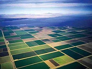
The Yuma Project is a U.S. Bureau of Reclamation project built to irrigate over 68,000 acres (280 km2) of land in Yuma County, Arizona and parts of Imperial County, California. The project is designed to exploit year-round farming conditions and water from the Colorado River. It consists of the Laguna Diversion Dam, pumping plants, a power plant, a 53-mile (85 km) system of canals, 218 miles (351 km) of lateral canals, levees and drains. The project began in 1903 and the majority of the work was completed by 1915. It was the first dam and reclamation project on the Colorado River and workers had to overcome many natural and logistical obstacles to build and maintain it. The Laguna Diversion Dam was replaced by the Imperial Dam as the Project's water source between 1941 and 1948. Today, it serves 275 farms and over 94,000 people.
Jaeger City, or Jaegerville, was a former settlement in what is now Imperial County, California, at Jaeger's Ferry on the Colorado River a mile downstream from Fort Yuma. It was named for L. J. F. Jaeger who ran the ferry there from 1851.

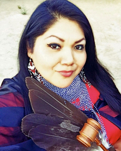
Claudette Christine White was an American Chief Judge for the Quechan Tribal Indian Court from 2006 to 2020 and for the San Manuel Band of Mission Indians from 2018 to 2020.


