
Yuma is a city in and the county seat of Yuma County, Arizona, United States. The city's population was 93,064 at the 2010 census, up from the 2000 census population of 77,515.

Fort Yuma was a fort in California located in Imperial County, across the Colorado River from Yuma, Arizona. It was on the Butterfield Overland Mail route from 1858 until 1861 and was abandoned May 16, 1883, and transferred to the Department of the Interior. The Fort Yuma Indian School and the Saint Thomas Yuma Indian Mission now occupy the site. It is one of the "associated sites" listed as Yuma Crossing and Associated Sites on the National Register of Historic Places in the Yuma Crossing National Heritage Area. In addition, it is registered as California Historical Landmark #806.
Hereford is a populated place in Cochise County along the San Pedro Riparian National Conservation Area in the southern part of the U.S. state of Arizona. It is southeast of Sierra Vista and is a part of the Sierra Vista-Douglas micropolitan area. The elevation is 4,193 feet at the location of the original townsite at the far eastern end of the unincorporated area; the residential area runs for another 8 miles west from this location, blending into the unincorporated area of Nicksville at an elevation of approximately 4800'. Hereford Station Post Office is located at the far western end of Nicksville, at the foot of the Huachuca Mountains.

Roll is a populated place in central Yuma County, Arizona, United States. It is part of the Yuma Metropolitan Statistical Area. Named for early settler John H. Roll, it lies along the lower Gila River in the Mohawk Valley, between the Yuma Proving Ground and the Barry M. Goldwater Air Force Range. It is located along the Union Pacific Railroad's Roll Industrial Lead. Local roads connect Roll to Interstate 8, east of the city of Yuma, the county seat of Yuma County. Its elevation is 262 feet (80 m). Although Roll is unincorporated, it has a post office. Roll has the ZIP Code of 85347; in the 2000 census, the population of the 85347 ZCTA was 1,235.

Yuma Quartermaster Depot State Historic Park, formerly Yuma Crossing State Historic Park, and now one of the Yuma Crossing and Associated Sites on the National Register of Historic Places in the Yuma Crossing National Heritage Area. It is an Arizona state park in the city of Yuma, Arizona, US.

Kofa, also historically known as Kofa Station, is a populated place situated in Yuma County, Arizona, United States. It is located in the northern San Cristobal Valley, along the Union Pacific Railroad's Roll Industrial Lead.
Allentown, is a populated place located in Apache County, Arizona, United States. It has an estimated elevation of 6,145 feet (1,873 m) above sea level.
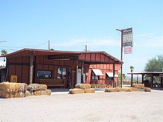
Araby is a populated place now situated within the city limits of Yuma in Yuma County, Arizona, United States. It has an estimated elevation of 217 feet (66 m) above sea level.

Texas Hill is a summit and landmark in the valley of the Gila River in Yuma County, Arizona. It rises to an elevation of 784 feet (239 m) from the 330-foot (100 m) level of the valley around it on the north side of the river. The mountain projects out into the valley, from its north side narrowing it considerably at that point and its dark color makes it stand out for long distances up and down the valley.
Blaisdell is a populated place situated in Yuma County, Arizona, United States, which was named after Hiram W. Blaisdell, who had been in charge of the construction of two nearby canals. It has an estimated elevation of 180 feet (55 m) above sea level. It is located on the Southern Pacific Railroad's Sunset Route and U.S. Route 95 12 miles east of Yuma.
Growler is a populated place situated in Yuma County, Arizona, United States. It is located along the Union Pacific Railroad's Roll Industrial Lead. It has an estimated elevation of 322 feet (98 m) above sea level.
Heaton is a populated place situated in Pinal County, Arizona, United States. Originally called Maricopa Station, it served as a stop on the railroad line, where passengers transferred to stagecoach. The post office at this location was simply named Maricopa. During a land boom in the late 1880s, it was thought that this stop would become a railway stop on the line directly connecting to Phoenix. As expansion into a town was being considered if the planned rail connection became reality, the expanded community was to be named Maricopaville. In 1887, when the rail line connection went to Maricopa Junction instead, the town's expansion was abandoned, and the name of the town was changed to its current Heaton. It has an estimated elevation of 1,197 feet (365 m) above sea level.
Ligurta is a populated place situated in Yuma County, Arizona, United States. It has an estimated elevation of 233 feet (71 m) above sea level. It is located in the Dome Valley south of the Gila River. Established as a railroad station on the [[[Sunset Route]] circa 1880,
Palomas is a populated place situated in Yuma County, Arizona, United States. It is located along the Gila River in the Park Valley
Raso is a populated place situated in Cochise County, Arizona, United States, seven miles northeast of Willcox in Dragoon Pass. It has an estimated elevation of 4,377 feet (1,334 m) above sea level. It was founded in 1881 as a flag station on the Southern Pacific Railroad, originally known as "Railroad Pass", the name was changed in 1903 to Raso, for easier usage in telegraph transmissions. Raso is Spanish for "a flat plain".
Richville is a populated place situated in Apache County, Arizona, United States. It has an estimated elevation of 6,079 feet (1,853 m) above sea level. Established approximately 12 miles north from Springerville on the Little Colorado River, it was originally named Walnut Grove, after a stand of walnut trees found in the location. It became known as Richey, after Joseph P. Richey, whose family settled the community. The name eventually morphed into the current Richville. A post office was opened there on June 23, 1892.
Sacate is a populated place situated in Pinal County, Arizona, United States. It has an estimated elevation of 1,093 feet (333 m) above sea level. Located eight miles north of Maricopa on the south side of the Gila River, Sacate was an Indian village and railroad station for the Southern Pacific Railroad. It had originally been called Sacaton, but the name was shortened to its current version in 1904.
Stark is a populated place situated in Cochise County, Arizona, United States, adjacent to the international border with Mexico. It has an estimated elevation of 4,393 feet (1,339 m) above sea level.
Vanar was a station on the Southern Pacific railroad and populated place situated in Cochise County, Arizona, United States, adjacent to the border with New Mexico. It has an estimated elevation of 3,917 feet (1,194 m) above sea level. The community was originally named Vanarman after Hiram M. Van Arman, and the name was shortened for telegraph purposes in 1905 to Vanar.

Youngberg is a populated place situated in Pinal County, Arizona, United States.


