
Gila Bend, founded in 1872, is a town in Maricopa County, Arizona, United States. The town is named for an approximately 90-degree bend in the Gila River, which is near the community's current location. As of the 2020 census, the population of the town was 1,892.

Stanwix Station, in western Arizona, was a stop on the Butterfield Overland Mail Stagecoach line built in the later 1850s near the Gila River about 80 miles (130 km) east of Yuma, Arizona. Originally the station was called Flap Jack Ranch later Grinnell's Ranch or Grinnell's Station. In 1862, Grinnell's was listed on the itinerary of the California Column in the same place as Stanwix Ranch which became the site of the westernmost skirmish of the American Civil War. A traveler in 1864, John Ross Browne, wrote Grinnell's was six miles southwest of the hot springs of Agua Caliente, Arizona.

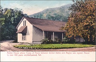
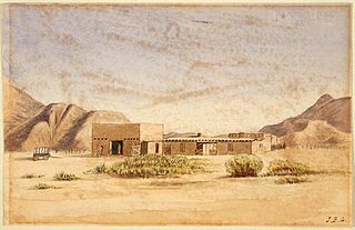
Fort Yuma was a fort in California located in Imperial County, across the Colorado River from Yuma, Arizona. It was on the Butterfield Overland Mail route from 1858 until 1861 and was abandoned May 16, 1883, and transferred to the Department of the Interior. The Fort Yuma Indian School and the Saint Thomas Yuma Indian Mission now occupy the site. It is one of the "associated sites" listed as Yuma Crossing and Associated Sites on the National Register of Historic Places in the Yuma Crossing National Heritage Area. In addition, it is registered as California Historical Landmark #806.

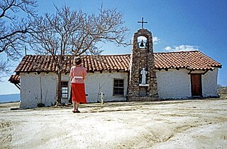
Oak Grove Butterfield Stage Station is located in the western foothills of the Laguna Mountains, in northern San Diego County, California. It is located on State Route 79, 13 miles (21 km) northwest of Warner Springs and Warner's Ranch. The station was built on the site of Camp Wright, an 1860s Civil War outpost.
Warner Springs is set of springs and a small unincorporated community in northern San Diego County, California. Warner Springs is on the Pacific Crest Trail.
Sackett's Wells is a former settlement in Imperial County, California. It was located 3 miles (4.8 km) west northwest of Plaster City, in or near Coyote Wash.
The Butterfield Overland Mail in California was created by the United States Congress on March 3, 1857, and operated until June 30, 1861. Subsequently, other stage lines operated along the Butterfield Overland Mail in route in Alta California until the Southern Pacific Railroad arrived in Yuma, Arizona in 1877.
The Butterfield Overland Mail was a transport and mail delivery system that employed stagecoaches that travelled on a specific route between St. Louis, Missouri and San Francisco, California and which passed through the New Mexico Territory. It was created by the United States Congress on March 3, 1857, and operated until March 30, 1861. The route that was operated extended from where the ferry across the Colorado River to Fort Yuma Station, California was located, through New Mexico Territory via, Tucson to the Rio Grande and Mesilla, New Mexico then south to Franklin, Texas, midpoint on the route. The New Mexico Territory mail route was divided into two divisions each under a superintendent. Tucson was the headquarters of the 3rd Division of the Butterfield Overland Mail Company. Franklin Station in the town of Franklin,, was the headquarters of the 4th Division.
Peterman's Station is a historic locale, site of a ranch and stage station located along the Gila River. It was first established by a man named Peterman, in 1857 along the route of the San Antonio-San Diego Mail Line, later a station of its successor, the Butterfield Overland Mail, 19 miles east of Filibuster Camp, 12 miles west of Griswell's Station.
The Butterfield Overland Mail route in Baja California was created as a result of an act by the United States Congress on March 3, 1857, and operated until June 30, 1861 as part of the Second Division of the route. Subsequently other stage lines operated along the route until the Southern Pacific Railroad arrived in Yuma, Arizona.
New River Station was a later station added into the Colorado Desert route of the Butterfield Overland Mail it was located 15 miles southeast of Indian Wells Station and 14 miles west of Alamo Mocho Station beside the New River. It was in operation until March 1861 when the Butterfield route was abandoned for the Central Route by the beginning of the American Civil War.
Gardener's Wells Station was built at the site of Gardener's Wells in Baja California was one of the wells developed by the Butterfield Overland Mail, as a part of its improvements of its Colorado Desert route between Cooke's Wells Station and Alamo Mocho Station. These wells allowed travel along the level ground along the 19th century course of the Alamo River, avoiding the more difficult route up on Andrade Mesa.
Seven Wells Station was built at the site, of Salt or Seven Wells one of the wells developed by the Butterfield Overland Mail, as a part of its improvements of its Colorado Desert route between Cooke's Wells Station and Alamo Mocho Station. These wells allowed travel along the level ground along the 19th century course of the Alamo River, avoiding the more difficult route up on Andrade Mesa.
Murderer's Grave Station is a historic locale, later called Kinyon Station and Kenyon Station was a stagecoach station of the Butterfield Overland Mail located along the Gila River in Arizona. The site was located 20 miles east of Oatmans Flat Station and 15 miles west of Gila Ranch Station. It was located along the Gila River near the present site of the Painted Rock Reservoir

Antelope Hill, formerly Antelope Peak, is a summit, at an elevation of 804 feet, near the Gila River in Yuma County, Arizona.
Socatoon Station was a stagecoach station of the Butterfield Overland Mail between 1858 and 1861. It was located four miles (6.4 km) east of Sacaton at a Maricopa village from which it took its name. This station was located 22 miles (35 km) east of Maricopa Wells Station, 11 miles (18 km) east of Casa Blanca Station and 13 miles (21 km) north of Oneida Station.
Filibuster Camp is the historic locale of a camp along the Gila River route of the Southern Emigrant Trail in Yuma County, Arizona, named in memory of a failed filibuster expedition to Sonora that began there in 1856.
Antelope Peak Station, a later Butterfield Overland Mail station located 15.14 miles east of Mission Camp, at the foot of Antelope Peak. It replaced Filibusters Camp Station, 6 miles to the west. The Overland Mail Company replaced Filibusters Camp, because Antelope Peak Station had a better water supply. Its location is thought to be 32°42′47″N114°00′54″W. The station was built by John Kilbride in 1857 but did not appear on the stagecoach itinerary until 1859.
Texas Hill Station is a site of a later Butterfield Overland Mail stagecoach station. It was one of several built in 1859 to increase the number of water stops and team changes along the drier and hotter sections of the route and was located about 2 miles east of Texas Hill.
Desert Station is a historic locale, the site of a later station of the Butterfield Overland Mail, in what is now Maricopa County, Arizona.

