Avenue B and C, Arizona | |
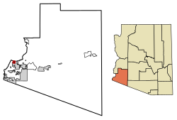
---|---|
Country | United States |
State | Arizona |
County | Yuma |
Area | |
• Total | 0.74 sq mi (1.92 km2) |
• Land | 0.74 sq mi (1.91 km2) |
• Water | 0.01 sq mi (0.02 km2) |
Population (2020) | |
• Total | 4,101 |
• Density | 5,572.01/sq mi (2,152.53/km2) |
Time zone | UTC-7 (MST (no DST)) |
ZIP code | 85364 [2] |
Area code | 928 |
FIPS code | 04-04710 |
Avenue B and C or B&C Colonia is a census-designated place (CDP) [3] and colonia [4] in Yuma County, Arizona, United States. [3] The population was 4,176 at the 2010 census. Areas that are part of Avenue B and C were first subdivided in the 1920s and 1930s. [5] The colonia received a sewer system in 2011. [6] It is the fifth most populous community in Yuma County and second most populous CDP (behind Fortuna Foothills). [7]
Census | Pop. | Note | %± |
---|---|---|---|
2010 | 4,176 | — | |
2020 | 4,101 | −1.8% | |
U.S. Decennial Census [8] |
Avenue B and C first appeared on the 2010 U.S. Census as a census-designated place (CDP). [7]
At the 2020 census, Avenue B and C had a population of 4,176. The racial and ethnic makeup of the population was 22.0% non-Hispanic white, 0.9% black or African American, 2.5% Native American, 0.3% Asian, 0.3% Pacific Islander, 0.1% non-Hispanic of some other race, 3.2% from two or more races and 74.7% Hispanic or Latino. [9]
Bouse is a census-designated place (CDP) and ghost town in La Paz County, Arizona, United States. Founded in 1908 as a mining camp, the economy of Bouse is now based on tourism, agriculture, and retirees. The population was 996 at the 2010 census. It was originally named Brayton after the store owner John Brayton Martin.
Salome is an unincorporated community and census-designated place (CDP) in La Paz County, Arizona, United States. The population was 1,530 at the 2010 census. It was established in 1904 by Dick Wick Hall, Ernest Hall and Charles Pratt, and was named after Pratt's wife, Grace Salome Pratt.
Arizona Village is a census-designated place (CDP) on the Fort Mojave Indian Reservation in Mohave County, Arizona, United States. The population was 1,057 at the 2020 census, up from 946 in 2010 and 351 in 2000.
Fortuna Foothills is a census-designated place (CDP) in Yuma County, Arizona, United States. The population was 26,265 at the 2010 census. It is part of the Yuma Metropolitan Statistical Area. Development of the area began in the 1960s, when local developer Hank Schechert purchased 3,000 acres east of Yuma. Fortuna Foothills serves as a bedroom community for Yuma, Yuma Proving Ground, and Marine Corps Air Station Yuma. Fortuna Foothills is also an area with a large amount of seasonal residents.
Gadsden is a census-designated place (CDP) in Yuma County, Arizona, United States. The population was 953 at the 2000 census. It is part of the Yuma Metropolitan Statistical Area.
Colonia is an unincorporated community and census-designated place (CDP) located within Woodbridge Township, in Middlesex County, in the U.S. state of New Jersey. As of the 2010 United States Census, the CDP's population was 17,795.
Bruni is a census-designated place (CDP) in Webb County, Texas, United States. The population was 379 at the 2010 census.
Grand Canyon West is a census-designated place (CDP) in Mohave County, Arizona, United States, located on the Hualapai Reservation. The population was reported as 0 at the 2020 census. Grand Canyon West is home to the tribe's Grand Canyon business operations, including the Grand Canyon West Airport and the Grand Canyon Skywalk. Typically, they are open from 8:00 a.m. – 6:00 p.m., including all holidays.
Orange Grove Mobile Manor is a census-designated place (CDP) and colonia in Yuma County, Arizona, United States. The population was 555 at the 2010 census. It is part of the Yuma Metropolitan Statistical Area.
Aztec is a census designated place situated in Yuma County, Arizona, United States. It had a population of 47 as of the 2010 U.S. Census. As of July 2015, Aztec had an estimated population of 52. It has an estimated elevation of 509 feet (155 m) above sea level. It is located along Interstate 8 to the west of Tenmile Wash.
Clacks Canyon is a census-designated place (CDP) in Mohave County, Arizona, United States. The population was 167 at the 2020 census.
Crystal Beach is an unincorporated community and census-designated place (CDP) in Mohave County, Arizona, United States. The population was 250 at the 2020 census.
Buckshot is a census-designated place (CDP) in Yuma County, Arizona, United States. The population was 153 at the 2010 census.
Drysdale is a census-designated place (CDP) in Yuma County, Arizona, United States. The population was 272 at the 2010 census.
El Prado Estates is a census-designated place (CDP) in Yuma County, Arizona, United States. The population was 504 at the 2010 census.
Donovan Estates is a census-designated place (CDP) in Yuma County, Arizona, United States. The population was 1,508 at the 2010 census.
Martinez Lake is a census-designated place (CDP) in Yuma County, Arizona, United States. The population was 798 at the 2010 census. It was founded in 1958 as a fishing community. It remains primarily a vacation community.
McConnico is an unincorporated community and census-designated place (CDP) in Mohave County, Arizona, United States. The population was 63 at the 2020 census.
Padre Ranchitos is a census-designated place (CDP) situated near both the international border with Mexico, and the state border with California, in Yuma County, Arizona, United States. The population was 171 at the 2010 census.
Yuma Proving Ground is a census-designated place (CDP) covering the residential population of the Yuma Proving Ground in Yuma County, Arizona.