
Mendocino County is a county located on the North Coast of the U.S. state of California. As of the 2020 census, the population was 91,601. The county seat is Ukiah.

Fort Bragg, officially the City of Fort Bragg, is a city along the Pacific Coast of California along Shoreline Highway in Mendocino County. The city is 24 miles (39 km) west of Willits, at an elevation of 85 feet (26 m). Its population was 6,983 at the 2020 census.
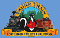
The California Western Railroad, AKA Mendocino Railway popularly called the Skunk Train, is a rail freight and heritage railroad transport railway in Mendocino County, California, United States, running from the railroad's headquarters in the coastal town of Fort Bragg to the interchange with the Northwestern Pacific Railroad at Willits.

The Round Valley Indian Reservation is a federally recognized Indian reservation lying primarily in northern Mendocino County, California, United States. A small part of it extends northward into southern Trinity County. The total land area, including off-reservation trust land, is 93.939 km2. More than two-thirds of this area is off-reservation trust land, including about 405 acres (1.64 km2) in the community of Covelo. The total resident population as of the 2000 census was 300 persons, of whom 99 lived in Covelo.
The Pacific coast theater of the American Civil War consists of major military operations in the United States on the Pacific Ocean and in the states and Territories west of the Continental Divide. The theater was encompassed by the Department of the Pacific that included the states of California, Oregon, and Nevada, the territories of Washington, Utah, and later Idaho.
The Pitt River Expedition is a series of expeditions in the U.S. state of California in the 1850s. The expeditions are named for the Pit River, one of many tributaries of the Sacramento River, and the Pitt River Indians. The expeditions were part of the larger American Indian Wars and took place during the California Gold Rush.

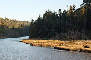
The Noyo River is a river on the north coast of California in Mendocino County. The river's headwaters are in the steep Mendocino Range, but downstream the river flows through gently sloping marine terraces before draining into the Pacific Ocean. The 113 square miles (290 km2) watershed extends east to the small city of Willits and the river's mouth is at Noyo Harbor in Fort Bragg, which uses the river for drinking water; it is neighbored on the south by Hare Creek and the Big River, on the east by the South Fork Eel River, and on the north by Ten Mile River, named for its distance from the Noyo River. The average annual rainfall is between 40 inches (1,000 mm) and 65 inches (1,700 mm).
The Big River is a 41.7-mile-long (67.1 km) river in Mendocino County, California, that flows from the northern California Coast Range to the Pacific Ocean at Mendocino, Mendocino County, California. From the mouth, brackish waters extend 8 miles (13 km) upstream, forming the longest undeveloped estuary in the state.
The Redwood Valley Rancheria is a federally recognized Indian tribe located in Redwood Valley, Mendocino County, California. The tribe is primarily composed of Pomo Indians. Redwood Valley Rancheria is a sovereign Indian tribe with the powers of self-governance.
Noyo Harbor is the port and boat docking area for Fort Bragg, California, USA. It is built near the mouth of the Noyo River in the town of Noyo, just south of Fort Bragg. Noyo Harbor is located in Mendocino County 130 nautical miles (240 km) northwest of the Port of San Francisco and 145 nautical miles (269 km) south-southeast of the port of Crescent City, California. Highway 1 passes over the Noyo Bridge above the harbor.

MacKerricher State Park is a state park in California in the United States. It is located 3 miles (4.8 km) north of Fort Bragg in Mendocino County. It covers 9 miles (14 km) of coastline and contains several types of coastal habitat, including beaches, dunes, headlands, coves, wetlands, tide pools, forest, and a freshwater lake.

Jackson Demonstration State Forest is a public forest in Mendocino County, California managed by the California Department of Forestry and Fire Protection. It is the largest demonstration forest operated by the State of California. The forest land, located along California State Highway 20 between Willits and the coastal city of Fort Bragg, was formerly owned by Caspar Lumber Company. The forest holds sacred value as an ancestral home and ceremonial site for the Coyote Valley Band of Pomo Indians.
The Sherwood Valley Rancheria of Pomo Indians of California is a federally recognized tribe of Pomo Indians in California.

Fort Seward is an unincorporated community in Humboldt County, California. It is located on the Eel River 3.5 miles (5.6 km) north-northwest of Alderpoint, at an elevation of 328 feet. The name honors William H. Seward, Secretary of State under President Abraham Lincoln.

Noyo is an unincorporated community in Mendocino County, California. It is located 1 mile (1.6 km) south of the center of Fort Bragg, at an elevation of 108 feet. It is named after the Noyo River, on which it lies; the Noyo River in turn was misnamed by white settlers to the Mendocino area after a village of the Pomo people named Noyo several miles north, on Pudding Creek. The Pomo named the creek after their village, and the settlers transferred the name to the larger river to the south.
Fort Gaston was founded on December 4, 1859, in the redwood forests of the Hoopa Valley, in Northern California, on the west bank of the Trinity River, 14 miles (23 km) from where the Trinity flows into the Klamath River. It was located in what is now the Hoopa Valley Indian Reservation. Fort Gaston as part of the Humboldt Military District was intended to control the Hupa Indians and to protect them from hostile white settlers. The post was named for 2nd Lieutenant William Gaston, of the First Dragoons, who had been killed May 17, 1858, during the Spokane–Coeur d'Alene–Paloos War.
Fort Wright, was an Army post located in the Round Valley of Mendocino County, about 1.5 miles (2.4 km) s northwest of the present town of Covelo, California. The principal duty of the garrison was to protect the Round Valley Indian Reservation's Indians from the intrusions, thefts and attacks of white settlers. From 1858, Federal troops had garrisoned the Round Valley Reservation until they were sent east in late 1861.

Bald Hills War (1858–1864) was a war fought by the forces of the California Militia, California Volunteers and soldiers of the U.S. Army against the Chilula, Lassik, Hupa, Mattole, Nongatl, Sinkyone, Tsnungwe, Wailaki, Whilkut and Wiyot Native American peoples.
Smith River Reservation was an Indian reservation on the Smith River, set aside April 9, 1862 by the Department of Indian Affairs to replace the Klamath River Reservation that had been destroyed by the Great Flood of 1862 and as a reservation for the Tolowa people.
The California Indian Wars were a series of wars, battles, and massacres between the United States Army, and the Indigenous peoples of California. The wars lasted from 1850, immediately after Alta California, acquired during the Mexican–American War, became the state of California, to 1880 when the last minor military operation on the Colorado River ended the Calloway Affair of 1880.


