Spyrock, California | |
|---|---|
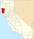
 Spyrock, California Location in California  Spyrock, California Spyrock, California (the United States) | |
| Coordinates: 39°52′36″N123°26′38″W / 39.87667°N 123.44389°W | |
| Country | United States |
| State | California |
| County | Mendocino County |
| Elevation | 259 m (850 ft) |
Spyrock (formerly, Spy Rock) is an unincorporated community of ranches in Mendocino County, California. [1] [2] It is located around Spyrock Road, which runs east of Highway 101 to the Eel River and Northwestern Pacific Railroad. [3] [2]
It is named after Spy Rock, a 540 feet (160 m) landmark hill on the east side of the river, and The Wildlands Conservancy operates the 5,832-acre (2,360 ha) Spyrock Reserve in the area. [4] [5]
A post office operated at Spyrock from 1910 to 1911, and from 1915 to 1967. [6] The currently closed Spy Rock Elementary School located on Spy Rock Road is in Laytonville Unified school district, [7] although Spy Rock previously had its own school district. [8]
There was a station on the railroad named Spy Rock which until 1914 was named Redwine. [9]
In 1982, a Petroglyph site beside Spy Rock Road was investigated which provided the first evidence of complex rock art boulders in the western United States. [10] [11]
The Spy Rock Road album by The Lookouts was named after the road by Larry Livermore who lived in Spy Rock in the 1980s. [2]
Spy Rock features prominently in the 2021 Hulu docuseries Sasquatch.