Bokea, California

Last updated

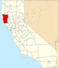
Bokea (also, Boch-heaf) is a former Pomo settlement in Mendocino County, California, [1] one of a number of Pomo settlements catalogued by Stephen Powers. [2] It was located in Rancheria Valley; its precise location is unknown. [1]

The Boch-heaf band of Pomo are one of four bands of Pomo described by George Gibbs as living between Hopland and the coast; the other three are Moiya, Tabahtea, and Ubakhea. [3]

Related Research Articles

<span class="mw-page-title-main">Pomo</span> Indigenous Californians

The Pomo are an Indigenous people of California. Historical Pomo territory in Northern California was large, bordered by the Pacific Coast to the west, extending inland to Clear Lake, and mainly between Cleone and Duncans Point. One small group, the Northeastern Pomo, lived in the vicinity

<span class="mw-page-title-main">Pomoan languages</span> Language family of California, US

The Pomoan, or Pomo, languages are a small family of seven languages indigenous to northern California spoken by the Pomo people, whose ancestors lived in the valley of the Russian River and the Clear Lake basin. Four languages are extinct, and all surviving languages except Kashaya have fewer than ten speakers.

<span class="mw-page-title-main">Gualala, California</span> Unincorporated community in California, United States

Gualala is an unincorporated community in Mendocino County in the U.S. state of California. It is located north of The Sea Ranch and south of Point Arena, California. Gualala shares its southern border with the southern border of Mendocino County. It is located on the Pacific coast at the mouth of the Gualala River, on State Route 1. It serves as a commercial center for the surrounding area. Gualala was once a logging town, but tourism is now its central economic activity.

<span class="mw-page-title-main">Northern Pomo language</span> Endangered Pomoan language of California

Northern Pomo is a critically endangered Pomoan language, spoken by the indigenous Pomo people in what is now called California. The speakers of Northern Pomo were traditionally those who lived in the northern and largest area of the Pomoan territory. Other communities near to the Pomo were the Coast Yuki, the Huchnom, and the Athabascan. Ukiah High School first began offering Northern Pomo in the Fall 2020.

<span class="mw-page-title-main">Lake Miwok</span> Branch of the Miwok

The Lake Miwok are a branch of the Miwok, a Native American people of Northern California. The Lake Miwok lived in the Clear Lake basin of what is now called Lake County.

<span class="mw-page-title-main">Miwok mythology</span>

The mythology of the Miwok Native Americans are myths of their world order, their creation stories and 'how things came to be' created. Miwok myths suggest their spiritual and philosophical world view. In several different creation stories collected from Miwok people, Coyote was seen as their ancestor and creator god, sometimes with the help of other animals, forming the earth and making people out of humble materials like feathers or twigs.

<span class="mw-page-title-main">Kuksu (religion)</span> Religion in Northern California

Kuksu, was a religion in Northern California practiced by members within several Indigenous peoples of California before and during contact with the arriving European settlers. The religious belief system was held by several tribes in Central California and Northern California, from the Sacramento Valley west to the Pacific Ocean.

Pomo traditional narratives include myths, legends, tales, and oral histories preserved by the Pomo people of the North Coast region of northwestern California.

Khawina is a former Pomo settlement in Lake County, California, one of a number of Pomo settlements catalogued by Stephen Powers. It was located at Sulphur Bank, at an elevation of 1362 feet.

Koi was the more southerly of the two main Pomo villages in the southeastern section of Clear Lake in Lake County, California, USA. Both it and the other triblet center, Elem, were located on islands near the shore and controlled territory on the mainland. It was located on Lower Lake Island, also called Indian Island.

<span class="mw-page-title-main">Buldam, California</span>

Buldam is a former Pomo settlement in Mendocino County, California. It was located on the north bank of Big River, near the mouth of the river and east of the present town of Mendocino; its precise location is unknown. Following the standard conventions of the Pomo people, in which a community of the Pomo was named by adding "-pomo" to the name of their principal site, the community at Buldam was called Buldam-pomo.

Chomchadila is a former Pomo settlement in Mendocino County, California. It was located southwest of Calpella, and Calpella was named after a chief of Chomdadila. Its precise location is unknown.

Dapishul is a former Pomo settlement in Mendocino County, California, one of a number of Pomo settlements catalogued by Stephen Powers. It was located in Redwood Valley; its precise location was near Mariposa creek and the Russian River on the eastern bank above the flood plain. In the language of the Pomo, "dapishul" means "high sun", referring a location that is cool and shaded by canyon walls, with the sun only visible when it is high in the sky.

Lema is a former Pomo settlement in Mendocino County, California, one of a number of Pomo settlements catalogued by Stephen Powers. It was 4 miles (6.4 km) northwest of Hopland. One of the mines of red clay from which the Pomo people took their name was located there.

Moiya is a former Pomo settlement in Mendocino County, California. It was located near Hopland; its precise location is unknown.

Pomo is an unincorporated community in Mendocino County, California. It is located 1.25 miles (2 km) southeast of Potter Valley, at an elevation of 942 feet.

Shiegho is a former Pomo settlement in Mendocino County, California. It was located near Hopland; its precise location is unknown.

Ubakhea is a former Pomo settlement in Mendocino County, California, and a division of the Pomo people named for the settlement, recorded by George Gibbs in 1851. It was located in southern Mendocino County, near Sanel; its precise location is unknown.

Cahto is a former settlement in Mendocino County, California. It was located 3 miles (4.8 km) southwest of Laytonville.

Samuel Alfred Barrett was an anthropologist and linguist who studied Native American peoples.

References

  1. 1 2 U.S. Geological Survey Geographic Names Information System: Bokea, California
  2. Hodge, Frederick Webb, ed. (1910), Handbook of American Indians North of Mexico, Part 2, Bulletin of the Smithsonian Institution Bureau of American Ethnology, vol. 30, Washington, Govt. print. off, p. 277
  3. Barrett, Samuel Alfred (1908), The Ethno-geography of the Pomo and Neighboring Indians, University of California Publications in American Archaeology and Ethnology, vol. 1, University of California Press, p. 178