References
- ↑ U.S. Geological Survey Geographic Names Information System: Ubakhea, California
- ↑ Hodge, Frederick Webb, ed. (1910), Handbook of American Indians North of Mexico, Part 2, Bulletin of the Smithsonian Institution Bureau of American Ethnology, vol. 30, Washington, Govt. print. off, p. 861
- ↑ Barrett, Samuel Alfred (1908), The Ethno-geography of the Pomo and Neighboring Indians, University of California Publications in American Archaeology and Ethnology, vol. 1, University of California Press, p. 178
Municipalities and communities of Mendocino County, California, United States | ||
|---|---|---|
| Cities | 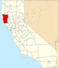 | |
| CDPs | ||
| Unincorporated communities |
| |
| Indian reservations | ||
| Former settlements | ||
| Footnotes | ‡This populated place also has portions in an adjacent county or counties | |
| | This Mendocino County, California–related article is a stub. You can help Wikipedia by expanding it. |