Sunset in ElkView of the ocean and the rock formations from Elk
Elk was originally called "Greenwood," after the Greenwood brothers,[2] early homesteaders and sons of mountain man Caleb Greenwood and his half-Crow wife, one of the rescuers of the Donner Party. When the post office was opened, in 1887,[2] there was already another Greenwood in California so it was called Elk Post Office. Eventually the name came to refer to the town. It is an outgrowth of an earlier town called Cuffy's Cove and the cemetery is located at that townsite 1 mile (2km) north of Elk. When pioneer lumberman Lorenzo White was unable to reach a satisfactory deal with the owners of the lumber chutes at Cuffy's Cove to ship out his redwood product, he constructed a wharf out along a string of rocks in the center of what is now Elk. When he built a large steam sawmill and 3-foot (90cm) gauge railroad, the new employment drained the town of Cuffy's Cove, which was eventually abandoned. The sawmill was producing 80,000 board feet (200m3) of lumber per day by 1890. The mill was sold to Goodyear Redwood Company in 1916. Elk River Company took over the sawmill when Goodyear went bankrupt in 1932. The local redwood lumber industry economy collapsed when the uninsured sawmill burned in 1936.[3]
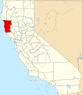
Greenwood - Elk Beach, Mendocino County, California
A new sawmill was built c.1953 and another followed in 1963. These operated until the late 1960s, when the redwood and Douglas fir was mostly logged out (which means that the ancient trees big enough to be thought of as more valuable dead than alive had been killed). After some quiet times, the town has had a rebirth[4] as a recreation destination particularly as a result of the pandemic with people wanting to get out of the urban areas.[5] A couple of the larger old houses are now bed and breakfast inns, and the state has acquired Greenwood State Beach and the original mill site as a state park. The ZIP Code is 95432. The community is inside area code 707.
1 2 3 Durham, David L. (1998). California's Geographic Names: A Gazetteer of Historic and Modern Names of the State. Clovis, California: Word Dancer Press. p.55. ISBN1-884995-14-4.
↑ Carranco, Lynwood (1982). Redwood Lumber Industry. Golden West Books. pp.206–207. ISBN0-87095-084-3.
This page is based on this Wikipedia article Text is available under the CC BY-SA 4.0 license; additional terms may apply. Images, videos and audio are available under their respective licenses.