Brooktrails, California

Last updated

Brooktrails
Mendocino County California Incorporated and Unincorporated areas Brooktrails Highlighted 0608530.svg
Location in Mendocino County and California
USA California location map.svg
Red pog.svg
Brooktrails
Usa edcp location map.svg
Red pog.svg
Brooktrails
Coordinates: 39°26′38″N123°23′07″W / 39.44389°N 123.38528°W / 39.44389; -123.38528
Country Flag of the United States (23px).png  United States
State Flag of California.svg  California
County Mendocino
Area
[1]
  Total7.32 sq mi (19.0 km2)
  Land7.27 sq mi (18.8 km2)
  Water0.05 sq mi (0.1 km2)  0.64%
Elevation
[2]
1,634 ft (498 m)
Population
 (2020) [3]
  Total3,632
  Density499.45/sq mi (192.84/km2)
Time zone UTC-8 (Pacific (PST))
  Summer (DST) UTC-7 (PDT)
ZIP code
95490 (Willits)
Area code 707
GNIS feature ID1724158; [2] 2628713 [4]

Brooktrails is a census-designated place and unincorporated community in Mendocino County, California, United States. [5] It shares ZIP code 95490 with Willits. [6] The population was 3,632 at the 2020 census. [3]

Contents

History

After being extensively logged from the 1880s to the middle of the twentieth century, [7] Brooktrails Township was founded under a special provision in state law. [8] It was marketed as a vacation mountain retreat for San Franciscans in the 1970s. [7] It has approximately 6,600 parcels varying in size from 0.3 acres (0.12 ha) to 10 acres (4.0 ha). The smaller parcels are mostly surrounded by the township-owned Brooktrails Redwood Park, [9] a 2,600-acre (1,100 ha) [10] forest green belt composed of tan oak, Douglas fir and redwood. [11] Brooktrails has over 30 hiking trails and two lakes, Lake Emily and Lake Ada Rose, that store and direct water to its water treatment plant. [12] There is also a small market and a deli. The Brooktrails Township Community Services District, governed by a five-member elected board of directors, provides water, sewer, and recreational services to the residents. [12] [13]

In 2012, Mendocino County paid the back assessments on hundreds of abandoned Brooktrails lots; however, they stopped paying water, sewer and fire assessments for those lots. [8]

The entire community of Brooktrails was evacuated in September 2020 due to the threat of the Oak Fire. [14]

Geography

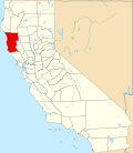
Brooktrails is in central Mendocino County, occupying hills to the west of Little Lake Valley. The fire department and golf course lie at an elevation of 1,634 feet (498 m), but the community's western edge rises to nearly 3,000 feet (910 m). [2] It is 3 miles (5 km) north of Willits. According to the United States Census Bureau, the CDP covers an area of 7.3 square miles (19 km2), 99.36% of it land, and 0.64% of it water. [1]

Demographics

Historical population
CensusPop.Note
2010 3,235
2020 3,63212.3%
2022 (est.)4,440 [15] 22.2%
U.S. Decennial Census [16]
1850–1870 [17] [18] 1880-1890 [19]
1900 [20] 1910 [21] 1920 [22]
1930 [23] 1940 [24] 1950 [25]
1960 [26] 1970 [27] 1980 [28]
1990 [29] 2000 [30] 2010 [31]

The 2010 United States Census [32] reported that Brooktrails had a population of 3,235. The population density was 442.0 inhabitants per square mile (170.7/km2). The racial makeup of Brooktrails was 2,818 (87.1%) White, 22 (0.7%) African American, 87 (2.7%) Native American, 26 (0.8%) Asian, 4 (0.1%) Pacific Islander, 109 (3.4%) from other races, and 169 (5.2%) from two or more races. Hispanic or Latino of any race were 329 persons (10.2%).

The Census reported that 3,235 people (100% of the population) lived in households, 0 (0%) lived in non-institutionalized group quarters, and 0 (0%) were institutionalized.

There were 1,322 households, out of which 428 (32.4%) had children under the age of 18 living in them, 628 (47.5%) were opposite-sex married couples living together, 156 (11.8%) had a female householder with no husband present, 84 (6.4%) had a male householder with no wife present. There were 124 (9.4%) unmarried opposite-sex partnerships, and 11 (0.8%) same-sex married couples or partnerships. 344 households (26.0%) were made up of individuals, and 93 (7.0%) had someone living alone who was 65 years of age or older. The average household size was 2.45. There were 868 families (65.7% of all households); the average family size was 2.90.

The population was spread out, with 752 people (23.2%) under the age of 18, 246 people (7.6%) aged 18 to 24, 894 people (27.6%) aged 25 to 44, 954 people (29.5%) aged 45 to 64, and 389 people (12.0%) who were 65 years of age or older. The median age was 38.4 years. For every 100 females, there were 108.2 males. For every 100 females age 18 and over, there were 102.5 males.

There were 1,444 housing units at an average density of 197.3 per square mile (76.2/km2), of which 955 (72.2%) were owner-occupied, and 367 (27.8%) were occupied by renters. The homeowner vacancy rate was 3.9%; the rental vacancy rate was 5.9%. 2,353 people (72.7% of the population) lived in owner-occupied housing units and 882 people (27.3%) lived in rental housing units.

Notable residents

Politics

In the state legislature, Brooktrails is in the 2nd Senate District , represented by Democrat Mike McGuire, [33] and the 2nd Assembly District , represented by Democrat Jim Wood. [34]

Federally, Brooktrails is in California's 2nd congressional district , represented by Democrat Jared Huffman. [35]

Related Research Articles

<span class="mw-page-title-main">Mendocino County, California</span> County in the United States

Mendocino County is a county located on the North Coast of the U.S. state of California. As of the 2020 census, the population was 91,601. The county seat is Ukiah.

<span class="mw-page-title-main">Ashland, California</span> Unincorporated community in California, United States

Ashland is a census-designated place (CDP) and unincorporated community in Alameda County, California, United States. The population was 23,823 at the 2020 census. Ashland is located between the city of San Leandro to the north, the unincorporated community of Cherryland to the south, the unincorporated community of Castro Valley to the east, and the unincorporated community of San Lorenzo to the southwest.

<span class="mw-page-title-main">Cobb, California</span> Census designated place in California, United States

Cobb is a census designated place (CDP) in Lake County, California, United States. Cobb is located 1 mile (1.6 km) northwest of Whispering Pines, at an elevation of 2,631 feet (802 m). The population was 1,778 at the 2010 census, up from 1,638 at the 2000 census.

<span class="mw-page-title-main">Bolinas, California</span> Unincorporated community in California, United States

Bolinas is an unincorporated coastal community and census-designated place in Marin County, California, United States. As of the 2020 census it had a population of 1,483. It is located on the California coast, approximately 13 miles (21 km) northwest of San Francisco, and 27 miles (43 km) by road.

<span class="mw-page-title-main">Covelo, California</span> Census-designated place in California, United States

Covelo is a census-designated place (CDP) in Mendocino County, California, United States. Covelo is located 14 miles (23 km) east-northeast of Laytonville, at an elevation of 1,398 feet (426 m). The population was 1,394 at the 2020 census, up from 1,255 at the 2010 census. 405 acres (1.64 km2) of Covelo is part of the Round Valley Indian Reservation.

<span class="mw-page-title-main">Laytonville, California</span> Census-designated place in California, United States

Laytonville is a census-designated place (CDP) in Mendocino County, California, United States. It is located 23 miles (37 km) north-northwest of Willits, at an elevation of 1,670 feet (510 m). The population was 1,152 at the 2020 census, down from 1,227 at the 2010 census.

<span class="mw-page-title-main">Mendocino, California</span> Place in California, United States

Mendocino is an unincorporated community in Mendocino County, California, United States. The name comes from Cape Mendocino 85 miles (137 km) to the north, named by early Spanish navigators in honor of Antonio de Mendoza, Viceroy of New Spain. Despite its small size, the town's scenic location on a headland surrounded by the Pacific Ocean has made it extremely popular as an artists' colony and with vacationers.

<span class="mw-page-title-main">Willits, California</span> City in California, United States

Willits is a city in Mendocino County, California, United States. It is located about 20 miles (32 km) north-northwest of Ukiah, at an elevation of 1,391 feet (424 m). The population was 4,988 at the 2020 census. Willits is at the center of Mendocino County and at the beginning of the county's extensive redwood forests as approached by Highway 101 from the south.

<span class="mw-page-title-main">Burbank, Santa Clara County, California</span> Place in California, United States

Burbank is a unincorporated community in Santa Clara County, California. As an urban Island, it is surrounded by the city of San Jose. The population was 4,926 at the 2010 census. For statistical purposes, the United States Census Bureau has defined Burbank as a census-designated place (CDP). The area was named for horticulturist Luther Burbank.

<span class="mw-page-title-main">Albion, California</span> Census-designated place in California, United States

Albion is a census-designated place in Mendocino County, California, United States. It is located 15 miles (24 km) south of Fort Bragg, at an elevation of 174 feet (53 m). Albion had a population of 153 at the 2020 census.

<span class="mw-page-title-main">Bodega, California</span> Unincorporated community in California, United States

Bodega is an unincorporated community and census-designated place (CDP) in Sonoma County in the U.S. state of California. The town had a population of 220 as of the 2010 Census.

Potter Valley is a census-designated place in Mendocino County, California, United States. It is located 18 miles (29 km) north-northeast of Ukiah, at an elevation of 948 feet (289 m) at the headwaters of the East Fork Russian River. The CDP population was 665 at the 2020 census.

<span class="mw-page-title-main">Hopland, California</span> Unincorporated community in California, United States

Hopland is a census-designated place in Mendocino County, California, United States. It is located on the west bank of the Russian River 13 miles (21 km) south-southeast of Ukiah, in the Sanel Valley, at an elevation of 502 feet (153 m). The population was 661 at the 2020 census, down from 756 at the 2010 census.

<span class="mw-page-title-main">Garberville, California</span> Census-designated place in California, United States

Garberville is a census-designated place in Humboldt County, California. It is located on the South Fork of the Eel River 52 miles (84 km) south-southeast of Eureka, at an elevation of 535 feet (163 m). The population was 913 at the 2010 United States Census. It is approximately 200 miles (320 km) north of San Francisco, California, and within a fifteen-minute drive to Humboldt Redwoods State Park and a sixty-minute drive to Eureka, the county seat. Garberville is the primary town in the area known as the Mateel Region, consisting of parts of the Mattole and Eel River watersheds in southern Humboldt and northern Mendocino counties.

Alderpoint is a census-designated place in Humboldt County, California at an elevation of 472 feet (144 m), 11 miles (18 km) east-northeast of Garberville. Its population is 137 as of the 2020 census, down from 186 from the 2010 census. The ZIP Code is 95511 and its area code is 707.

<span class="mw-page-title-main">Little River, California</span> Census-designated place in California, United States

Little River is a small census-designated place in Mendocino County, California, United States. It lies at an elevation of 66 feet (20 m), 3 miles (5 km) south of the town of Mendocino and running along the Pacific Ocean coast on State Route 1. The town takes its name from the nearby Little River. The town center sits on a scenic bluff overlooking the mouth of the Little River and hosts a grocery store, two gas pumps, a post office, and a restaurant within a single structure. The population was 94 at the 2020 census, down from 117 at the 2010 census.

<span class="mw-page-title-main">Caspar, California</span> Place in California, United States

Caspar is an unincorporated community in Mendocino County, California, United States. It is located on the Pacific Ocean, 4 miles (6 km) north of Mendocino, at an elevation of 82 feet (25 m). It is bounded on three sides by state parks: the historic 1909 Point Cabrillo Light Station is nearby to the south, Jug Handle State Natural Reserve lies to the north, and its coast forms Caspar Headlands State Beach. The population was 500 at the 2020 census. For statistical purposes, the United States Census Bureau has defined Caspar as a census-designated place (CDP).

<span class="mw-page-title-main">Calpella, California</span> Census-designated place in California, United States

Calpella is an unincorporated community and census-designated place (CDP) in Mendocino County, California, United States. It is located on the Russian River, 6 miles (10 km) north of Ukiah. It is situated within the Ukiah Valley, at the intersection of U.S. Route 101 and State Route 20. The population was 799 at the 2020 census, up from 679 in 2010. The small town is the site of the Mendocino Redwood Company mill and offices, which controls ten percent of the private land in the county.

<span class="mw-page-title-main">Coffee Creek, California</span> Census-designated place in California, United States

Coffee Creek is a census-designated place located within Trinity County in the U.S. state of California. It is located just north of where Coffee Creek flows into the Trinity River along Highway 3 and is the most northern community in Trinity County. It contains the Coffee Creek elementary school. Coffee Creek Road originates at Highway 3 offering access to the interior of the Trinity Alps; the road is 20 miles long, dirt and only for high clearance vehicles. Coffee Creek sits at an elevation of 2,495 feet (760 m). Its population is 152 as of the 2020 census, down from 217 from the 2010 census.

<span class="mw-page-title-main">Anchor Bay, California</span> Census-designated place in California, United States

Anchor Bay is a census-designated place in Mendocino County, California. It is located 3.5 miles (5.6 km) northwest of Gualala, at an elevation of 105 feet. The population was 473 at the 2020 census.

References

  1. 1 2 "2021 U.S. Gazetteer Files: California". United States Census Bureau. Retrieved July 29, 2022.
  2. 1 2 3 U.S. Geological Survey Geographic Names Information System: Brooktrails
  3. 1 2 "P1. Race – Brooktrails CDP, California: 2020 DEC Redistricting Data (PL 94-171)". U.S. Census Bureau. Retrieved July 29, 2022.
  4. U.S. Geological Survey Geographic Names Information System: Brooktrails Census Designated Place
  5. U.S. Geological Survey Geographic Names Information System: Brooktrails, California
  6. 95490 Zip Code Detailed Profile, City-Data.com, accessed 8 March 2013
  7. 1 2 Greenbelt Stewardship Plan Archived February 14, 2013, at the Wayback Machine , Brooktrails Township Community Services District, accessed 8 March 2013
  8. 1 2 Anderson, Bruce, Mendocino County Today: June 24, 2012, Anderson Valley Advertiser, 23 June 2012, accessed 08 March 2013, quote: "... the Brooktrails housing development outside of Willits where unsuspecting buyers were buying small, unbuilding lots in Brooktrails, not knowing that they had no water or sewer, and in some cases not even decent road access."
  9. "Brooktrails Redwood Park". Archived from the original on December 2, 2013. Retrieved November 27, 2013.
  10. Anderson, Glenda, Mendocino County trees cut for marijuana garden, The Press Democrat, 2 June 2008, accessed 8 March 2013
  11. Introduction Archived December 14, 2012, at the Wayback Machine , Greenbelt Stewardship Plan, Brooktrails Township Community Services District, accessed 8 March 2013
  12. 1 2 Brooktrails Water System Facilities & Sewer System Information Archived March 14, 2013, at the Wayback Machine , Brooktrails Township Community Services District, accessed 8 March 2013
  13. BTCSD General Information Archived February 14, 2013, at the Wayback Machine , Brooktrails Township Community Services District, accessed 8 March 2013
  14. Fernandez Baumann, Adrian; Maxwell, Kate B. (September 7, 2020). "Oak Fire is at 700 acres with no official containment —evacuation centers open, call-line set-up for COVID-19 evacuation questions — Willits & Laytonville school districts close tomorrow due to fire (updated 9:15pm)". The Mendocino Voice. Retrieved September 9, 2020.
  15. "Census.gov: American Community Survey 2022".
  16. "Decennial Census by Decade". United States Census Bureau .
  17. "1870 Census of Population - Population of Civil Divisions less than Counties - California - Almeda County to Sutter County" (PDF). United States Census Bureau .
  18. "1870 Census of Population - Population of Civil Divisions less than Counties - California - Tehama County to Yuba County" (PDF). United States Census Bureau .
  19. "1890 Census of Population - Population of California by Minor Civil Divisions" (PDF). United States Census Bureau .
  20. "1900 Census of Population - Population of California by Counties and Minor Civil Divisions" (PDF). United States Census Bureau .
  21. "1910 Census of Population - Supplement for California" (PDF). United States Census Bureau .
  22. "1920 Census of Population - Number of Inhabitants - California" (PDF). United States Census Bureau .
  23. "1930 Census of Population - Number and Distribution of Inhabitants - California" (PDF). United States Census Bureau .
  24. "1940 Census of Population - Number of Inhabitants - California" (PDF). United States Census Bureau .
  25. "1950 Census of Population - Number of Inhabitants - California" (PDF). United States Census Bureau .
  26. "1960 Census of Population - General population Characteristics - California" (PDF). United States Census Bureau .
  27. "1970 Census of Population - Number of Inhabitants - California" (PDF). United States Census Bureau .
  28. "1980 Census of Population - Number of Inhabitants - California" (PDF). United States Census Bureau .
  29. "1990 Census of Population - Population and Housing Unit Counts - California" (PDF). United States Census Bureau .
  30. "2000 Census of Population - Population and Housing Unit Counts - California" (PDF). United States Census Bureau .
  31. "2010 Census of Population - Population and Housing Unit Counts - California" (PDF). United States Census Bureau .
  32. "2010 Census Interactive Population Search: CA - Brooktrails CDP". U.S. Census Bureau. Archived from the original on July 15, 2014. Retrieved July 12, 2014.
  33. "Senators". State of California. Retrieved March 10, 2013.
  34. "Members Assembly". State of California. Retrieved March 2, 2013.
  35. "California's 2nd Congressional District - Representatives & District Map". Civic Impulse, LLC. Retrieved March 1, 2013.